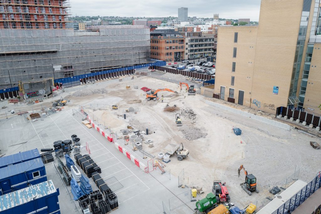
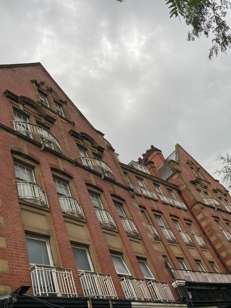
Sheffield City Council has gone to market with two new development plots within its transformational £470m Heart of the City masterplan.
The Council and its appointed marketing agent, CBRE, are seeking buyers for two development sites located on the former car park between Rockingham Street, Wellington Street and Carver Street.
The new developments would further contribute to the rapidly growing mixed-use district that is being created through Heart of the City – this includes the already completed Grosvenor House, plus several under-construction office, leisure, and residential developments.
The two new plots are located at opposite corners of the evolving Pound’s Park, having been originally outlined during the Council’s public consultation for this landmark public space last year.
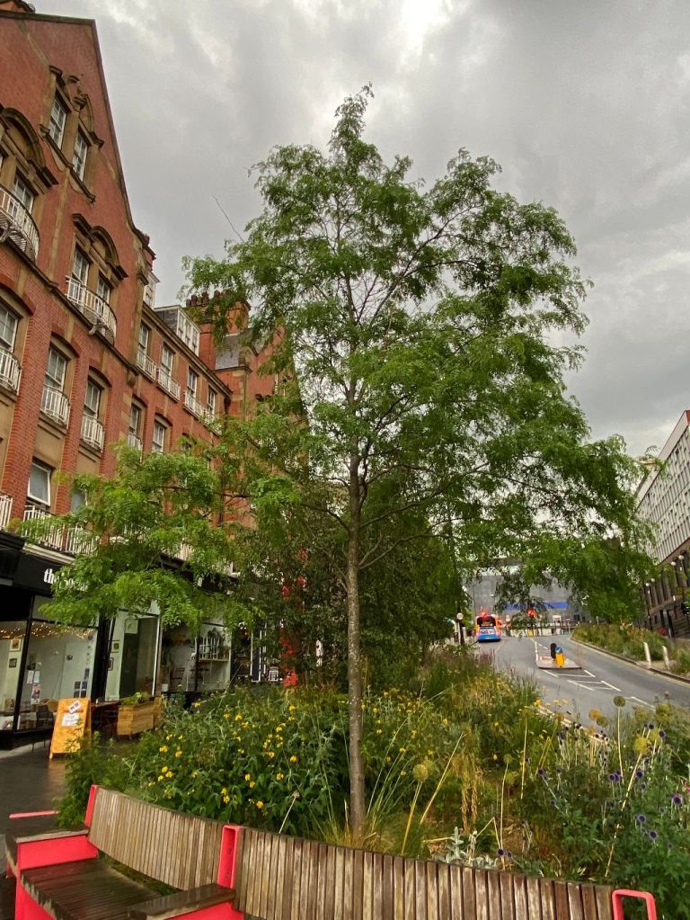
Construction of Pound’s Park is already well underway and is set to complete towards the end of this year. By prioritising the physical and mental wellbeing of its visitors – through a focus on pedestrians, cycling, active play, and relaxation – the new green space is seen as a big draw for potential developers.
The sites are expected to provide active ground floor uses such as cafes and restaurants onto this high-quality public realm with office, hotel and residential uses on the upper floors considered appropriate. Whilst both sites could be developed by a single purchaser, the Council will consider separate or combined offers for the sites.
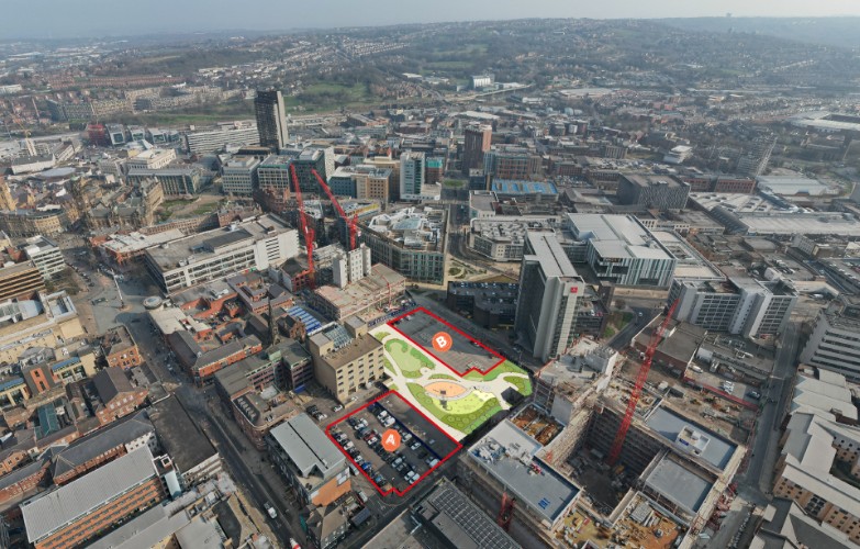
The largest of the two new sites (Site B) sits on the southeastern side of the park on the corner of Carver Street and Wellington Street.
One of the requirements for this site is that it must incorporate and display the locally cherished William Mitchell Frieze artwork, which was carefully removed from Barker’s Pool House to make way for a new Radisson Blu hotel last year.
The second site (Site A) sits to the northeast of the park on the corner of Rockingham Street and Division Lane.
Happy Yorkshire Day. A celebration of the United Kingdom’s largest county.
Named after the old county town of York, we are familiar with its sub-division into North, West, South Yorkshire (the best of the lot), and Humberside.
But these are modern creations, and until 1974, the county was split into three ‘Ridings,’ derived from the Old Norse Þriding or Þriðing, meaning a “thirding”.
Yorkshire was divided into three ridings and surrounded the city of York, their boundaries meeting at the walls of the city: thus, York within the walls was the only part of Yorkshire outside any of the ridings.
East Riding, was the smallest and least hilly of the three, much of it in the plains extending from the north bank of the Humber and containing the seaport city of Kingston upon Hull.
The North Riding, extending from the Pennines to the North Sea, was the most rural but still contained Middlesbrough on industrial Teesside.
The West Riding, the largest and most urbanised as the southern part, contained the great industrial cities of Yorkshire, the largest being Sheffield and Leeds, though in its north it encompassed some of the finest of the Yorkshire Dales.
And each riding was divided into wapentakes, the Danelaw equivalent of an Anglo-Saxon Hundred in most other counties. The word derived from an assembly or meeting place, usually at cross-roads or near a river, where literally one’s presence or a vote was taken by a show of weapons.
And Sheffield was in the southern most wapentake of Strafforth and Tickhill, the original meeting place unknown, but may have been the future site of Conisbrough Castle, near Doncaster.
Map of Yorkshire wapentakes
And to add further confusion, there are portions of the great county which retain, from old feudal times, names unrecognised by the geographer, but well known and adopted by Yorkshiremen themselves. You may look in vain on a map for Cleveland, Richmondshire, Hallamshire, Craven, or Holderness, but you will hear of them spoken in each area.
Hallamshire, a large manor at the time of the Conquest was the southern most part of the West Riding, including Sheffield.
South Yorkshire was created on 1 April 1974 because of the Local Government Act 1972. It was created from 32 local government districts of the West Riding of Yorkshire (the administrative county and four independent county boroughs), with small areas from Derbyshire and Nottinghamshire. South Yorkshire County Council was abolished in 1986 and its four metropolitan boroughs (Sheffield, Rotherham, Barnsley, and Doncaster) effectively becoming unitary authorities, although the metropolitan county continues to exist in law.
And while we are left with North, West, and South Yorkshire, Humberside reverted to its original name of the East Riding of Yorkshire in 1996.
If you’ve stuck with it so far, I’ll confuse you further by throwing in the South Yorkshire Mayoral Combined Authority (formerly Sheffield City Region), led by Oliver Coppard, Mayor of South Yorkshire.
He has powers over transport, economic development and regeneration, and includes the metropolitan county of South Yorkshire as full members, with North East Derbyshire, Derbyshire Dales, Bassetlaw, Chesterfield and Bolsover, non-metropolitan Districts, as non-constituent members.
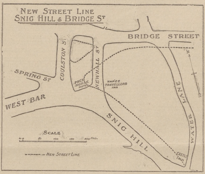
In 1900, the Improvements Committee of Sheffield Corporation paid £10,500 for 2,546 yards of land in Newhall Street. There were certain freehold premises here, including the Hollis Hospital.
The question we ask ourselves 122 years later, where was Newhall Street?
Sheffield Corporation wanted to carry out a road diversion with a straight way from Westbar to Bridge Street.
Newhall Street was at the bottom of Snig Hill and disappeared, the line of Westbar continued across land occupied by the Pack Horse Hotel (demolished), until it joined Bridge Street.
This illustration from 1902 shows the original road layout, with dotted lines indicating the new street pattern and building lines. It also shows the widening of Snig Hill.
The scheme was completed in 1903 providing a more direct route from Westbar to the Victoria Station, and in due course tram lines ran from Westbar into the Wicker. It allowed tramcars to run from Hillsborough to the Wicker and then back to Hillsborough by the Owlerton Route – another step in the completion of the city’s circular tramway system.
The loss of Newhall Street was significant because this had been the boundary between Saint Peter’s Ward and Saint Philip’s Ward, dating to 1843 when Queen Victoria granted The Charter to the Borough of Sheffield.
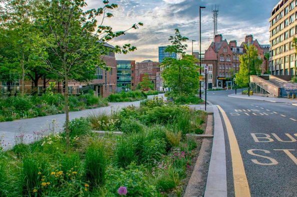
Fast forward to the present day and things are remarkably quieter, and more beautiful, thanks to Sheffield City Council’s ‘Grey-to-Green project.
The ‘Grey to Green ’ project is a development from Sheffield City Council to transform redundant carriageway in the city centre into a network of sustainable drainage and rain gardens. The greening of West Bar has already been completed. Photograph: Nigel Dunnett.
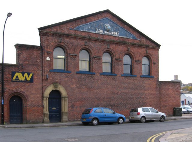
More development proposals at Kelham Island. This time it involves the former Globe Steel Works on Alma Street.
Plans have been lodged to convert it into a bar, café, multi-use events and music venue. The full planning application has been submitted by Citu, supported by Directions Planning Consultancy.
The traditional red brick building was built about 1845 and is one of the last standing remnants of the former Globe Steel Works, which once incorporated land to the east, south and west. The extended site was last occupied by Richardson’s Cutlery Works and, more recently, this building was used by AW Tools (Europe) Limited.
Under the plans, an existing single-storey enclosed yard area that is already partially covered along the western elevation would be fully utilised to provide further accommodation at ground floor and a terrace at the first floor level. A new lobby area would also be created in the north-east corner.
The existing Globe Steel Works sign would be retained.
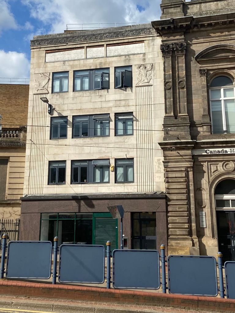
A story above. No. 9 Commercial Street, Sheffield. Image: DJP/2022
I recently featured Canada House, on Commercial Street, a well-known building, built in 1874 for the Sheffield United Gas Light Company. Plans have been submitted to convert it into Harmony Works, a home for music education in the region.
However, next door to Canada House is an often overlooked building that was originally an extension to the former gas showrooms.
The building, No. 9 Commercial Street, is no longer connected with Canada House, and was recently used by Jessops photographic shop.
This Portland stone building is conspicuous against its Victorian neighbours, added in 1938 by Hadfield & Cawkwell. It is described as ‘between stripped classical and modern.’ Harman and MInnis in Pevsner’s Architectural Guide describe it as ‘a Greek Key band and flutes representing pilasters combining sculpture by Philip Lindsey Clark of a flying female figure with a sunbeam behind her and a male figure backed by flames.’
Next time you pass, take a good look because the sculpture makes sense when you know what you are looking at.
The life-size sculptural figures represent Heat and Light.
Heat is represented by the male figure with the feet coming out of the earth to suggest the origin of gas. Flames twisting and expanding upwards, with a ‘quivering’ background, convey the suggestion of heat.
The female figure was chosen to represent light, designed to give an impression of light descending in rays controlled by the arms of the figure to shed light on the earth. In the background, a star suggests night turned into day by means of this light.
Philip Lindsey Clark (1889-1977) was the son of sculptor Robert Lindsey Clark, and he worked with him at the Cheltenham School of Art from 1905 until 1910. He later studied at the City and Guilds School in Kennington, had a distinguished record in World War One, and continued his training at the Royal Academy and Salon des Artistes, Paris.
His work from 1930 onwards became more of a religious nature and can be seen in ecclesiastical buildings across the country.
In Sheffield, there are other examples of his sculpture at Church of the Sacred Heart (Hillsborough), the Royal Institution to the Blind in Mappin Street (still retained in the replacement building), and St Theresa of the Child Jesus Church at Manor, including, amongst others, the stone statue of St Theresa above the main door of the church.
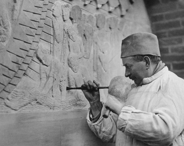
Philip Lindsey Clark works on a stone panel for the tympanum of the new Sacred Heart Church in Hillsborough, Sheffield, 12th March 1936.
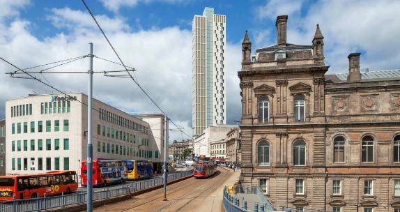
News of what could become Sheffield’s tallest building, and it’s a development that has featured on this page before.
Revised plans have been lodged for King’s Tower, a 40-storey tower in the city centre.
CJS7 Ltd (trading as Oppidan Life) and SFGE Properties Ltd have applied to Sheffield City Council for development on the site at the junction of High Street, Angel Street, and Arundel Gate, previously occupied by part of the city’s Primark store.
Planning permission was granted in December 2020 for a 39-storey development featuring 206 apartments. However, new plans seek full planning permission for the demolition of the existing building and construction of a new 40-storey tower. It would now comprise 428 co-living units and 33 studio apartments.
Shared facilities would include workspaces, cycle store, private meeting and dining rooms, cinema/presentation rooms, gym, bar and lounges. Roof terraces and balconies would be provided where possible.
The site is of little architectural value, much of its history lost underneath twentieth century developments.
It is the site of the ancient market adjacent to Sheffield Castle, first established as the result of a Royal Charter of 1296. The market stall and buildings that occupied the site were demolished in 1786 to make way for the construction of the Fitzalan Market (also known as ‘The Shambles’).
Fitzalan Market was demolished in 1930 when the new Castle Hill Market opened, and a new shop was constructed on the corner of Angel Street for Montague Burton, of Burton Menswear, in 1932.
The Burton building was badly damaged during the Sheffield Blitz of 1940, and stood as an empty shell for many years
It was eventually demolished and replaced by a new steel-framed building, clad in concrete and tile panels, and opened in 1962 as a Peter Robinson department store.
From 1974, the adjacent C&A store absorbed the upper floors of Peter Robinson, while furniture retailer Waring & Gillow occupied the ground floor.
After C&A vacated in the 1990s, it became Primark until it relocated to The Moor in 2016, leaving the old department store empty.
If it is completed it would become Sheffield’s tallest building, a claim that will shortly pass from St Paul’s Tower to Code Sheffield (on the site which borders Rockingham Street, Wellington Street, and Trafalgar Street, and adjacent to Kangaroo Works), at 38 storeys and 383ft tall.
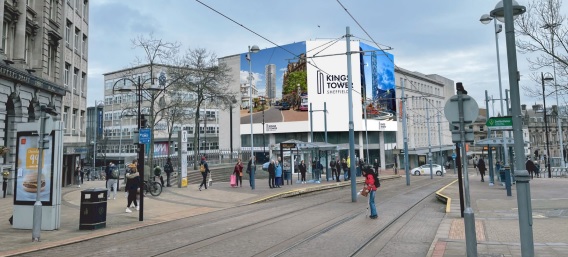
In the meantime, planning is also sought for the temporary display of an illuminated building wrap advertisement around the facing elevations of the existing building for a period of 12 months whilst pre-enabling works take place.
The advertisement will principally display signage relating to the new development – King’s Tower – highlighting the positive change and regeneration the area will experience on completion of the landmark development.
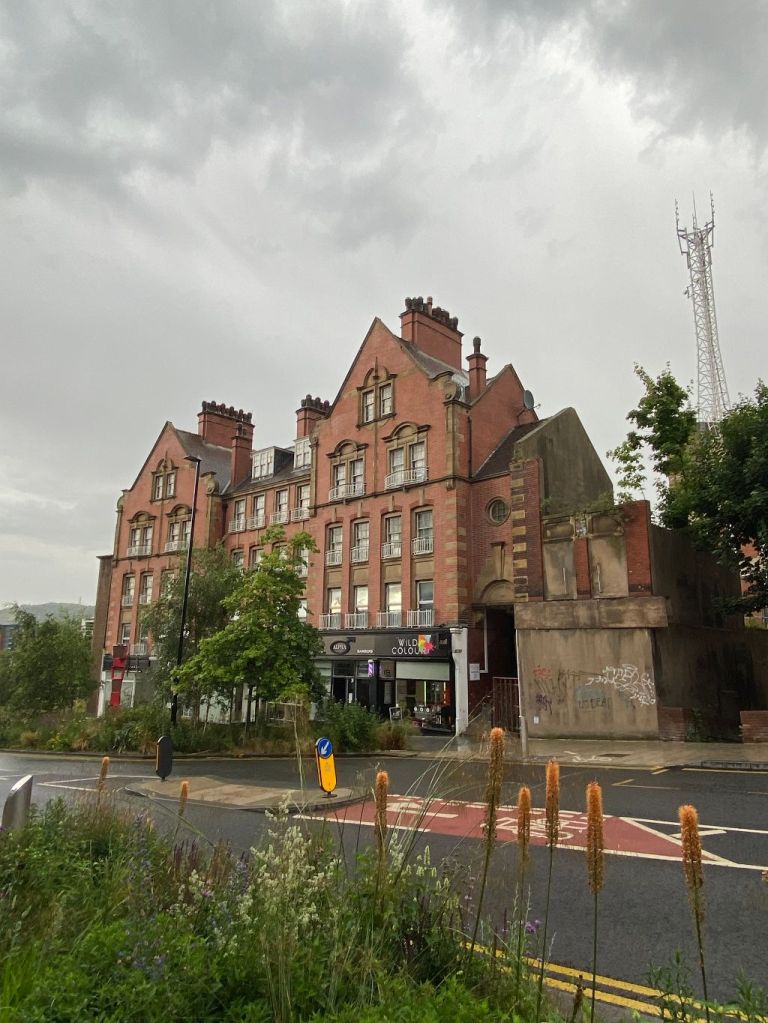
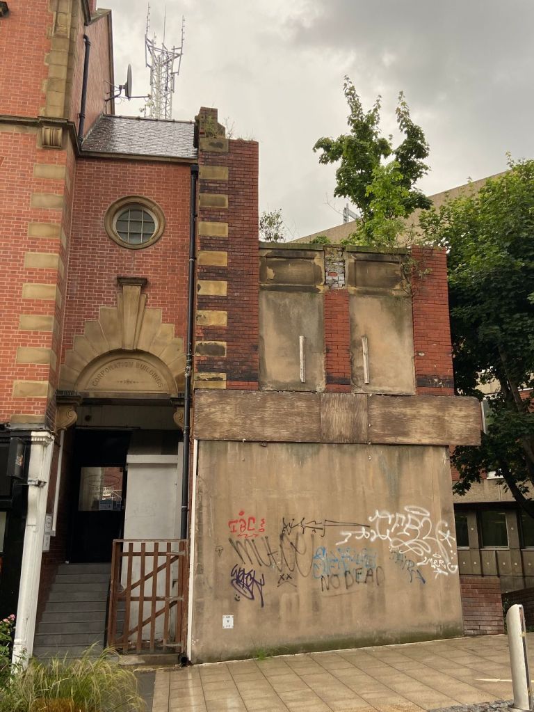
Corporation Buildings, Snig Hill, Sheffield. Image: DJP/2022
I think this building looks quite elegant. Corporation Buildings, at the bottom of Snig Hill, is one of the few survivors of old Sheffield in this forgotten part of the city centre. And its proximity to the grey-to-green project adds to its stylishness.
But this was a troubled building from the start, and what you see today is a fragment of what it once looked like.
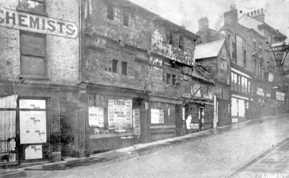
Our Victorian and Edwardian forebears had embarked on a plan to improve our streets, and too often we focus on Pinstone Street, Fargate, and High Street, as examples of their enterprise. But there were others, and Snig Hill was one of them.
Snig Hill from West Bar, derelict timber framed shops, prior to demolition in 1900. Image: Picture Sheffield
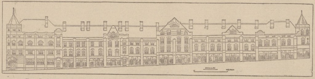
At the turn of the twentieth century, plans were revealed to widen Snig Hill from Angel Street down to Bridge Street. Old buildings were swept away and in 1902 Sheffield Corporation revealed plans to build new Corporation Buildings stretching the whole of the right side going from the centre of town.
The original plans were drawn up by the city surveyor, Charles. F. Wilke, and showed a four-storey building, with a frontage of 140 yards, including thirteen shops, with showrooms above, and sixty artisan dwellings on top of them. The plans showed that turrets were included at each end, with gables introduced to break the differences in height created by the sloping gradient of the site.
Charles F. Wilke’s rejected 1902 design for Corporation Buildings on Snig Hill. Image: British Newspaper Archive
The problem was that the Improvement Committee had drawn up the plans, but the council had already created an independent committee to deal with surplus land. The project was handed over to them and appears to have disregarded Mr Wilke’s plan.
Instead, the committee approached architects Gibbs and Flockton which came up with an alternative, if not dissimilar, plan for the site. Work began in 1903 and cost between £60K and £70K and was completed the following year.
Like all council-backed projects there was criticism about the Corporation Buildings, fuelled by the fact that when it was completed only three of the twenty-one shops had been let, and the rents for the flats appeared too expensive for Sheffield’s working class. One councillor referred to Corporation Buildings as ‘a ghastly array of empty shops.’
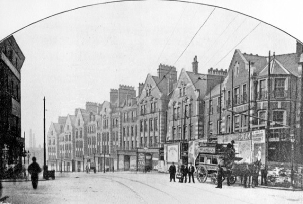
Newly constructed Corporation Buildings and shops, Snig Hill, 1905. Image: Picture Sheffield
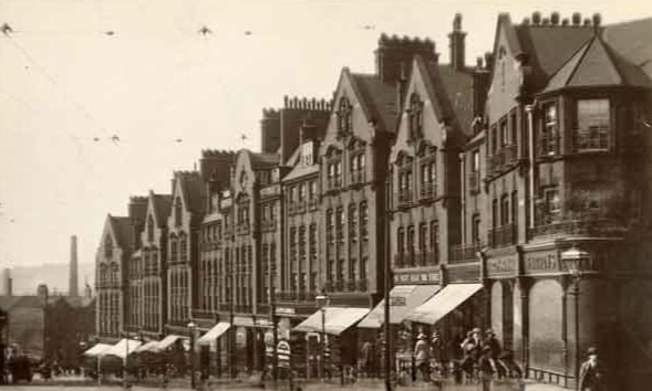
Snig Hill. This image was originally part of the Tim Hale Photographic Collection. Image: Picture Sheffield
The scheme inevitably made a loss in its early years, but once shops and flats were occupied, it brought in steady income.
Nearly 120 years later, we are left with a small portion of the original construction.
What happened to the rest of it?
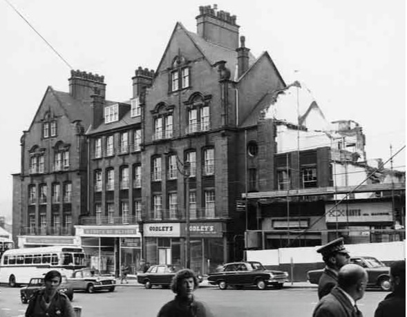
In World War Two, bombs destroyed much of the upper block at the top of Snig Hill. This had to be demolished and was replaced with ‘temporary’ single storey shops. A further portion was demolished in 1971 to make way for the new headquarters of Sheffield and Rotherham Constabulary, subsequently for South Yorkshire Police, and is now used as the divisional police station covering the city centre.
But at least we have something left, and most of us can only speculate as to how impressive the full block would have looked had it survived.
Demolition of Council flats in 1971 on Snig Hill showing (left to right) Sheffield and Rotherham Constabulary (Criminal Investigation Department); W. H. Godley and Son, gents outfitters (Nos.78-80) and Arthur Davy and Sons Ltd, bakers (No.74). Image: SCC/Picture Sheffield
Corporation Buildings, Snig Hill, Sheffield. Image: DJP/2022
Earlier this week, I wrote about an exciting planning application for Canada House, formerly the Gas Offices, on Commercial Street. It might be some time away, but the regeneration of Fitzalan Square, Haymarket, Commercial Street, and Castlegate, is already on the mind of property developers and investors.
Here’s a recent statement from Connor Rogers, at Cushman & Wakefield:-
“The transformation of the immediate area led by the redevelopment of Fitzalan Square, part of the city’s £5m Knowledge Gateway programme, and the proximity to Sheffield Hallam and the city’s amenities, will allow Glenbrook to adapt its strategy to suit future market conditions.”
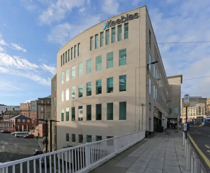
He refers to Manchester-based Glenbrook Investments which has made its first acquisition in Sheffield, across the road from Canada House. It has paid £3m for Commercial House, once the Barclays Bank building, that lays adjacent to Ponds Forge International Sports Centre.
Scott Griffiths, investment director at Glenbrook Investments, said: “Commercial House provides a high-quality income return until December 2024 from an attractive building that is well positioned within Sheffield city centre for both access and amenities.
“The ambition of Sheffield City Council to reposition the city through targeted investment makes it a very interesting proposition for investors. We look forward to bringing forward our vision for the building as we seek to maximise its potential as a landmark office.”
The building is predominantly let to law firm Knights plc (formerly Keebles) and comprises 33,000 sq ft arranged over basement, ground and four upper floors.
It is also home to Sheffield Town Trust, one of the oldest charitable organisations in the country, having originally been established in 1297 by Thomas de Furnival, Lord of the Manor of Hallam.
I can date Commercial House to the late 1960s or early 1970s, built for Barclays Bank to replace an older branch at the corner of Commercial Street and Fitzalan Square, and stands behind the site once occupied by the King’s Arms Hotel, both buildings demolished to turn Commercial Street into dual carriageway.
I suspect the new owners will be looking to 2024, when office leases expire, and future redevelopment.
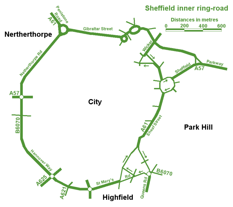
The best map of Sheffield’s Inner Ring Road, but spoilt by spelling mistakes.
An unusual post, in so much that we are looking at a road. In fact, a series of roads that form one big one – Sheffield Inner Ring Road.
We might live in Sheffield, but sometimes it’s difficult to see wood for the trees, and this is the case with the inner ring road, because you probably don’t realise its purpose and where it is.
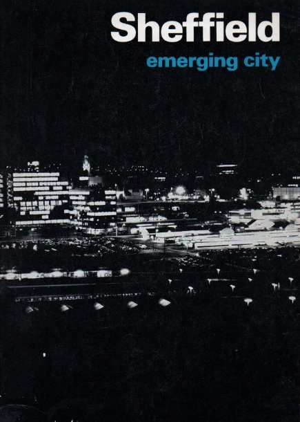
Let’s start in the 1930s when a route around the city centre was first proposed. Truth be known, World War Two stalled plans until the sixties, and in 1969 Sheffield Corporation published an impressive handbook called ‘Sheffield – Emerging City,’ in which plans for a detailed road system were revealed for the first time.
The council intended to pour £65m into the scheme which included bus lanes, pedestrian areas, as well as an urban motorway and motorway links with the M1.
Robert Waterhouse, writing in The Guardian in 1972, said that “Sheffield was as proud of its new roads as of its housing, its clean air, and its flourishing arts. They were all symbols of rebirth after years of stagnation among the ruins of the Industrial Revolution.”
The Guardian article, long forgotten, provides an interesting snapshot into the arguments that raged at the time.
It pointed out that after 1969, things had started to go wrong. In May 1971, a joint report by the city engineer, the city planning officer and architect, and the general manager of the transport department, had taken a gloomy view.
‘Although a large highway construction programme has been embarked upon,’ it said, ‘the growth of vehicular traffic is much greater than the growth of road capacity. The disparity has been obvious for many years and there seems negligible hope of it being ended in the foreseeable future.”
The report estimated that the proposed highway system, capable of carrying about 50 per cent of commuters to work by car, would cost ratepayers another 20p in the pound, which was probably acceptable, but that a system by which nearly everyone went by car could cost £300m, or another pound on the rates, clearly unacceptable. If the ‘compromise,’ £65m system was going to get clogged up anyway, was it worth building at all?
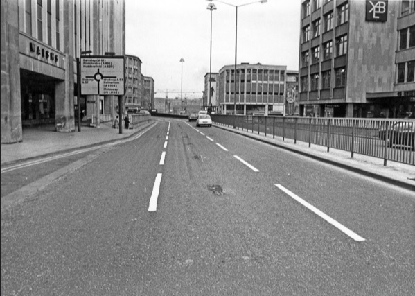
Arundel Gate in 1973 looking towards the Hole in the Road – new barriers erected in attempt to make pedestrians use the subways. Image: Sheffield Newspapers/Picture Sheffield
Waterhouse identified growing opposition within the council.
Sir Ron Ironmonger, Labour’s council leader, admitted that a growing number of councillors were against the scheme, and there had been public exchanges between the planning department and engineers.
The planners, headed by R. Adamson, felt that the engineers were going about the job the wrong way: instead of giving priority to the inner ring road, which everybody thought essential, construction had been advanced near the city centre. This meant that the civic circle – the inner ring road ultimately intended to carry only local shoppers and delivery vans – was being used as a throughway.
But the engineers, under K.D. Wiilliams, replied that highways the size of the inner ring road – a six-lane urban motorway – didn’t happen overnight.
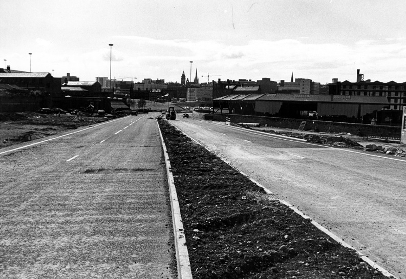
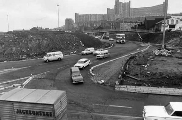
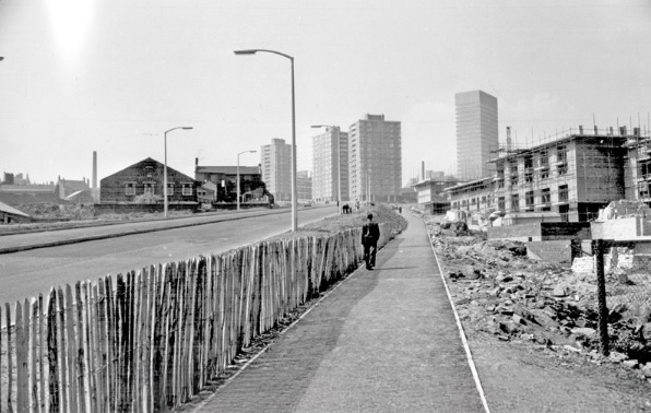
It seemed that Sheffield residents didn’t know what they were in for but would soon find out. The new interchange between the inner ring road and the Parkway was near completion at the bottom of Commercial Street. Sheffield Parkway was also being built and would be the main route into the city centre from the M1.
Construction of Sheffield Parkway in 1974 looking towards Park Square. Image: Sheffield Newspapers/Picture Sheffield
Sheaf Street/Commercial Street (latterly known as Park Square) roundabout under construction in 1973. Image: Sheffield Newspapers/Picture Sheffield
But the argument in 1971 was that traffic coming into the city centre was being diverted onto newly-constructed roads, because there was no proper inner ring road. And it was causing problems.
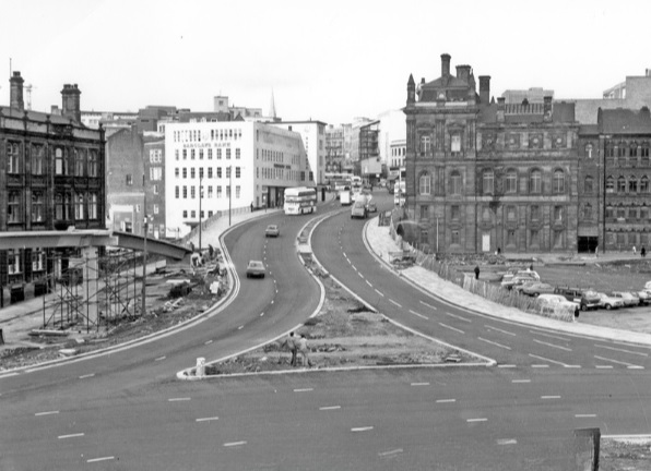
On Commercial Street itself, a bridge was being widened to take four lanes of traffic. It joined the civic circle at Castle Square, where traffic and pedestrians were already separated – cars at ground level, pedestrians underground. But before the road got there, it had to pass Fitzalan square, one of the principal routes for shoppers on foot. Everybody agreed this was a problem, but work on widening Commercial Street continued anyway, despite open criticism from Labour councillors.
Widened Commercial Street in 1970s, looking towards the Gas Company Offices on right, Electricity Supply Offices and Barclay’s Bank on left. Shude Hill behind car park on right. Image: Picture Sheffield
There were others also opposed to the scheme. Dr Leonard Taitz, a young South African doctor, working in Sheffield, was convener of the Conservation Society’s national transportation working party. He had started a campaign to bring the road building programme to a halt while a new policy on integrated transportation was formulated.
New roads were being built within the city centre but there were design flaws.
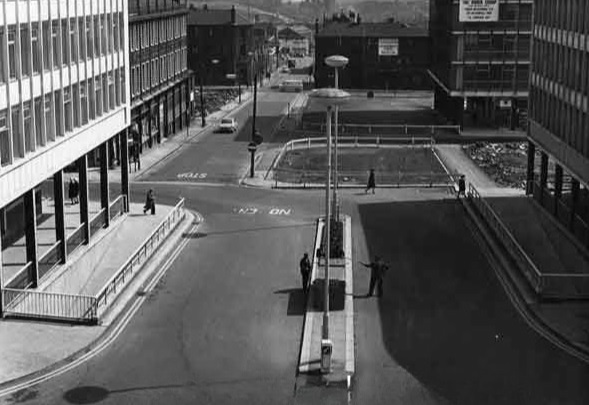
He cited the case of Furnival Gate, also a four-lane highway which, he suggested, was bound to be used by commuter traffic, but which divided The Moor and Pinstone Street, two proposed precinct streets. A subway to take people under the road had already been built, while Charter Row, another radial, had a barrier down its middle which cut a whole segment of the city from the centre.
Furnival Gate at the junction with The Moor showing (middle left) junction with Union Street in the 1960s. Image: Picture Sheffield
He argued that these roads were primarily being used by commuters cutting across town. But Mr K.D. Williams, head of technical design at the engineers, said this wasn’t the case, and that they were a necessary part of an integral system, that will one day be blocked off to prevent through traffic, and channel motorists to off-street car parks.
Whatever the interpretation, the roads were ‘not a pretty site.’ Certainly not ‘Sheffield’s Champs Elysees,’ as a councillor had called Arundel Gate.
Robert Waterhouse asked the important question? Would the new roads ever carry the massive traffic that Sheffield had come to expect? Would the inner ring road be built as a motorway, and would Sheffield get its two, or even three, motorway links with the M1?
Sir Ron Ironmonger pointed out that after 1974, highways would become the responsibility of the new South Yorkshire metropolitan authority and had no wish to make any drastic moves at such a late stage, and cited Nottingham which had done away with a major part of its road programme. (Sir Ron later became leader of South Yorkshire Metropolitan County Council).
What did happen?
The 1970s proposal for the Inner Ring Road was abandoned because it would have destroyed important heritage assets like Kelham Island and the canal basin, and cash, as ever, was the stumbling block. But we did eventually get an Inner Ring Road, but it took a long time for it to be completed in its entirety.
We can thank Duncan Froggatt, a Chartered Engineer, in his excellent book, ‘Sheffield – A Civilised Place’ (2018), for providing the timeline.
“The inner relief road had started in the 1960s starting with the dualling of Netherthorpe Road. But the later stages came much later with St Mary’s Gate and Hanover Way widened to dual carriageways in the 1980s.
“Sheaf Street was improved in the early 2000s leading to the improvement of Sheaf Square and subsequently links to St Mary’s Road up to 2009.
“The northern section from Sheffield Parkway to Penistone Road was built in two phases in the 1990s. The phase from the Parkway to The Wicker was completed in 2000, originally called Cutlers’ Gate, but later renamed Derek Dooley Way. The next stage, between the Wicker and Shalesmoor was finished in 2008.
“Once completed, it provided a continuous loop of dual carriageway, clockwise from Granville square in the southeast to Sheffield Parkway in the east, linking all main arterial routes in the city.”
Netherthorpe Road with Netherthorpe Street Flats under construction in 1965, looking towards Netherthorpe High Rise Flats. Image: SCC/Picture Sheffield
All done and dusted, but these days it is what is happening within the Inner Ring Road that creates the interest.
Mr Williams’ plan for streets to be blocked off to traffic within the city centre did and continues to happen. Fargate and The Moor were the first to be pedestrianised, Pinstone Street is in transition, and Arundel Gate will be downgraded.
But what nobody in the 1970s envisaged was something that had been around for centuries… and that was the bicycle. Cycle routes, and the eagerness to cut car emissions, while greening our urban spaces, means that Sheffield city centre will eventually change beyond recognition.
I leave you with a story. Last week, I had to travel by car from one side of the city centre to the other. By foot it was less than a mile. By car, I travelled 2.5 miles.
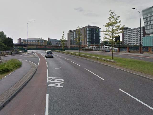
Derek Dooley Way. Image: Sheffield Star
“Driving into Sheffield, I was looking forward to my friend’s hen-do. We had booked a city centre apartment, a spa day and a restaurant. What could go wrong? Yet, an hour-and-a-half later, I was bellowing tearfully into my mobile at my boyfriend: “You came to university here. Where AM I?” What had caused this emotional meltdown? Certainly not a fall-out with my friends – I hadn’t even seen them yet. Instead, my fun-filled city break had been spent navigating a series of roundabouts on the city’s ring road which kept spitting me out with increasing ferocity. Sheffield’s inner ring road has been tormenting drivers since 1961. Like many of the nation’s worst ring roads, it twists you round its little finger only to catapult you into bus-only zones or roads that lead you off in the opposite direction to the one you need.” – Jenny Scott – BBC News – 2014
NOTE Robert Waterhouse is a journalist. Starting on the Guardian in Manchester and London, he turned freelance and was launch editor of the daily North West Times. He is a co-editor of the review Mediterraneans. His books include The Other Fleet Street, a history of national newspaper publishing in Manchester.
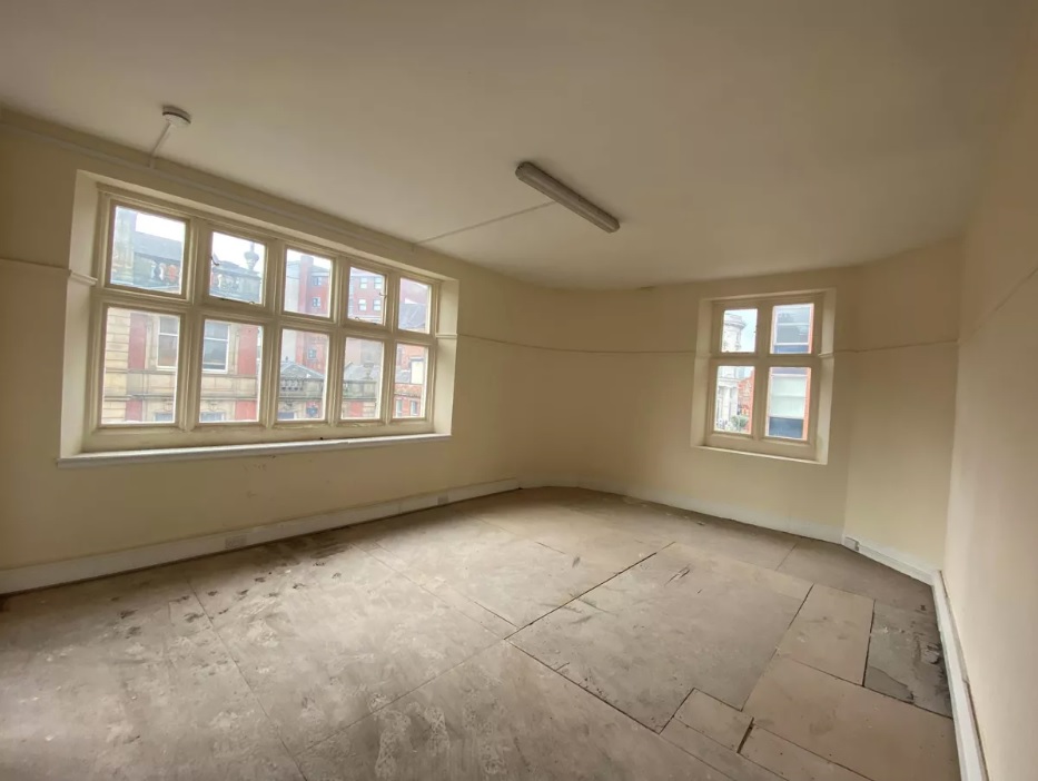
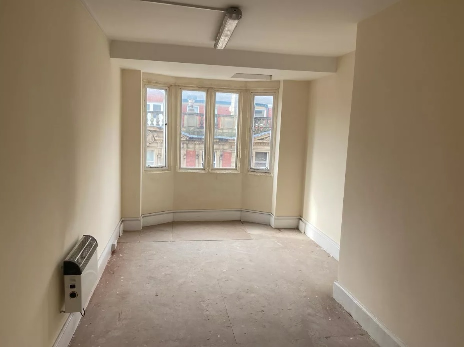
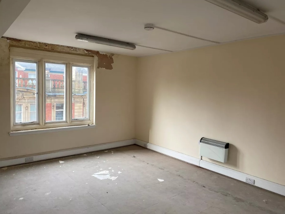
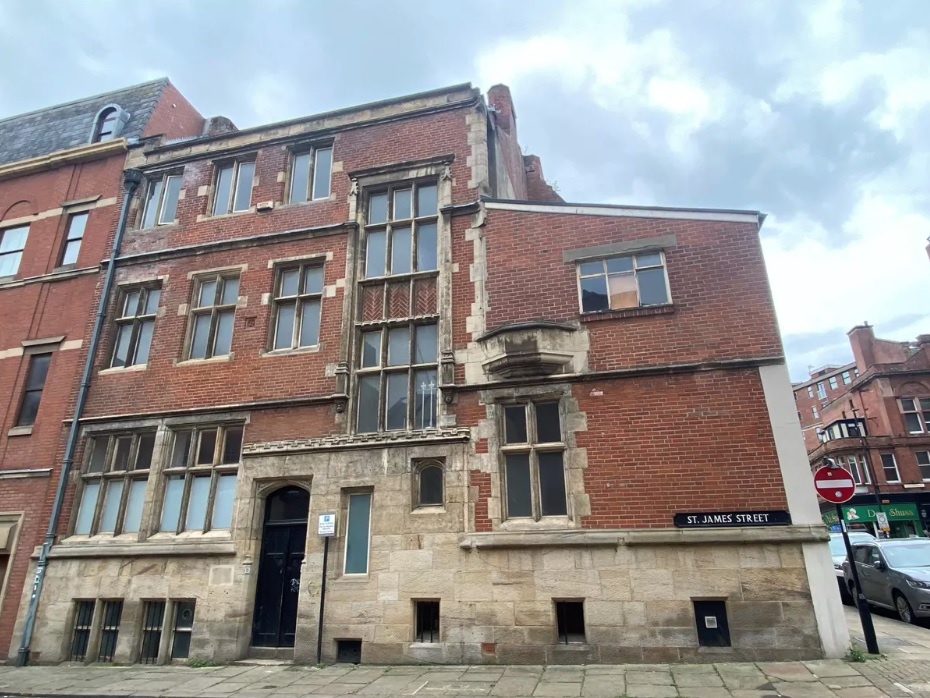
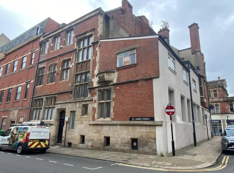
Here’s a nice development opportunity in the heart of Sheffield city centre. The Cairn’s Chambers building, built in Tudor-Gothic style, on Church Street, is up for sale (offers invited).
Grade II listed Cairn’s Chambers was built between 1894-1896 by Charles Hadfield, of M.E. Hadfield, Son and Garland, for Henry and Alfred Maxfield, solicitors. It was built in scholarly Tudor-style, a favourite of Hadfield’s, featuring decorative stonework by Frank Tory Sr., including a four-foot statue of Earl Cairns, a former Lord Chancellor.
Henry and Alfred Maxfield occupied a large suite of offices, but it was also built to accommodate other businesses, a common trait of Victorian entrepreneurship.
The offices were used for almost 40 years by Charles Hadfield’s own company, C & C.M. Hadfield, architects, and later by Hadfield and Cawkwell. It was also where John Dodsley Webster, another Sheffield architect, had his office with an entrance at the back, on St James’s Street.
The Hadfield company remained until World War Two, leaving after the building was damaged by a German bomb in 1940. The rear of the property was almost destroyed, but the decorative front survived.
Afterwards, Cairn’s Chambers became a branch of the District Bank, subsequently becoming NatWest until its closure.
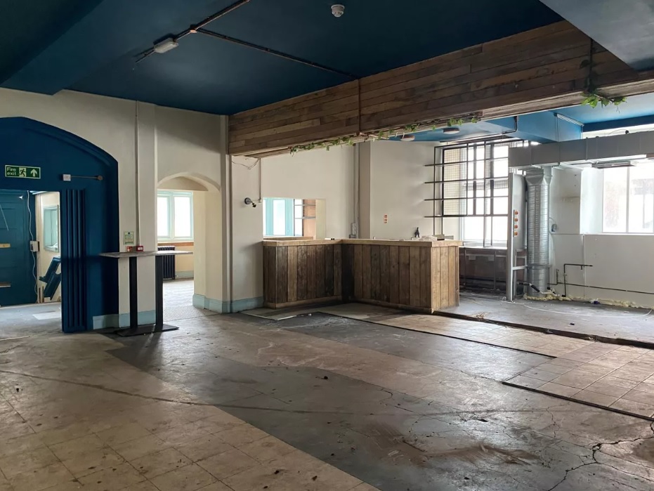
Most recently, the ground floor was occupied by Cargo Hold, a seafood restaurant.
Last year an offer was accepted for the building, and subject to planning permission, was to be turned into a restaurant, with up to a dozen luxury apartments on the first, second, and third floors.
However, the development appears to have stalled and the building is now on sale at Knight Frank.
Cairn’s Chambers, Church Street, Sheffield. Images: Knight Frank