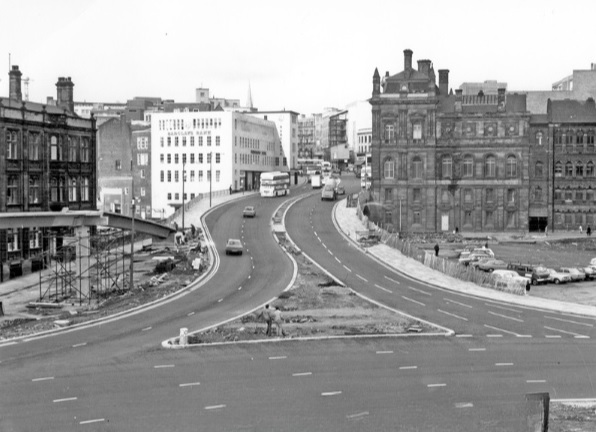
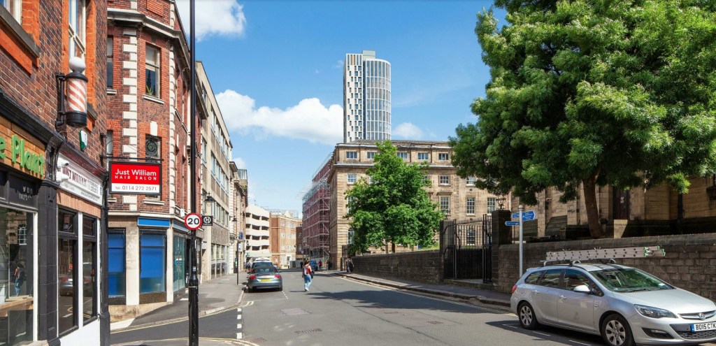
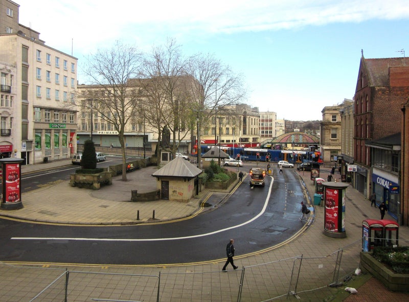
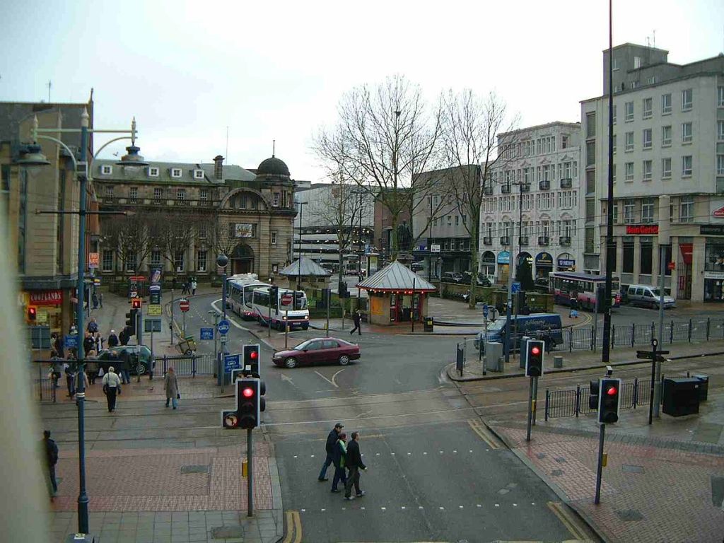
It is hard to imagine that beneath Arundel Gate, at its junction with Norfolk Street, is a lost road. When the dual carriageway was constructed in the 1960s, it swept away a street that had once been one of the most influential in Sheffield.
As someone who researches our past, the name of Milk Street frequently appears in the obituaries of well-known medical men, clergymen, merchants, manufacturers, solicitors, and people who rose to prominence, not only in Sheffield, but across Britain, and in all parts of the world.
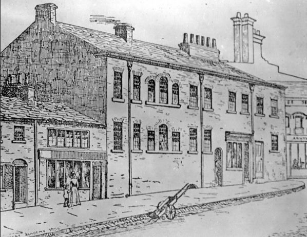
Milk Street had once been called Petticoat Lane, but by the 1700s had changed its name, and in 1800 became the site of Milk Street Academy, its most famous building.
The academy was established by John Hessay Abraham, a Methodist, as a classical, commercial, philosophical, and mathematical seminary for boys. It used a single room in an existing building and was soon successful enough to occupy the rest of it.
Beneath Arundel Gate, at its junction with Norfolk Street, is a lost road. Image: DJP/2022
At this time, elementary education in Sheffield was poor, and only the wealthiest people paid for the privilege of private schooling. The boys started lessons at 7am and the curriculum included English, French, mathematics, penmanship, drawing, and the use of the globe. That a very high standard was reached may be judged in the London ‘Universal Magazine’ for April 1805, which produced ‘Juvenile Essays, comprising, in order of merit, the first and second half-yearly prize competitions of the pupils belonging to the Milk Street Academy, Sheffield.’
J.H. Abraham has appeared on these pages before as one of the occupants of Holy Green House. He was an extremely clever man, a Fellow of the Royal Society, and on his death in 1846, his extensive library was auctioned and included standard works in literature, especially philosophy, astronomy, electricity, magnetism, galvanism, chemistry, and mathematics.
In 1840, his daughter Emma had married Richard Bowling, a teacher of twenty years at Milk Street, who succeeded Abraham as principal.
Under ‘Dicky’ Bowling, the academy thrived and achieved success at preparing pupils for Oxford and Cambridge.
He was a fine gentleman – 5ft 11in high and very proportionate, a thorough disciplinarian – a good, all-round scholar who besides the three r’s which he thoroughly drilled into his pupils, taught Latin and Greek.
One guinea a quarter was the fee, drawing and languages extra, and when a new scholar arrived, the father had to pay a 5 shillings entrance fee.
There were about 400 boys in total, and there was what was called the Cabinet, which went to the boy who attained first prize in all subjects.
However, Bowling’s methods were somewhat barbaric.
“For playing truant he laid a boy across the desk (or on another boy’s back) and put his trousers down and gave him the cane on his bare flesh,” said a former pupil. “One boy was made to stand on the form while he sent another boy for an old-fashioned treacle-stick. He tore part of the paper off and made him suck it for a quarter of an hour allowing the schoolboys to jeer at him all the time.”
“I remember him giving me a severe blow to the side of the face because I was holding my pen improperly,” said another. “However, I remember Mr Bowling with pleasant memories as a great and distinguished schoolmaster, who developed in us the faculties which have contributed to any success we may have attained.”
All in all, the boys appeared to enjoy themselves, with physical education taking place at playing fields on the site of the old Winter Street Hospital, now part of Sheffield University. When let loose, they used Cheney Square (lost underneath the Town Hall) as happy hunting grounds.
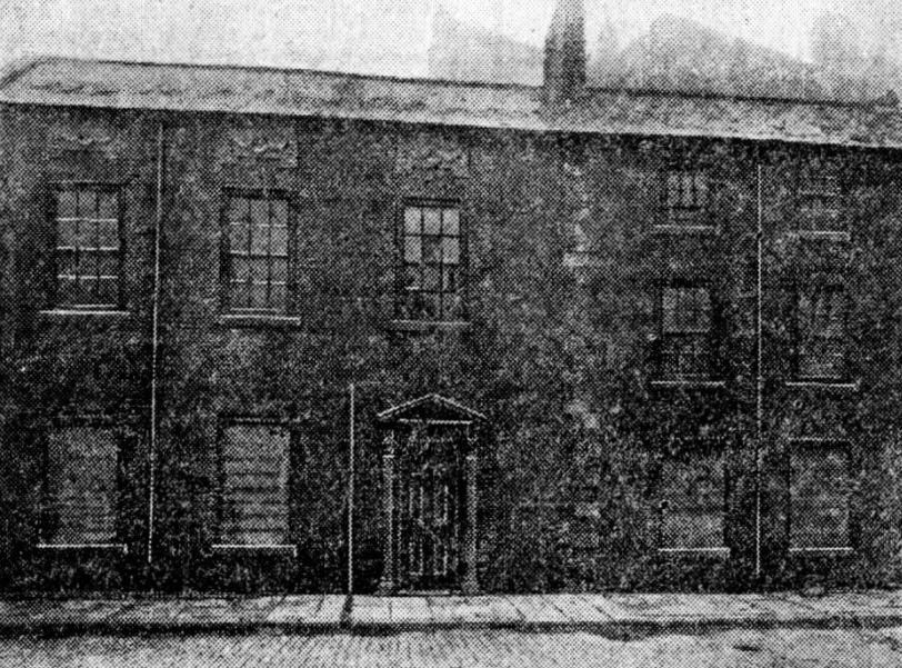
Bowling resided at Norwood Rise, Pitsmoor, and subsequently at Clough House. At both places he had boarders, who attended the school every day. On his death in 1876, the academy became Milk Street School and continued under the partnership of his son, Walter Henry Bowling, and John Irwin, a former master, who, aged eighteen, had been apprenticed to the academy.
However, its days were numbered, hastened by the 1870 Education Act, the first legislation to provide for national education and create school boards across the country.
Milk Street from Sycamore Street looking towards Norfolk Street (1851-1859). Image: Picture Sheffield
In August 1880, Irwin closed Milk Street School, now surrounded by industry, and moved it to Montgomery College, Sharrow.
Gone, but not forgotten. “One Sheffield institution which is frequently mentioned in records of the early careers of public men is the old Milk Street School,” said a newspaper in 1904. “It is referred to more frequently even than the Grammar School or Wesley School as the educational home of prominent citizens. There seem to be few records of the school left, and the old boys have not formed themselves into an association.”
A few years later, the Rescue and Evangelisation Mission was established in the old building, and in 1913 it was occupied by the Sheffield Chauffeurs’ Society, that promoted sociability amongst its drivers, and to safeguard members. It later became premises for Harry Hartley and Son, hardware merchants.
The building and the street may have long disappeared, but you might be interested to know that the name lives on, and not far away from its original location.
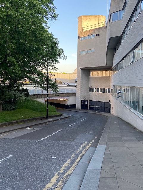
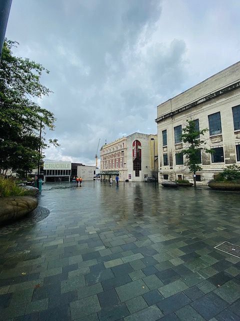
Beside the Crucible Theatre, leading from Norfolk Street, underneath Arundel Gate to the multi-storey car-park, is a service road, appropriately called… Milk Street.
Besides the Crucible Theatre, leading from Norfolk Street, underneath Arundel Gate to the multi-storey car-park, is a service road, appropriately called Milk Street. Image: DJP/2022
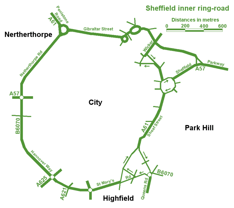
The best map of Sheffield’s Inner Ring Road, but spoilt by spelling mistakes.
An unusual post, in so much that we are looking at a road. In fact, a series of roads that form one big one – Sheffield Inner Ring Road.
We might live in Sheffield, but sometimes it’s difficult to see wood for the trees, and this is the case with the inner ring road, because you probably don’t realise its purpose and where it is.
Let’s start in the 1930s when a route around the city centre was first proposed. Truth be known, World War Two stalled plans until the sixties, and in 1969 Sheffield Corporation published an impressive handbook called ‘Sheffield – Emerging City,’ in which plans for a detailed road system were revealed for the first time.
The council intended to pour £65m into the scheme which included bus lanes, pedestrian areas, as well as an urban motorway and motorway links with the M1.
Robert Waterhouse, writing in The Guardian in 1972, said that “Sheffield was as proud of its new roads as of its housing, its clean air, and its flourishing arts. They were all symbols of rebirth after years of stagnation among the ruins of the Industrial Revolution.”
The Guardian article, long forgotten, provides an interesting snapshot into the arguments that raged at the time.
It pointed out that after 1969, things had started to go wrong. In May 1971, a joint report by the city engineer, the city planning officer and architect, and the general manager of the transport department, had taken a gloomy view.
‘Although a large highway construction programme has been embarked upon,’ it said, ‘the growth of vehicular traffic is much greater than the growth of road capacity. The disparity has been obvious for many years and there seems negligible hope of it being ended in the foreseeable future.”
The report estimated that the proposed highway system, capable of carrying about 50 per cent of commuters to work by car, would cost ratepayers another 20p in the pound, which was probably acceptable, but that a system by which nearly everyone went by car could cost £300m, or another pound on the rates, clearly unacceptable. If the ‘compromise,’ £65m system was going to get clogged up anyway, was it worth building at all?
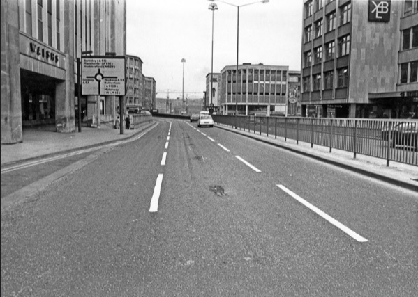
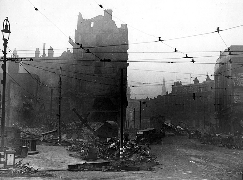
Arundel Gate in 1973 looking towards the Hole in the Road – new barriers erected in attempt to make pedestrians use the subways. Image: Sheffield Newspapers/Picture Sheffield
Waterhouse identified growing opposition within the council.
Sir Ron Ironmonger, Labour’s council leader, admitted that a growing number of councillors were against the scheme, and there had been public exchanges between the planning department and engineers.
The planners, headed by R. Adamson, felt that the engineers were going about the job the wrong way: instead of giving priority to the inner ring road, which everybody thought essential, construction had been advanced near the city centre. This meant that the civic circle – the inner ring road ultimately intended to carry only local shoppers and delivery vans – was being used as a throughway.
But the engineers, under K.D. Wiilliams, replied that highways the size of the inner ring road – a six-lane urban motorway – didn’t happen overnight.
It seemed that Sheffield residents didn’t know what they were in for but would soon find out. The new interchange between the inner ring road and the Parkway was near completion at the bottom of Commercial Street. Sheffield Parkway was also being built and would be the main route into the city centre from the M1.
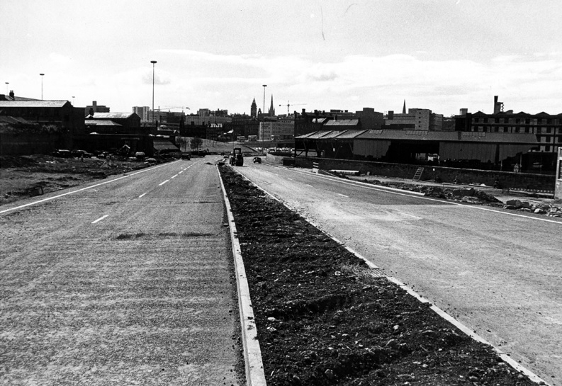
Construction of Sheffield Parkway in 1974 looking towards Park Square. Image: Sheffield Newspapers/Picture Sheffield
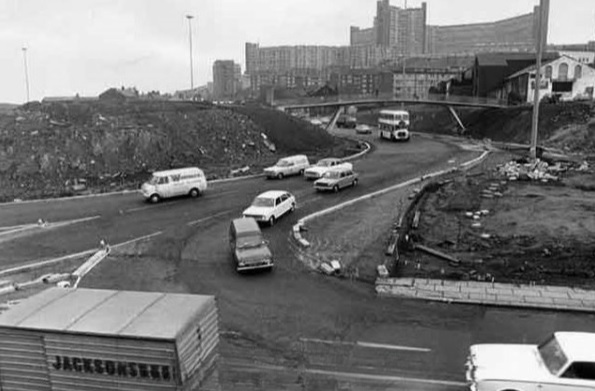
Sheaf Street/Commercial Street (latterly known as Park Square) roundabout under construction in 1973. Image: Sheffield Newspapers/Picture Sheffield
But the argument in 1971 was that traffic coming into the city centre was being diverted onto newly-constructed roads, because there was no proper inner ring road. And it was causing problems.
On Commercial Street itself, a bridge was being widened to take four lanes of traffic. It joined the civic circle at Castle Square, where traffic and pedestrians were already separated – cars at ground level, pedestrians underground. But before the road got there, it had to pass Fitzalan square, one of the principal routes for shoppers on foot. Everybody agreed this was a problem, but work on widening Commercial Street continued anyway, despite open criticism from Labour councillors.
Widened Commercial Street in 1970s, looking towards the Gas Company Offices on right, Electricity Supply Offices and Barclay’s Bank on left. Shude Hill behind car park on right. Image: Picture Sheffield
There were others also opposed to the scheme. Dr Leonard Taitz, a young South African doctor, working in Sheffield, was convener of the Conservation Society’s national transportation working party. He had started a campaign to bring the road building programme to a halt while a new policy on integrated transportation was formulated.
New roads were being built within the city centre but there were design flaws.
He cited the case of Furnival Gate, also a four-lane highway which, he suggested, was bound to be used by commuter traffic, but which divided The Moor and Pinstone Street, two proposed precinct streets. A subway to take people under the road had already been built, while Charter Row, another radial, had a barrier down its middle which cut a whole segment of the city from the centre.
Furnival Gate at the junction with The Moor showing (middle left) junction with Union Street in the 1960s. Image: Picture Sheffield
He argued that these roads were primarily being used by commuters cutting across town. But Mr K.D. Williams, head of technical design at the engineers, said this wasn’t the case, and that they were a necessary part of an integral system, that will one day be blocked off to prevent through traffic, and channel motorists to off-street car parks.
Whatever the interpretation, the roads were ‘not a pretty site.’ Certainly not ‘Sheffield’s Champs Elysees,’ as a councillor had called Arundel Gate.
Robert Waterhouse asked the important question? Would the new roads ever carry the massive traffic that Sheffield had come to expect? Would the inner ring road be built as a motorway, and would Sheffield get its two, or even three, motorway links with the M1?
Sir Ron Ironmonger pointed out that after 1974, highways would become the responsibility of the new South Yorkshire metropolitan authority and had no wish to make any drastic moves at such a late stage, and cited Nottingham which had done away with a major part of its road programme. (Sir Ron later became leader of South Yorkshire Metropolitan County Council).
What did happen?
The 1970s proposal for the Inner Ring Road was abandoned because it would have destroyed important heritage assets like Kelham Island and the canal basin, and cash, as ever, was the stumbling block. But we did eventually get an Inner Ring Road, but it took a long time for it to be completed in its entirety.
We can thank Duncan Froggatt, a Chartered Engineer, in his excellent book, ‘Sheffield – A Civilised Place’ (2018), for providing the timeline.
“The inner relief road had started in the 1960s starting with the dualling of Netherthorpe Road. But the later stages came much later with St Mary’s Gate and Hanover Way widened to dual carriageways in the 1980s.
“Sheaf Street was improved in the early 2000s leading to the improvement of Sheaf Square and subsequently links to St Mary’s Road up to 2009.
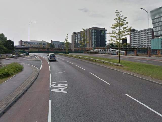
“The northern section from Sheffield Parkway to Penistone Road was built in two phases in the 1990s. The phase from the Parkway to The Wicker was completed in 2000, originally called Cutlers’ Gate, but later renamed Derek Dooley Way. The next stage, between the Wicker and Shalesmoor was finished in 2008.
“Once completed, it provided a continuous loop of dual carriageway, clockwise from Granville square in the southeast to Sheffield Parkway in the east, linking all main arterial routes in the city.”
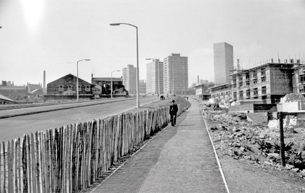
Netherthorpe Road with Netherthorpe Street Flats under construction in 1965, looking towards Netherthorpe High Rise Flats. Image: SCC/Picture Sheffield
All done and dusted, but these days it is what is happening within the Inner Ring Road that creates the interest.
Mr Williams’ plan for streets to be blocked off to traffic within the city centre did and continues to happen. Fargate and The Moor were the first to be pedestrianised, Pinstone Street is in transition, and Arundel Gate will be downgraded.
But what nobody in the 1970s envisaged was something that had been around for centuries… and that was the bicycle. Cycle routes, and the eagerness to cut car emissions, while greening our urban spaces, means that Sheffield city centre will eventually change beyond recognition.
I leave you with a story. Last week, I had to travel by car from one side of the city centre to the other. By foot it was less than a mile. By car, I travelled 2.5 miles.
Derek Dooley Way. Image: Sheffield Star
“Driving into Sheffield, I was looking forward to my friend’s hen-do. We had booked a city centre apartment, a spa day and a restaurant. What could go wrong? Yet, an hour-and-a-half later, I was bellowing tearfully into my mobile at my boyfriend: “You came to university here. Where AM I?” What had caused this emotional meltdown? Certainly not a fall-out with my friends – I hadn’t even seen them yet. Instead, my fun-filled city break had been spent navigating a series of roundabouts on the city’s ring road which kept spitting me out with increasing ferocity. Sheffield’s inner ring road has been tormenting drivers since 1961. Like many of the nation’s worst ring roads, it twists you round its little finger only to catapult you into bus-only zones or roads that lead you off in the opposite direction to the one you need.” – Jenny Scott – BBC News – 2014
NOTE Robert Waterhouse is a journalist. Starting on the Guardian in Manchester and London, he turned freelance and was launch editor of the daily North West Times. He is a co-editor of the review Mediterraneans. His books include The Other Fleet Street, a history of national newspaper publishing in Manchester.
Tudor Square. The gated road on the right, between the Central Library and Lyceum Theatre, is Tudor Place, once the site of Tudor House. Photograph: DJP/2021
Tudor Square, the home of theatres, the library, and the Winter Garden, and created in 1991 to become Sheffield’s cultural centre. But how did it get its name?
Let us go back to the late 1700s, and we would be standing in the grounds of Tudor House. This Adam house was built in 1770 for Dr Sherburn with commanding country views across Alsop Fields. The gardens extended to the front and right, the land sloping down across what is now Arundel Gate, amid sycamore trees, to the margin of the Sheaf.
Now let us introduce Henry Tudor, a man identified by Dr Sherburn to become head of a firm making the best wrought silver plate. Tudor teamed up with Thomas Leader and the firm of Tudor and Leader was created, eventually building a workshop close to the house. Dr Sherburn showed his appreciation of the efforts of his active partners by bequeathing the bulk of his property to Henry Tudor, with a share in the concern to Thomas Leader.
Henry Tudor moved into what became Tudor House, while Thomas Leader rented a house nearby that the Duke of Norfolk built for his land agent and became known as Leader House.
Fairbank’s Map of Sheffield 1771. Tudor House is shown on the left of the map below Bowling Green Lane (later Arundel Street). The proposed road became Surrey Street. Just above the letter ‘s’ is Leader House. Photograph: Picture Sheffield.
Mr Tudor was for many years a prominent man in the town’s affairs – as a Town Trustee, one of the first Guardians of the Assay Office, and in other offices. He had the reputation of being the proudest man in Sheffield, and this earned him the title of ‘My Lord Harry.’ He was highly indignant at finding another Henry Tudor, a journeyman, and he vainly endeavoured to bribe the man to change his name.
This idyllic retreat, with bright flowers and country air, changed as Sheffield grew. The front garden became a bowling green, and in 1808, the house of the late Henry Tudor, though shorn of its once extensive grounds, retained as garden, the whole of the triangle which with Tudor Street as its base, had its sides along Arundel Street and Surrey Street, and its apex at their junction. Narrow streets (Tudor Street, Tudor Place) had surrounded it, with industry spreading into the Sheaf Valley below. By now, one of the Lucas’s, of the Royd’s Mill Silver Refinery, was the occupant of the house, coach-house, and stables.
Fairbank’s Map of Sheffield 1808. Tudor House had lost much of its land, but still had a garden enclosed by Surrey Street, Arundel Street and Sycamore Street. The portion of Sycamore Street, nearest the house, became Tudor Street. Photograph: Picture Sheffield.
Tudor House stopped being a home, its remaining land sold off, and it became a Dispensary (1832-33), the Tudor Place Institute (a bible society), Medical Officer’s Department, and Offices of the Weights and Measures Department.
In 1872, a letter appeared in the Sheffield and Rotherham Independent.
“Passing through Tudor Place the other day I could not help being struck with the lost and demoralised appearance it presents. Grimy brick walls, whose monotony is increased by tattered shreds of flaring posting bills, stare at the once considerable residence of Henry Tudor, which, with its ancient adornments of wreathed flowers, contemplates with an aspect which is the height of melancholy, the deep puddles, the chaotic boulders, the piles of stones, the layers of timber, and general waste heap look that have invaded the sacred precincts of its once charming garden. The parade ground of the Artillery Volunteers and the other buildings that intervene between Tudor Place and Arundel Street have usurped the place of the flower beds and fruit trees of Henry Tudor, and the sycamores that surrounded his domain have their memory perpetuated in the adjoining street, that breathes a fragrance of anything but bright flowers and green trees.”
The parade ground mentioned was cleared, and a large wooden circus erected. It later became the site of the Lyceum Theatre and Tudor House’s last use was as storage for theatrical scenery.
This might be the only photograph in existence of Tudor House. It was taken in 1907 and the house was demolished the following year. Photograph: British Newspaper Archive.
By 1908, Tudor House was doomed.
“It is remarkable that at the moment when a special appeal is being made for funds for the erection of a new Infirmary in the city the home of the oldest of our medical charities, the Sheffield Dispensary, is about to be demolished. The building referred to is in Tudor Place. Its broken windows and deserted appearance give little indication as to the important part it played for many years in the alleviation of suffering humanity. A few days, and the building will be demolished. What is to become of the old operating table which is in the old building? A gruesome relic it would doubtless be, but it is surely worthy of consideration whether something cannot be done with a view to preserving it from the flames.”
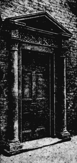
The most striking feature of the building was the door, which, with its surroundings, indicated that in its day the building was considered of some importance.Photograph: British Newspaper Archive.
The house was demolished, the old oak panelling chopped up, and the Adam mantelpieces with one exception (rescued by artist Charles Green), shared a similar fate, with the promise of a few shillings to a workman employed in the destruction, for carting it away.
The site stood empty until the 1930s, and its foundations lie somewhere beneath the Central Library. The old roads – Tudor Street, Tudor Way, Sycamore Street – have long disappeared, and only Tudor Place survives as a private road between the Lyceum and the Library.
This image is dated between 1900 and 1919 and may possibly show buildings once connected with Tudor House (on the right). This is looking down Tudor Street towards Sycamore Street and Arundel Street. On the left, John Round and Son, silversmiths, built on the site of Tudor and Leader’s old workshops. The Theatre Royal is on the far left (it subsequently burnt down). The only familiar landmark is the Lyceum Theatre on the right, separated from the Tudor House buildings by Tudor Place. Today, this is the exact location for Tudor Square. Photograph: Picture Sheffield.
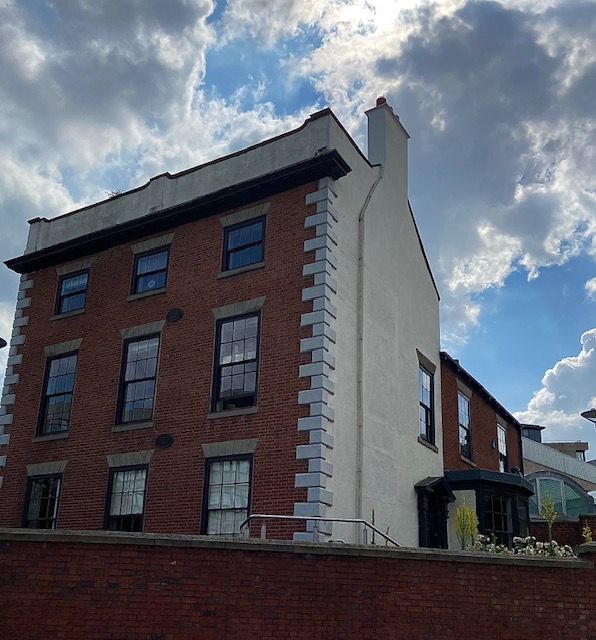
A rare survivor of Georgian Sheffield. Brick with pedimented Doric doorcase and a big-canted bay window, that was added in the early 19th century. Picture: DJP/2021
Realistically, Leader House, overlooking Arundel Gate, from Surrey Street, should not be here anymore. In 1938, Sheffield Corporation bought it with intention of demolition, using the site as part of an ambitious plan to build a new College of Arts and Crafts. The plans were postponed because of World War Two and the Georgian House survived.
A similar thing happened in the 1970s, when Leader House (along with the Lyceum Theatre, the Education Offices and Gladstone Buildings) all came under threat of demolition. In 1970, an application was made to the Minister of Housing for Listed Building Consent to replace it with a modern circular register office. After a public enquiry permission was refused, and the infamous ‘wedding cake’ was built elsewhere.
Leader House was built by the Duke of Norfolk in 1770 for his land agent, Vincent Eyre. The brick building, with slated roof, looked across Alsop Fields, amid sycamore trees, to the margin of the River Sheaf. About this time, the Duke commissioned designs from James Paine, and also from Thomas Atkinson, for laying out the fields with handsome squares and terraces. A start was made on building just before his death in 1777, but the scheme was abandoned, and we can speculate that Leader House was part of this grand plan.
In 1777, it was leased to Thomas Leader, a silversmith, from Broxted, Essex, who came to Sheffield to set up the firm of Tudor, Leader & Co in 1762 with Henry Tudor, who lived at nearby Tudor House.
The eminent Leader family remained until 1817, when it passed to the Pearson family until 1872. It was bought by Charles Wardlow, owner of Wardlow Steels Company on Carlisle Street, whose son, Marmaduke, later lived here spending large amounts of money renovating and improving the building.
It was sold by the Wardlows in 1920 and had several occupants including the silversmith company, Thomas Bradbury, and Son, which had workshops in Arundel Street, and the accountants Joshua Wortley & Sons.
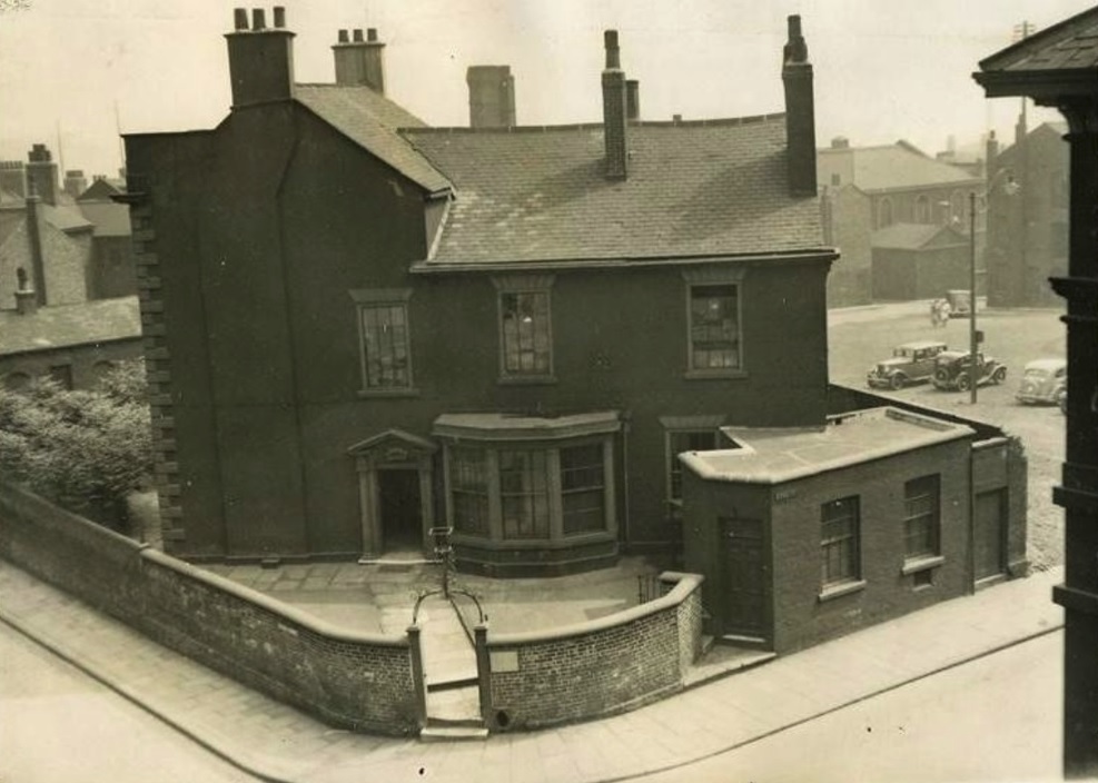
The lease was bought by Sheffield Corporation in 1938 with plans of demolition, but the advent of the Second World war meant it was used as a headquarters for the ARP. It has remained with the council ever since, except for a period when it was leased to Sheffield Polytechnic, and today is used as administrative offices for Sheffield Museums.
The late 1880s building at the rear is classed as a separate building, 2 Surrey Place, and later housed the Central Deaf Club, and The Source Skills Academy. This view is from July 1937. Image: Sheffield Museums.
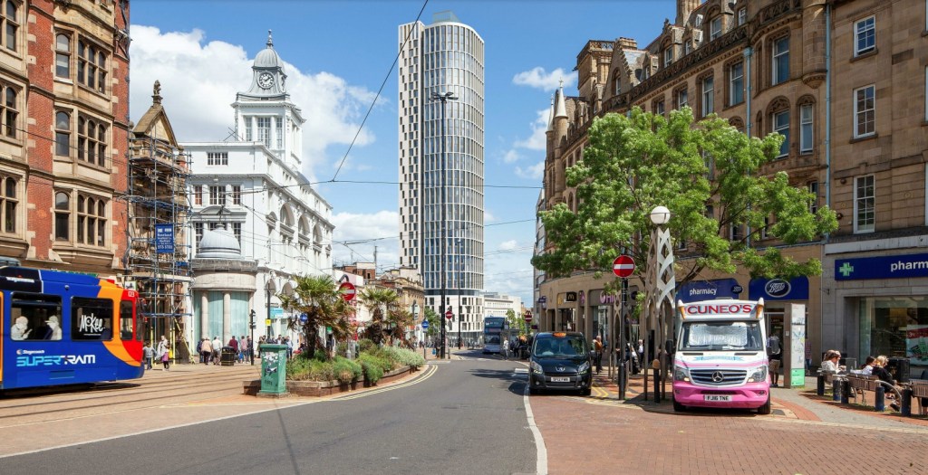
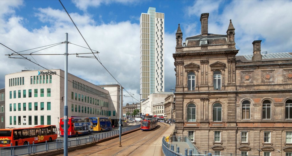
A dramatic change to the High Street. King’s Tower, a 39-storey tower block, that has been granted planning permission.
Prepare for a major new addition to the Sheffield skyline, and its location may come as a surprise.
King’s Tower, at 51-57 High Street, will be a 39-storey tower, comprising 206 apartments, with space for a ground floor commercial unit, drinking establishment or hot food takeaway.
It is probably the first regeneration step for one of the most unkempt parts of the city centre.
King’s Tower will be a significant change to the High Street.
The building will be on the site of what many of us know as the former Primark building, and even further back, the one-time Peter Robinson department store.
When the wrecking balls arrive, there will likely be cries of contempt, but in the eyes of planners, the existing building has no architectural value.
In fact, when researching this post, it was discovered that it was always meant to be a temporary structure, even though it’s lasted almost sixty years.
King’s Tower will be on the site of the ancient market adjacent to Sheffield Castle, first established as the result of a Royal Charter of 1296. The market stall and buildings that occupied the site were demolished in 1786 to make way for the construction of the Fitzalan Market (also known as ‘The Shambles’), which underwent improvement about 1855.
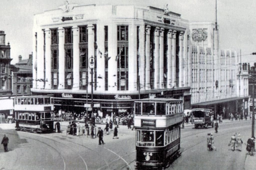
Fitzalan Market was demolished in 1930 when the new Castle Hill Market opened, and a new shop was constructed on the corner of Angel Street for Montague Burton, of Burton Menswear, in 1932. The shop occupied the lower floors while the upper tiers were home to the City Billiard Hall and ‘The City’ Roller Skating Rink.
The grand-looking Burton Building, built at the corner of High Street and Angel Street in 1932. A billiard hall and roller-skating rink occupied the upper floors. (Image: Sheffield Telegraph)
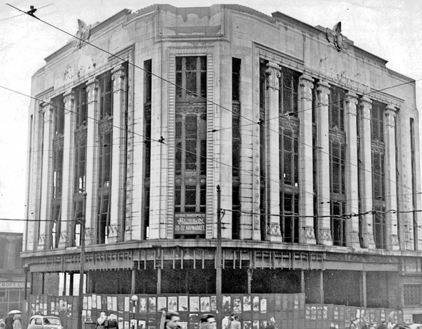
The Burton building was badly-damaged during the Sheffield Blitz of 1940, and stood as an empty shell for many years, its replacement held up by funding and lack of building materials. By the 1950s, Sheffield Corporation insisted that plans for an alternative building would only be granted if it were of ‘temporary character, and not as before,’ because it had plans for a new roundabout intersecting Angel Street, High Street and what would become Arundel Gate.
After being badly damaged by German bombs in 1940, the Burton Building remained empty for many years. (Image: Picture Sheffield)
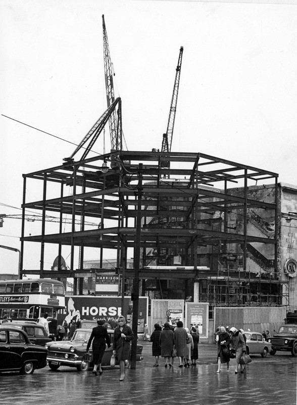
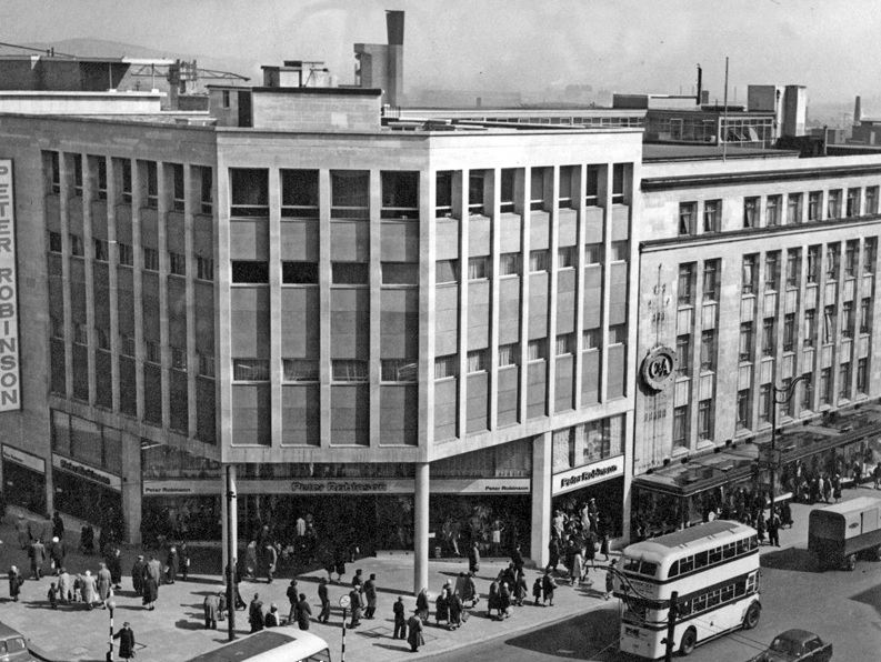
It was eventually demolished and replaced by a new steel-framed building, clad in concrete and tile panels, and opened in 1962 as a Peter Robinson department store. The chain store had been founded in 1833 as a drapery, soon expanding with a flagship store at Oxford Circus, London, and bought by Burton’s in 1946.
The shop in Sheffield was part of Peter Robinson’s nationwide expansion, at its height having 39 stores across Britain.
Whilst the building may not be considered of architectural importance, it most certainly played a part in shaping High Streets across the country.
It was here, in 1964, that a new department was launched on the third floor, Top Shop, a youth brand, selling fashion by young British designers such as Polly Peck, Mary Quant, Gerald McCann, Mark Russell and Stirling Cooper.
The Top Shop name was later used for a large standalone store on Oxford Street, London, and expanded into further Peter Robinson branches at Ealing, Norwich, and Bristol.
It was not until 1973 that Top Shop was split from Peter Robinson, the Top Shop (later Topshop) brand flourished, subsequently becoming part of Phillip Green’s Arcadia Group, whose demise dominates present-day headlines.
Alas, by the end of the 1970s, the Peter Robinson name had all but disappeared.
The steel-frame of the Peter Robinson department store during construction in the early 1960s. (Image: Picture Sheffield)
Completed. Peter Robinson dominated this High Street corner. In 1964, the first Top Shop was opened on the third floor. (Image: Picture Sheffield)
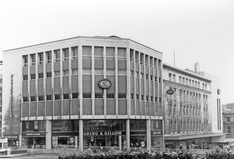
From 1974, the adjacent C&A store absorbed the upper floors of Peter Robinson, while furniture retailer Waring & Gillow occupied the ground floor.
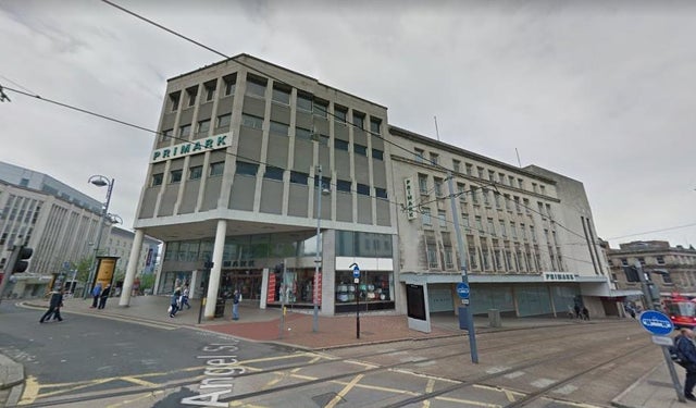
After C&A vacated in the 1990s, it became Primark until it relocated to The Moor in 2016, leaving the old department store empty.
During the 1970s C&A occupied the upper floors while Waring & Gillow sold furniture at ground level. (Image: Picture Sheffield)
Primark, originating from Dublin, took over the premises when C&A pulled out of the UK. (Image: Google)
On a final note, that proposed roundabout eventually became Castle Square, with the famous ‘Hole-in-the-Road’ linking into the building, filled in to accommodate Supertram in 1994.
As part of the works to build King’s Tower, King Street, to the rear, will be improved with the market retained and access for vehicles.
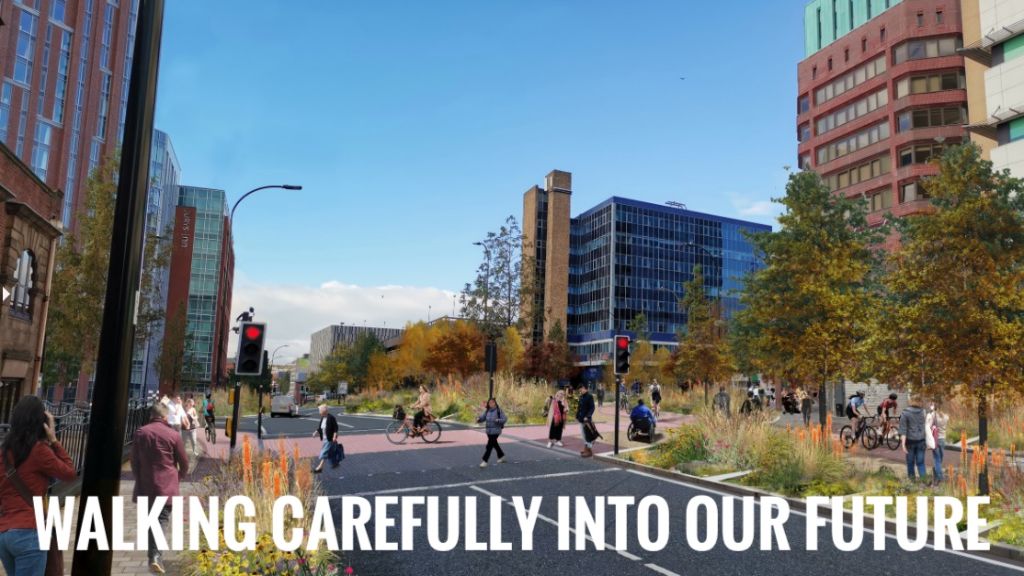
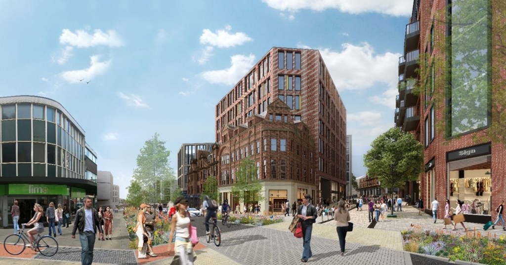
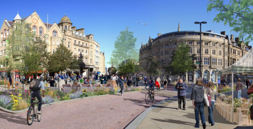
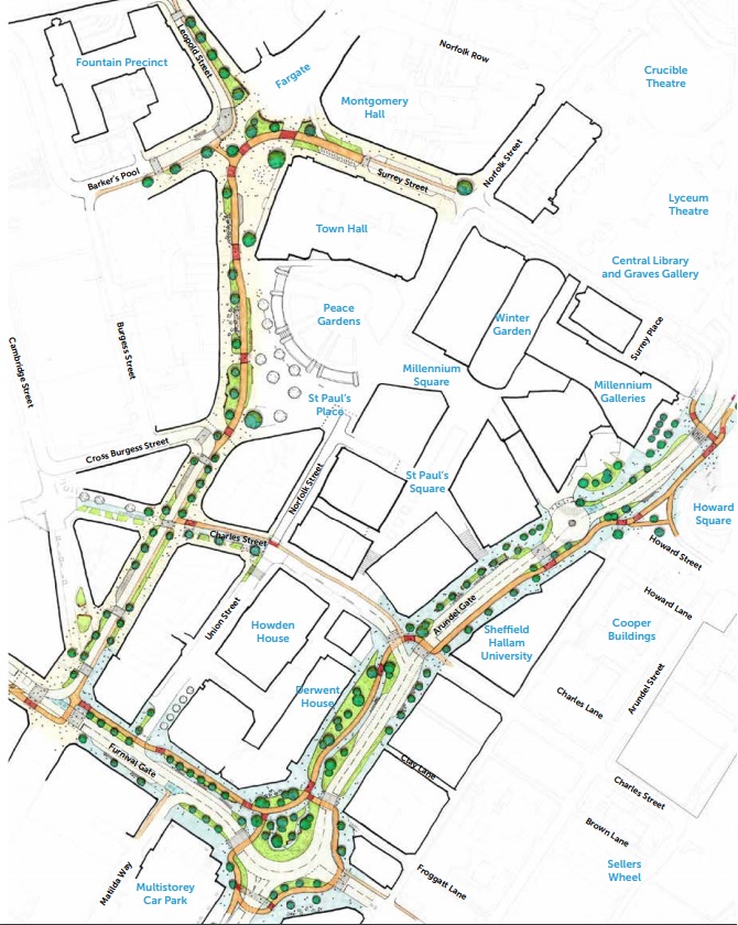
Our city centre may take on a new look if plans to pedestrianise large swathes of it get the go ahead. Sheffield City Council want to make foot and bicycle journeys easier and quicker, while streamlining public transport services.
The proposals include pedestrianisation to Pinstone Street and Leopold Street, linking Fargate with the Peace Gardens, as well as Charles Street between Union Street and Pinstone Street. The pedestrianisation of Surrey Street would create a traffic-free Town Hall Square.
Work would include more greenery, replicating the ‘Grey-to-Green’ scheme already seen between Castlegate and West Bar.
Bus gates would be installed in both directions on Furnival Gate, and along Arundel Gate to Norfolk Street
Rockingham Street would get a new bus hub with improvements to pavements, green planting, a pocket park, and bus stops.
The future of our city? Pedestrianisation of Pinstone Street and Charles Street connects with Heart of the City II redevelopment, due for completion in 2021. (Image: Connecting Sheffield)
Of course, there are benefits to the scheme – improved air quality, better accessibility to shops and businesses, a more attractive city centre, and public spaces that create city uniqueness.
Artist impressions paint a bright picture, but there are notes of caution.
Sheffield city centre is at a midpoint in its regeneration, with the pandemic decimating footfall, and placing even more uncertainty on retail, hospitality, and office space requirements.
The city centre is a travesty of its former self, Covid-19 exposing retailers already reeling from Meadowhall and the internet. And, after restrictions are eventually lifted, how many pubs, bars, and restaurants, will have survived?
Half-hearted attempts to open cycle lanes at the heart of the city, further reducing traffic flow, have met with lukewarm response. With respects to cyclists, our seven hills make four wheels the favoured choice in and out of the city.
The prospect of a Town Hall Square, with pedestrian access and cycle routes linking Fargate, Leopold Street, Surrey Street, and the Peace Gardens. (Image: Connecting Sheffield).
The key to any redevelopment must take into consideration transport links.
Cars are already deterred from entering due to over-complicated traffic flow and the extortionate cost of parking. Our buses remain empty, not least because nobody knows where they go, or where to catch them anymore. Our elderly citizens must walk a distance to catch a bus, and the question remains whether they will bother anymore?
We must tread carefully, mindful that change must happen if our city centre is to be revitalised.
Any changes must take place before 2023 to qualify for a Government grant, managed by Sheffield City Region, and must be subject of public consultation.
An overview of the ‘Connecting Sheffield’ proposal, providing a green space around the city centre. (Image: Connecting Sheffield)
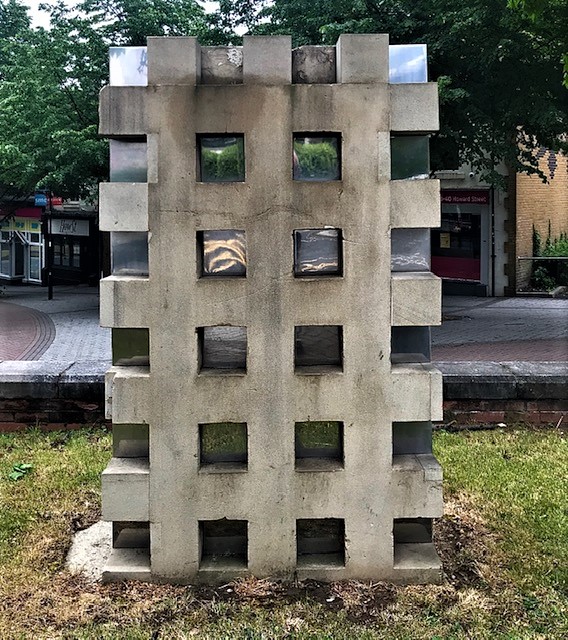
It’s remarkable that Sheffield has never officially paid tribute to Marti Caine. However, there is a sculpture at the top of Howard Street, near Sheffield Hallam University, that is named after her.
Marti Caine grew up in Shiregreen and her vocal talents, wit and engaging personality made her a mainstay of the northern club circuit before she leapt to national prominence by winning the TV talent show New Faces in 1975 – a programme she went on to present with great success.
In her later years, she campaigned tirelessly on behalf of cancer charities before succumbing to lymphatic cancer on November 4, 1995, aged 50, after a long illness.
Marti was awarded an honorary doctorate by Sheffield Hallam University in recognition of her contribution to the world of entertainment, and the film Funny Cow, starring Maxine Peake, was loosely based on her compelling life story.
The gritstone and stainless steel sculpture dedicated to her, originally called Sheen, is often referred to simply as ‘Marti’, one of the pieces made for the Stone City Symposium of 1995. It was commissioned by Sheffield Hallam University and was to have been revealed by Marti Caine, who died two weeks before the opening; it was decided to dedicate the sculpture to her instead.
The stainless steel was intended to reflect the changing weather and reflect passing traffic which flicker across the inset steel squares on the Arundel Gate side of the sculpture.
Describing his work at the time, Mick Farrell, its creator said: “Using stainless steel and stone I hope to set up a contradiction within the nature of both materials. This architectural piece would act both as a landmark and a point to view from.”
Marti Caine (1945-1995). Comedian, actress, singer and dancer. (Image: BBC)
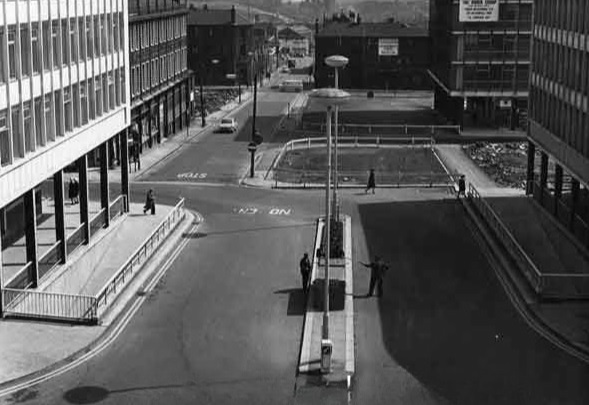
It is a strange name for a small street in Sheffield. Esperanto Place is the short road that stretches between Arundel Gate, going down past Mecca Bingo, and into Fitzalan Square.
Many years ago, this was the eastern end of Norfolk Street, later separated by the construction of Arundel Gate, and insignificant to most people.
However, in 1974, when Sheffield hosted the British Esperanto Conference, this section of road was renamed in its honour.
Sheffield has been important in the world of Esperanto, hosting the British Esperanto Conference on four occasions, and is one of the few places in Britain to have a street named Esperanto.
Esperanto is a language created in the 19th century which soon became the most widely-spoken constructed international auxiliary language in the world. Advocates included film star Charlie Chaplin and writers J. R. R. Tolkien and Leo Tolstoy.
What do you do with a problem like Fitzalan Square? Those of you that have seen it lately cannot have failed to notice its recent overhaul with a new grassed area around the statue of King Edward VII, and the addition of new trees. The square has also been given open access from Norfolk Street, across Arundel Gate, and down Esperanto Place.
The improvements to Fitzalan Square and the surrounding area are part of a £5.5million ‘Knowledge Gateway’ project to transform the area which runs from the Cultural Industries Quarter up to the square.
However, there will be doubters that look upon this work with a note of scepticism. Fitzalan Square has never lived up to its name, not helped by unremarkable twentieth century buildings on one side of the square, and a tendency to attract ‘undesirables’.
Its history goes back to 1869 when Sheffield Corporation started purchasing and demolishing premises on the east side of Market Street (where the top end of the square is now) and the south side of the old Haymarket.
Several properties came down, including the Star Hotel, Theaker’s Coffee House, the King’s Arms Hotel, the Blue Bell, Fisher and Sons, Mr Arnison’s drapery, and Mr Jeffrey’s pawnbrokers.
A large portion of the premises belonged to the Misses Shearwood. These two ladies objected to part with their property and refused to lend themselves in any way to the proceedings for acquiring it. Sheffield Corporation had to execute a deed poll vesting the property in themselves and paid money into a bank account for the benefit of the ladies. The Sheriff of Yorkshire was called in to give the Corporation possession of the property, and did so by placing in the street an article of furniture and getting the tenants to ‘attorn’ to the Corporation – that was to admit that the Corporation was their landlord. The money remained in a Bank of England account until the death of the ladies some years later.
When the property between Market Street and Jehu Lane (still standing off Commercial Street) was pulled down the open space was called Fitzalan Square, after the Duke of Norfolk’s family.
It was in 1882 that the council announced that it was obtaining plans and specifications for completing a new layout in the open space.
“The space will be levelled, and a retaining wall built along Market Street, surmounted with ornamental palisades, leaving a part open in the centre with steps down to the space levelled, at each of which is to be erected two small ornamental stone buildings, the one near the markets for the use of gentlemen, to contain a good reception or waiting room, lavatory, retiring and attendant’s rooms. The building at the other end near to Norfolk Street, for the use of ladies; to be provided with similar accommodation. The open space is to be well spaced with good flagstones, and in the centre a suitable fountain to be erected, or a statue to William Jeffcock, the first Mayor of Sheffield.”
It appears that the plans were rejected in full, the toilets not built, but some improvements were made to ‘Welshers’ Oval’, as the Sheffield Independent called Fitzalan Square.
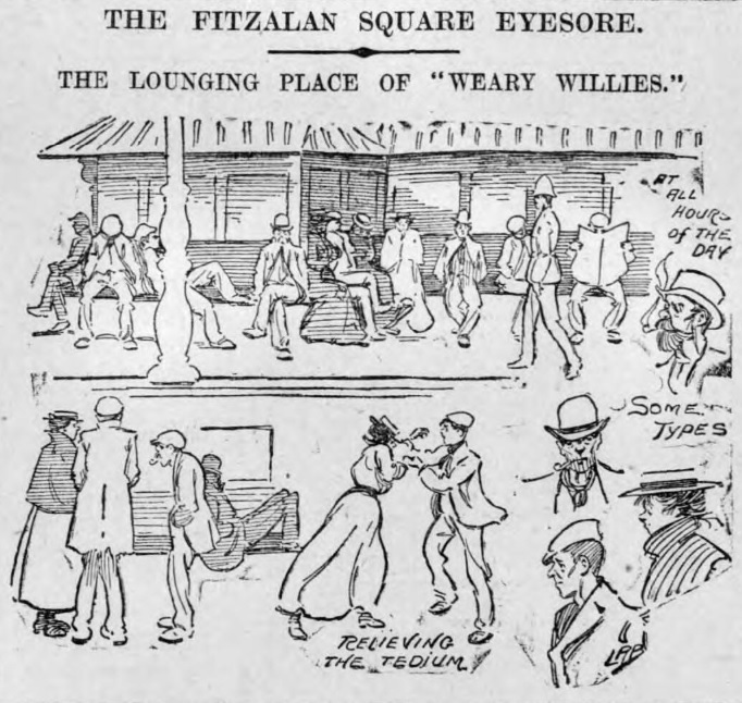
“The police were asked to undertake the keeping of order in the open space,” said Le Flaneur in the newspaper. “I am afraid this open space will be very much like the proverbial white elephant. It certainly cost enough to get, and now a permanent addition of the police force will be necessary to keep it constantly free of the loafers, idlers and book makers that make it their daily resort.”
Photograph by Picture Sheffield
It was left to Police-constable George Warhurst to be the object of terror. Betting loungers were prompt to obey his orders to make themselves scarce, and it was a difficult task for the Chief Constable when Warhurst died in 1884.
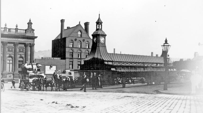
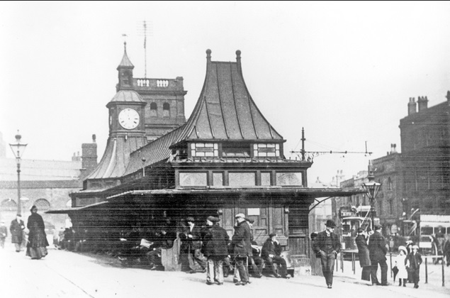
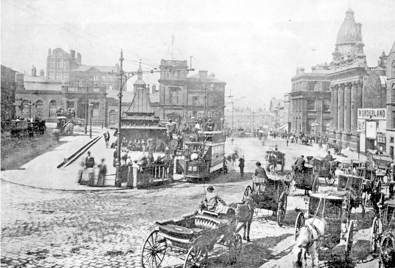
Matters did not improve after a pagoda-style building, comprising tram waiting rooms, water closets and urinals, as well as a clock turret, was built in the centre of the square in 1885.
Photograph by Picture Sheffield
Far from enhancing the appearance of the square, it provided shelter to ‘mouldy old men and frowsy women’ and in a short time had acquired a shabby reputation.
“If only some of our worthy Aldermen and Councillors would make it convenient to spend a few hours each day, for a week, in the immediate vicinity of this structure, they would, I am sure, be earnest in their endeavours to put an end to the constant ‘loafing’ which takes place by ‘undesirables’ at this particular sport,” said one letter to the Sheffield Daily Telegraph.
Photograph by Picture Sheffield
It was a subject repeated day after day.
“The evil at the shelter is a radiating evil. It embraces all the seats around, for the reason that, while the shelter is the converging point of the very pick of Sheffield’s undesirable characters, they also use it as a kind of base from which they carry on their predatory prowling: a long rest, then a short spell of loafing at the street corners, – that is the day’s programme.”
And
“It has been a disgrace far too long, and from every point of view. In my judgement the lavatories themselves are a menace to public decency.”
The ‘Current Topics’ column in the Sheffield Daily Telegraph took up the matter and its biting words make painful reading today.
“The correspondents who are raising the question of this unpicturesque resort of the city’s Weary Willies and Tired Tims will do good service if they can stimulate the authorities into action. We will confess that we never pass through Fitzalan Square without experiencing a keen desire to turn a hose pipe on those seats, partly because it would be a pleasing novelty to see the people run, as in their abhorrence of cold water they would, and partly because both they and the seats they occupy look as if they would be the better for a smart wash.
“There need be no sentiment wasted over the denizens of Fitzalan Square. When we are really civilised, we shall transport such people to Labour Colonies and give them to eat exactly what they earn. Failing that there is neither reason nor sense in retaining them as permanent decorations to the city’s ‘finest site’. Fitzalan Square might be something to be proud of. At present it is only disgusting.”
Illustration from 1903 by The British Newspaper Archive
Sheffield Corporation was indeed stimulated into action, probably the result of land at one end of the square being chosen as the site for the new General Post Office.
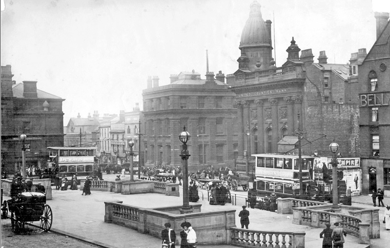
While land was cleared for the Post Office in 1907, councillors proposed reconstructing Fitzalan Square to harmonise with the new building.
It was probably one of the best known public spaces in Sheffield, but the most ardent son could scarcely claim that the pagoda-like structure which gave it its chief characteristic had added either architectural grace or dignity to this part of the city.
“The pagoda had served various purposes satisfactorily, and, notably, as a rendezvous for a little army of folk with apparently little to do than doze and gossip the day through.”
The council adopted a scheme for laying out Fitzalan Square in ornamental style as an open space, and at the same time taking advantage for utilitarian purposes. The scheme was worked out by Mr C.F. Wike, City Engineer, based on drawings prepared by the Sheffield Society of Architects and Surveyors.
At the time it was noted that there were more pipes laid through Fitzalan Square than through any part of the city. Here, the lines to the GPO, the National Telephone, and Electric Light Power stations converged. The Post Office was also laying cables to connect trunk wires to the new GPO building and on completion of work, in January 1909, renovation of the square commenced.
The contractor chosen for the work was George Longden and Son, but the original plan had been shorn of ornamental detail due to cost, although the property overlooking the square was nearly all rebuilt.
The ugly pagoda went and the central part of the square it occupied was enlarged. This was made possible by removing an old cab stand and filling up the slope on the south side of the square to make it level and wider.
The upper part of Baker’s Hill, a sloping road in front of where the new GPO was being built, had been done away with, and steps substituted as an outlet from that corner of the square into Pond Street.
Illustration from 1908 by The British Newspaper Archive
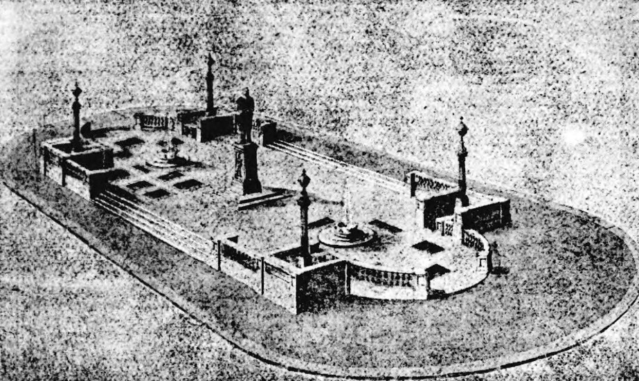
The new scheme provided an ornamental stone balustrade, public conveniences at either end of the square, and a tramway office, all underground. At the four corners were electric arc lamps, with further embellishments, in the shape of a fountain and a statue, planned for a later date.
Photograph by Picture Sheffield
However, the scheme was embroiled in controversy, the council wanting to use Norwegian or Swedish granite because it resisted damage, but the majority wanting cheaper Stoke Hall stone. In the end, the balustrades were built of imported granite.
Fitzalan Square was formally opened on Wednesday December 8, 1909, by the Lord Mayor, Earl Fitzwilliam, at which he made an expressive speech: –
“We live in a time when the question – a burning question in some cities – of open spaces is bidding fair to see some very satisfactory accomplishment. In no city more than Sheffield are these open spaces desirable. In a city like Sheffield where we burned the very best ‘South Yorkshire’, they made the very best mess of the South Yorkshire atmosphere. Science has not yet taught us how altogether to avoid this murky effect, but by providing open spaces we might make best of the atmosphere that is left to us. Sheffield is especially fortunate in its open spaces and in this particular one, because although in the past they had had a space here, it had not been one worthy of the size or importance of the city.”
The improvements had cost £9,000 (about £1.1 million now), but the age-old problems refused to go away, and criticism was often scathing.
Photograph by Picture Sheffield
Photograph by Picture Sheffield
“Within a year an article appeared in the Sheffield Evening Telegraph, written by an anonymous correspondent, under the heading ‘THAT SQUARE’: –
“A good deal of the recent talk about Fitzalan Square may have been ineffectual, but if it did nothing else it sent me to inspect the place. Though my work brings me into the city daily, I had never had reason to descend to the bottom of High Street since the so-called improvement had taken place. Yesterday I determined to see for myself what the fuss was all about.
“I have no desire to exaggerate but I do not hesitate to say that Fitzalan Square is the most pestilently ill-favoured open space in England. This is patent without seeing all the others, for there is an instinct which tells you when you have seen the absolute nadir of ugliness. I have seen IT.
“If you are at all run down the effect of suddenly coming upon such a spectacle as this forlorn wilderness of paltry dog kennels and pretentious architectural incoherencies may easily cause a shock dangerous to health.
“The said ‘improvement’ consists of a stone balustrade round a large piece of nothing at all. What this petty stone fence is meant to enclose or exclude is not obvious. There are four lamp-posts of the most abysmal hideousness. Possibly there is poetic fitness in this, for they are meant to light the way below.
“It might be roofed in and let as a skating rink or turned into a rifle range. It might be dug up and let out to husbandmen. Unless three out of four of the surrounding buildings are absolutely wiped out and a big sum spent in covering up the alleged ‘improvement’ which has recently been carried out, nothing can be done to make the place decent.”
Wartime bomb damage. Photograph by Picture Sheffield
Photograph by Sheffield Star
And so, the tone was set, for decades subject of ridicule, damaged during the Blitz, and often left to its own unsavoury devices.
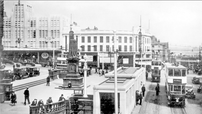
The fountain never materialised and a plan to relocate a statue of Ebenezer Elliot from Weston Park to Fitzalan Square was abandoned. It was graced with a statue of King Edward VII (subject of another post) in 1913.
In time the underground toilets were removed, the trams disappeared, and even the taxis left for busier parts of the city centre.
Photograph by Picture Sheffield
Photograph by Sheffield Star
When the area has become too down-at-heel there have been attempts to restore it, including a 2003 facelift, with the restoration of the King Edward VII statue, new sandstone paving, steel benches and improved street lighting.
The latest restoration comes at a time when this part of the city centre is in transition. A vast proportion of people have migrated to The Moor along with the old market, the old General Post Office now belongs to Sheffield Hallam University, and the future depends on the Castlegate development and most probably our student population.
Fitzalan Square in 2020. Photograph by David Poole
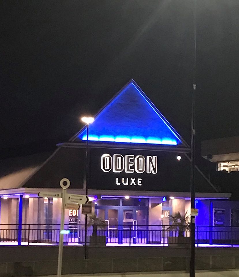
The cinema experience in Sheffield is reaching new heights with the opening of The Light and the recent makeover of the Odeon on Arundel Gate. Now rebranded as Odeon Luxe – “cinema like you’ve never experienced before” – it’s hard to believe this building was constructed in the sixties.
The history will be lost to a younger generation, familiar with the cinema and Tank nightclub alongside, but its beginnings go back to the Epic Development of 1968-1969, a massive £1million project to provide an entertainment complex for the city.
The scheme exploited the steeply sloping ground above Pond Street, rising to the newly-constructed inner ring road (Arundel Gate). With shops and car-parking below, it linked Pond Street bus station to the city centre by means of walkways, escalators and subways. The key features were two large windowless blocks, clad entirely in panels of white tiles, designed by Jefferson Sheard & Partners, responsible for the brutalist Moore Street Substation.
One of the buildings was taken by the Rank Organisation as a 2,500 capacity nightclub and conference centre, known to generations as Top Rank (later the Roxy, now the O2 Academy), while the other unit was proposed as another nightclub with twin cinemas underneath.
The Cinecenta cinemas opened in January 1969, but it wasn’t until the summer of 1970 that a cabaret club opened above. This was the Fiesta Club, operated by two brothers, Keith and Jim Lipthorpe, who had managed the Club Fiesta at Stockton-on-Tees since 1965. The cost of fitting out the building was said to be £500,000, a huge undertaking, and provided 1,300 seats in the auditorium.
It was reputed to be the largest cabaret club in Europe, building a reputation in attracting big names to the city. The Jackson Five, The Beach Boys, Roy Orbison, Stevie Wonder, Ella Fitzgerald and The Four Tops all played here.
And there were many famous homegrown names too – Cilla Black, Bruce Forsyth, Les Dawson, Tommy Cooper and Sheffield’s own Tony Christie – to name but a few. Legend suggests that Elvis Presley nearly appeared here, but alas it never happened.
For a time, the Fiesta Club was legendary, but the ever-increasing demands of artists and agents had taken its toll. In 1976, following a 17-day strike by staff wanting to join a union, the Fiesta Club closed with debts of £300,000.
After a spell in darkness, it reopened under the management of a Scarborough-based company, but when this also failed it passed into the hands of the Rank Organisation. Uncomfortable with such a large venue, it leased the Fiesta Club to a businessman who later disappeared.
The Epic Development never reached the heights it intended. Far from providing a link to the city centre, Arundel Gate was the problem, wider then, and only crossed by pedestrians via a series of subways. By the end of the seventies the area was already down-at-heel, the underpasses were dangerous places at night, the escalators had stopped working, and the shops were only attracting low-end retailers.
The lights finally went out at the Fiesta Club in 1980, standing empty until the Rank Organisation converted it into the Odeon multiplex cinema in 1992. Five of the seven screens were fitted into the shell of the Fiesta, two screens were taken in the former Cinecenta auditoriums, and extra screens added later.