Categories
Buildings

Leader House: A survivor from days of fields and gardens


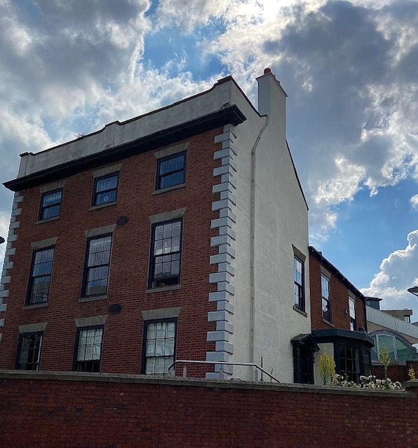
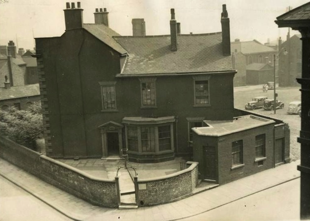
A rare survivor of Georgian Sheffield. Brick with pedimented Doric doorcase and a big-canted bay window, that was added in the early 19th century. Picture: DJP/2021

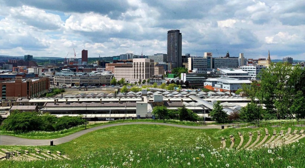
Realistically, Leader House, overlooking Arundel Gate, from Surrey Street, should not be here anymore. In 1938, Sheffield Corporation bought it with intention of demolition, using the site as part of an ambitious plan to build a new College of Arts and Crafts. The plans were postponed because of World War Two and the Georgian House survived.

A similar thing happened in the 1970s, when Leader House (along with the Lyceum Theatre, the Education Offices and Gladstone Buildings) all came under threat of demolition. In 1970, an application was made to the Minister of Housing for Listed Building Consent to replace it with a modern circular register office. After a public enquiry permission was refused, and the infamous ‘wedding cake’ was built elsewhere.

Leader House was built by the Duke of Norfolk in 1770 for his land agent, Vincent Eyre. The brick building, with slated roof, looked across Alsop Fields, amid sycamore trees, to the margin of the River Sheaf. About this time, the Duke commissioned designs from James Paine, and also from Thomas Atkinson, for laying out the fields with handsome squares and terraces. A start was made on building just before his death in 1777, but the scheme was abandoned, and we can speculate that Leader House was part of this grand plan.

In 1777, it was leased to Thomas Leader, a silversmith, from Broxted, Essex, who came to Sheffield to set up the firm of Tudor, Leader & Co in 1762 with Henry Tudor, who lived at nearby Tudor House.

The eminent Leader family remained until 1817, when it passed to the Pearson family until 1872. It was bought by Charles Wardlow, owner of Wardlow Steels Company on Carlisle Street, whose son, Marmaduke, later lived here spending large amounts of money renovating and improving the building.  

It was sold by the Wardlows in 1920 and had several occupants including the silversmith company, Thomas Bradbury, and Son, which had workshops in Arundel Street, and the accountants Joshua Wortley & Sons.

The lease was bought by Sheffield Corporation in 1938 with plans of demolition, but the advent of the Second World war meant it was used as a headquarters for the ARP. It has remained with the council ever since, except for a period when it was leased to Sheffield Polytechnic, and today is used as administrative offices for Sheffield Museums.

The late 1880s building at the rear is classed as a separate building, 2 Surrey Place, and later housed the Central Deaf Club, and The Source Skills Academy. This view is from July 1937. Image: Sheffield Museums.

© 2021 David Poole. All Rights Reserved.

Categories
Buildings

Sheffield Hallam University

Block D will become a key anchor for Howard Street and
gateway building to the city and campus. This requires a
building facade that is both civic but restrained in its nature. (BDP)

News of a significant proposed development within Sheffield’s Cultural Industries Quarter Conservation Area.

Sheffield Hallam University has submitted a planning application for the erection of three new higher education blocks within its city campus on the existing Science Park site and adjacent surface car park. Blocks A, BC and D are planned around a new public green space provisionally named University Green. It forms a revised Phase One of SHU’s campus masterplan, initiated in 2017/18, and considers changes to the workplace because of the pandemic.

The site covers an area bordered by Paternoster Row, Howard Street, Arundel Street and Charles Street, and is alongside the Hubs complex.

The ground floor plan illustrates public entrances,
key internal spaces, range of activities and location of key
green spaces (internal yards and University Green). (BDP)

Block D will become a key civic gateway building to the city and campus. In response to this, the tallest part of the development is located at the key junction between Howard Street and Paternoster Row to symbolise a new gateway and reference to the old clock tower of the Arthur Davy & Sons building that once stood on part of the site.

The architectural expression of Block BC is three simple
masses that step down from University Green towards the
Globe Pub.
(BDP)
Block A has showcase opportunities on Charles Street and
Arundel Street where applied learning functions such as SHU
Law may be showcased. (BDP)

This area was once known as Alsop Fields where ancient hunting rights were claimed. In the late 18th century, the Duke of Norfolk set about his ambitious and grand plan to develop the neighbourhood into a fashionable residential district in response to the growing wealth of manufacture. The masterplan was prepared by James Paine. He proposed a rigid grid framework incorporating a hierarchy of streets, with main streets and a pattern of smaller ones for each urban block, serving mews to the rear of the main houses.

In the 1780s, work on the Georgian estate grid commenced to the north of the site beginning with the parallel routes of Union Street, Eyre Street and Arundel Street from the town centre, extending to Matilda Street (formerly Duke Street). However, the masterplan didn’t transpire largely because Sheffield’s inhabitants didn’t want or couldn’t afford the properties as planned.

Despite the masterplan never being wholly built, the legacy of the Duke of Norfolk is retained in many of the streets being named after his family members.

The site designated for redevelopment became a series of factories, workshops, small shops, as well as the site of the County Hotel. Much of the land was cleared during the 1980s, with the creation of Sheffield Hallam University’s Science Park (1996) in red brick by Hadfield Cawkwell Davidson. This will be swept away in the proposed development.

The Campus plan was developed around a number of
Campus plan Principles that are embedded in the design of
blocks A, BC, D and University Green. (BDP)
Illustrative photomontage view looking from Park Hill. (BDP)
Entrance to the Science Park on Howard Street. If planning permission is granted, the site will be cleared and replaced with the new development. (Wikimedia)

© 2021 David Poole. All Rights Reserved.