Categories
Buildings People

Tudor House: Bright flowers and green trees

Tudor Square. The gated road on the right, between the Central Library and Lyceum Theatre, is Tudor Place, once the site of Tudor House. Photograph: DJP/2021

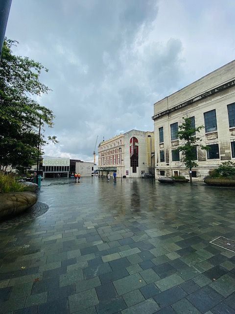
Tudor Square, the home of theatres, the library, and the Winter Garden, and created in 1991 to become Sheffield’s cultural centre. But how did it get its name?

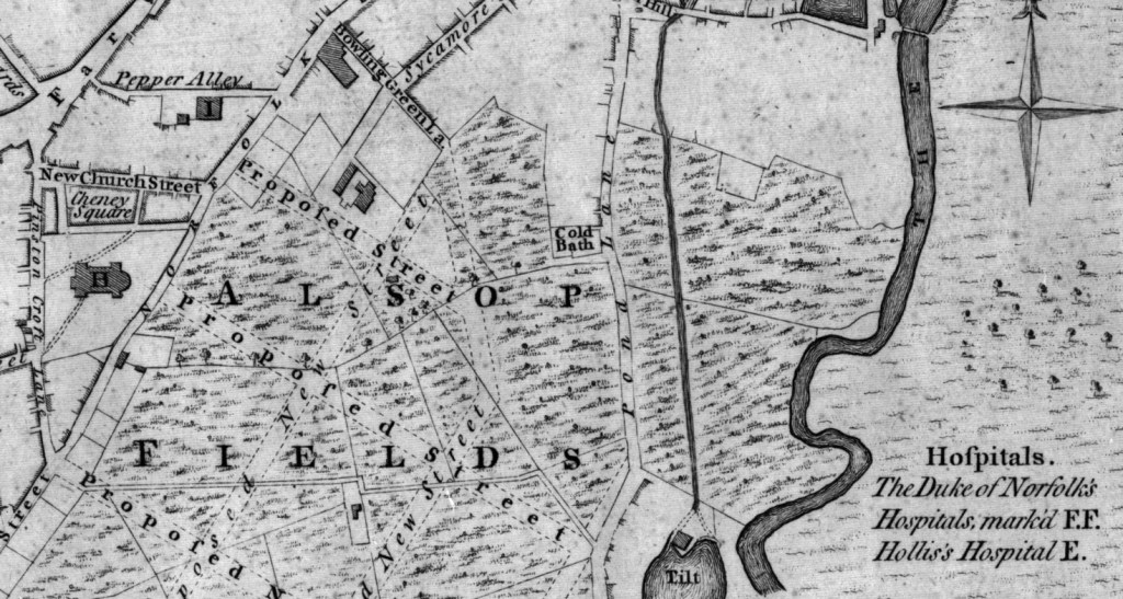
Let us go back to the late 1700s, and we would be standing in the grounds of Tudor House. This Adam house was built in 1770 for Dr Sherburn with commanding country views across Alsop Fields. The gardens extended to the front and right, the land sloping down across what is now Arundel Gate, amid sycamore trees, to the margin of the Sheaf.

Now let us introduce Henry Tudor, a man identified by Dr Sherburn to become head of a firm making the best wrought silver plate. Tudor teamed up with Thomas Leader and the firm of Tudor and Leader was created, eventually building a workshop close to the house. Dr Sherburn showed his appreciation of the efforts of his active partners by bequeathing the bulk of his property to Henry Tudor, with a share in the concern to Thomas Leader.

Henry Tudor moved into what became Tudor House, while Thomas Leader rented a house nearby that the Duke of Norfolk built for his land agent and became known as Leader House.

Fairbank’s Map of Sheffield 1771. Tudor House is shown on the left of the map below Bowling Green Lane (later Arundel Street). The proposed road became Surrey Street. Just above the letter ‘s’ is Leader House. Photograph: Picture Sheffield.

Mr Tudor was for many years a prominent man in the town’s affairs – as a Town Trustee, one of the first Guardians of the Assay Office, and in other offices. He had the reputation of being the proudest man in Sheffield, and this earned him the title of ‘My Lord Harry.’ He was highly indignant at finding another Henry Tudor, a journeyman, and he vainly endeavoured to bribe the man to change his name.

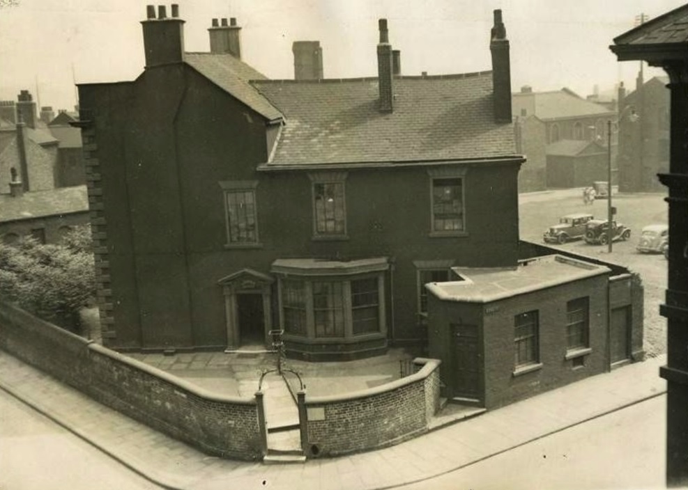
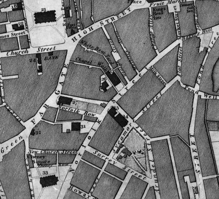
This idyllic retreat, with bright flowers and country air, changed as Sheffield grew. The front garden became a bowling green, and in 1808, the house of the late Henry Tudor, though shorn of its once extensive grounds, retained as garden, the whole of the triangle which with Tudor Street as its base, had its sides along Arundel Street and Surrey Street, and its apex at their junction. Narrow streets (Tudor Street, Tudor Place) had surrounded it, with industry spreading into the Sheaf Valley below. By now, one of the Lucas’s, of the Royd’s Mill Silver Refinery, was the occupant of the house, coach-house, and stables.

Fairbank’s Map of Sheffield 1808. Tudor House had lost much of its land, but still had a garden enclosed by Surrey Street, Arundel Street and Sycamore Street. The portion of Sycamore Street, nearest the house, became Tudor Street. Photograph: Picture Sheffield.

Tudor House stopped being a home, its remaining land sold off, and it became a Dispensary (1832-33), the Tudor Place Institute (a bible society), Medical Officer’s Department, and Offices of the Weights and Measures Department.

In 1872, a letter appeared in the Sheffield and Rotherham Independent.

“Passing through Tudor Place the other day I could not help being struck with the lost and demoralised appearance it presents. Grimy brick walls, whose monotony is increased by tattered shreds of flaring posting bills, stare at the once considerable residence of Henry Tudor, which, with its ancient adornments of wreathed flowers, contemplates with an aspect which is the height of melancholy, the deep puddles, the chaotic boulders, the piles of stones, the layers of timber, and general waste heap look that have invaded the sacred precincts of its once charming garden. The parade ground of the Artillery Volunteers and the other buildings that intervene between Tudor Place and Arundel Street have usurped the place of the flower beds and fruit trees of Henry Tudor, and the sycamores that surrounded his domain have their memory perpetuated in the adjoining street, that breathes a fragrance of anything but bright flowers and green trees.”

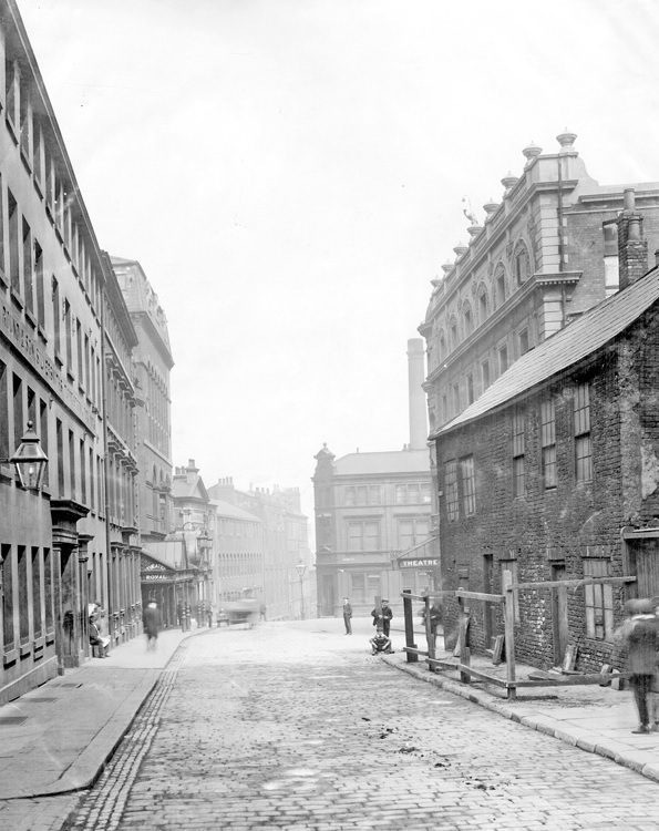
The parade ground mentioned was cleared, and a large wooden circus erected. It later became the site of the Lyceum Theatre and Tudor House’s last use was as storage for theatrical scenery.

This might be the only photograph in existence of Tudor House. It was taken in 1907 and the house was demolished the following year. Photograph: British Newspaper Archive.

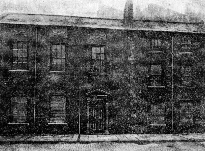
By 1908, Tudor House was doomed.

“It is remarkable that at the moment when a special appeal is being made for funds for the erection of a new Infirmary in the city the home of the oldest of our medical charities, the Sheffield Dispensary, is about to be demolished. The building referred to is in Tudor Place. Its broken windows and deserted appearance give little indication as to the important part it played for many years in the alleviation of suffering humanity. A few days, and the building will be demolished. What is to become of the old operating table which is in the old building? A gruesome relic it would doubtless be, but it is surely worthy of consideration whether something cannot be done with a view to preserving it from the flames.”

The most striking feature of the building was the door, which, with its surroundings, indicated that in its day the building was considered of some importance. Photograph: British Newspaper Archive.

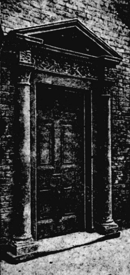
The house was demolished, the old oak panelling chopped up, and the Adam mantelpieces with one exception (rescued by artist Charles Green), shared a similar fate, with the promise of a few shillings to a workman employed in the destruction, for carting it away.

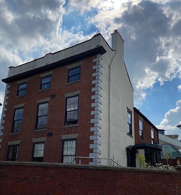
The site stood empty until the 1930s, and its foundations lie somewhere beneath the Central Library. The old roads – Tudor Street, Tudor Way, Sycamore Street – have long disappeared, and only Tudor Place survives as a private road between the Lyceum and the Library.

This image is dated between 1900 and 1919 and may possibly show buildings once connected with Tudor House (on the right). This is looking down Tudor Street towards Sycamore Street and Arundel Street. On the left, John Round and Son, silversmiths, built on the site of Tudor and Leader’s old workshops. The Theatre Royal is on the far left (it subsequently burnt down). The only familiar landmark is the Lyceum Theatre on the right, separated from the Tudor House buildings by Tudor Place. Today, this is the exact location for Tudor Square. Photograph: Picture Sheffield.

© 2021 David Poole. All Rights Reserved.

Categories
Buildings

Leader House: A survivor from days of fields and gardens


A rare survivor of Georgian Sheffield. Brick with pedimented Doric doorcase and a big-canted bay window, that was added in the early 19th century. Picture: DJP/2021

Realistically, Leader House, overlooking Arundel Gate, from Surrey Street, should not be here anymore. In 1938, Sheffield Corporation bought it with intention of demolition, using the site as part of an ambitious plan to build a new College of Arts and Crafts. The plans were postponed because of World War Two and the Georgian House survived.

A similar thing happened in the 1970s, when Leader House (along with the Lyceum Theatre, the Education Offices and Gladstone Buildings) all came under threat of demolition. In 1970, an application was made to the Minister of Housing for Listed Building Consent to replace it with a modern circular register office. After a public enquiry permission was refused, and the infamous ‘wedding cake’ was built elsewhere.

Leader House was built by the Duke of Norfolk in 1770 for his land agent, Vincent Eyre. The brick building, with slated roof, looked across Alsop Fields, amid sycamore trees, to the margin of the River Sheaf. About this time, the Duke commissioned designs from James Paine, and also from Thomas Atkinson, for laying out the fields with handsome squares and terraces. A start was made on building just before his death in 1777, but the scheme was abandoned, and we can speculate that Leader House was part of this grand plan.

In 1777, it was leased to Thomas Leader, a silversmith, from Broxted, Essex, who came to Sheffield to set up the firm of Tudor, Leader & Co in 1762 with Henry Tudor, who lived at nearby Tudor House.

The eminent Leader family remained until 1817, when it passed to the Pearson family until 1872. It was bought by Charles Wardlow, owner of Wardlow Steels Company on Carlisle Street, whose son, Marmaduke, later lived here spending large amounts of money renovating and improving the building.  

It was sold by the Wardlows in 1920 and had several occupants including the silversmith company, Thomas Bradbury, and Son, which had workshops in Arundel Street, and the accountants Joshua Wortley & Sons.

The lease was bought by Sheffield Corporation in 1938 with plans of demolition, but the advent of the Second World war meant it was used as a headquarters for the ARP. It has remained with the council ever since, except for a period when it was leased to Sheffield Polytechnic, and today is used as administrative offices for Sheffield Museums.

The late 1880s building at the rear is classed as a separate building, 2 Surrey Place, and later housed the Central Deaf Club, and The Source Skills Academy. This view is from July 1937. Image: Sheffield Museums.

© 2021 David Poole. All Rights Reserved.

Categories
Buildings

Sheffield Hallam University

Block D will become a key anchor for Howard Street and
gateway building to the city and campus. This requires a
building facade that is both civic but restrained in its nature. (BDP)

News of a significant proposed development within Sheffield’s Cultural Industries Quarter Conservation Area.

Sheffield Hallam University has submitted a planning application for the erection of three new higher education blocks within its city campus on the existing Science Park site and adjacent surface car park. Blocks A, BC and D are planned around a new public green space provisionally named University Green. It forms a revised Phase One of SHU’s campus masterplan, initiated in 2017/18, and considers changes to the workplace because of the pandemic.

The site covers an area bordered by Paternoster Row, Howard Street, Arundel Street and Charles Street, and is alongside the Hubs complex.

The ground floor plan illustrates public entrances,
key internal spaces, range of activities and location of key
green spaces (internal yards and University Green). (BDP)

Block D will become a key civic gateway building to the city and campus. In response to this, the tallest part of the development is located at the key junction between Howard Street and Paternoster Row to symbolise a new gateway and reference to the old clock tower of the Arthur Davy & Sons building that once stood on part of the site.

The architectural expression of Block BC is three simple
masses that step down from University Green towards the
Globe Pub.
(BDP)
Block A has showcase opportunities on Charles Street and
Arundel Street where applied learning functions such as SHU
Law may be showcased. (BDP)

This area was once known as Alsop Fields where ancient hunting rights were claimed. In the late 18th century, the Duke of Norfolk set about his ambitious and grand plan to develop the neighbourhood into a fashionable residential district in response to the growing wealth of manufacture. The masterplan was prepared by James Paine. He proposed a rigid grid framework incorporating a hierarchy of streets, with main streets and a pattern of smaller ones for each urban block, serving mews to the rear of the main houses.

In the 1780s, work on the Georgian estate grid commenced to the north of the site beginning with the parallel routes of Union Street, Eyre Street and Arundel Street from the town centre, extending to Matilda Street (formerly Duke Street). However, the masterplan didn’t transpire largely because Sheffield’s inhabitants didn’t want or couldn’t afford the properties as planned.

Despite the masterplan never being wholly built, the legacy of the Duke of Norfolk is retained in many of the streets being named after his family members.

The site designated for redevelopment became a series of factories, workshops, small shops, as well as the site of the County Hotel. Much of the land was cleared during the 1980s, with the creation of Sheffield Hallam University’s Science Park (1996) in red brick by Hadfield Cawkwell Davidson. This will be swept away in the proposed development.

The Campus plan was developed around a number of
Campus plan Principles that are embedded in the design of
blocks A, BC, D and University Green. (BDP)
Illustrative photomontage view looking from Park Hill. (BDP)
Entrance to the Science Park on Howard Street. If planning permission is granted, the site will be cleared and replaced with the new development. (Wikimedia)

© 2021 David Poole. All Rights Reserved.