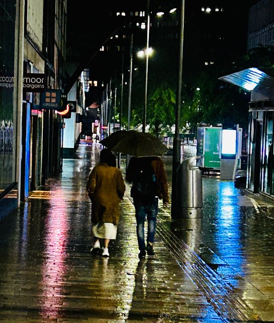
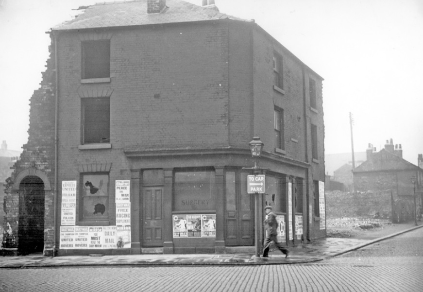
With apologies to the unknown couple who walked down The Moor late at night. Same place. Different times.
*****
It was dark and raining, and Benjamin and Mary tramped across bleak Sheffield Moor. “I said it was a bad idea,” cried Mary. “My brother Thomas offered to take us if we slipped him a few coins. He would have brought his gun along.”
“Stop worrying,” Benjamin told her. He held her arm to stop her falling. “Stick to the track, that way we know we’re heading in the right direction.”
“It’s muddy, and I can’t see anything in front of me.”
“We must travel by night so that nobody sees us. Rest assured, Mary, there won’t be many robbers out tonight.”
A cold wind blew across the scrub and rattled the branches of the trees. She was wet through, and she pulled the shawl around her to keep warm. “I feel like a thousand eyes are watching us.”
“Keep walking and don’t think about what might be in the shadows.” Benjamin patted the knife that he’d stolen from the slaughterhouse. Mary didn’t know that he had it, but he was prepared if there was anybody who might be a threat.
“I’m frightened. How far is it,” Mary asked.
“I’m not sure,” he said, “but we have to cross the Porter first.”
“Oh Benjamin. That makes it sound even more dangerous.” She wished she was at home in the bed that she knew she would never see again.
“There is a plank across it, and then we head towards Little Sheffield.” He put his arm around her hoping that it might reassure her. “We’ll catch a horse and cart in the morning.”
“Do you think that we’re doing the right thing?”
“We’ve no choice, Mary. If the constable catches me, I’ll be put in the stocks like last time.”
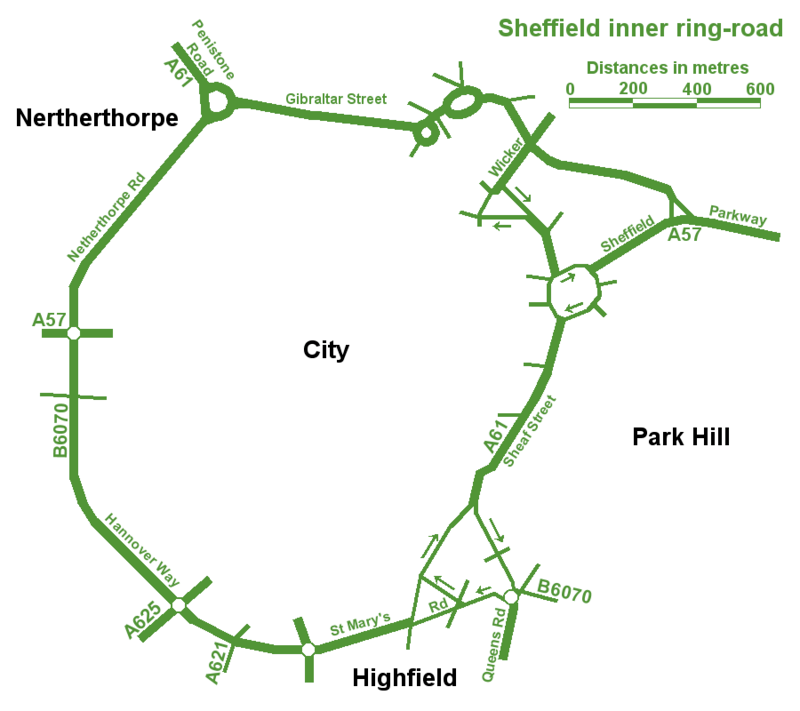
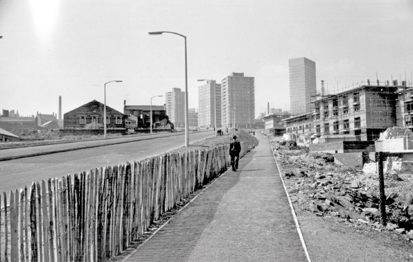
The best map of Sheffield’s Inner Ring Road, but spoilt by spelling mistakes.
An unusual post, in so much that we are looking at a road. In fact, a series of roads that form one big one – Sheffield Inner Ring Road.
We might live in Sheffield, but sometimes it’s difficult to see wood for the trees, and this is the case with the inner ring road, because you probably don’t realise its purpose and where it is.
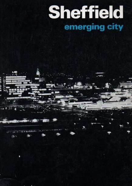
Let’s start in the 1930s when a route around the city centre was first proposed. Truth be known, World War Two stalled plans until the sixties, and in 1969 Sheffield Corporation published an impressive handbook called ‘Sheffield – Emerging City,’ in which plans for a detailed road system were revealed for the first time.
The council intended to pour £65m into the scheme which included bus lanes, pedestrian areas, as well as an urban motorway and motorway links with the M1.
Robert Waterhouse, writing in The Guardian in 1972, said that “Sheffield was as proud of its new roads as of its housing, its clean air, and its flourishing arts. They were all symbols of rebirth after years of stagnation among the ruins of the Industrial Revolution.”
The Guardian article, long forgotten, provides an interesting snapshot into the arguments that raged at the time.
It pointed out that after 1969, things had started to go wrong. In May 1971, a joint report by the city engineer, the city planning officer and architect, and the general manager of the transport department, had taken a gloomy view.
‘Although a large highway construction programme has been embarked upon,’ it said, ‘the growth of vehicular traffic is much greater than the growth of road capacity. The disparity has been obvious for many years and there seems negligible hope of it being ended in the foreseeable future.”
The report estimated that the proposed highway system, capable of carrying about 50 per cent of commuters to work by car, would cost ratepayers another 20p in the pound, which was probably acceptable, but that a system by which nearly everyone went by car could cost £300m, or another pound on the rates, clearly unacceptable. If the ‘compromise,’ £65m system was going to get clogged up anyway, was it worth building at all?
Arundel Gate in 1973 looking towards the Hole in the Road – new barriers erected in attempt to make pedestrians use the subways. Image: Sheffield Newspapers/Picture Sheffield
Waterhouse identified growing opposition within the council.
Sir Ron Ironmonger, Labour’s council leader, admitted that a growing number of councillors were against the scheme, and there had been public exchanges between the planning department and engineers.
The planners, headed by R. Adamson, felt that the engineers were going about the job the wrong way: instead of giving priority to the inner ring road, which everybody thought essential, construction had been advanced near the city centre. This meant that the civic circle – the inner ring road ultimately intended to carry only local shoppers and delivery vans – was being used as a throughway.
But the engineers, under K.D. Wiilliams, replied that highways the size of the inner ring road – a six-lane urban motorway – didn’t happen overnight.
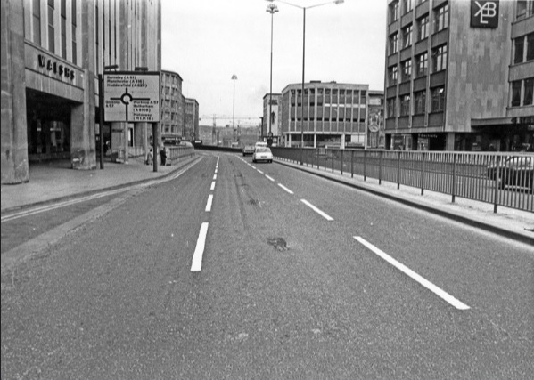
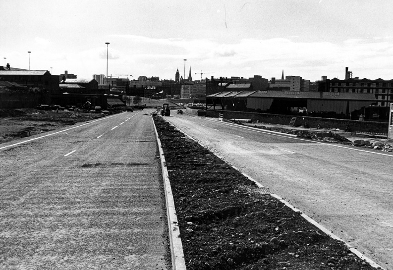
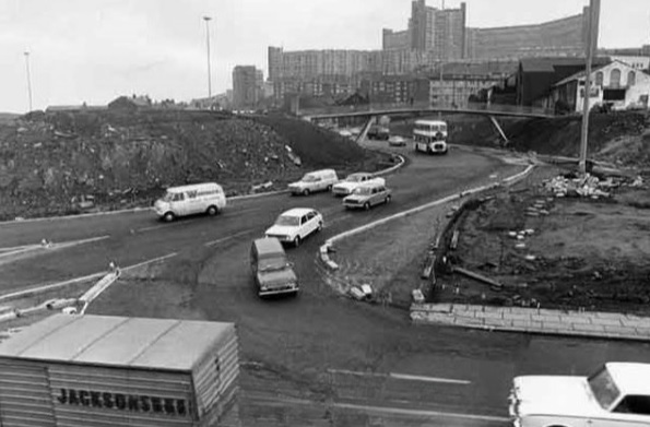
It seemed that Sheffield residents didn’t know what they were in for but would soon find out. The new interchange between the inner ring road and the Parkway was near completion at the bottom of Commercial Street. Sheffield Parkway was also being built and would be the main route into the city centre from the M1.
Construction of Sheffield Parkway in 1974 looking towards Park Square. Image: Sheffield Newspapers/Picture Sheffield
Sheaf Street/Commercial Street (latterly known as Park Square) roundabout under construction in 1973. Image: Sheffield Newspapers/Picture Sheffield
But the argument in 1971 was that traffic coming into the city centre was being diverted onto newly-constructed roads, because there was no proper inner ring road. And it was causing problems.
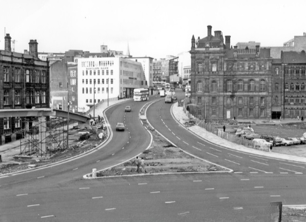
On Commercial Street itself, a bridge was being widened to take four lanes of traffic. It joined the civic circle at Castle Square, where traffic and pedestrians were already separated – cars at ground level, pedestrians underground. But before the road got there, it had to pass Fitzalan square, one of the principal routes for shoppers on foot. Everybody agreed this was a problem, but work on widening Commercial Street continued anyway, despite open criticism from Labour councillors.
Widened Commercial Street in 1970s, looking towards the Gas Company Offices on right, Electricity Supply Offices and Barclay’s Bank on left. Shude Hill behind car park on right. Image: Picture Sheffield
There were others also opposed to the scheme. Dr Leonard Taitz, a young South African doctor, working in Sheffield, was convener of the Conservation Society’s national transportation working party. He had started a campaign to bring the road building programme to a halt while a new policy on integrated transportation was formulated.
New roads were being built within the city centre but there were design flaws.
He cited the case of Furnival Gate, also a four-lane highway which, he suggested, was bound to be used by commuter traffic, but which divided The Moor and Pinstone Street, two proposed precinct streets. A subway to take people under the road had already been built, while Charter Row, another radial, had a barrier down its middle which cut a whole segment of the city from the centre.
Furnival Gate at the junction with The Moor showing (middle left) junction with Union Street in the 1960s. Image: Picture Sheffield
He argued that these roads were primarily being used by commuters cutting across town. But Mr K.D. Williams, head of technical design at the engineers, said this wasn’t the case, and that they were a necessary part of an integral system, that will one day be blocked off to prevent through traffic, and channel motorists to off-street car parks.
Whatever the interpretation, the roads were ‘not a pretty site.’ Certainly not ‘Sheffield’s Champs Elysees,’ as a councillor had called Arundel Gate.
Robert Waterhouse asked the important question? Would the new roads ever carry the massive traffic that Sheffield had come to expect? Would the inner ring road be built as a motorway, and would Sheffield get its two, or even three, motorway links with the M1?
Sir Ron Ironmonger pointed out that after 1974, highways would become the responsibility of the new South Yorkshire metropolitan authority and had no wish to make any drastic moves at such a late stage, and cited Nottingham which had done away with a major part of its road programme. (Sir Ron later became leader of South Yorkshire Metropolitan County Council).
What did happen?
The 1970s proposal for the Inner Ring Road was abandoned because it would have destroyed important heritage assets like Kelham Island and the canal basin, and cash, as ever, was the stumbling block. But we did eventually get an Inner Ring Road, but it took a long time for it to be completed in its entirety.
We can thank Duncan Froggatt, a Chartered Engineer, in his excellent book, ‘Sheffield – A Civilised Place’ (2018), for providing the timeline.
“The inner relief road had started in the 1960s starting with the dualling of Netherthorpe Road. But the later stages came much later with St Mary’s Gate and Hanover Way widened to dual carriageways in the 1980s.
“Sheaf Street was improved in the early 2000s leading to the improvement of Sheaf Square and subsequently links to St Mary’s Road up to 2009.
“The northern section from Sheffield Parkway to Penistone Road was built in two phases in the 1990s. The phase from the Parkway to The Wicker was completed in 2000, originally called Cutlers’ Gate, but later renamed Derek Dooley Way. The next stage, between the Wicker and Shalesmoor was finished in 2008.
“Once completed, it provided a continuous loop of dual carriageway, clockwise from Granville square in the southeast to Sheffield Parkway in the east, linking all main arterial routes in the city.”
Netherthorpe Road with Netherthorpe Street Flats under construction in 1965, looking towards Netherthorpe High Rise Flats. Image: SCC/Picture Sheffield
All done and dusted, but these days it is what is happening within the Inner Ring Road that creates the interest.
Mr Williams’ plan for streets to be blocked off to traffic within the city centre did and continues to happen. Fargate and The Moor were the first to be pedestrianised, Pinstone Street is in transition, and Arundel Gate will be downgraded.
But what nobody in the 1970s envisaged was something that had been around for centuries… and that was the bicycle. Cycle routes, and the eagerness to cut car emissions, while greening our urban spaces, means that Sheffield city centre will eventually change beyond recognition.
I leave you with a story. Last week, I had to travel by car from one side of the city centre to the other. By foot it was less than a mile. By car, I travelled 2.5 miles.
Derek Dooley Way. Image: Sheffield Star
“Driving into Sheffield, I was looking forward to my friend’s hen-do. We had booked a city centre apartment, a spa day and a restaurant. What could go wrong? Yet, an hour-and-a-half later, I was bellowing tearfully into my mobile at my boyfriend: “You came to university here. Where AM I?” What had caused this emotional meltdown? Certainly not a fall-out with my friends – I hadn’t even seen them yet. Instead, my fun-filled city break had been spent navigating a series of roundabouts on the city’s ring road which kept spitting me out with increasing ferocity. Sheffield’s inner ring road has been tormenting drivers since 1961. Like many of the nation’s worst ring roads, it twists you round its little finger only to catapult you into bus-only zones or roads that lead you off in the opposite direction to the one you need.” – Jenny Scott – BBC News – 2014
NOTE Robert Waterhouse is a journalist. Starting on the Guardian in Manchester and London, he turned freelance and was launch editor of the daily North West Times. He is a co-editor of the review Mediterraneans. His books include The Other Fleet Street, a history of national newspaper publishing in Manchester.
Thursday 29 May 1856. Thousands of people attended a May-day procession to celebrate the fall of Sevastopol, the capital of Crimea, the previous October. “The view from Moor-head along this fine street was lively in the extreme, presenting to the eye at one glance a greater number of flags and banners than perhaps any other part of the town.”
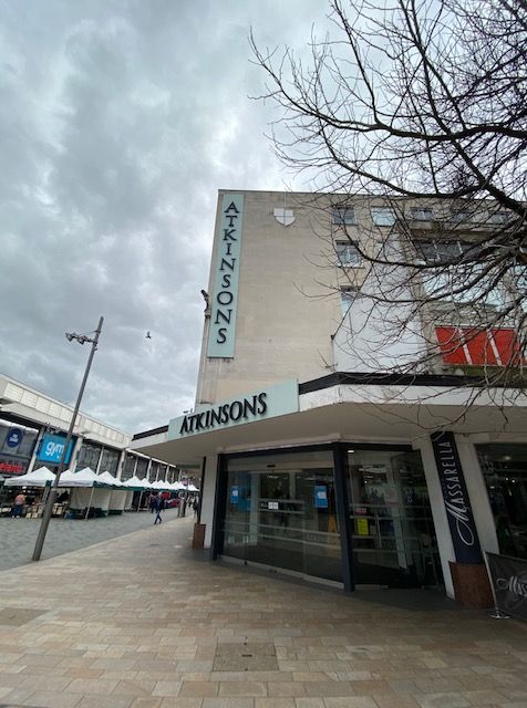
“My great-grandfather used to go out and meet the carriages on The Moor when they arrived in the morning.” Nicholas Atkinson. Image: DJP/2022
In March 1929, John Atkinson, aged 84, took to his bed at No. 86, The Moor, and remained there for a week. He had been in ill-health and died a week later.
His death meant that Sheffield had lost a veteran businessman, who not only had built up a great establishment, but was largely responsible for the development of the principal shopping thoroughfare in the city.
While John Atkinson lay on his death-bed, would he have ever contemplated that his business would still exist 150 years later?
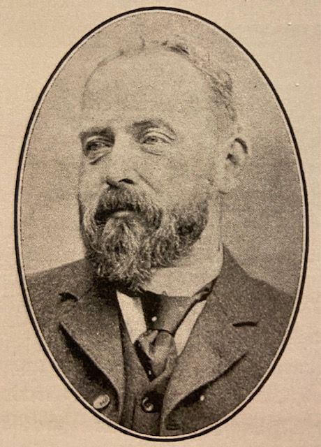
John Atkinson (1845-1929). Image: Neil Anderson
The Atkinson family came from Low Dunsworth, near Boroughbridge, and John, one of a family of nine, was determined to try his fortune away from his home surroundings.
His first venture was at York, where he became an assistant in a leading establishment of that city. But he was stirred with ambition, and he fixed his eye on Sheffield, a growing centre of commerce.
He came in 1865 and became acquainted with the Sheffield public by working at Cole Brothers, at their premises at the corner of Church Street.
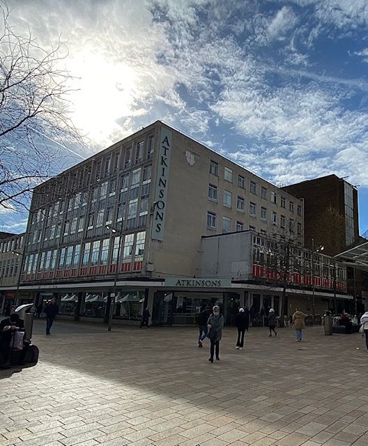
Once settled in Sheffield, he looked for an opportunity, and in 1872 secured premises in South Street, on Sheffield Moor. No. 90 was a two-windowed shop and was opened by 26-year-old John in March of that year.
In those days the Moor was not the shopping centre that we are familiar with. It was on the fringe of the country and people used to ‘go to Sheffield’ to do their shopping when they really meant going to Fargate and High Street.
It was his mission to see that his windows were sufficiently attractive to draw the attention of those on their way to ‘shop in town’ and was one of the pioneers of the ‘Shop on the Moor’ movement and had the pride of seeing the completion of his commodious emporium that became his life work.
Atkinson worked hard for seven years and established gradual growth of regular customers. His business required expansion, and in 1879, a piece of land known as Holy Green became available. It adjoined his premises and two additional shops, Nos 86 and 88 were erected, the former leased to a trader. But trade and custom grew, and in 1884, No 86 was taken over by Atkinson and became the millinery department.
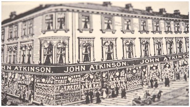
From 1900. John Atkinson, The Draper, 76, 80, 82, 86, 88 and 90, The Moor. Image: Picture Sheffield
Three years later, Nos. 2,4, and 6, Prince Street (a street that has disappeared) were added, and became the furniture department, and four years after that an extensive space at the back of the Prince Street premises was secured and covered for the development of the mantle and shawl trade of the day.
The business expanded, and a few years later brought another acquisition. In 1892, the shops, land, and works covering a large block of buildings as far back as Button Lane (another lost street), facing Eldon Street, were purchased, and in 1897 a new dress warehouse was built in another portion of Holy Green.
Atkinson’s love of beautiful architecture, and his ever expanding business, led him to demolish all his shops, ranging from Nos. 79 to 86, on the South Street site. The foundation stone was laid in 1901, and the new building was ready for occupation in 1902.
The store had a glass roof to let light down into the three floors which were decked with flowers and maintained by a gardener.
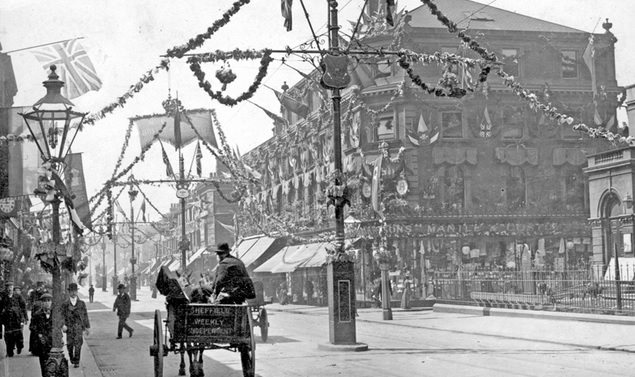
South Street, Moor, decorated for the Royal Visit of King Edward VII in 1905, Nos 76-90, John Atkinson, Draper. Image: Picture Sheffield
At the outbreak of World War One, the shop had empty warehouses, and these were utilised for war work, responsible for making hundreds of thousands of stamped parts for guns, shells, and tanks.
In 1918 two new wings were added, and in 1920 more of the Eldon Street block was brought into use.
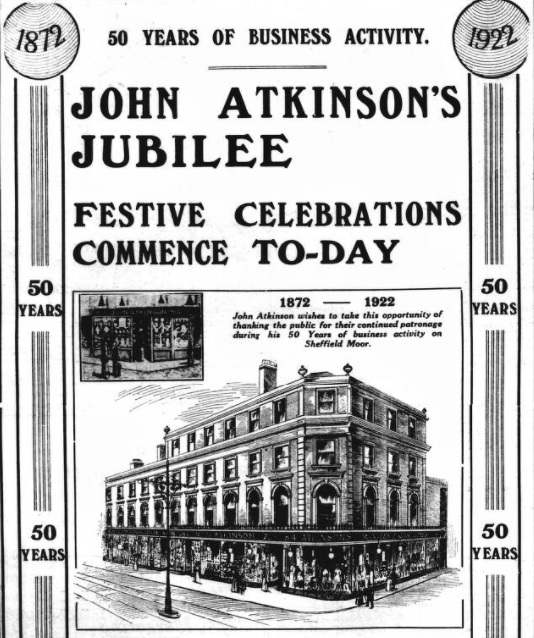
By the time of its fifty year centenary in 1922, Atkinson was assisted by his sons, Harold Thomas Atkinson, and John Walter Atkinson.
“There is an atmosphere of completeness about the store. It is not merely a draper’s store. It is a general outfitting establishment, with its well-cuisined restaurant, and its café; with its departments for gas-fitting, and electrical outfit; its men’s clothing department and its footgear stores; it has an ironmongery branch; as well as its branches for stationary, sweetmeats, and drugs and perfumes; for china and glass, as well as for bedding and bedsteads; while its fur department, its section for robes and gowns, costumes and skirts, wools, dress goods, piece silks, velveteens, Manchester goods, and millinery, gloves, and hosiery, and its cabinet and carpet and oilcloth departments, are just part of the wide-varied whole.”
Newspaper advertisement celebrating fifty years of John Atkinson in 1922. Image: British Newspaper Archive
A lot changed afterwards, the business flourished, but during the Second World War the store was destroyed in the Blitz of 1940, resulting in temporary shops for all its departments across the city.
The business operated like this until 1960 when a new purpose built store opened on The Moor.
This year marks Atkinsons 150th anniversary and John Atkinson would have been shocked to find that his family-owned store is now the only department store left in Sheffield.
Atkinsons. The family-run business has seen wars, new out-of-town shopping developments and the coronavirus pandemic. Image: DJP/2022
There is a whisper that New River, owner of The Moor, might be in talks with Sheffield City Council about purchasing the Moorfoot building. This ties in with the council’s Strategic Vision document that suggests the area will be targeted at young professionals and promoted as a ‘prime location for city core living’.
“The future of the Moorfoot Building itself (adaptation or replacement) is currently being considered’ due to the emergence of hybrid working.”
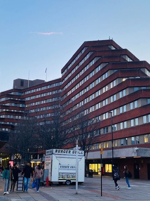
Eleven storeys high, with stepped levels across east, west, and north wings, it was built for the Manpower Services Commission which occupied it from 1981. It was here that the infamous Youth Training Scheme (YTS) was instigated, before being used by other Government agencies. The council bought it in the late 2000s.
Will Moorfoot be demolished and replaced?
I think there will be obstacles in the way of demolition, not least from architectural experts who regard the building as a Brutalist landmark. Don’t be surprised if there is an application to get it listed.
It might also seem a waste of money for Sheffield City Council to spend a fortune buying and renovating Moorfoot, and then spend even more money to relocate departments elsewhere. But stranger things have happened.
I don’t think the Moorfoot building will disappear, although there might be an opportunity to demolish the indoor car park attached to it. Much more likely is that the block of shops, and hospitality venues bordering Moorfoot, Hereford Street, South Lane, and Cumberland Street, will go instead. This would provide an ideal public space, paving the way for the Moorfoot building to be converted to residential (think of The Barbican in London).
And don’t forget that the former Office Outlet/Theatre Deli block is earmarked to be replaced by Lidl.
A lot of speculation and perhaps wide of the mark, but extremely interesting.
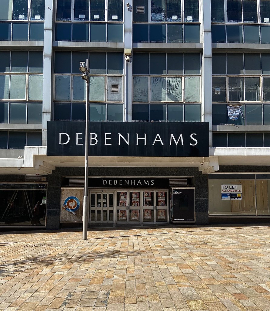
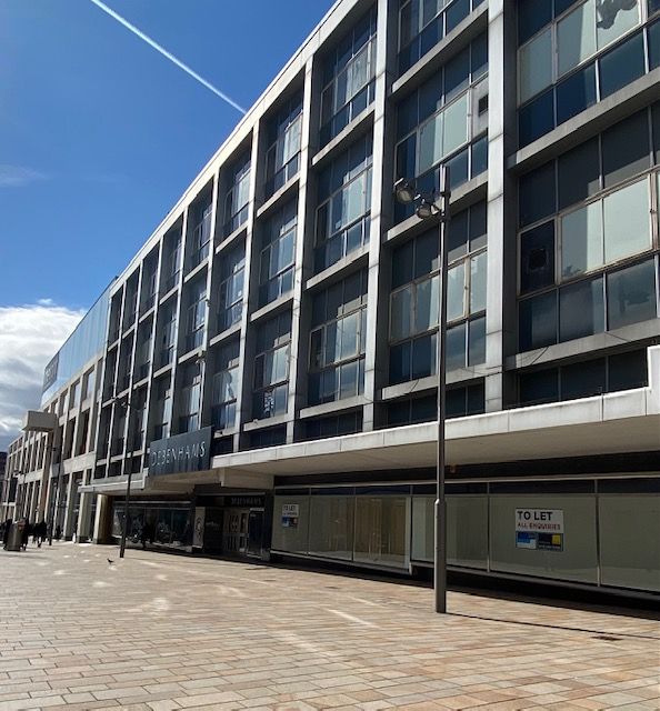
It opened as Pauldens of Sheffield, but was rebranded to Debenhams in 1973. It lasted over 50 years before closing in May 2021. Image: DJP/2022
According to new UK retail data, nearly 90 per cent of former Debenhams stores remain empty almost a year after the department store closed its doors for the last time, in a sign of the challenge to reinvent high streets across the country.
The figures include former Debenhams stores at Meadowhall and on The Moor.
Only last week, MHA London, which bought the city centre building for £1.5m in March 2021, said there was interest but “nothing substantial.”
Since then, property agent Colliers said it was talking to prospective occupiers, thought to be a discount department store company and a leisure operator, both interested in taking space.
Might the discount operator be B&M Retail?
It currently occupies space on Haymarket, also operating Heron Foods at nearby King Street, both in a part of the city centre suffering from declining footfall.
A move to the vibrant Moor shopping area might be considered a good move and could include a B&M and a Heron Foods offering as well.
According to reports, the former Debenhams building might become a discount store or a leisure facility. Image: DJP/2022
Hereford Street, Sheffield. The road was one much wider, lined with shops, houses, and factories. Photograph: DJP/2021
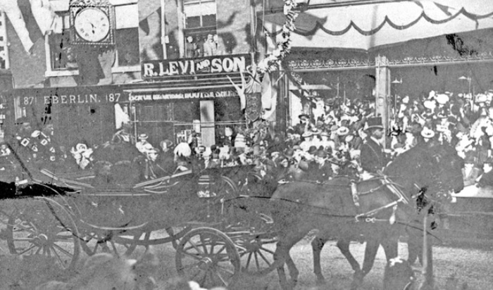
Hereford Street’s greatest moment was when Queen Victoria officially opened Sheffield Town Hall in May 1897 and travelled down here on her way to Norfolk Park. It might be hard to believe now, but let your imagination do the rest.
“To stand on The Moor, at the top of Hereford Street, and look down the latter thoroughfare affords the spectator a great amount of pleasure. A scene is presented of bright flags of dainty and artistic colours, fancy streamers of every description, while other kinds of bunting and bannerettes float out gaily in every direction.
“Venetian masts are erected on either side of the street, 15 yards apart, and are surmounted by large gilt spearheads, while banners, shields, and trophies of flags are fixed to each mast. Every alternate mast has a pedestal covered with crimson cloth and gilt ornamentation, and at the summit of each pedestal is a group of real plants.
“Across the street at intervals are fixed canopies of handsome floral work, and streamer flags of harmonious colours and flower baskets are suspended from the centre of each floral canopy, with lines of streamer flags along the street at either side connecting the masts with the whole design.
“The buildings, too, in Hereford Street have been dealt with in the most artistic manner. Flags float out bravely from the tops of the principal works and houses, and on the fronts are displayed handsome shields, backed up with designs of small flags and other similar trophies.
“As the time arrived for the stopping of traffic, the corner where Hereford Street joins the Moor became so blocked with cars, cabs, and buses that the Derbyshire police, who extended from the top of Hereford Street along part of St Mary’s Road were hard put to it to prevent serious accidents.
“People would still insist on leaving the shelter of the barriers and coming across the road, and then, as likely as not, they were stranded amongst the horses and vehicles, who, being unused to the terrible commotion, were almost frantic and the drivers, but for the efforts of the police, could not possibly have helped running down some of these belated wayfarers.
“However, this was soon cleared, the arrival of the 1st Battalion of the Hallamshire Rifles having a great deal to do with the transformation.
“The men were placed eight paces apart and covered the entire length of Hereford Street and part of St Mary’s Road.
The visit of Queen Victoria. Pictured here on The Moor. Photograph: Picture Sheffield
“The crowd was very orderly, only a few attempting to elude the vigilant eye of the constables, and those that attempted this being in most cases drunk.
“As the time wore on, however, getting tired, perhaps, and some of them thirsty, occasional rows occurred. People attempted to change their positions and their neighbours’ mild remonstrations gradually developed into what may be styled ‘words,’ and again, in some cases, where the sum was particularly irritating, into blows.
“The few fights, however, that did take place soon raised cries of ‘Police!’ and the guardians of the peace immediately quelled the disorder and left the combatants to sing and shout once more with the rest.
“Several cases of fainting occurred, and it was rather unfortunate that at this point of the route there was no ambulance corps, but the gallantry to the ladies of the rough and ready grinders was quite touching, and these were immediately made room for even in the thickest crushes.
“Of course, skits and jokes passed amongst the members of the crowd, but, as a rule, the language was ‘fit for the Queen.’
“Stands, windows, and roofs were all crowded, and the number of people in the street was, as far as can be judged, above the average.
“The procession passed, the military lined up, and the crowd in one huge migration, made tracks, some for the park, and others in order to get another view, if possible, along South Street, Park.”
Looking towards The Moor from Hereford Street. Today, this part of the road is pedestrianised and is occupied by Dempseys, bar and Club and QJ (the former Yorkshire Bank). Photograph: Picture Sheffield
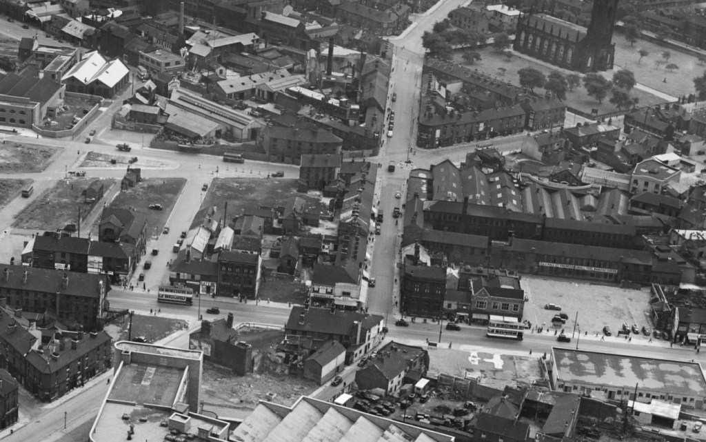
Aerial photograph of Hereford Street (top to bottom) in 1951
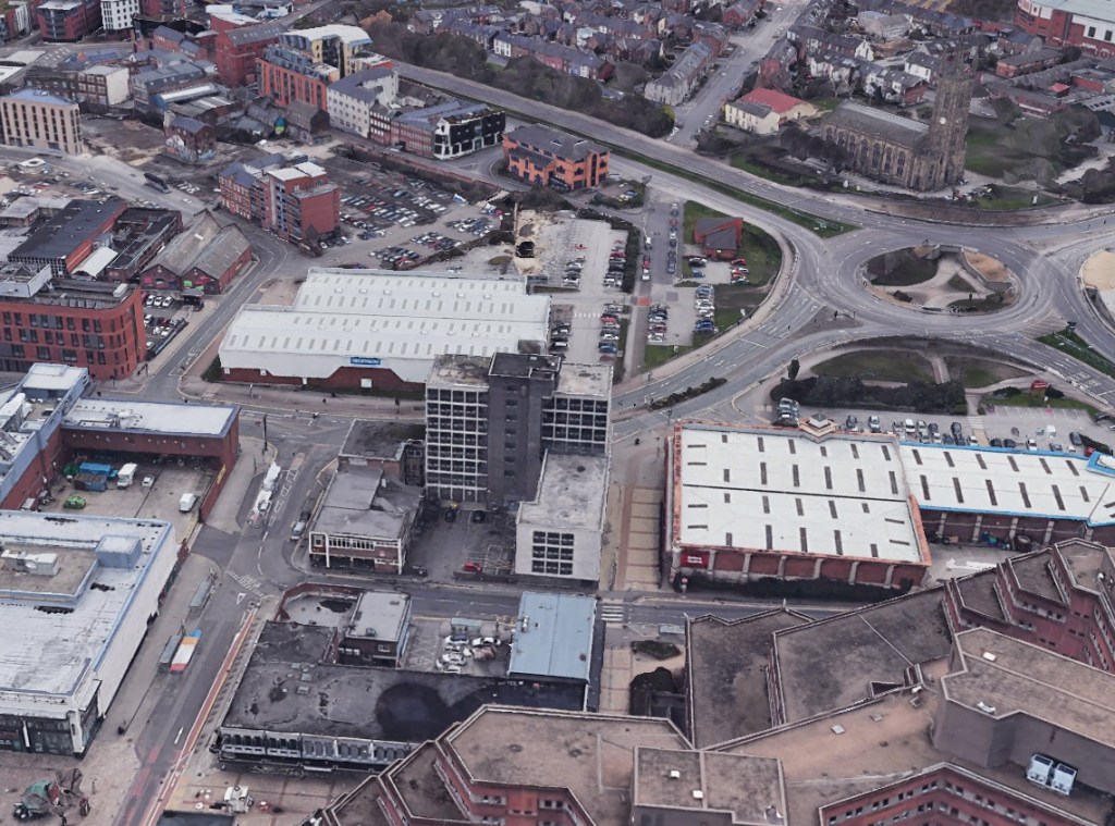
Aerial photograph of Hereford Street (top to bottom) in 2021
Two photographs that show how a Sheffield street lost its identity.
Hereford Street is shown as a wide thoroughfare in 1951, a continuation of Charlotte Road, and intersected by narrow St Mary’s Road, and Porter Street (that became the lower end of Eyre Street). It joined The Moor that continued south towards London Road. Note that Bramall Lane roundabout did not exist.
Seventy years later, the outline of Hereford Street can still be seen but is split by two dual carriageways – St Mary’s Road and Eyre Street. Gone are the factories, houses, and small shops, and the Moor-end is pedestrianised, and this section of The Moor lost beneath the Moorfoot Building.
Sadly, this area has become an unloved part of the city centre with Hereford Street falling on hard times.
Most astonishing is that few buildings appear in both photographs. Most were swept away for road development, factories were surplus to requirement, and old houses and shops deemed unfit for purpose.
St Mary’s Church, on Bramall Lane, does appear in both photographs. In 1951, it was covered in soot and suffered from air pollution, but look how large the churchyard was, and how much was taken away to make St Mary’s Road a dual-carriageway.
Buildings to point out in the modern-day image are the South Yorkshire Fire and Rescue Headquarters and Moor Markets (left), Decathlon and Deacon House (centre) and, of course, the Moorfoot Building (bottom).
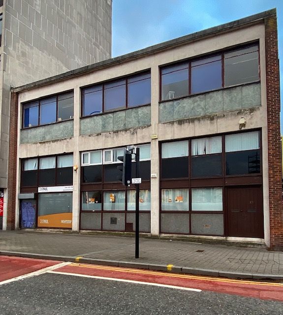
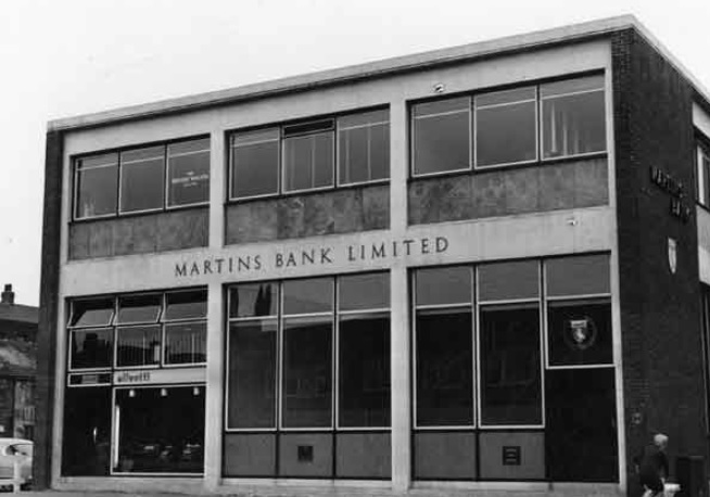
Former Martins Bank, now listed as Cumberland House, on Eyre Street, Sheffield. Photograph: DJP/2021
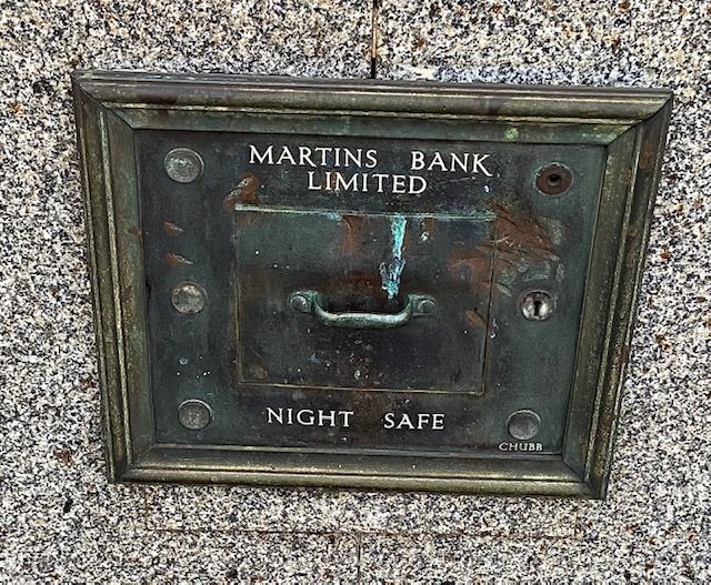
History is all around us. Keep your eyes open and sometimes you will see something that reveals something of our past. At the corner of Eyre Street and Cumberland Street, set in the wall of a building, is an old night safe. Unused for forty-eight years, it is marked ‘Martins Bank Limited’.
It is an obvious clue as to the origins of this rather run-down looking 1960s building, and tells us that once-smart buildings can become eyesores if we don’t look after them.
A clue at the building’s former use. Night safes were built on the outside of banks, allowing money to be deposited into the bank’s safe outside of bank opening hours. Photograph: DJP/2021
Martin’s Bank was a London private bank that could trace its origins back to the London goldsmiths. Martin’s agreed to its acquisition by the Bank of Liverpool in 1918, which wanted a London presence and a seat on the London Bankers’ Clearing House; the Martin’s name was retained in the title of the enlarged bank which was known as The Bank of Liverpool and Martin’s Limited. The title was shortened to Martins Bank Limited (without an apostrophe) in 1928.
The bank had a presence in Sheffield from 1927 when the Equitable Bank, at 64 Leopold Street, merged with the Bank of Liverpool and Martins. It outgrew the premises and opened a new branch in the Telephone Buildings at the bottom of West Street in 1930. It wasn’t until 1960 that a Sheffield University branch was opened, quickly followed by this purpose-built bank – Sheffield Moor – on Eyre Street. (Another, on Bank Street, came later).
This branch opened in 1961 on land that had once been the site of Greer and Rigby, Surgeons, and land left vacant after the bombings of World War Two.
Junction of Porter Street and Cumberland Street (in background). No 118, Porter Street, former premises of Greer and Rigby, Surgeons. Former entrance to Court No. 10 on left. Porter Street later became part of Eyre Street. Photograph: Picture Sheffield
Martins Bank in 1963. It did not occupy all the building, following the Victorian tradition of creating shop and office rental space to generate additional income. Photograph: Picture Sheffield
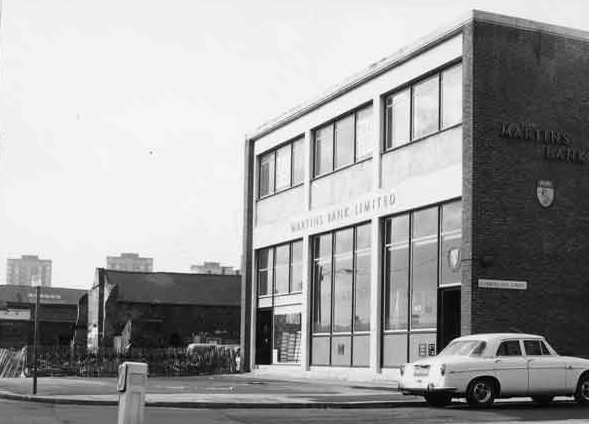
Martins Bank in 1970. The old buildings adjacent were demolished to make way for Deacon House. Photograph: Picture Sheffield
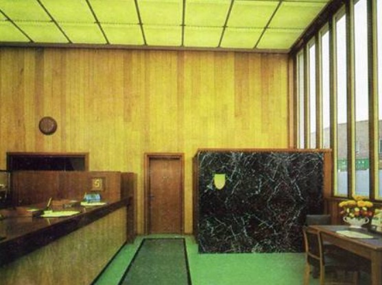
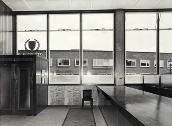
According to archives, this part of Sheffield was too far from the old commercial quarter to be effectively served by the West Street branch. “A beautiful modern building with interior décor which responds to the full blaze of sunshine most cheerfully, or, on a dark day when the illuminatedceiling has to be switched on, creates an oasis of light, warmth and welcome which makes it a pleasure to step inside.”
The ground floor was shared with Olivetti, typewriters, and office machine dealers, while the British Wagon Company occupied part of the first floor.
Martins Bank was bought by Barclays in 1968 and five years later the Sheffield Moor branch was closed – its existence as a bank lasting only twelve years.
The building itself was used for a variety of purposes, even a gym, and is now sub-divided as office space.
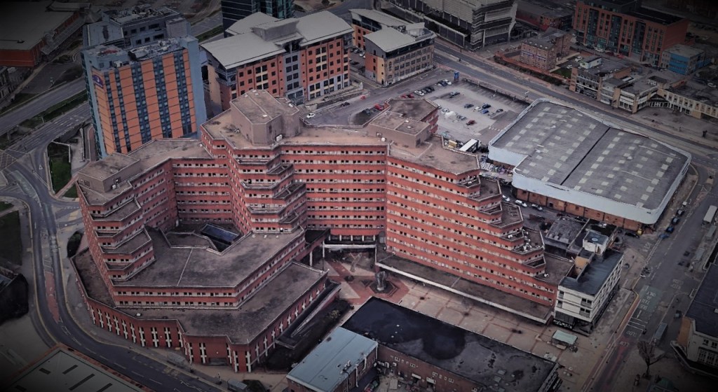
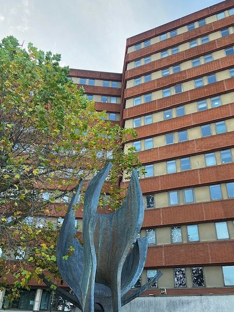
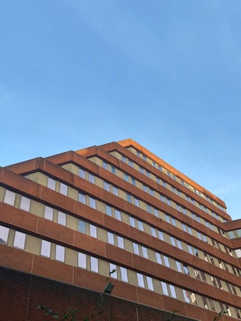
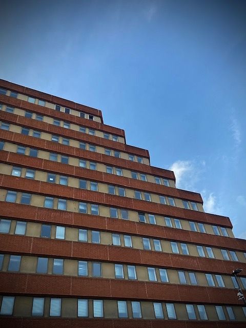
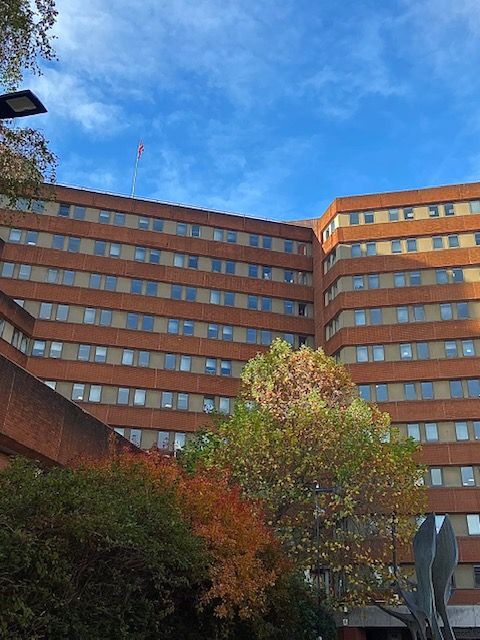
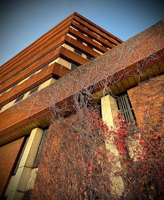
Moorfoot. A late seventies Government-built office complex that opened in 1981. Now home to Sheffield City Council. Photograph: Google
Moorfoot is a brute of a building, dominating the Sheffield skyline, and 40 years after it opened, remains one of the city’s most controversial structures.
Its origins are in 1973 when Edward Heath’s Conservative Government created the Manpower Services Commission (MSC), to co-ordinate employment and training services in the UK through a ten-member commission drawn from industry, trade unions, local authorities and education interests.
Pat Duffy, the Labour MP for Attercliffe, excited by the prospect of 2,000 jobs, campaigned for the new headquarters to be built in Sheffield. Two years later, Harold Walker, Under Secretary at the Employment Department, told the House of Commons, “The decision has been made to locate the headquarters in Sheffield.”
It was an accomplishment for a down-at-heel northern city, but the citizens of Sheffield weren’t prepared for what came next.
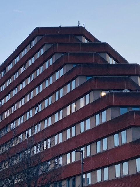
The futuristic new headquarters was designed by the Government’s Property Services Agency – “A truly monolithic brutalistic office building. Red brick bands between rows of windows separated by concrete panels.” – eleven storeys high, with stepped levels across east, west, and north wings. Something of a pyramid, it earned nicknames like the ‘Aztec Temple’ and ‘Dalek City.’
Photograph: DJP/2021
That it would be built on land at the bottom of The Moor was even more controversial, cutting off Sheffield’s main shopping street from busy London Road, and depriving road and pedestrian traffic of a popular and historic route.
To compensate, it was designed to allow pedestrian access through the building, starting with an elevated ramp near the corner of Young Street and South Lane, before proceeding via a tunnel through the building, exiting above the car park, and using ramps to ground level on The Moor.
The route never opened, allegedly because IRA activity posed a threat to a government building, and the upper parts of the elevated walkway were left suspended mid-air before eventual removal.
The MSC opened in 1981, and for such a high-profile building, it was shrouded in mystery. Apart from the cavernous office-space, restaurant, bar, and basement squash court, were there really underground nuclear bunkers and a luxury apartment for Government hierarchy? Even today, the amount of information available about the building is incomplete – no floor plans, no design architect, no history forthcoming.
If ever a building divides opinion. The Moorfoot Building will probably escape demolition, unlike many other Sheffield buildings built in the 1970s. Photographs: DJP/2021
The MSC building was famous for its management of the Youth Training Scheme and various other training programmes intended to help alleviate the high levels of unemployment in the 1980s, but after 1987 the MSC lost functions and was briefly re-branded the Training Agency (TA), before being replaced by a network of 72 training and enterprise councils.
The MSC Building gave way to other Government agencies, including the Department for Work and Pensions (DWP) and the Home Office. However, it was too big and expensive to maintain, with departments vacating over a twenty year period.
In the late 2000s, the MSC Building was bought by Sheffield City Council, and with demolition in mind, wanted to create a new financial services district in its place.
The timing could not have been worse, and the monetary crisis of 2007-2008 prompted a rethink, and the building was overhauled, renamed Moorfoot, with potential office space for 2,600 council employees, and consolidation of various departments from around the city centre.
As for the Moorfoot’s future, it is likely to stay, worthy of a facelift and a bit of greenery might not go amiss. The iron gates at ground level could be opened to allow public access between The Moor and London Road. And, as the aerial photograph shows, there is a chance to create a green square in front of its main entrance (demolition required).