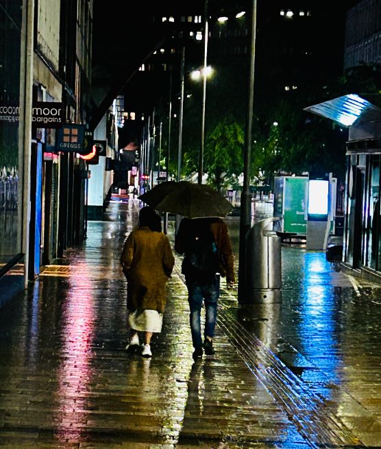
With apologies to the unknown couple who walked down The Moor late at night. Same place. Different times.
*****
It was dark and raining, and Benjamin and Mary tramped across bleak Sheffield Moor. “I said it was a bad idea,” cried Mary. “My brother Thomas offered to take us if we slipped him a few coins. He would have brought his gun along.”
“Stop worrying,” Benjamin told her. He held her arm to stop her falling. “Stick to the track, that way we know we’re heading in the right direction.”
“It’s muddy, and I can’t see anything in front of me.”
“We must travel by night so that nobody sees us. Rest assured, Mary, there won’t be many robbers out tonight.”
A cold wind blew across the scrub and rattled the branches of the trees. She was wet through, and she pulled the shawl around her to keep warm. “I feel like a thousand eyes are watching us.”
“Keep walking and don’t think about what might be in the shadows.” Benjamin patted the knife that he’d stolen from the slaughterhouse. Mary didn’t know that he had it, but he was prepared if there was anybody who might be a threat.
“I’m frightened. How far is it,” Mary asked.
“I’m not sure,” he said, “but we have to cross the Porter first.”
“Oh Benjamin. That makes it sound even more dangerous.” She wished she was at home in the bed that she knew she would never see again.
“There is a plank across it, and then we head towards Little Sheffield.” He put his arm around her hoping that it might reassure her. “We’ll catch a horse and cart in the morning.”
“Do you think that we’re doing the right thing?”
“We’ve no choice, Mary. If the constable catches me, I’ll be put in the stocks like last time.”
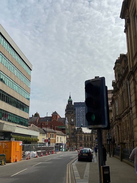
Work in progress. The pedestrianisation of Leopold Street (above), Pinstone Street, and Surrey Street, will create a traffic-free Town Hall Square. (DJP/2021)
Our city centre is at a crossroads. The city is in flux and a street that highlights it most is Leopold Street. Buses no longer run along here, and all traffic is halted mid-way. Sheffield is going car-free, and with it our streets become soulless. Nothing is sadder than a street about to undergo pedestrianisation. It is blocked with traffic cones and concrete barriers and unsure what it wants to be.
As far as Sheffield streets go, Leopold Street is relatively new, a pet-project for town planners in 1873. Back then, access to Fargate and Pinstone Street was via Church Street, along awkwardly narrow Orchard Street, to its junction with Orchard Lane, and dog-legged towards what is now the top of Fargate.
Its making was the result of Sheffield Corporation’s three-street development scheme – the creation of Surrey Street, Fargate improvements, and the construction of ‘modern-day’ Pinstone Street. A new road was needed to link these streets with Bow Street (the road that became the bottom of West Street) and a link between old Sheffield Moor and Shalesmoor.
A long-standing road, South Street, was swept away, the land around it cleared, and the large sloping site bounded by the proposed new road, Orchard Lane, Holly Street and Bow Street (West Street) earmarked for educational purposes. It became the site of Firth College (1879), School Board offices and the Central School (both 1880). Of course, we now know these buildings as the Leopold Hotel and Leopold Square
By May 1880, half its length had been completed, 60-feet wide from Bow Street to Fargate, paved in wooden blocks, and converted to macadam in 1883.
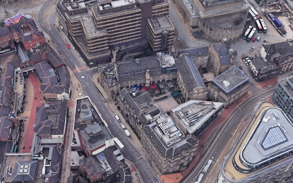
Aerial view of Leopold Street. The Leopold Hotel and Leopold Square are centre. Before 1880, the main route between Church Street and Fargate was along narrow Orchard Street, to the left, which curved at its junction with Orchard Lane (where the mini-roundabout is today). The top-end of Orchard Street (near to Fargate) was absorbed into Leopold Street. (Google)
The Watch Committee recommended that the new street be named after Prince Leopold, Duke of Albany (1853-1884), eighth and youngest son of Queen Victoria, who had opened Firth College in October 1879.
The addition of the Sheffield Medical Institution on the other side of the road in 1888 prompted one expert to say that Leopold Street would become a “street of institutions.”
It never became a street of learning. Firth College and the Medical Institution were the foundation stones for the University of Sheffield and moved away. By the late 1970s, the old education buildings were in decline, mostly unoccupied, but spared the fate that befell the nearby Assay Office and Grand Hotel, both demolished, and replaced with office blocks.
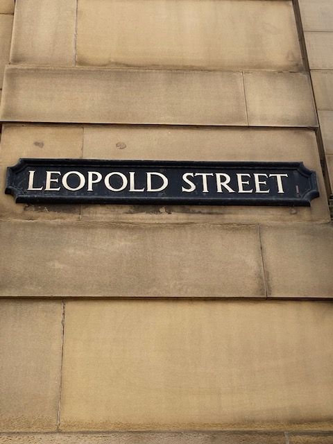
A street sign on the wall of what was once Firth College, at its junction with West Street, and now part of the Leopold Hotel. (DJP/2021)
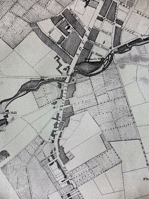
Fairbanks’ Map of Little Sheffield in 1808. South Street became The Moor. The road marked Little Sheffield is now London Road. There are some familiar road names in the top half of the map. (Image: Picture Sheffield)
Once upon a time there was a small hamlet near Sheffield town that went by the name of Little Sheffield.
During the early 1800s, Sheffield’s rapidly growing population needed to expand outside the historical boundaries, and Little Sheffield disappeared.
We know where Little Sheffield was, but its boundaries blurred over time, with experts long contesting where it started and finished. The area has never been clearly defined, like those forgotten places of Port Mahon and Hallamshire.
We must go back to olden days when Sheffield was a town surrounded by fields and countryside. It gradually expanded until its southern edges skirted a gorse-clad swampy common called Sheffield Moor.
Today, we know this marshy land as The Moor with its surrounding streets.
A path was made by throwing up two embankments, between which was a deep ditch, with only a footbridge over Porter Brook.
By the 1760s, travellers had to go down Coal Pit Lane (Cambridge Street) and Button Lane (long disappeared) to Little Sheffield – a group of poor and time-worn cottages. The road to it ran across Sheffield Moor, thence up a sharp rise to Highfield. The only house you came to after passing Moorhead was Mr Kirkby’s, standing on Button Lane (opposite where the ramp to Sainsbury’s car-park on Charter Row now stands). There was one other building nearby, with a bowling green attached to Sheffield Moor. Beyond was Little Sheffield, the outlying hamlet.
By the nineteenth century, the fields around Little Sheffield had been swallowed up for the working classes, a poor and densely populated area, its houses with roofs of stone slabs, low windows, and red brick walls.
Nowadays, we can define Little Sheffield’s northern boundary as being where the Moorfoot Building stands, taking in Young Street, South Lane, St Mary’s Gate, London Road, and surrounding streets like Hermitage Street, Sheldon Street, Hill Street, John Street, and Boston Street (once called George Street), up towards its southern boundary at Highfield.
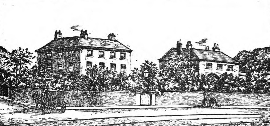
Brightfield House and to its right, the soon-to-be-demolished Highfield Club in 1885. (Image: The British Newspaper Archive)
In 1885, a large and commodious house situated at the bottom of Sharrow Lane was threatened with demolition. The Sheffield Independent printed an article, ‘Doomed Houses at Highfield’, highlighting the plight of Brightfield House, along with an adjacent property fronting London Road, once a family residence, and in its declining years used as the Highfield Club.
“Brightfield House is one of the few remaining examples of comfortable homes of well-to-do manufacturers at Highfield, in the time when it was quite a journey to go ‘over Sheffield Moor’ to that region ‘then a bit of country.’ Where now are long rows of brick houses stood the mansions of the Brights, the Woodheads, the Henfreys, the Lees, and others.
“A long, square house, standing in its own grounds, reminds one of the olden times. It is a pleasant break in the landscape; but appearances point to its early demolition, the builder approaching perilously near with his army of mortar men ‘to make the old order give way to the new.’”
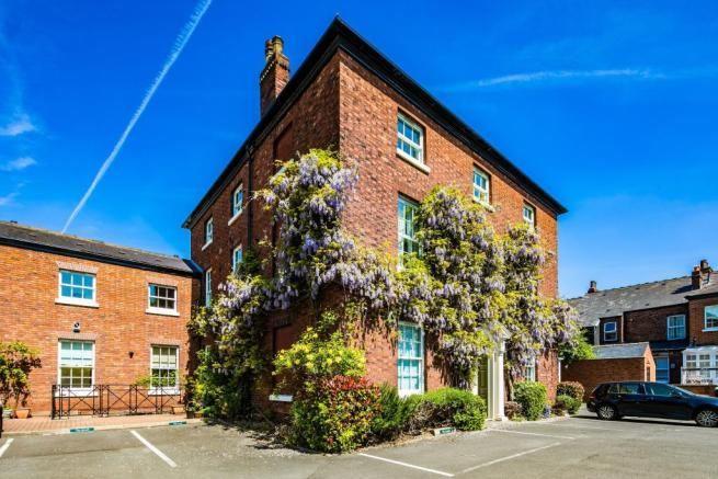
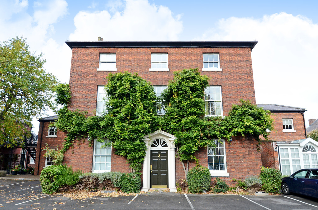
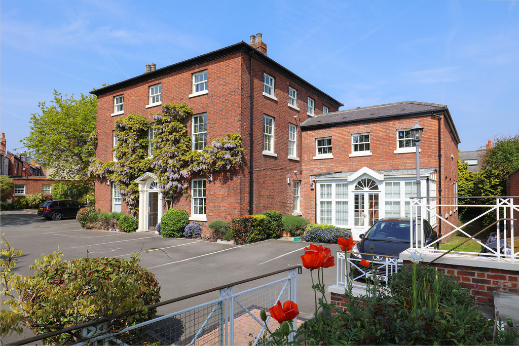
Astonishingly, it wasn’t demolished, the Highfield Club was, and Brightfield House still stands, a monument to Sheffield’s forgotten past. Today, it goes by the name of Wisteria Gardens, divided into apartments, but to many it is known as the former Charnwood Hotel.
Brightfield House, now called Wisteria Gardens. (Image: Rightmove)
As will be explained, Brightfield House lost its name in the 1870s, renamed Highfield House, until losing its identity altogether.
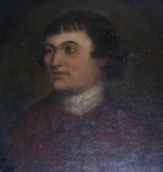
It was erected about 1788 for John Henfrey, a prominent scissor-smith, whose family had been involved in the scissor trade for generations. He became a Freeman in 1753 and was the fourth generation to be apprenticed by The Company of Cutlers in Hallamshire. He went on to train his brother and his sons in the Brightside area, and was listed in the 1787 trade directory as having premises in Norfolk Street.
“He built for himself a country mansion at Highfield and being asked by his friends if he was not afraid of going over Sheffield Moor after dark, he replied that he took good care always to get home by daylight.”
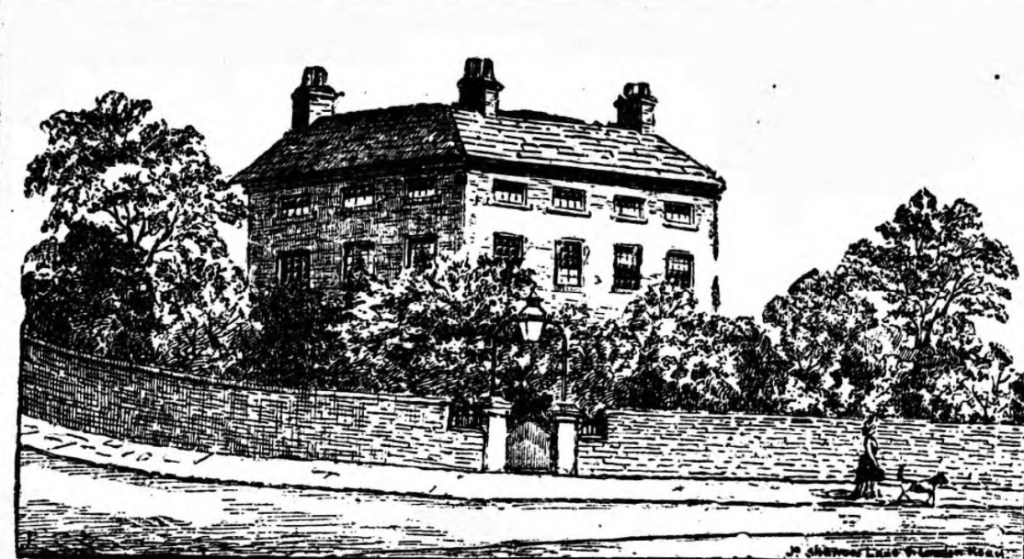
Brightfield House, the Sharrow Lane home of Dr Gwynne in 1885. (Image: The British Newspaper Archive)
At that time Sheffield Moor was ‘a shocking road for coaches’. There was quite a steep slope from the Moor head to the Horse Dyke (at the bottom of what eventually became Ecclesall Road), Sharrow Lane being the only road for wheels. Coaches coming from the south were often met by two extra horses at Heeley, to pull them up Goose Green to Highfield, and then up Sheffield Moor. It was a crooked road, with houses few and far between – there were practically none past Little Sheffield, and the surrounding area was rural.
It was no coincidence that John Henfrey built his house opposite Mount Pleasant, built for Francis Hurt Sitwell a few years earlier. This was on the Buxton Road which ran via Sheffield Moor, to Highfields, up Sharrow Lane, along Psalter Lane and up Ringinglow Road.
When it was built in the 1780s, Wisteria Gardens was in the countryside. (Image: Cocker & Carr)
Brightfield House was named after the field it was built in, the suggestion being that Henfrey wanted to call it Highfield House, but a house of that name belonging to the Wilsons of Sharrow already existed at the top of the hill looking towards what became Sheaf House (yes, the pub on Bramall lane) with a large lawn bordered with fine sycamores and horse chestnut trees.
John Henfrey’s family was involved in a scandal when in 1791-92, one of his daughters eloped to Gretna Green with Thomas Leader, ‘one of those dashing young men of the time,’ a young Colonel in the Sheffield Volunteers.
John Henfrey (Image: The Company of Cutlers in Hallamshire)
After Henfrey’s death, Brightfield House became home to William Wilson, a member of the same family at Highfield House.
Following Wilson’s death, the mansion was offered at auction but failed to sell for several years, the empty house left in the care of a servant, and subjected to burglaries.
“Comprising drawing room, dining room, and breakfast room, lofty and well-lighted. Seven bedrooms, with closets and dressing rooms. Principal and secondary staircases, capital kitchens, dry cellars, bathroom, water-closet, and brewhouse.
“The views from the house, notwithstanding its proximity to the Town, are extensive and diversified, comprising, in front, the Park, studded with mansions and villas, and the line of the hill stretching towards Norton, and behind, ranging over Sharrowhead, the Botanical Gardens, Broomhill, Crookes, etc.”
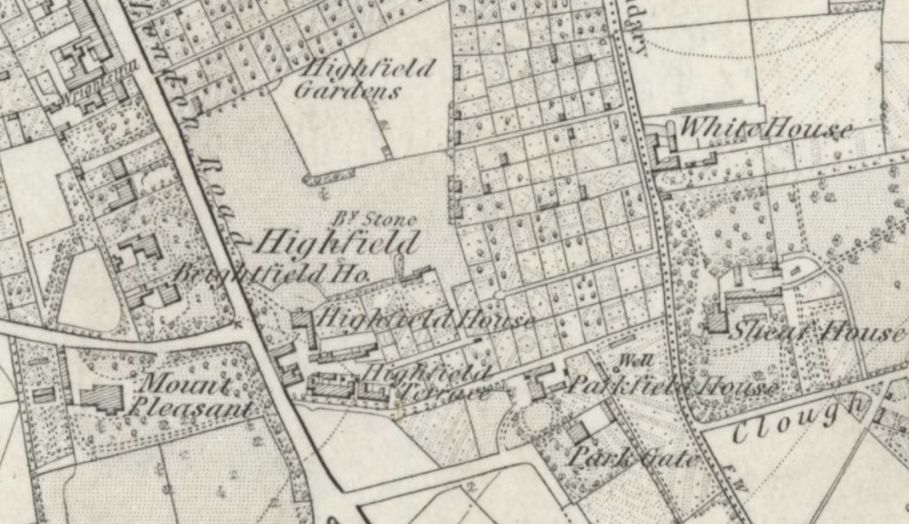
The big houses of Highfield. The original Highfield House was demolished. (Image: National Library of Scotland)
It appears that Brightfield House was still in the possession of the Wilson family until the 1870s until bought by John Parkinson Mawhood, of Farm Bank, in 1874. He was head of Stevenson, Mawhood and Company, tool manufacturers, of Pond Street and later the Palm Tree Works at Attercliffe.
His tenure was short-lived and following the failure of the company in 1879 it was bought by Dr Charles Nelson Gwynne, an Irishman, who came to Sheffield in 1875 when he purchased the practice of Dr Webb at Highfield, and built up connections in Sharrow, Highfield, and Heeley.
Gwynne became Honorary Medical Officer at the Children’s Hospital in 1879, after completing a special study of diseases in children.
In 1879, the nearby Highfield House estate was available for development, suggesting the mansion had been demolished, allowing Gwynne to rename Brightfield as Highfield House.
Gwynne died in 1906, and Highfield House became home to Dr George Scott Davidson, who ran a practice here with his son, Dr John Davidson, of Repton Lodge, in Sharrow.
Later this week we’ll look at a remarkable event that took place at Highfield House during Dr Davidson’s tenure.
Davidson practised for over thirty years, his son later moving into Highfield and taking over the practice, the house remaining a surgery until the 1970s.
It became the 22-bed Charnwood Hotel in 1985, opened by Chris and Valerie King, and operated almost 20 years as a wedding venue, along with two top restaurants, Brasserie Leo and the smaller more upmarket Henfrey’s.
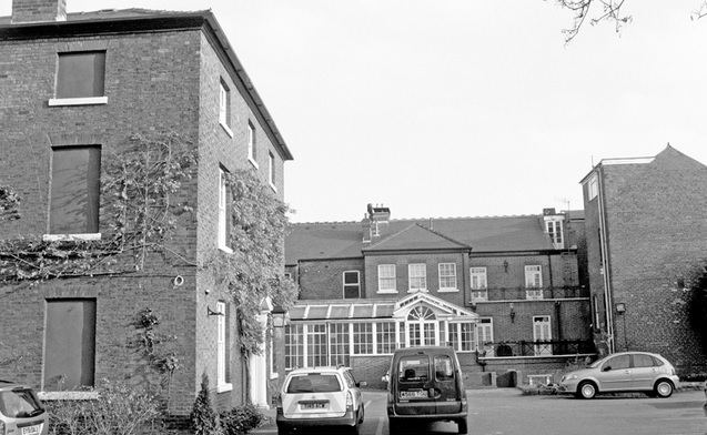
Charnwood Hotel in 2004. (Image: Picture Sheffield)
The Charnwood Hotel closed in December 2004 after being unsuccessfully marketed for £1.3 million. It was turned into apartments in 2005 and renamed Wisteria Gardens.
The house and adjoining former coach house are Grade II listed by Historic England.
Wisteria Gardens. A survivor of Georgian England. (Image: Redbrik)