Categories
Streets

Sands Paviours – a long forgotten street

West side of Sands Paviours (ran from Orchard Lane to Bow Street), pre 1890, demolished to make way for the Central Schools, Science School. Image: Picture Sheffield

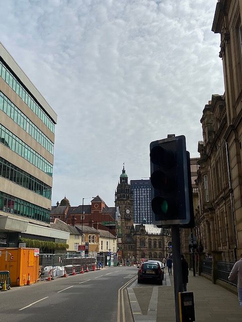
Today, a look at a street in Sheffield city centre that was consigned to history long ago.

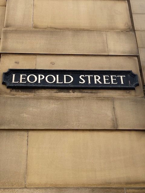
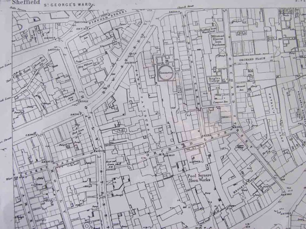
In 1874, a plan was produced by Sheffield architects, Innocent and Brown, for the laying out of Leopold Street, and the realignment of Church Street and Bow Street (now the bottom-end of West Street).

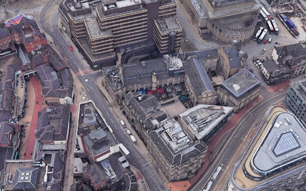
About this time, land between Orchard Lane, Bow Street, Orchard Street and Balm Green was covered by old houses in two streets, Smith Street and Sands Paviours.

The site was bought by the Sheffield School Board for building the Central Schools and offices. At the same time, Mark Firth founded Firth College, later part of the University of Sheffield, and this was opened by Prince Leopold in 1879.

The removal of old property between Bow Street and Orchard Lane caused the obliteration of the marvellously named Sands Paviours.

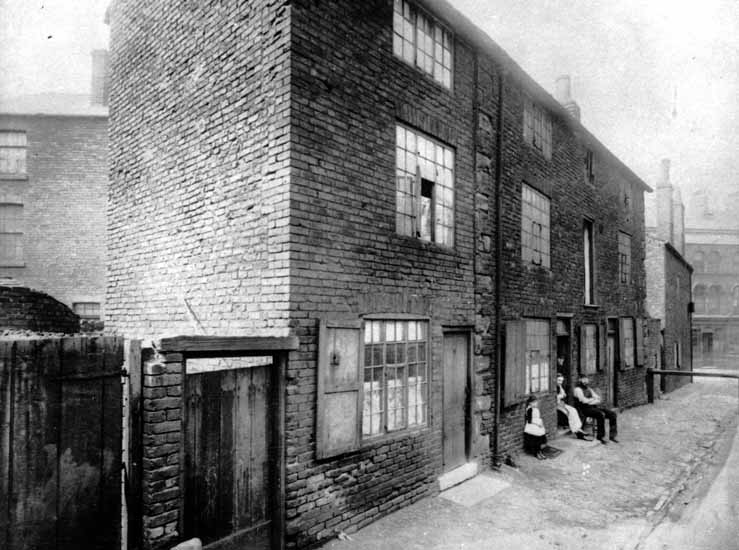
But what had once been a pathway across rural land had become a street of slum housing, workshops, shops, and a public house called the Norfolk Arms. And murder and crime were evident on the street.

According to John Daniel Leader, this little court of houses may have derived its name from Samuel Sands, who flourished in the reign of Queen Ann.

By an indenture dated 25 September 1708, Samuel Sands, a Sheffield cutler, conveyed to George Hawke of Leavygreave, yeoman, for the sum of £100, all that messuage, near the Townhead Cross with a smithy, barn, orchard, and garden, lately in the possession of John Hobson; also, a cottage adjoining, lately in the possession of Mary Wilson, to hold the same for ever of the chief Lord or Lords of the fee. The vendor signed his name ‘Samwell Sandes.”

However, there was another suggestion for it being named so.

In other towns there were streets called Sans Paviours (without paving stones), and it might be that because Sandes’ house was here, that he saw the name Sans Paviours elsewhere, and thought it appropriate for his own property.

The mystery was cleared up when the land was bought by the School Board, and the old deeds showed that it had been in the family called Sandes from 1657 to 1727, and that early mention was also made to Sands Croft and Sands Orchard.

Like many old street names that were adapted over the years, Sands Paviours was also referred to as Saint Pavers.

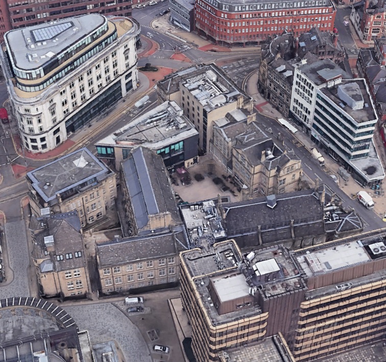
Remember this the next time you relax in Leopold Square. There is history beneath your feet.

Sands Paviors once ran from Orchard Lane to Bow Street (now the bottom part of West Street). Image: Google

© 2022 David Poole. All Rights Reserved.

Categories
Buildings Streets

Leopold Street

Work in progress. The pedestrianisation of Leopold Street (above), Pinstone Street, and Surrey Street, will create a traffic-free Town Hall Square. (DJP/2021)

Our city centre is at a crossroads. The city is in flux and a street that highlights it most is Leopold Street. Buses no longer run along here, and all traffic is halted mid-way. Sheffield is going car-free, and with it our streets become soulless. Nothing is sadder than a street about to undergo pedestrianisation. It is blocked with traffic cones and concrete barriers and unsure what it wants to be.

As far as Sheffield streets go, Leopold Street is relatively new, a pet-project for town planners in 1873.  Back then, access to Fargate and Pinstone Street was via Church Street, along awkwardly narrow Orchard Street, to its junction with Orchard Lane, and dog-legged towards what is now the top of Fargate.

Its making was the result of Sheffield Corporation’s three-street development scheme – the creation of Surrey Street, Fargate improvements, and the construction of ‘modern-day’ Pinstone Street. A new road was needed to link these streets with Bow Street (the road that became the bottom of West Street) and a link between old Sheffield Moor and Shalesmoor.

A long-standing road, South Street, was swept away, the land around it cleared, and the large sloping site bounded by the proposed new road, Orchard Lane, Holly Street and Bow Street (West Street) earmarked for educational purposes. It became the site of Firth College (1879), School Board offices and the Central School (both 1880). Of course, we now know these buildings as the Leopold Hotel and Leopold Square

By May 1880, half its length had been completed, 60-feet wide from Bow Street to Fargate, paved in wooden blocks, and converted to macadam in 1883.

Aerial view of Leopold Street. The Leopold Hotel and Leopold Square are centre. Before 1880, the main route between Church Street and Fargate was along narrow Orchard Street, to the left, which curved at its junction with Orchard Lane (where the mini-roundabout is today). The top-end of Orchard Street (near to Fargate) was absorbed into Leopold Street. (Google)

The Watch Committee recommended that the new street be named after Prince Leopold, Duke of Albany (1853-1884), eighth and youngest son of Queen Victoria, who had opened Firth College in October 1879.

The addition of the Sheffield Medical Institution on the other side of the road in 1888 prompted one expert to say that Leopold Street would become a “street of institutions.”

It never became a street of learning. Firth College and the Medical Institution were the foundation stones for the University of Sheffield and moved away. By the late 1970s, the old education buildings were in decline, mostly unoccupied, but spared the fate that befell the nearby Assay Office and Grand Hotel, both demolished, and replaced with office blocks.

A street sign on the wall of what was once Firth College, at its junction with West Street, and now part of the Leopold Hotel. (DJP/2021)

© 2021 David Poole. All Rights Reserved.