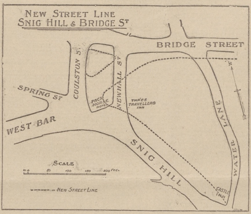
In 1900, the Improvements Committee of Sheffield Corporation paid £10,500 for 2,546 yards of land in Newhall Street. There were certain freehold premises here, including the Hollis Hospital.
The question we ask ourselves 122 years later, where was Newhall Street?
Sheffield Corporation wanted to carry out a road diversion with a straight way from Westbar to Bridge Street.
Newhall Street was at the bottom of Snig Hill and disappeared, the line of Westbar continued across land occupied by the Pack Horse Hotel (demolished), until it joined Bridge Street.
This illustration from 1902 shows the original road layout, with dotted lines indicating the new street pattern and building lines. It also shows the widening of Snig Hill.
The scheme was completed in 1903 providing a more direct route from Westbar to the Victoria Station, and in due course tram lines ran from Westbar into the Wicker. It allowed tramcars to run from Hillsborough to the Wicker and then back to Hillsborough by the Owlerton Route – another step in the completion of the city’s circular tramway system.
The loss of Newhall Street was significant because this had been the boundary between Saint Peter’s Ward and Saint Philip’s Ward, dating to 1843 when Queen Victoria granted The Charter to the Borough of Sheffield.
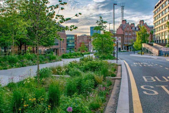
Fast forward to the present day and things are remarkably quieter, and more beautiful, thanks to Sheffield City Council’s ‘Grey-to-Green project.
The ‘Grey to Green ’ project is a development from Sheffield City Council to transform redundant carriageway in the city centre into a network of sustainable drainage and rain gardens. The greening of West Bar has already been completed. Photograph: Nigel Dunnett.
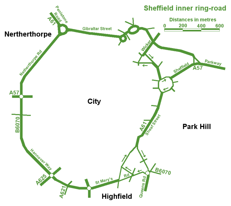
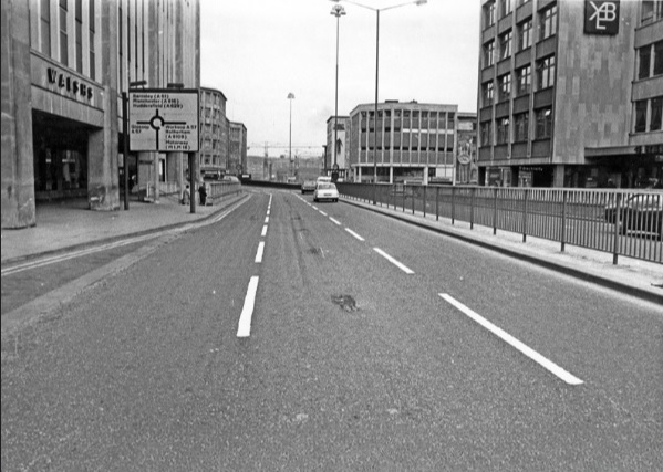
The best map of Sheffield’s Inner Ring Road, but spoilt by spelling mistakes.
An unusual post, in so much that we are looking at a road. In fact, a series of roads that form one big one – Sheffield Inner Ring Road.
We might live in Sheffield, but sometimes it’s difficult to see wood for the trees, and this is the case with the inner ring road, because you probably don’t realise its purpose and where it is.
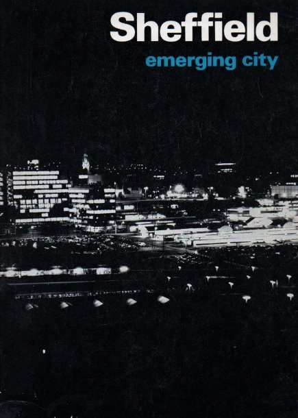
Let’s start in the 1930s when a route around the city centre was first proposed. Truth be known, World War Two stalled plans until the sixties, and in 1969 Sheffield Corporation published an impressive handbook called ‘Sheffield – Emerging City,’ in which plans for a detailed road system were revealed for the first time.
The council intended to pour £65m into the scheme which included bus lanes, pedestrian areas, as well as an urban motorway and motorway links with the M1.
Robert Waterhouse, writing in The Guardian in 1972, said that “Sheffield was as proud of its new roads as of its housing, its clean air, and its flourishing arts. They were all symbols of rebirth after years of stagnation among the ruins of the Industrial Revolution.”
The Guardian article, long forgotten, provides an interesting snapshot into the arguments that raged at the time.
It pointed out that after 1969, things had started to go wrong. In May 1971, a joint report by the city engineer, the city planning officer and architect, and the general manager of the transport department, had taken a gloomy view.
‘Although a large highway construction programme has been embarked upon,’ it said, ‘the growth of vehicular traffic is much greater than the growth of road capacity. The disparity has been obvious for many years and there seems negligible hope of it being ended in the foreseeable future.”
The report estimated that the proposed highway system, capable of carrying about 50 per cent of commuters to work by car, would cost ratepayers another 20p in the pound, which was probably acceptable, but that a system by which nearly everyone went by car could cost £300m, or another pound on the rates, clearly unacceptable. If the ‘compromise,’ £65m system was going to get clogged up anyway, was it worth building at all?
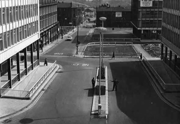
Arundel Gate in 1973 looking towards the Hole in the Road – new barriers erected in attempt to make pedestrians use the subways. Image: Sheffield Newspapers/Picture Sheffield
Waterhouse identified growing opposition within the council.
Sir Ron Ironmonger, Labour’s council leader, admitted that a growing number of councillors were against the scheme, and there had been public exchanges between the planning department and engineers.
The planners, headed by R. Adamson, felt that the engineers were going about the job the wrong way: instead of giving priority to the inner ring road, which everybody thought essential, construction had been advanced near the city centre. This meant that the civic circle – the inner ring road ultimately intended to carry only local shoppers and delivery vans – was being used as a throughway.
But the engineers, under K.D. Wiilliams, replied that highways the size of the inner ring road – a six-lane urban motorway – didn’t happen overnight.
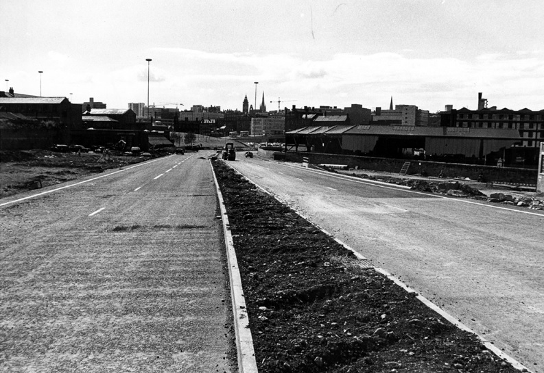
It seemed that Sheffield residents didn’t know what they were in for but would soon find out. The new interchange between the inner ring road and the Parkway was near completion at the bottom of Commercial Street. Sheffield Parkway was also being built and would be the main route into the city centre from the M1.
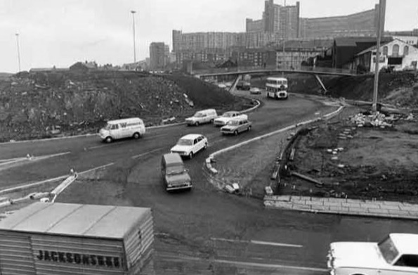
Construction of Sheffield Parkway in 1974 looking towards Park Square. Image: Sheffield Newspapers/Picture Sheffield
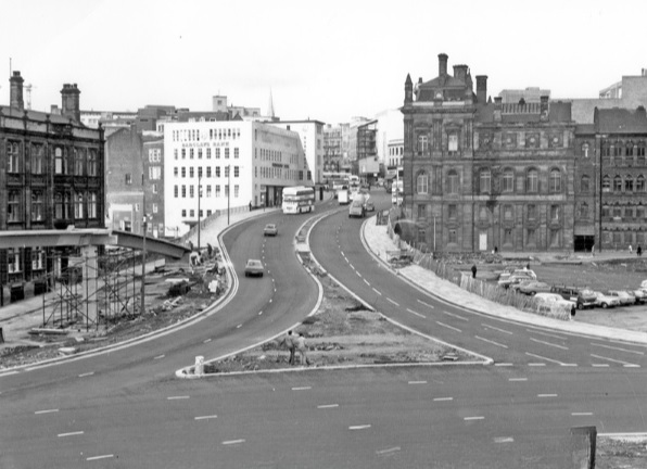
Sheaf Street/Commercial Street (latterly known as Park Square) roundabout under construction in 1973. Image: Sheffield Newspapers/Picture Sheffield
But the argument in 1971 was that traffic coming into the city centre was being diverted onto newly-constructed roads, because there was no proper inner ring road. And it was causing problems.
On Commercial Street itself, a bridge was being widened to take four lanes of traffic. It joined the civic circle at Castle Square, where traffic and pedestrians were already separated – cars at ground level, pedestrians underground. But before the road got there, it had to pass Fitzalan square, one of the principal routes for shoppers on foot. Everybody agreed this was a problem, but work on widening Commercial Street continued anyway, despite open criticism from Labour councillors.
Widened Commercial Street in 1970s, looking towards the Gas Company Offices on right, Electricity Supply Offices and Barclay’s Bank on left. Shude Hill behind car park on right. Image: Picture Sheffield
There were others also opposed to the scheme. Dr Leonard Taitz, a young South African doctor, working in Sheffield, was convener of the Conservation Society’s national transportation working party. He had started a campaign to bring the road building programme to a halt while a new policy on integrated transportation was formulated.
New roads were being built within the city centre but there were design flaws.
He cited the case of Furnival Gate, also a four-lane highway which, he suggested, was bound to be used by commuter traffic, but which divided The Moor and Pinstone Street, two proposed precinct streets. A subway to take people under the road had already been built, while Charter Row, another radial, had a barrier down its middle which cut a whole segment of the city from the centre.
Furnival Gate at the junction with The Moor showing (middle left) junction with Union Street in the 1960s. Image: Picture Sheffield
He argued that these roads were primarily being used by commuters cutting across town. But Mr K.D. Williams, head of technical design at the engineers, said this wasn’t the case, and that they were a necessary part of an integral system, that will one day be blocked off to prevent through traffic, and channel motorists to off-street car parks.
Whatever the interpretation, the roads were ‘not a pretty site.’ Certainly not ‘Sheffield’s Champs Elysees,’ as a councillor had called Arundel Gate.
Robert Waterhouse asked the important question? Would the new roads ever carry the massive traffic that Sheffield had come to expect? Would the inner ring road be built as a motorway, and would Sheffield get its two, or even three, motorway links with the M1?
Sir Ron Ironmonger pointed out that after 1974, highways would become the responsibility of the new South Yorkshire metropolitan authority and had no wish to make any drastic moves at such a late stage, and cited Nottingham which had done away with a major part of its road programme. (Sir Ron later became leader of South Yorkshire Metropolitan County Council).
What did happen?
The 1970s proposal for the Inner Ring Road was abandoned because it would have destroyed important heritage assets like Kelham Island and the canal basin, and cash, as ever, was the stumbling block. But we did eventually get an Inner Ring Road, but it took a long time for it to be completed in its entirety.
We can thank Duncan Froggatt, a Chartered Engineer, in his excellent book, ‘Sheffield – A Civilised Place’ (2018), for providing the timeline.
“The inner relief road had started in the 1960s starting with the dualling of Netherthorpe Road. But the later stages came much later with St Mary’s Gate and Hanover Way widened to dual carriageways in the 1980s.
“Sheaf Street was improved in the early 2000s leading to the improvement of Sheaf Square and subsequently links to St Mary’s Road up to 2009.
“The northern section from Sheffield Parkway to Penistone Road was built in two phases in the 1990s. The phase from the Parkway to The Wicker was completed in 2000, originally called Cutlers’ Gate, but later renamed Derek Dooley Way. The next stage, between the Wicker and Shalesmoor was finished in 2008.
“Once completed, it provided a continuous loop of dual carriageway, clockwise from Granville square in the southeast to Sheffield Parkway in the east, linking all main arterial routes in the city.”
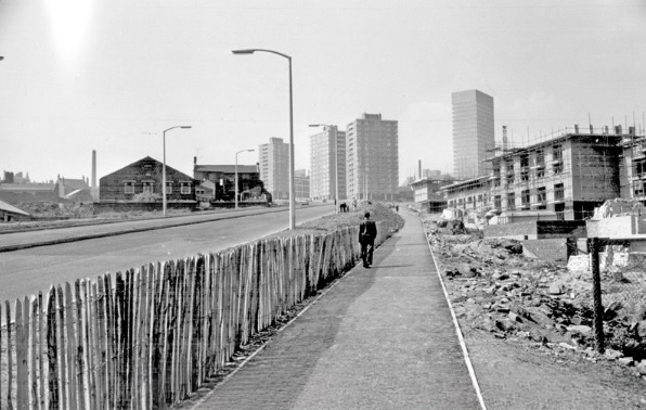
Netherthorpe Road with Netherthorpe Street Flats under construction in 1965, looking towards Netherthorpe High Rise Flats. Image: SCC/Picture Sheffield
All done and dusted, but these days it is what is happening within the Inner Ring Road that creates the interest.
Mr Williams’ plan for streets to be blocked off to traffic within the city centre did and continues to happen. Fargate and The Moor were the first to be pedestrianised, Pinstone Street is in transition, and Arundel Gate will be downgraded.
But what nobody in the 1970s envisaged was something that had been around for centuries… and that was the bicycle. Cycle routes, and the eagerness to cut car emissions, while greening our urban spaces, means that Sheffield city centre will eventually change beyond recognition.
I leave you with a story. Last week, I had to travel by car from one side of the city centre to the other. By foot it was less than a mile. By car, I travelled 2.5 miles.
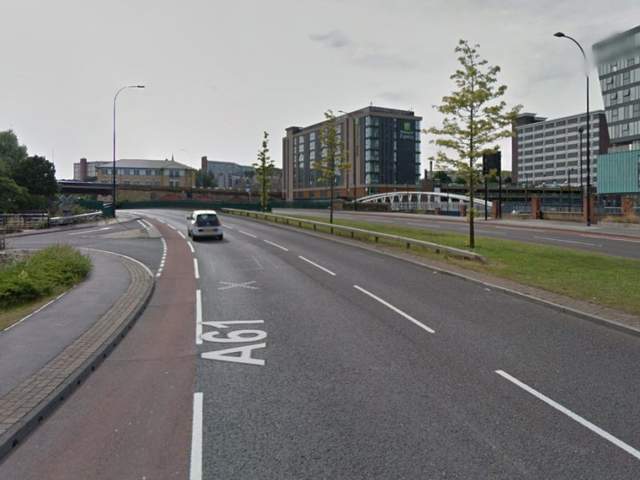
Derek Dooley Way. Image: Sheffield Star
“Driving into Sheffield, I was looking forward to my friend’s hen-do. We had booked a city centre apartment, a spa day and a restaurant. What could go wrong? Yet, an hour-and-a-half later, I was bellowing tearfully into my mobile at my boyfriend: “You came to university here. Where AM I?” What had caused this emotional meltdown? Certainly not a fall-out with my friends – I hadn’t even seen them yet. Instead, my fun-filled city break had been spent navigating a series of roundabouts on the city’s ring road which kept spitting me out with increasing ferocity. Sheffield’s inner ring road has been tormenting drivers since 1961. Like many of the nation’s worst ring roads, it twists you round its little finger only to catapult you into bus-only zones or roads that lead you off in the opposite direction to the one you need.” – Jenny Scott – BBC News – 2014
NOTE Robert Waterhouse is a journalist. Starting on the Guardian in Manchester and London, he turned freelance and was launch editor of the daily North West Times. He is a co-editor of the review Mediterraneans. His books include The Other Fleet Street, a history of national newspaper publishing in Manchester.
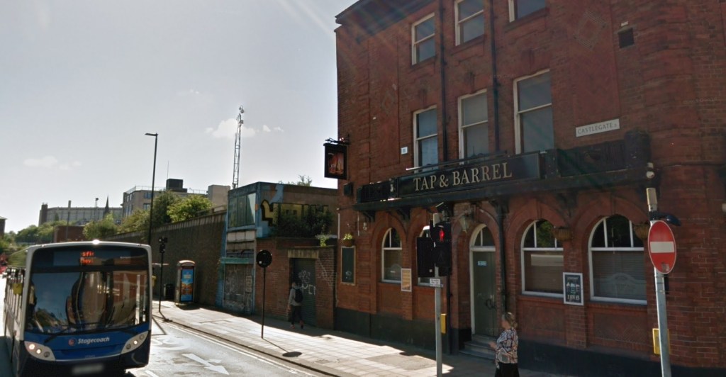
The name suggests that this is one of Sheffield’s ancient roads, perhaps named after Sheffield Castle, this stronghold destroyed by Parliamentarians during the 1600s. Castlegate is the road that runs alongside the River Don between Blonk Street and the junction of Waingate and Bridge Street.
However, you might be surprised to know that Castlegate is a relatively modern road and celebrates its centenary in 2030.
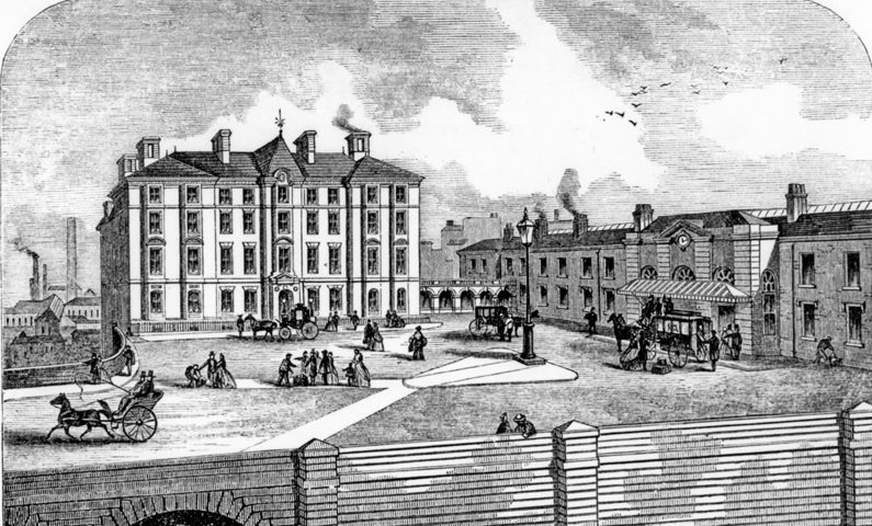
The road is found on the site of the lost castle and was first suggested by Edward Mitchel Gibbs, the Sheffield architect, as part of his ambitious plans for a Viaduct Scheme connecting Great Central Station (Victoria Station) with Haymarket.
The River Don Road was the only portion of the proposal adopted by Sheffield Corporation and built to ease congestion around Blonk Street, The Wicker and Lady’s Bridge. Its construction was made easier by the council’s Castle Hill Market development built on the embankment of the castle.
Castlegate (or Castle Gate), 60 feet wide and 200 yards long, was built at a cost of £13,000 in 1930, using over 9,000 tons of material, with a one-foot layer of strong concrete laid below the asphalt.
It was divided from the River Don by an old stone wall which had to be reinforced by 14 concrete buttresses each weighing 50 tons. Over the buttresses was a solid mass of concrete stretching from the wall halfway under the road and taking the weight of the traffic.
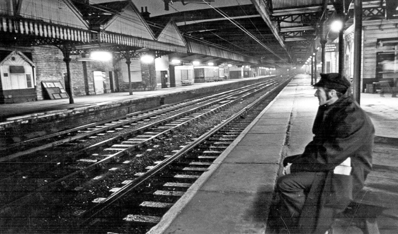
There is a photograph from January 1970 that shows a train driver, sitting in reflective mood on a bench at Sheffield’s Victoria Station. He was waiting to take out one of the last passenger trains from Sheffield Victoria to Manchester.
Once it had departed the lights went out and darkness descended on a railway station once considered the city’s ‘pride and joy’.
An eventual victim of cuts initiated by Dr Beeching, almost nothing remains today, but if you know where to look, and use a bit of imagination, you can see where once Sheffield folk hopped on a train across the Pennines and down to London’s Marylebone and King’s Cross stations.
Image: Picture Sheffield
The Sheffield, Ashton-under-Lyne and Manchester Railway was engineered by Joseph Locke and opened in 1845, the line originally terminating at Bridgehouses Station (the site on waste land above the lower end of Derek Dooley Way).
In 1847, it merged with two other railway companies to form the Manchester, Sheffield, and Lincolnshire Railway, prompting an extension of the line and construction of a new railway station about 1km to the east.
It was developed by Sheffield-born John Fowler, engineer-in-chief, and included a 40ft-high, 750-yard long, viaduct over The Wicker (Wicker Arches) and was completed in 1847-1848. The new Victoria Station opened on September 15th, 1851.
The railway station was opened for the convenience of the Manchester, Sheffield, and Lincolnshire, the Great Northern, and the south traffic of the Midland Company. It occupied a space between Wicker Arches to the canal, crossing the river, the site of the old Blonk Dam, the cattle market, and fairground, and the back of Sheaf Works.
Image: Picture Sheffield
Built on arches by Miller, Blackie and Shortridge, it rose 40ft above the level of The Wicker, the station fronting south-west with prominent views of the Corn Exchange, the New Market Hall, and canal warehouses.
The approaches to the station and the platforms were the work of John and Amos Ridal, and the station buildings were erected by Robert Tomlinson Carlisle, the builder of Beighton Viaduct and the New Market Hall.
It was not the magnificent station envisaged by Fowler. The architects, Weightman, Hadfield and Goldie, were asked to reduce costs, probably the result of high expenditure engineering the approach to the station.
The front of the Victoria Station was destitute of ornament, being simple in architectural character. It was approached from Blonk Street by a straight incline, built upon the arches, 50ft wide, 220-yards long, and rose at a rate of 1 in 30. As the road approached the station it opened out into an extended area.
The station consisted of a centre and wings, the latter being extended with a high fence wall, with gateways for the exit of arriving passengers, and beyond these, on each side, covered by stands for horse-drawn cabs.
The length of the masonry front was 400ft, built of rock-faced Greenmoor stone, with chiselled beds and joints, and facings of ashlar stone from Wadsley.
A covered veranda, with glazed roof supported by iron brackets, extended the whole length of the centre building, to allow carriages to set people down under cover.
The entrance, or waiting hall, was 50ft by 30ft, and 25ft high, having an enclosed office for booking clerks. Tickets were issued at three windows. At the centre, first-class passengers of the Manchester, Sheffield, and Lincolnshire Railway got their tickets, and on the right-hand side, second and third class passengers got theirs. The left-hand window was for Great Northern passengers.
Image: Picture Sheffield
In the eastern wing were refreshment and waiting rooms, public conveniences, parcels office, and on the chamber floor the station master’s house. The refreshment rooms were rented by Mr Moyes, the landlord of the Great Northern Hotel at Lincoln.
In the western wing were the telegraph and station master’s office, rooms for lamps and porters, guards etc., and the engineer’s office. Above these were the boardroom and other offices.
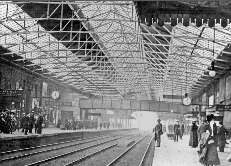
Having passed through the booking office and reaching the platform, the passengers were greeted with ample light and a conveniently arranged station.
The platforms were covered with a light roof of iron and glass, 83ft wide and 400ft long, regarded as one of the “first fruits of the Crystal Palace.” It was the work of Fox, Henderson and Company, a ridge and furrow roof, with Paxton gutters, designed to carry away rain and condensation underneath (used for water closets and urinals), and the centre of the roof was raised to permit a line of ventilation.
The roof was not supported by pillars, but its principals were set 25ft apart, resting on the inner wall of the station buildings on one side, and a lofty wall on the other. The glass was strong crown glass, about the thickness of ordinary pottery, and extended to an area of 34,600 sq. ft.
Through the station ran four lines of rails – two for passenger trains and two for spare carriages. Two other lines were laid outside the north-eastern wall for goods traffic.
The exits were closed by sliding gates, opened only when a train arrived and thus preventing ‘idlers’ entering the platforms, which themselves were divided by iron railings through which only passengers with tickets could pass.
With the building of Victoria Station, the Bridgehouses Station was converted into a goods, cattle and minerals station that operated until the 1960s.
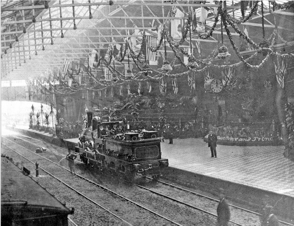
Victoria Station decked out for the visit of the Prince of Wales to open Firth Park in 1875. Image: Picture Sheffield
The Victoria Station opened on Monday September 15th, 1851. Although not fully completed, the station was elaborately decorated with flags, some bearing loyal inscriptions, others wishing good wishes for the prosperity of the railway and docks, while others were simple decorative banners.
The first train to leave the station was an early morning service with 500 passengers bound for Hull and Grimsby. About 9am, a pleasure train with 2000 travellers set off for Worksop, and in the early afternoon a special train left for London. Combined with local services the station was a scene of bustling activity, soon tested by the presence at the same time of two through trains and two Eckington trains sharing the same platforms.
With formalities out of the way, and the Victoria Station left to its daily business, Robert Tomlinson Carlisle, the builder responsible for the station buildings, entertained 500 of his men at the New Market Hall.
His workers were treated to a substantial dinner of beef and ham provided by Mrs Outram of the Black Swan in Snig Hill.
The ceremony was attended by John Fowler, engineer-in-chief, the man responsible for the massive project.
Robert Tomlinson Carlisle gave a toast to “The Queen, Prince Albert, Albert – Prince of Wales, and the rest of the Royal Family; Prosperity to the Manchester, Sheffield and Lincolnshire Railway, and the Grimsby Docks; Success to the Sheffield Markets, the Duke of Norfolk and the Earl of Yarborough.”
Charles Anderson Worsley Anderson-Pelham, 2nd Earl of Yarborough, former MP, was the chairman of the Manchester, Sheffield, and Lincolnshire Railway. His Lincolnshire estate was adjacent to the line and had been responsible for the development of the track through the county, especially its extension to Grimsby Docks
The Victoria Station was a success and received a new roof spanning main line platforms in 1867. Three years later the Midland Railway opened the Midland Station and it received its first real competition. Victoria was enlarged by Logan and Hemingway in 1874 and received a new frontage in 1908.
Image: Picture Sheffield
The Great Central Railway came into being when the Manchester, Sheffield and Lincolnshire Railway changed its name in 1897, anticipating the opening in 1899 of its London Extension. Interestingly, for a short time afterwards Victoria Station was renamed Great Central Station but as was often the case, old names refused to go away, and it reverted to its original name. The Great Central Railway was later grouped into the London and North Eastern Railway.
In 1948 the railways were nationalised, and it brought wholesale change to the network, as governments committed to the elimination of steam traction in favour of diesel and electric power.
After World War Two, the Victoria track was the first main line in the UK to be electrified, reaching Victoria Station by 1954.
Image: Picture Sheffield
Over time, with the growth of the road haulage sector, passengers replaced freight (especially coal transport) as the railways’ main source of income, and Victoria’s glory period was in the 1950s.
The Manchester London Road to London Marylebone service, via Victoria Station, used the Great Central Line. Other expresses ran to King’s Cross over the East Coast main line, and The Master Cutler, The Sheffield Pullman and The South Yorkshireman all served the station.
However, by the end of the decade expresses to Marylebone had either been cut or re-routed to King’s Cross and by the mid-1960s many local and express services had been transferred to the Midland Station. It left Victoria with just one hourly Manchester service and the daily Liverpool-Harwich ‘Continental’.
Percy Williamson. The last Station Master. Image: Picture Sheffield
Image: Picture Sheffield
The Beeching Report of 1963 resulted in the closure of a third of the rail network and originally favoured closing Midland Station. However, in the ensuing years Victoria Station became the chosen casualty instead, the Hope Valley line between Sheffield Midland Station and Manchester preferred because it served more communities. There was a suggestion that the cost of upgrading Victoria’s obsolete electric line was too expensive, but there were also suggestions that politics decided its fate. After much wrangling, and a two-year enquiry, passenger services were withdrawn from Victoria Station on January 5th, 1970.
Image: Picture Sheffield
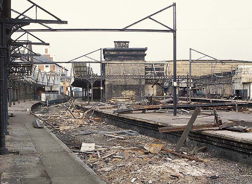
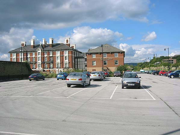
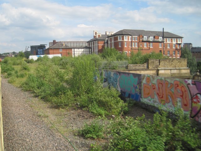
Goods traffic still ran through the station but all tracks (except one that still exists nearby) were lifted in 1983, and the station buildings demolished in 1989 to make way for extensions to the nearby Royal Victoria Hotel.
Image: Disused Stations
Perhaps we should mention HS2. The long-running saga of Britain’s next generation railway originally had plans for a station at Meadowhall, but Sheffield City Council wanted a city centre location.
For a brief time, it seemed that Victoria Station might have been resurrected but alas, once again, its old rival, the Midland Station (now Sheffield Station), became the preferred option instead.
And so, to the present. Much of the site of Victoria Station’s former buildings and platforms is now lost under modern hotel buildings and car-parks. However, the elegant sloping approach to the Crowne Plaza Royal Victoria hotel remains much the same as it did when the station existed.