In 1900, the Improvements Committee of Sheffield Corporation paid £10,500 for 2,546 yards of land in Newhall Street. There were certain freehold premises here, including the Hollis Hospital.
The question we ask ourselves 122 years later, where was Newhall Street?
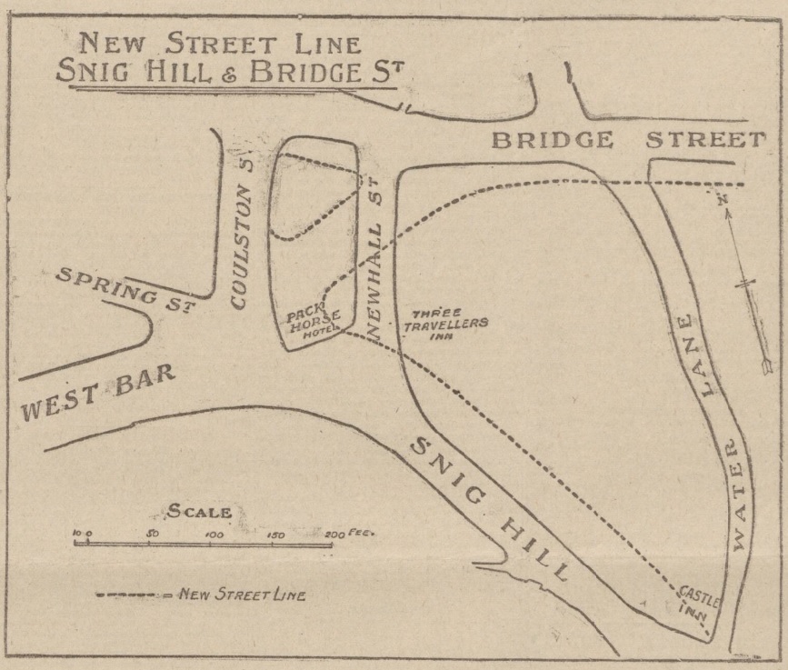
Sheffield Corporation wanted to carry out a road diversion with a straight way from Westbar to Bridge Street.
Newhall Street was at the bottom of Snig Hill and disappeared, the line of Westbar continued across land occupied by the Pack Horse Hotel (demolished), until it joined Bridge Street.
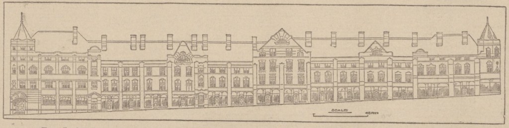
This illustration from 1902 shows the original road layout, with dotted lines indicating the new street pattern and building lines. It also shows the widening of Snig Hill.
The scheme was completed in 1903 providing a more direct route from Westbar to the Victoria Station, and in due course tram lines ran from Westbar into the Wicker. It allowed tramcars to run from Hillsborough to the Wicker and then back to Hillsborough by the Owlerton Route – another step in the completion of the city’s circular tramway system.
The loss of Newhall Street was significant because this had been the boundary between Saint Peter’s Ward and Saint Philip’s Ward, dating to 1843 when Queen Victoria granted The Charter to the Borough of Sheffield.
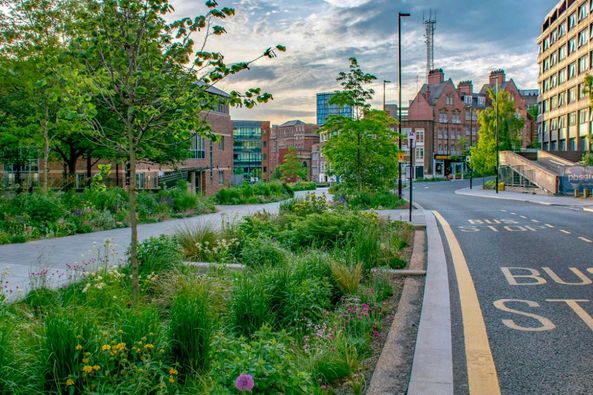
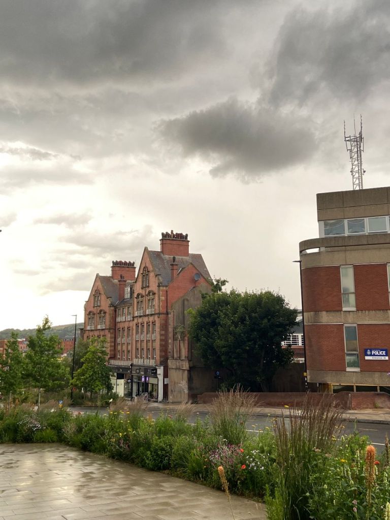
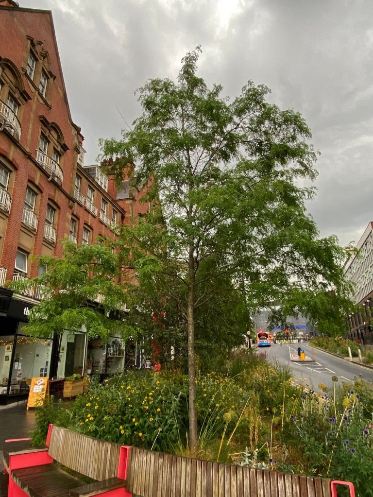
Fast forward to the present day and things are remarkably quieter, and more beautiful, thanks to Sheffield City Council’s ‘Grey-to-Green project.
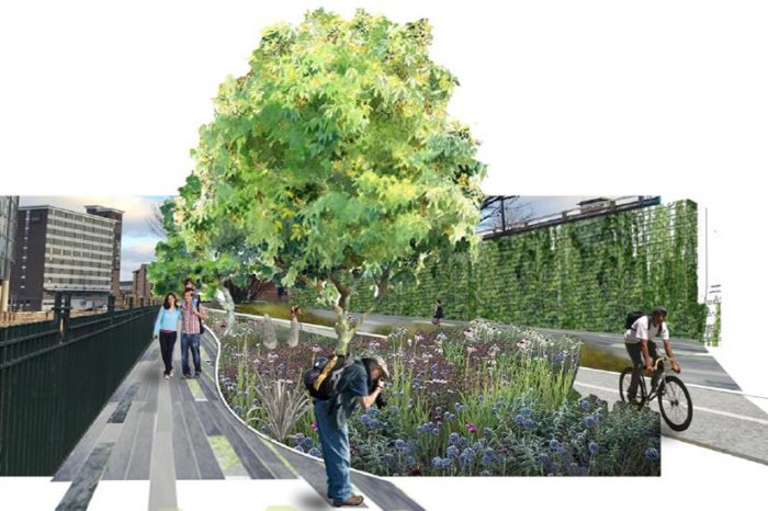
The ‘Grey to Green ’ project is a development from Sheffield City Council to transform redundant carriageway in the city centre into a network of sustainable drainage and rain gardens. The greening of West Bar has already been completed. Photograph: Nigel Dunnett.
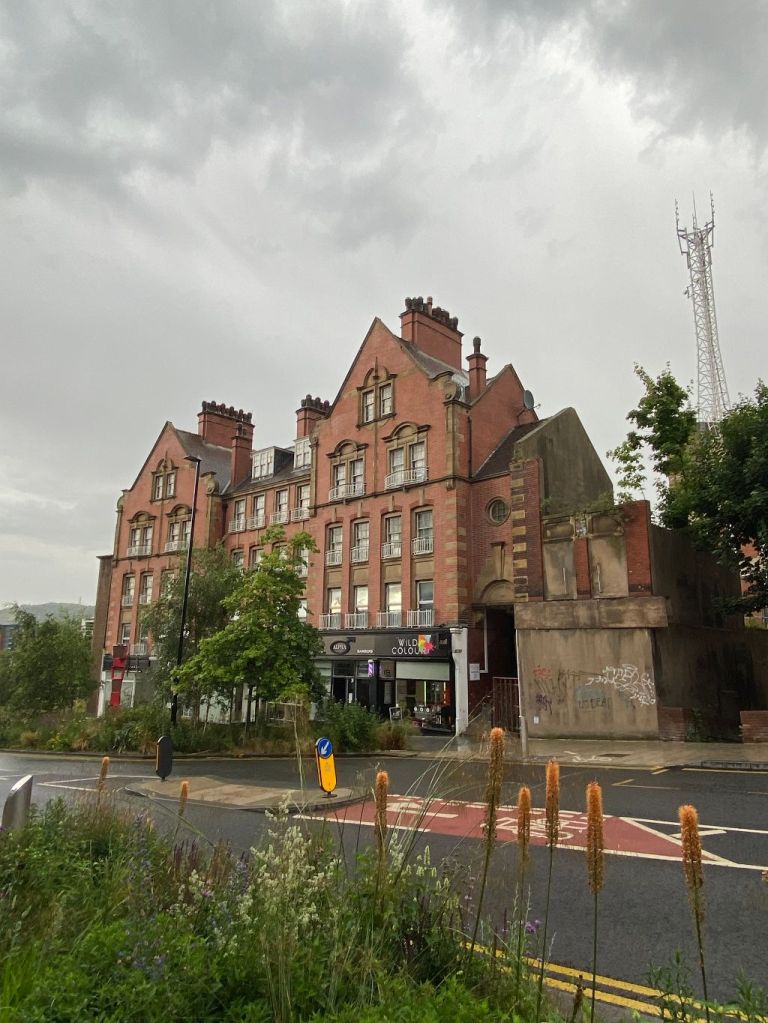
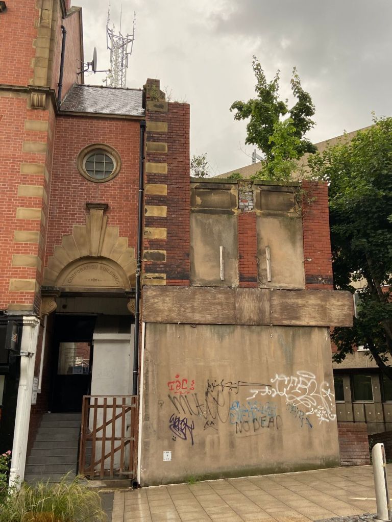
Corporation Buildings, Snig Hill, Sheffield. Image: DJP/2022
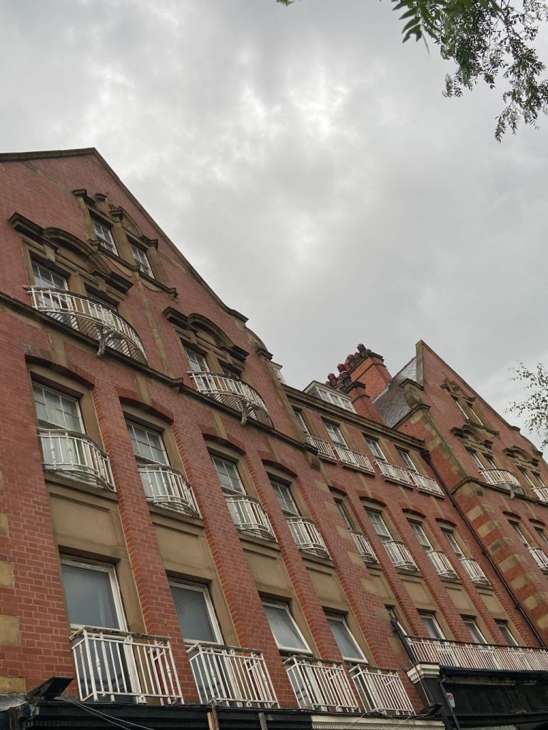
I think this building looks quite elegant. Corporation Buildings, at the bottom of Snig Hill, is one of the few survivors of old Sheffield in this forgotten part of the city centre. And its proximity to the grey-to-green project adds to its stylishness.
But this was a troubled building from the start, and what you see today is a fragment of what it once looked like.
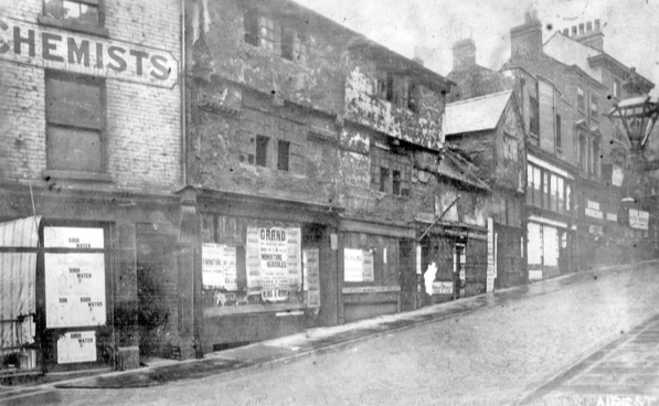
Our Victorian and Edwardian forebears had embarked on a plan to improve our streets, and too often we focus on Pinstone Street, Fargate, and High Street, as examples of their enterprise. But there were others, and Snig Hill was one of them.
Snig Hill from West Bar, derelict timber framed shops, prior to demolition in 1900. Image: Picture Sheffield
At the turn of the twentieth century, plans were revealed to widen Snig Hill from Angel Street down to Bridge Street. Old buildings were swept away and in 1902 Sheffield Corporation revealed plans to build new Corporation Buildings stretching the whole of the right side going from the centre of town.
The original plans were drawn up by the city surveyor, Charles. F. Wilke, and showed a four-storey building, with a frontage of 140 yards, including thirteen shops, with showrooms above, and sixty artisan dwellings on top of them. The plans showed that turrets were included at each end, with gables introduced to break the differences in height created by the sloping gradient of the site.
Charles F. Wilke’s rejected 1902 design for Corporation Buildings on Snig Hill. Image: British Newspaper Archive
The problem was that the Improvement Committee had drawn up the plans, but the council had already created an independent committee to deal with surplus land. The project was handed over to them and appears to have disregarded Mr Wilke’s plan.
Instead, the committee approached architects Gibbs and Flockton which came up with an alternative, if not dissimilar, plan for the site. Work began in 1903 and cost between £60K and £70K and was completed the following year.
Like all council-backed projects there was criticism about the Corporation Buildings, fuelled by the fact that when it was completed only three of the twenty-one shops had been let, and the rents for the flats appeared too expensive for Sheffield’s working class. One councillor referred to Corporation Buildings as ‘a ghastly array of empty shops.’
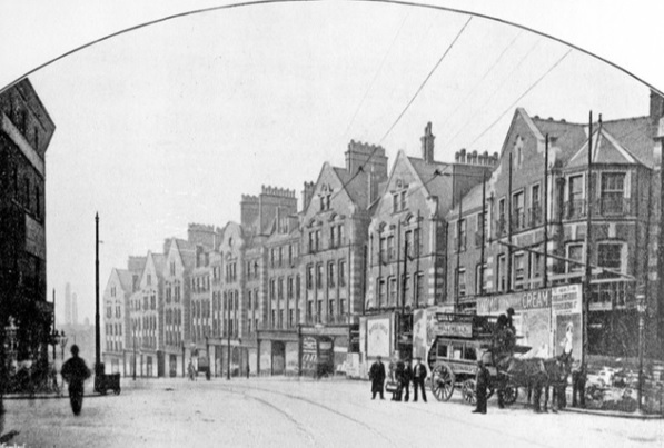
Newly constructed Corporation Buildings and shops, Snig Hill, 1905. Image: Picture Sheffield
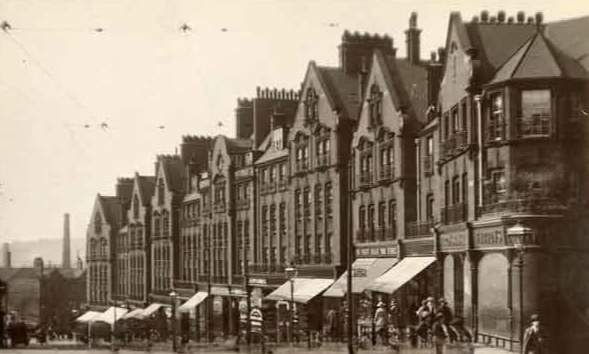
Snig Hill. This image was originally part of the Tim Hale Photographic Collection. Image: Picture Sheffield
The scheme inevitably made a loss in its early years, but once shops and flats were occupied, it brought in steady income.
Nearly 120 years later, we are left with a small portion of the original construction.
What happened to the rest of it?
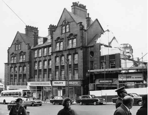
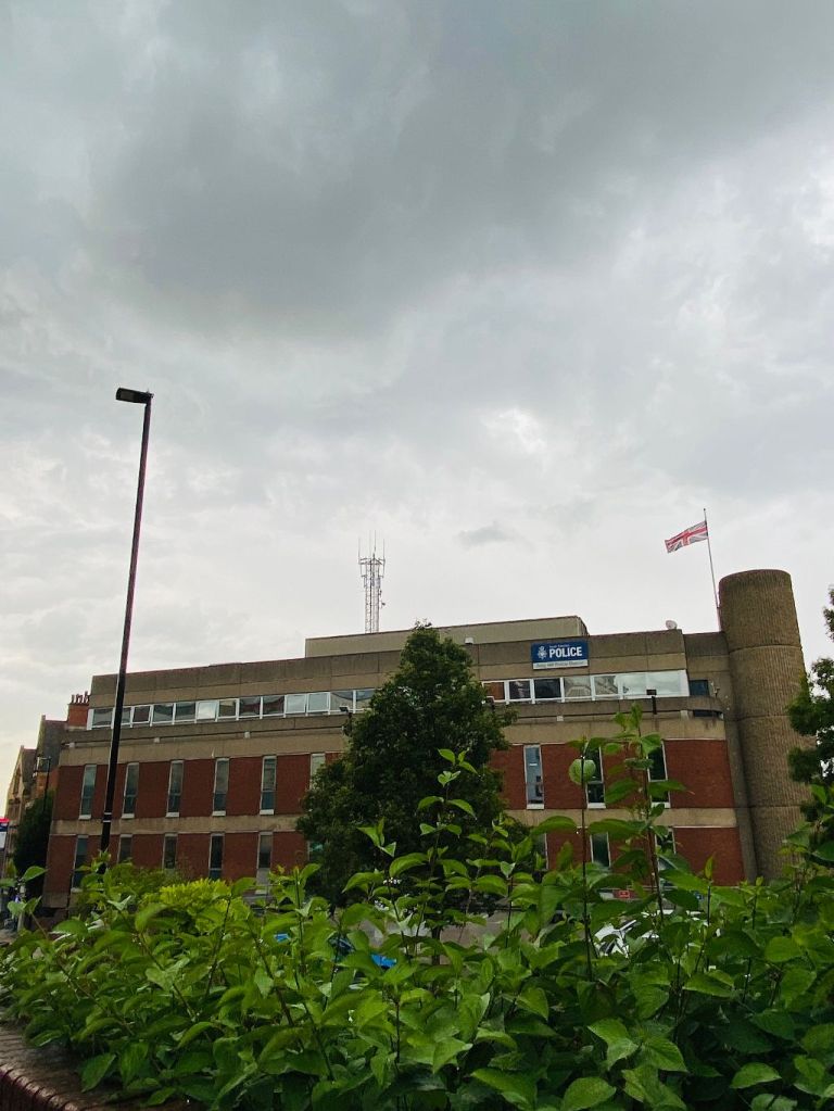
In World War Two, bombs destroyed much of the upper block at the top of Snig Hill. This had to be demolished and was replaced with ‘temporary’ single storey shops. A further portion was demolished in 1971 to make way for the new headquarters of Sheffield and Rotherham Constabulary, subsequently for South Yorkshire Police, and is now used as the divisional police station covering the city centre.
But at least we have something left, and most of us can only speculate as to how impressive the full block would have looked had it survived.
Demolition of Council flats in 1971 on Snig Hill showing (left to right) Sheffield and Rotherham Constabulary (Criminal Investigation Department); W. H. Godley and Son, gents outfitters (Nos.78-80) and Arthur Davy and Sons Ltd, bakers (No.74). Image: SCC/Picture Sheffield
Corporation Buildings, Snig Hill, Sheffield. Image: DJP/2022
Snig Hill, looking down towards Bridge Street. Snig Hill Police Station can be seen on the right. Image: DJP/2022
Mention Snig Hill and most people will attach the name to the police station that has stood here since 1970. But Snig Hill refers to the sloping road between the bottom of Angel Street and West Bar. This was once a bustling thoroughfare but has been slowly downgraded because of traffic flow changes.
It is not an unpleasant place. The ‘grey-to-green’ project has seen the introduction of trees and wildflowers to re-connect the Castlegate area with the rest of the city centre and re-use redundant highway. And it soaks up rainwater that would have flowed into the nearby River Don, therefore reducing the risk of flooding.
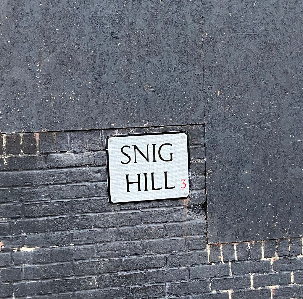
The mystery about Snig Hill is how it got its name. It has mystified Sheffielders for centuries and various suggestions have been put forward.
Snig Hill, street sign. Image: DJP/2022
Once upon a time, there was a corn mill at Millsands, next to the River Don, and to access this, people used a packhorse track running between high banks behind gardens of old houses that stood on what is now the right hand side of Snig Hill going down the hill.
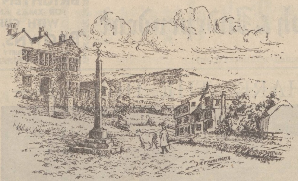
According to J.W. Farnsworth in 1939, this became so waterlogged in wet weather with rain and the sewage that drained from the Beast Market, that it earned itself the name of Water Lane (think, Hen & Chickens, now Castle Green).
When Snig Hill was made and cobbled, the ancient lane fell into disuse, and several townsmen built houses. On the opposite side, at what became the Black Swan Hotel, was Costnough Hall which stood just below the Irish Cross at the junction of Angel Street.
The hall disappeared, and Snig Hill became a narrow street, and the projecting upper stories of the houses gave an appearance of still greater narrowness.
J.W. Farnsworth’s sketch of old Snig Hill. Costnough Hall is seen on the left. Image: British Newspaper Archive
And so, to the name. In dialect English, of the word ‘snig’ there were five meanings: (1) To cut or chop; (2) to sneak off; (3) to drag over the ground; (4) close and private; (5) a small eel.
One suggestion was that ‘Snig Hill’ derived its name from the fact that it was the incline up which the ‘trees’ were ‘snigged’ from the lower area (the area down to the banks of the river, say) which no doubt was very well wooded at one time.
A ‘snig chain’ was also the chain used for hauling timber or attaching an extra horse to a wagon. At our Snig Hill, it was said that a horse was once kept to ‘snig’ up the hill any wagon that paid a small fee.
But Sidney Oldall Addy in ‘A Glossary of Words used in Sheffield,’ published in 1888, thought differently.
“To snig a load of anything up a hill is to take up the load in two or more instalments. For instance, a load of timber might be left at the bottom of the hill. Each portion brought up would be called a snig. The incline of the hill is not great, and the hill is small. Snig Hill thus appears to mean Little Hill. I think this is really the meaning, there being no proof that the timber was ever dragged up the hill in instalments.”
But he contradicted himself in ‘The Hall of Waltheof,’ published in 1893.
“The word snug, meaning lying close and warm is identical with the word snig used in this street name. It is not the hill in this case, which is snug, but the narrow old street, and had it been Snicket Hill, the meaning would have been clear.”
Others thought that it took its name from the practice of putting a ‘snig’ or length of wood through the back wheels of carts going down the hill to act as a brake.
Snig Hill, looking towards Angel Street. Image: DJP/2022
Willis Crookes, of Normandale, Loxley, said in 1930 that at the Bridge Street end of Snig Hill, there was a depression in the road, where a pool once existed, and which was really a backwash of the River Don. He told of his boyhood (the 1870s), when he often talked to old men who told him that in their young days it swarmed with eels.
When anybody wanted a fish dinner they took a long stick with a cleft in it, pushed it into the mud of the pool, and dragged out an eel. This useful form of diversion was called ‘snigging.’
A far more likely explanation came about the same time from somebody who said that an old relative had been a stagecoach driver between Leeds and Sheffield. Among stories passed down in his family was one to the effect that the flour ground at Millsands was put into barrels and were ‘snigged up t’hill.’ He suggested that ‘to snig’ was to roll the barrel up the slope and put a under it.
However, it seems that the true meaning of ‘Snig Hill’ may never be known.
South Yorkshire Police at Snig Hill. It was originally built by B. Warren, Sheffield’s Planning Officer and Architect, as force headquarters for Sheffield and Rotherham Constabulary in 1970. It is now the police station covering Sheffield city centre. Image: DJP/2022
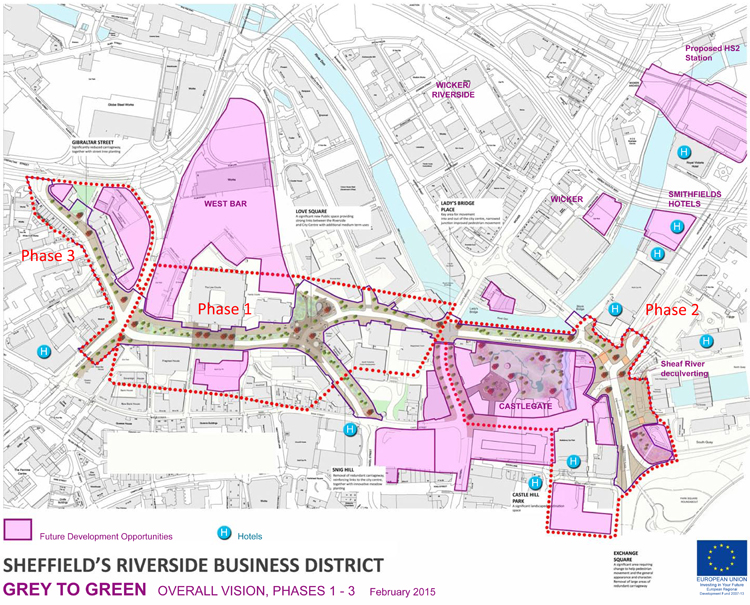
The recent post about Castlegate failed to mention that it is in the process of being part-pedestrianised, Phase 2 of Sheffield’s ‘Grey to Green’ project. Unless you visit this forgotten part of the city centre the relevance of the initiative might escape you.
It is part of an approach to transform ‘redundant’ road space into a network of public spaces, sustainable drainage and urban rain gardens, which aims to improve the setting of the Riverside Business District, Castlegate and the rest of the city centre and then on to Kelham Island and Victoria Quays, as a place to work, live and enjoy, whilst also dealing with the effects of climate change.
Phase 1 (West Bar/Bridge Street/Snig Hill) was completed in Spring 2016 and was funded by the European Regional Development Fund, Sheffield City Region Infrastructure Fund and Sheffield City Council.
The area suffered catastrophic river floods in 2007. With the completion of the Inner Relief Road in 2008, traffic was diverted away from West Bar. The opportunity was seized to replace the ‘grey’ impermeable ‘redundant’ roads into ‘green’ permeable beds, transforming the space with colourful meadow-like planting and significantly increasing surface water storage.
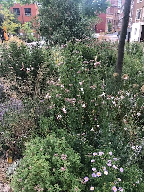
With advice on plant selection from the University of Sheffield Landscape Department this has created a new townscape that is different to anything done in Sheffield before. Over 40,000 bulbs, 40 new trees, 600 evergreen shrubs and 26,000 herbaceous plants were introduced to form a seasonal urban meadow.
The new road layout was designed to slow vehicle speeds and make walking and cycling more attractive. New paving, street furniture, colourful seating and five eye-catching public art ‘totems’ celebrate the local history of the West Bar area including its Victorian music halls and theatres, its lively street life, its complex relationship to the river and its legacy of industry and brewing.
Phase 2 (Castlegate to Exchange Place) is nearing completion, and Phase 3 (Gibraltar Street to Shalesmoor) will eventually transform 1.2km of ‘redundant’ road-space into an attractive new linear green public space.