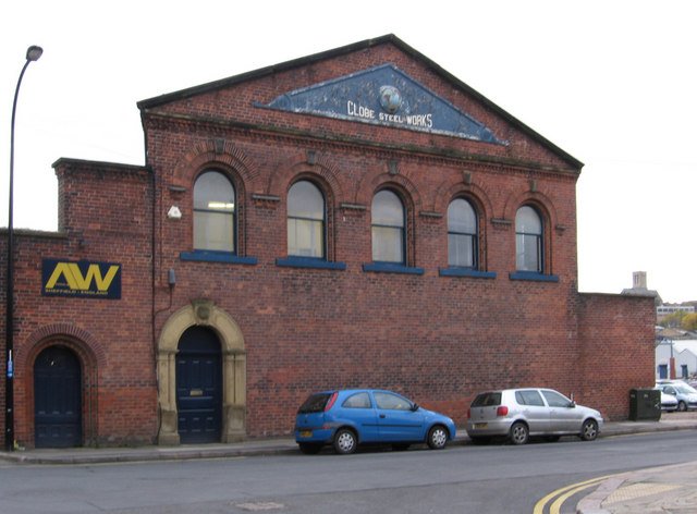
More development proposals at Kelham Island. This time it involves the former Globe Steel Works on Alma Street.
Plans have been lodged to convert it into a bar, café, multi-use events and music venue. The full planning application has been submitted by Citu, supported by Directions Planning Consultancy.
The traditional red brick building was built about 1845 and is one of the last standing remnants of the former Globe Steel Works, which once incorporated land to the east, south and west. The extended site was last occupied by Richardson’s Cutlery Works and, more recently, this building was used by AW Tools (Europe) Limited.
Under the plans, an existing single-storey enclosed yard area that is already partially covered along the western elevation would be fully utilised to provide further accommodation at ground floor and a terrace at the first floor level. A new lobby area would also be created in the north-east corner.
The existing Globe Steel Works sign would be retained.
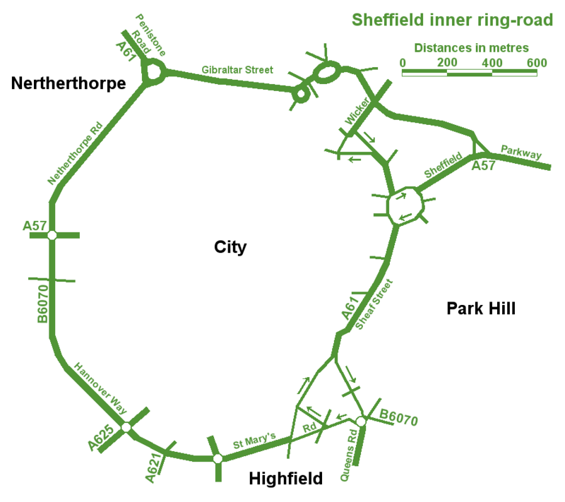
The best map of Sheffield’s Inner Ring Road, but spoilt by spelling mistakes.
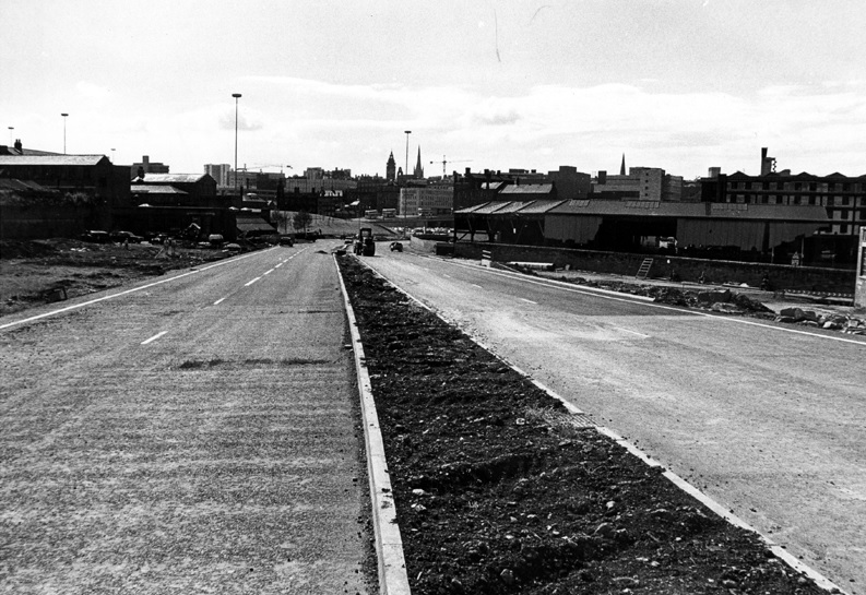
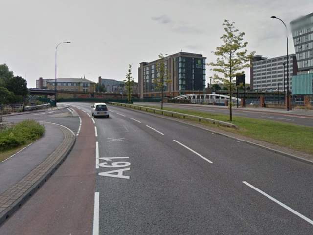
An unusual post, in so much that we are looking at a road. In fact, a series of roads that form one big one – Sheffield Inner Ring Road.
We might live in Sheffield, but sometimes it’s difficult to see wood for the trees, and this is the case with the inner ring road, because you probably don’t realise its purpose and where it is.
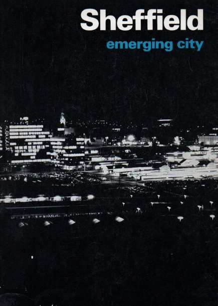
Let’s start in the 1930s when a route around the city centre was first proposed. Truth be known, World War Two stalled plans until the sixties, and in 1969 Sheffield Corporation published an impressive handbook called ‘Sheffield – Emerging City,’ in which plans for a detailed road system were revealed for the first time.
The council intended to pour £65m into the scheme which included bus lanes, pedestrian areas, as well as an urban motorway and motorway links with the M1.
Robert Waterhouse, writing in The Guardian in 1972, said that “Sheffield was as proud of its new roads as of its housing, its clean air, and its flourishing arts. They were all symbols of rebirth after years of stagnation among the ruins of the Industrial Revolution.”
The Guardian article, long forgotten, provides an interesting snapshot into the arguments that raged at the time.
It pointed out that after 1969, things had started to go wrong. In May 1971, a joint report by the city engineer, the city planning officer and architect, and the general manager of the transport department, had taken a gloomy view.
‘Although a large highway construction programme has been embarked upon,’ it said, ‘the growth of vehicular traffic is much greater than the growth of road capacity. The disparity has been obvious for many years and there seems negligible hope of it being ended in the foreseeable future.”
The report estimated that the proposed highway system, capable of carrying about 50 per cent of commuters to work by car, would cost ratepayers another 20p in the pound, which was probably acceptable, but that a system by which nearly everyone went by car could cost £300m, or another pound on the rates, clearly unacceptable. If the ‘compromise,’ £65m system was going to get clogged up anyway, was it worth building at all?
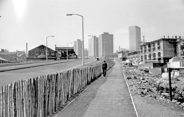
Arundel Gate in 1973 looking towards the Hole in the Road – new barriers erected in attempt to make pedestrians use the subways. Image: Sheffield Newspapers/Picture Sheffield
Waterhouse identified growing opposition within the council.
Sir Ron Ironmonger, Labour’s council leader, admitted that a growing number of councillors were against the scheme, and there had been public exchanges between the planning department and engineers.
The planners, headed by R. Adamson, felt that the engineers were going about the job the wrong way: instead of giving priority to the inner ring road, which everybody thought essential, construction had been advanced near the city centre. This meant that the civic circle – the inner ring road ultimately intended to carry only local shoppers and delivery vans – was being used as a throughway.
But the engineers, under K.D. Wiilliams, replied that highways the size of the inner ring road – a six-lane urban motorway – didn’t happen overnight.
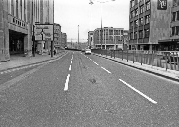
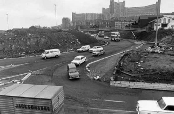
It seemed that Sheffield residents didn’t know what they were in for but would soon find out. The new interchange between the inner ring road and the Parkway was near completion at the bottom of Commercial Street. Sheffield Parkway was also being built and would be the main route into the city centre from the M1.
Construction of Sheffield Parkway in 1974 looking towards Park Square. Image: Sheffield Newspapers/Picture Sheffield
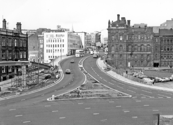
Sheaf Street/Commercial Street (latterly known as Park Square) roundabout under construction in 1973. Image: Sheffield Newspapers/Picture Sheffield
But the argument in 1971 was that traffic coming into the city centre was being diverted onto newly-constructed roads, because there was no proper inner ring road. And it was causing problems.
On Commercial Street itself, a bridge was being widened to take four lanes of traffic. It joined the civic circle at Castle Square, where traffic and pedestrians were already separated – cars at ground level, pedestrians underground. But before the road got there, it had to pass Fitzalan square, one of the principal routes for shoppers on foot. Everybody agreed this was a problem, but work on widening Commercial Street continued anyway, despite open criticism from Labour councillors.
Widened Commercial Street in 1970s, looking towards the Gas Company Offices on right, Electricity Supply Offices and Barclay’s Bank on left. Shude Hill behind car park on right. Image: Picture Sheffield
There were others also opposed to the scheme. Dr Leonard Taitz, a young South African doctor, working in Sheffield, was convener of the Conservation Society’s national transportation working party. He had started a campaign to bring the road building programme to a halt while a new policy on integrated transportation was formulated.
New roads were being built within the city centre but there were design flaws.
He cited the case of Furnival Gate, also a four-lane highway which, he suggested, was bound to be used by commuter traffic, but which divided The Moor and Pinstone Street, two proposed precinct streets. A subway to take people under the road had already been built, while Charter Row, another radial, had a barrier down its middle which cut a whole segment of the city from the centre.
Furnival Gate at the junction with The Moor showing (middle left) junction with Union Street in the 1960s. Image: Picture Sheffield
He argued that these roads were primarily being used by commuters cutting across town. But Mr K.D. Williams, head of technical design at the engineers, said this wasn’t the case, and that they were a necessary part of an integral system, that will one day be blocked off to prevent through traffic, and channel motorists to off-street car parks.
Whatever the interpretation, the roads were ‘not a pretty site.’ Certainly not ‘Sheffield’s Champs Elysees,’ as a councillor had called Arundel Gate.
Robert Waterhouse asked the important question? Would the new roads ever carry the massive traffic that Sheffield had come to expect? Would the inner ring road be built as a motorway, and would Sheffield get its two, or even three, motorway links with the M1?
Sir Ron Ironmonger pointed out that after 1974, highways would become the responsibility of the new South Yorkshire metropolitan authority and had no wish to make any drastic moves at such a late stage, and cited Nottingham which had done away with a major part of its road programme. (Sir Ron later became leader of South Yorkshire Metropolitan County Council).
What did happen?
The 1970s proposal for the Inner Ring Road was abandoned because it would have destroyed important heritage assets like Kelham Island and the canal basin, and cash, as ever, was the stumbling block. But we did eventually get an Inner Ring Road, but it took a long time for it to be completed in its entirety.
We can thank Duncan Froggatt, a Chartered Engineer, in his excellent book, ‘Sheffield – A Civilised Place’ (2018), for providing the timeline.
“The inner relief road had started in the 1960s starting with the dualling of Netherthorpe Road. But the later stages came much later with St Mary’s Gate and Hanover Way widened to dual carriageways in the 1980s.
“Sheaf Street was improved in the early 2000s leading to the improvement of Sheaf Square and subsequently links to St Mary’s Road up to 2009.
“The northern section from Sheffield Parkway to Penistone Road was built in two phases in the 1990s. The phase from the Parkway to The Wicker was completed in 2000, originally called Cutlers’ Gate, but later renamed Derek Dooley Way. The next stage, between the Wicker and Shalesmoor was finished in 2008.
“Once completed, it provided a continuous loop of dual carriageway, clockwise from Granville square in the southeast to Sheffield Parkway in the east, linking all main arterial routes in the city.”
Netherthorpe Road with Netherthorpe Street Flats under construction in 1965, looking towards Netherthorpe High Rise Flats. Image: SCC/Picture Sheffield
All done and dusted, but these days it is what is happening within the Inner Ring Road that creates the interest.
Mr Williams’ plan for streets to be blocked off to traffic within the city centre did and continues to happen. Fargate and The Moor were the first to be pedestrianised, Pinstone Street is in transition, and Arundel Gate will be downgraded.
But what nobody in the 1970s envisaged was something that had been around for centuries… and that was the bicycle. Cycle routes, and the eagerness to cut car emissions, while greening our urban spaces, means that Sheffield city centre will eventually change beyond recognition.
I leave you with a story. Last week, I had to travel by car from one side of the city centre to the other. By foot it was less than a mile. By car, I travelled 2.5 miles.
Derek Dooley Way. Image: Sheffield Star
“Driving into Sheffield, I was looking forward to my friend’s hen-do. We had booked a city centre apartment, a spa day and a restaurant. What could go wrong? Yet, an hour-and-a-half later, I was bellowing tearfully into my mobile at my boyfriend: “You came to university here. Where AM I?” What had caused this emotional meltdown? Certainly not a fall-out with my friends – I hadn’t even seen them yet. Instead, my fun-filled city break had been spent navigating a series of roundabouts on the city’s ring road which kept spitting me out with increasing ferocity. Sheffield’s inner ring road has been tormenting drivers since 1961. Like many of the nation’s worst ring roads, it twists you round its little finger only to catapult you into bus-only zones or roads that lead you off in the opposite direction to the one you need.” – Jenny Scott – BBC News – 2014
NOTE Robert Waterhouse is a journalist. Starting on the Guardian in Manchester and London, he turned freelance and was launch editor of the daily North West Times. He is a co-editor of the review Mediterraneans. His books include The Other Fleet Street, a history of national newspaper publishing in Manchester.
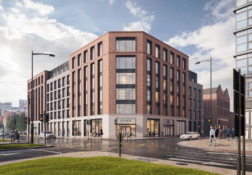
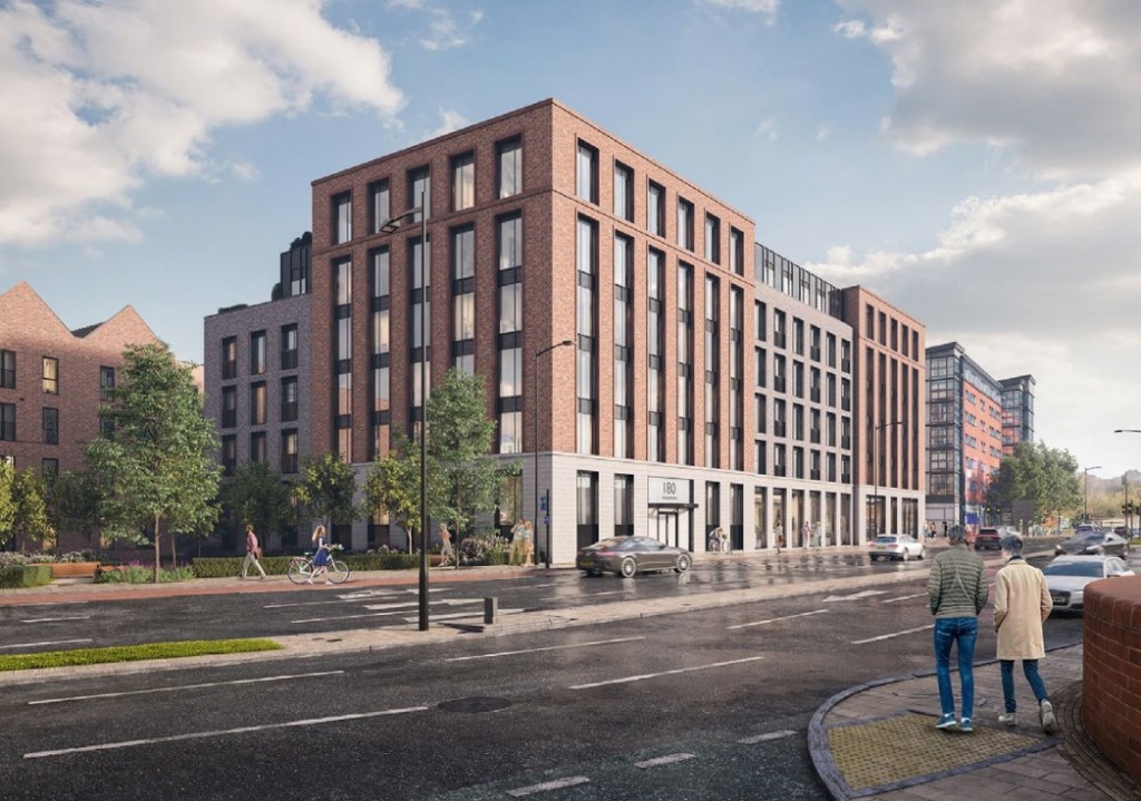
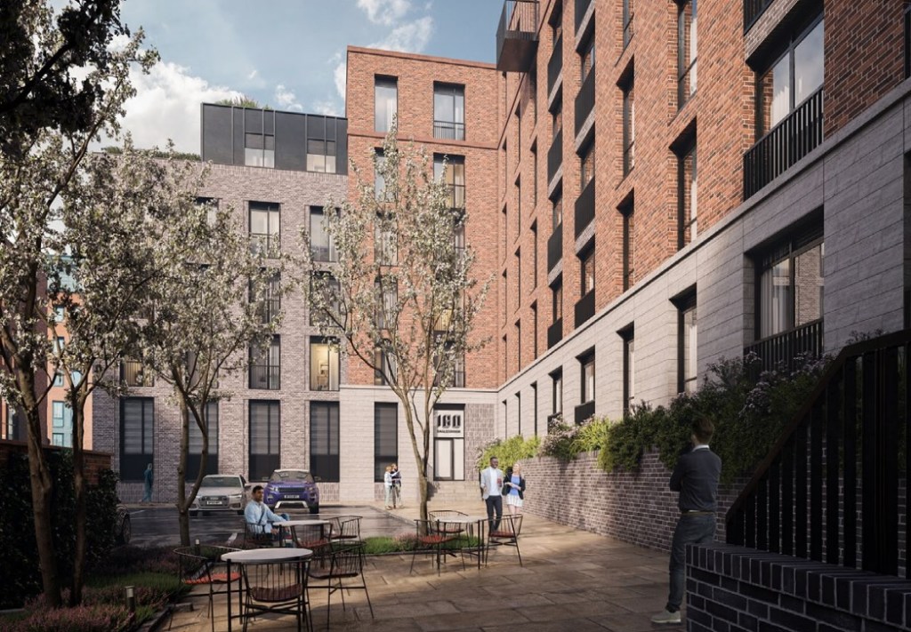
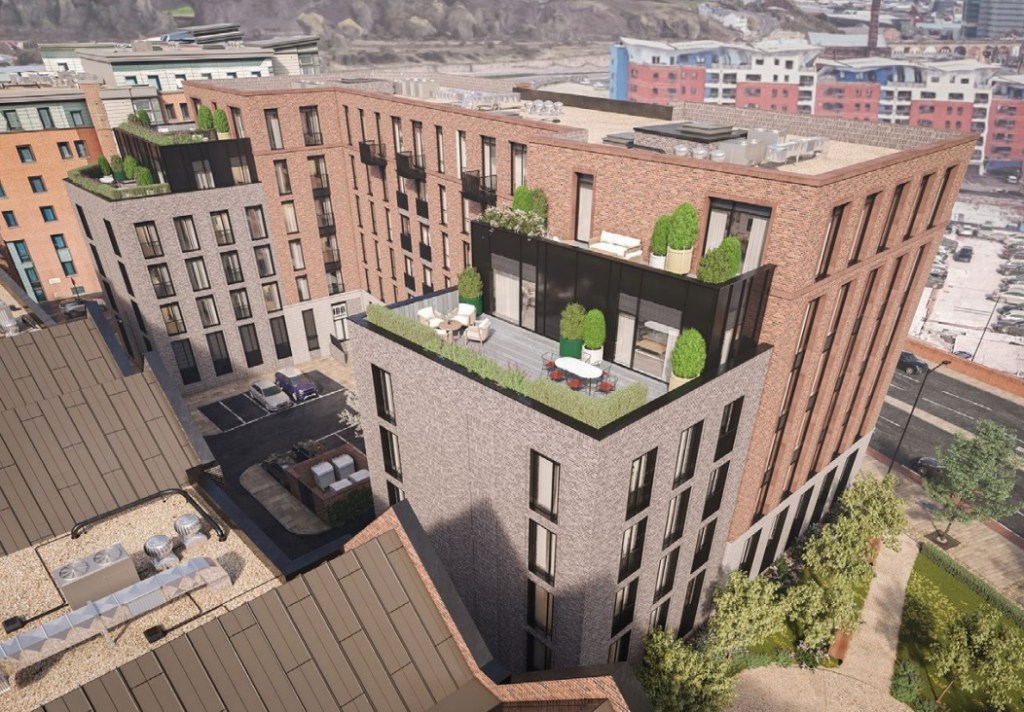
Architects plan for 180 Shalesmoor, Sheffield. Image: CODA Architecture
The appeal of Kelham Island shows no signs of abating. Next up is a planning application for 122 apartments and a commercial unit in a six storey block at the corner of Corporation Street and Alma Street.
The planning application, called 180 Shalesmoor, has been submitted by CODA Architecture on behalf of R.S. Sabkha Construction and Developments Ltd.
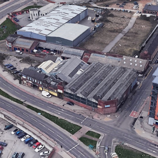
The site is currently occupied by a few car repair workshops, a collection of one and two storey buildings in various states of disrepair.
Back in the 1700s this was an area of orchards and fields related to Coulston Croft, but the area was divided up along the Don into parcels of land which would later be filled by industrial development.
The area known as Kelham Island was one of the largest and most significant industrial zones in Sheffield. Its position along the River Don was very advantageous in the early days of industry for transportation and power. The surrounding areas such as St. Vincent’s and Bridgehouses were densely packed residential areas, many traditional back-to-back style houses were home to the many industrial workers for Kelham.
Existing site. Image: CODA Architecture
The site itself has housed some form of industrial property since it was first built on. It was originally called Mill Works, and maps dating back to 1850 show a steel and iron wire factory on site called Pilot Works which occupied much of the site, part of which became Corporation Street when it was introduced in the 1860-70s. Sections were added and removed from the works over the early 20th century.
Most recently it was occupied by City Centre Clutch, Yello Car & Van Hire, and VMC Bodyshop fronting along Corporation Street. It was on the market for £1.4m and was bought in December.
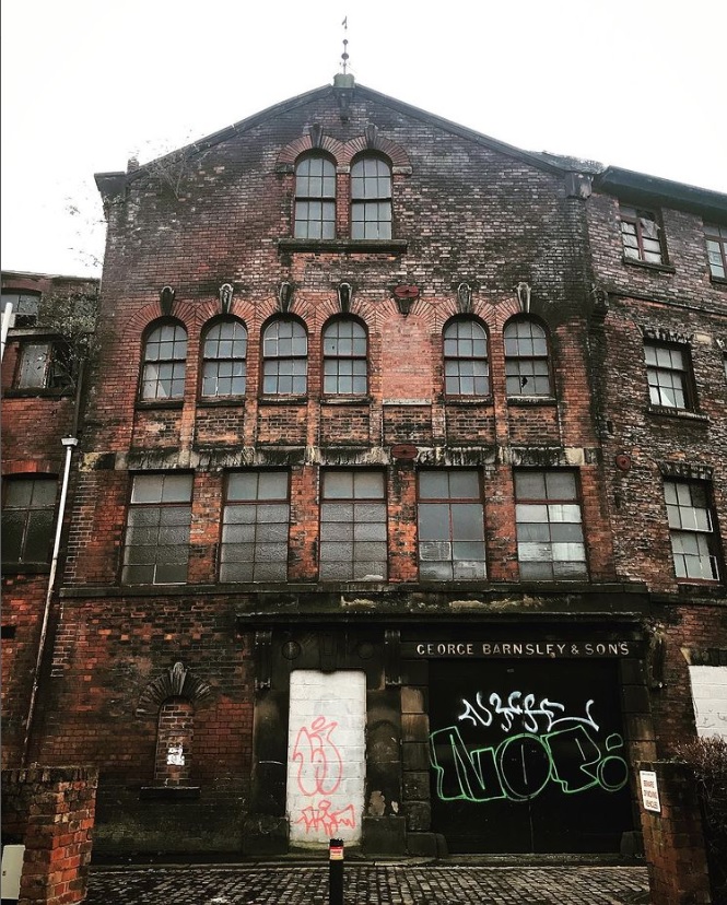
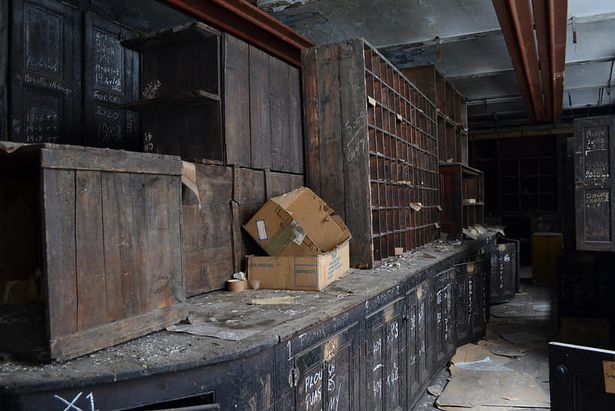
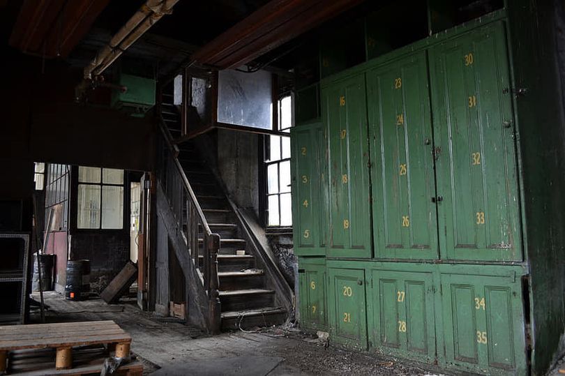
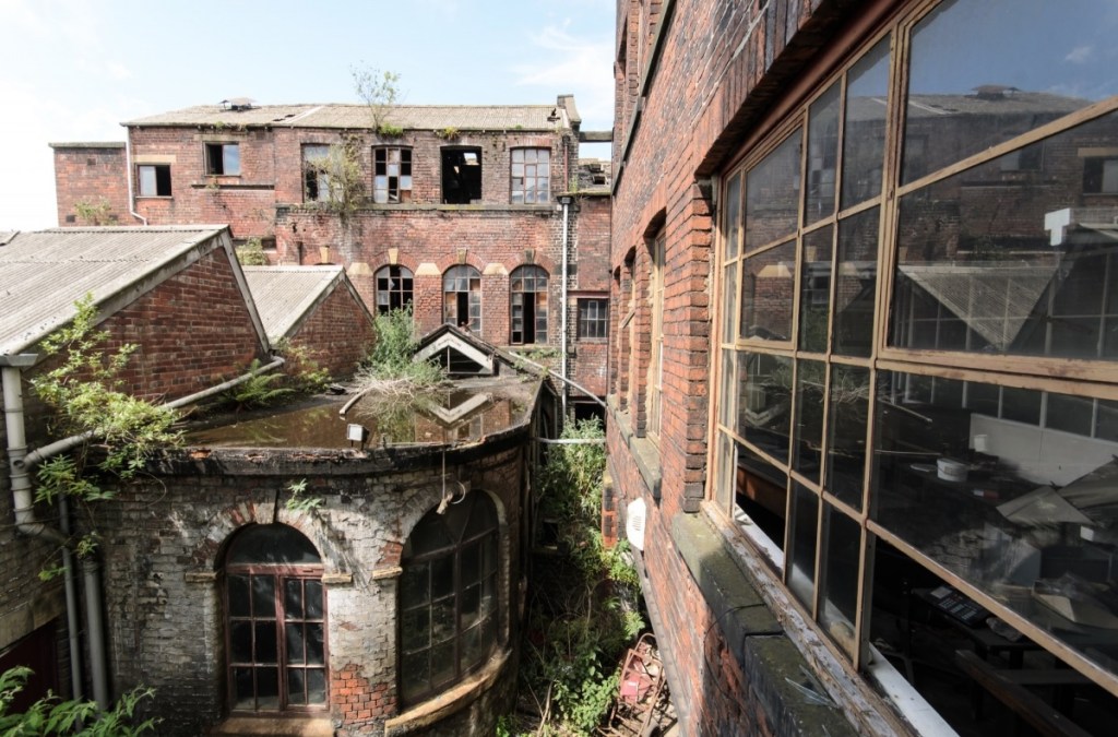
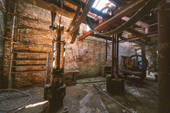
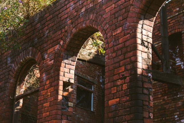
If I had a favourite building in Sheffield, this would be it. Cornish Works, abandoned, derelict, still charming, is one of the last substantial development opportunities at Kelham Island. This was once home to George Barnsley and Sons, specialists in files and cutting tools for leather workers and the shoe-making industry.
Unlike many famous Sheffield firms, its name lives on in premises at Mowbray Street. But for many years the business was located here, at Cornish Street, a narrow road, that is slowly readying itself for regeneration.
If I had made this year’s Sunday Times Rich List, then I might have considered paying the £1.65m being asked for it, and substantially more for it to be made good. Until somebody else does, the building falls into ruin.
“It is an amazing labyrinth,” said a friend of mine. “Obsolete machinery has become museum pieces, old offices have finely crafted woodwork, and everywhere you look there’s evidence of Victorian and Edwardian history. But nature is taking over, with greenery covering old courtyards, the sides of buildings, and encroaching inside. Roofs have collapsed and birds have made home. It is an urban explorer’s paradise, most of whom show the respect it deserves, but the big worry is that one day somebody will set it on fire.”
Image: Leeds Explorer
Image: Leeds Explorer
Cornish Works is a collection of listed buildings, including crucible furnaces and a dwelling house, constructed about 1850, and extended in the later nineteenth century.
Image: The Time Chamber
George Barnsley was a manufacturer of files and other tools. He was born into humble surroundings in 1810 and educated at the Boys’ Charity School,
However, aged 26, he was clever enough to start a file making firm on Wheeldon Street and moved into the new Cornish Works in 1850, improving his product range to include shoes and butchers’ knives. He was a member of the Town Council for the St Philip’s Ward, and a member of the Cutlers’ Company.
Image: Colloco
Image: Colloco
His son, George Jnr, joined the company as a travelling salesman at 14 and was made a partner when he reached twenty-one. He took over the company on the death of his father in 1874.
Like George Snr, he became a Town Councillor, as well as becoming an alderman, J.P., and Master Cutler.
George Jnr died at Oakvale, Collegiate Crescent, in 1895, and the business passed to his son, Henry, who steered the business through the difficult times of the twentieth century.
But when he died in 1958, the number of employees had dwindled to around one hundred, and by the time the works closed in 2004 only a handful remained in this cavernous and dilapidated workspace.
The name eventually passed to the Mowbray Manufacturing Company of which it is now a wholly owned subsidiary.
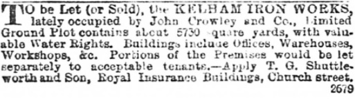
A small newspaper advertisement from July 1895. John Crowley and Co had left, and the Sheffield Tramways Committee bought the site for £7,575. It was cleared and rebuilt, and an order was placed with the British Thomson-Houston Company (a subsidiary of the General Electric Company) for eight engines and dynamos, and 12 boilers, to power Sheffield’s new electric tram network. It operated until the 1930s before being used for storage and workshops. And this building survives as Kelham Island Museum.
Once a rural idyll, along came industry, and Kelham Island became famous for its factories and works. It’s hard to believe that in a remarkably short space of time, the last remnants of industrial heritage are being squeezed out, and Kelham is becoming one of the “coolest places to live in Britain.”
Here’s an extract from Robert Eadon Leader’s ‘Reminiscences of Old Sheffield: Its Streets and Its People’ (1876), in which Richard Leonard remembered the days before industry.
“Beyond Bower Spring, the footpath – Cottonmill Walk – was the continuation of Spring Street. It ran in the direction now taken by Russell Street, across ‘Longcroft,’ as the open space was called in 1771, towards Green Lane. Of course, it took its name from the cotton mill of Mr Middleton.
“An open stream ran from the top of Cornish Street, in front of Green Lane, and emptied itself in the Don, below where Green Lane works now stand. On the other side of the stream were cottage gardens. Middleton’s silk mill – built in 1758, burnt down in 1792, and the cotton mill, re-erected on the same site only in turn to be burnt down in 1810, and again built only to become the Poor-house in 1829 – stood alone in its glory, its nearest neighbour being Kelham Wheel, still there, as it had been at least as long before as in 1674, on the now covered-in ‘Goit’.
“Across the river was the suburb of Bridgehouses, and all around was verdure. Those were the days when ‘the old cherry tree,’ whose name is now perpetuated only by the public-house (on Gibraltar Street) and the yard where it stood, was still young, and when Allen ‘Lane’ and the Bowling Green marked the extremity of the inhabited region of Gibraltar. Beyond the road ran between fields – ‘Moorfields’ (now Shalesmoor) – and on to the distant rural haunts of Philadelphia and Upperthorpe.”
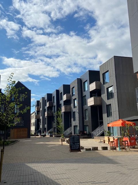
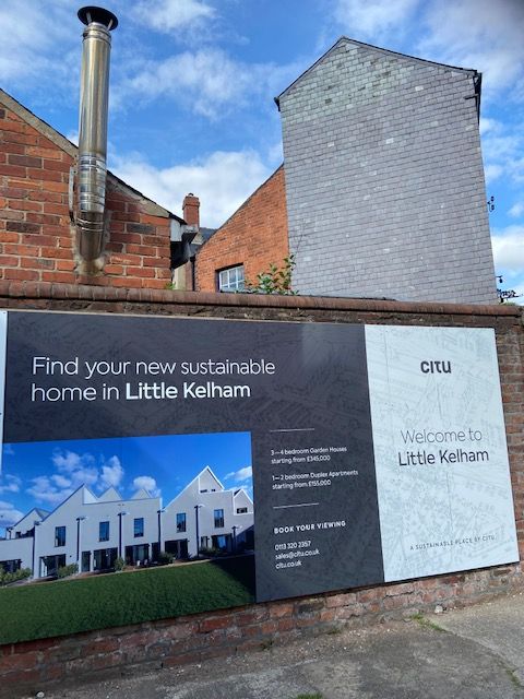
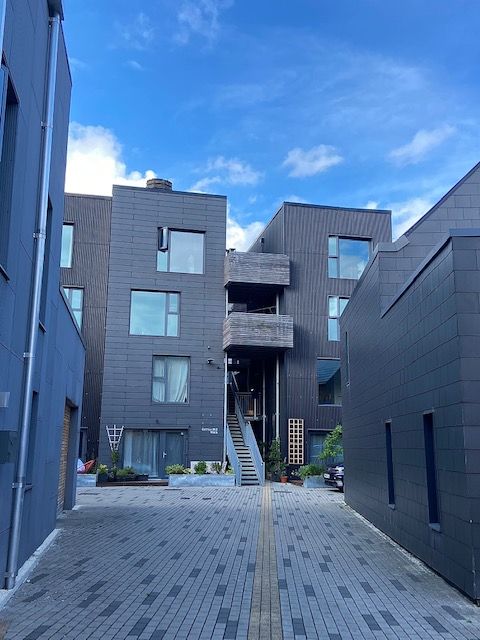
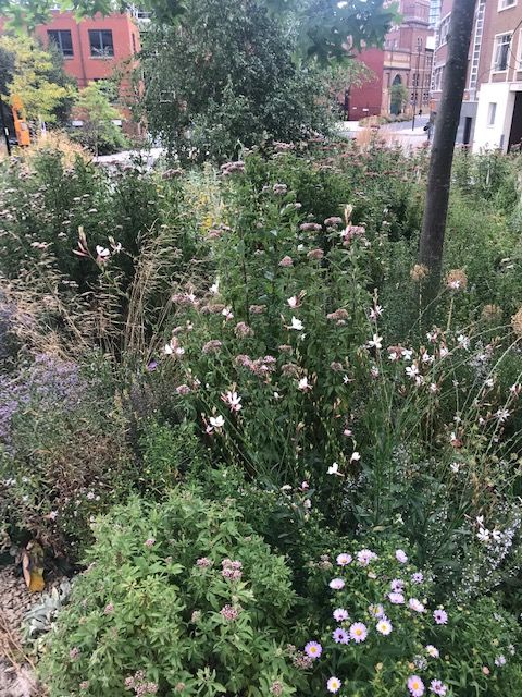
The photographs show Citu’s recent sustainable housing development at Little Kelham (Little Kelham Street).
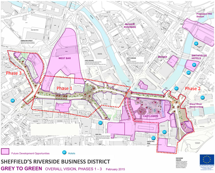
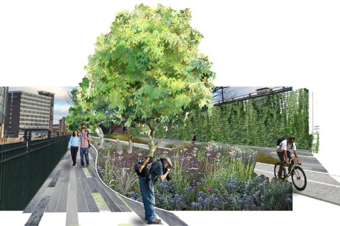
The recent post about Castlegate failed to mention that it is in the process of being part-pedestrianised, Phase 2 of Sheffield’s ‘Grey to Green’ project. Unless you visit this forgotten part of the city centre the relevance of the initiative might escape you.
It is part of an approach to transform ‘redundant’ road space into a network of public spaces, sustainable drainage and urban rain gardens, which aims to improve the setting of the Riverside Business District, Castlegate and the rest of the city centre and then on to Kelham Island and Victoria Quays, as a place to work, live and enjoy, whilst also dealing with the effects of climate change.
Phase 1 (West Bar/Bridge Street/Snig Hill) was completed in Spring 2016 and was funded by the European Regional Development Fund, Sheffield City Region Infrastructure Fund and Sheffield City Council.
The area suffered catastrophic river floods in 2007. With the completion of the Inner Relief Road in 2008, traffic was diverted away from West Bar. The opportunity was seized to replace the ‘grey’ impermeable ‘redundant’ roads into ‘green’ permeable beds, transforming the space with colourful meadow-like planting and significantly increasing surface water storage.
With advice on plant selection from the University of Sheffield Landscape Department this has created a new townscape that is different to anything done in Sheffield before. Over 40,000 bulbs, 40 new trees, 600 evergreen shrubs and 26,000 herbaceous plants were introduced to form a seasonal urban meadow.
The new road layout was designed to slow vehicle speeds and make walking and cycling more attractive. New paving, street furniture, colourful seating and five eye-catching public art ‘totems’ celebrate the local history of the West Bar area including its Victorian music halls and theatres, its lively street life, its complex relationship to the river and its legacy of industry and brewing.
Phase 2 (Castlegate to Exchange Place) is nearing completion, and Phase 3 (Gibraltar Street to Shalesmoor) will eventually transform 1.2km of ‘redundant’ road-space into an attractive new linear green public space.
In the early part of the twentieth century, the World’s best car was unquestionably the Rolls-Royce Silver Ghost.
But a legion of fresh luxury cars soon appeared, and the Rolls-Royce revolution was challenged by Lanchester, Leyland Eight, Hispano-Suiza, Ensign, Farman… and the Sheffield-Simplex.
And yes, for loyal younger readers… Sheffield could and should have been a centre for car production.
The Sheffield-Simplex owed its success to Earl Fitzwilliam, from Wentworth Woodhouse, whose attempt at the Templeborough works to make the finest motor car in the world very nearly succeeded.
The company received financial backing from the Earl, the first few cars called Brotherhoods, and were a continuation of the Brotherhood-Crocker cars made in London in which he had been an investor.
Brotherhood sold the London site in 1905 and moved to Peterborough but could not get permission to build a car factory, so the Earl suggested a move to Sheffield where he built a new factory in Tinsley.
In 1908, the first cars to bear the Sheffield-Simplex name appeared designed by Percy Richardson, ex Daimler and Brotherhood. The LA1 had a six cylinder 6,978 cc engine and three speed gearbox.
It was joined in 1908 by the LA2, intended for lighter open bodies which did without a conventional gear system.
Four smaller cars joined the line-up in 1910 but lasted only one year, and in 1911 were replaced by the LA7 with a six cylinder 4,740 cc engine.
Sheffield-Simplex considered their only rival to be Rolls-Royce and even opened a London showroom in Conduit Street very close to theirs.
During World War One, the company made armoured cars which were supplied to the Belgian and Russian armies, as well as making ABC Wasp and Dragonfly aircraft engines and munitions.
Car production resumed in 1919, and judged by pre-war standards, the Simplex was a very fine car indeed. But it was also very costly, and it never again captured the exclusive market.
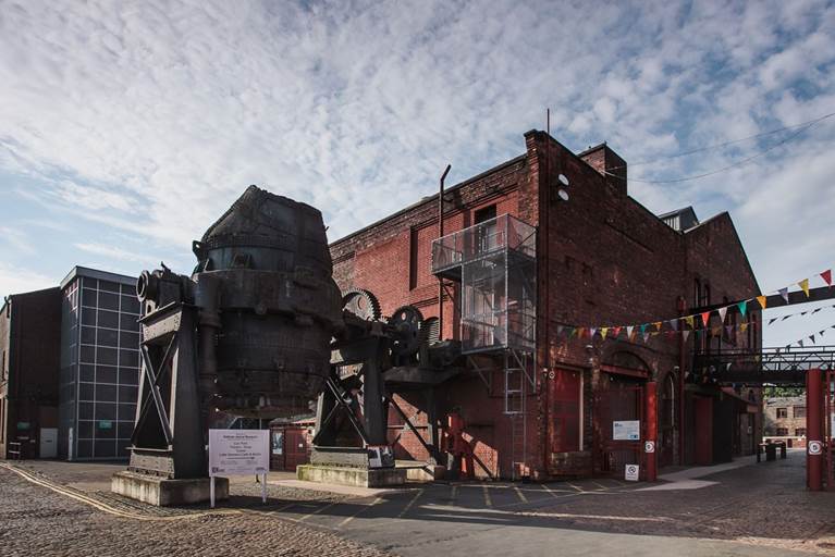
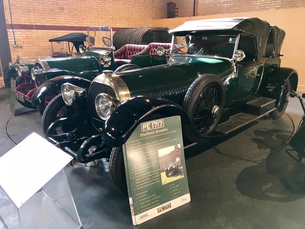
Sheffield-Simplex went into steep decline, building a few Shefflex trucks and the Ner-a-Car fully enclosed motorcycle to the designs of the American, Carl A. Neracher. When the doors finally closed, around 1500 cars had been made during the company’s history… and it seems that only three survive, two of which are at Kelham Island Museum.