Categories
Streets

“One side of the city centre to the other, and less than a mile. By car, I travelled 2.5 miles.”

The best map of Sheffield’s Inner Ring Road, but spoilt by spelling mistakes.

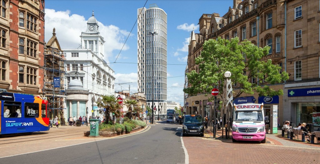
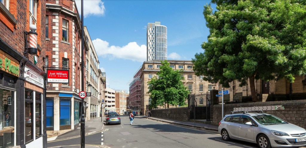
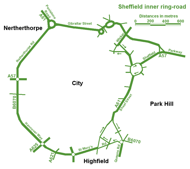
An unusual post, in so much that we are looking at a road. In fact, a series of roads that form one big one – Sheffield Inner Ring Road.

We might live in Sheffield, but sometimes it’s difficult to see wood for the trees, and this is the case with the inner ring road, because you probably don’t realise its purpose and where it is.

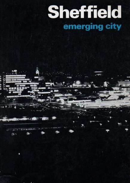
Let’s start in the 1930s when a route around the city centre was first proposed. Truth be known, World War Two stalled plans until the sixties, and in 1969 Sheffield Corporation published an impressive handbook called ‘Sheffield – Emerging City,’ in which plans for a detailed road system were revealed for the first time.

The council intended to pour £65m into the scheme which included bus lanes, pedestrian areas, as well as an urban motorway and motorway links with the M1.

Robert Waterhouse, writing in The Guardian in 1972, said that “Sheffield was as proud of its new roads as of its housing, its clean air, and its flourishing arts. They were all symbols of rebirth after years of stagnation among the ruins of the Industrial Revolution.”

The Guardian article, long forgotten, provides an interesting snapshot into the arguments that raged at the time.

It pointed out that after 1969, things had started to go wrong. In May 1971, a joint report by the city engineer, the city planning officer and architect, and the general manager of the transport department, had taken a gloomy view.

‘Although a large highway construction programme has been embarked upon,’ it said, ‘the growth of vehicular traffic is much greater than the growth of road capacity. The disparity has been obvious for many years and there seems negligible hope of it being ended in the foreseeable future.”

The report estimated that the proposed highway system, capable of carrying about 50 per cent of commuters to work by car, would cost ratepayers another 20p in the pound, which was probably acceptable, but that a system by which nearly everyone went by car could cost £300m, or another pound on the rates, clearly unacceptable. If the ‘compromise,’ £65m system was going to get clogged up anyway, was it worth building at all?

Arundel Gate in 1973 looking towards the Hole in the Road – new barriers erected in attempt to make pedestrians use the subways. Image: Sheffield Newspapers/Picture Sheffield

Waterhouse identified growing opposition within the council.

Sir Ron Ironmonger, Labour’s council leader, admitted that a growing number of councillors were against the scheme, and there had been public exchanges between the planning department and engineers.

The planners, headed by R. Adamson, felt that the engineers were going about the job the wrong way: instead of giving priority to the inner ring road, which everybody thought essential, construction had been advanced near the city centre. This meant that the civic circle – the inner ring road ultimately intended to carry only local shoppers and delivery vans – was being used as a throughway.

But the engineers, under K.D. Wiilliams,  replied that highways the size of the inner ring road – a six-lane urban motorway – didn’t happen overnight.

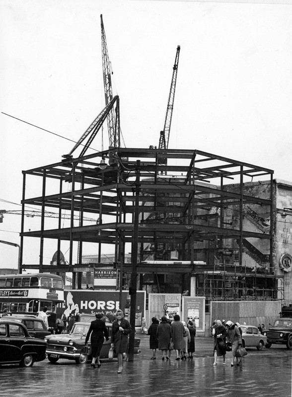
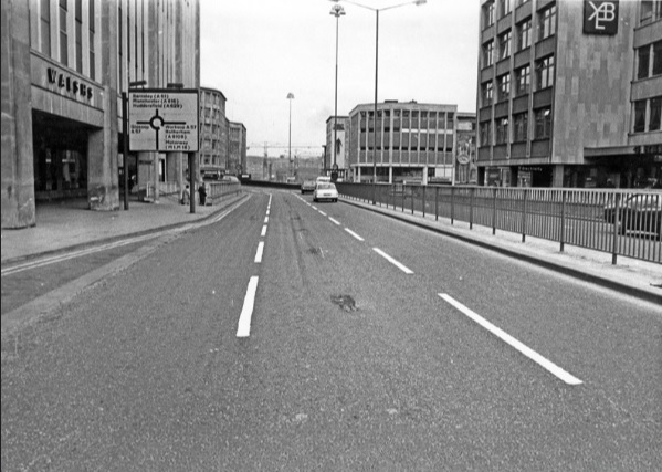
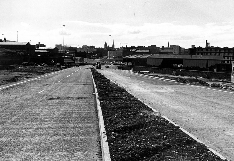
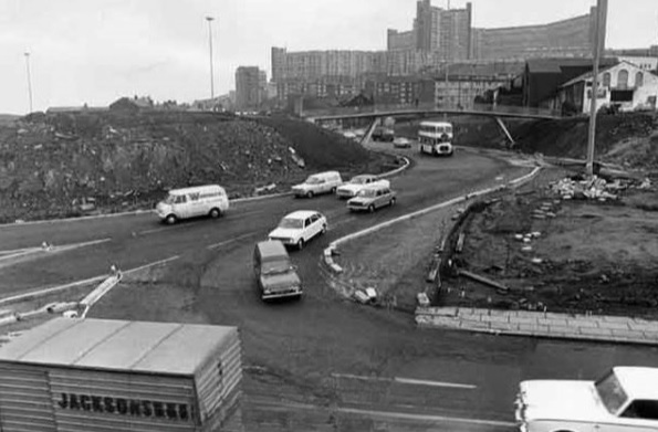
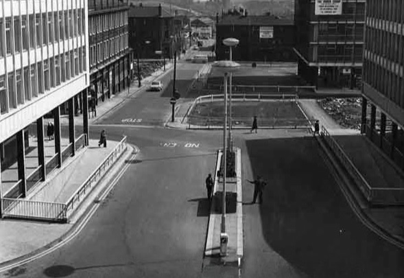
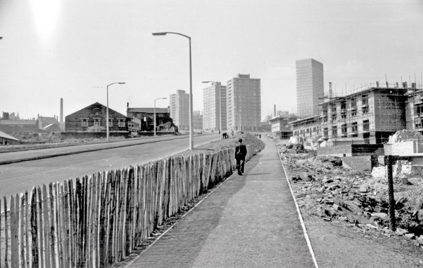
It seemed that Sheffield residents didn’t know what they were in for but would soon find out. The new interchange between the inner ring road and the Parkway was near completion at the bottom of Commercial Street. Sheffield Parkway was also being built and would be the main route into the city centre from the M1.

Construction of Sheffield Parkway in 1974 looking towards Park Square. Image: Sheffield Newspapers/Picture Sheffield
Sheaf Street/Commercial Street (latterly known as Park Square) roundabout under construction in 1973. Image: Sheffield Newspapers/Picture Sheffield

But the argument in 1971 was that traffic coming into the city centre was being diverted onto newly-constructed roads, because there was no proper inner ring road. And it was causing problems.

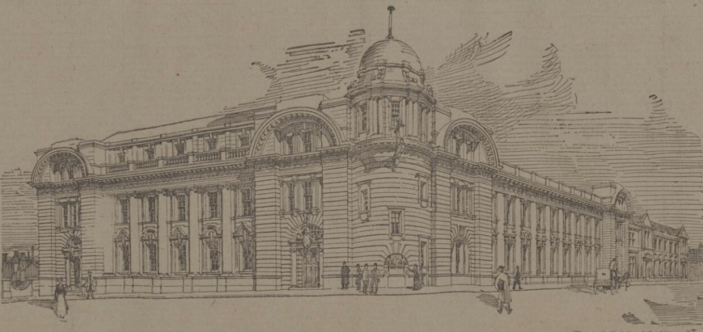
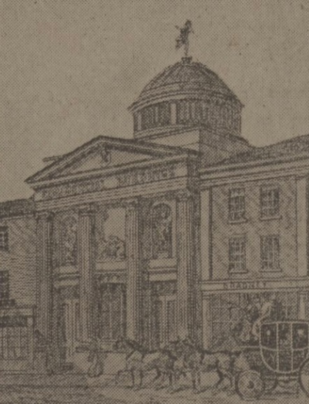
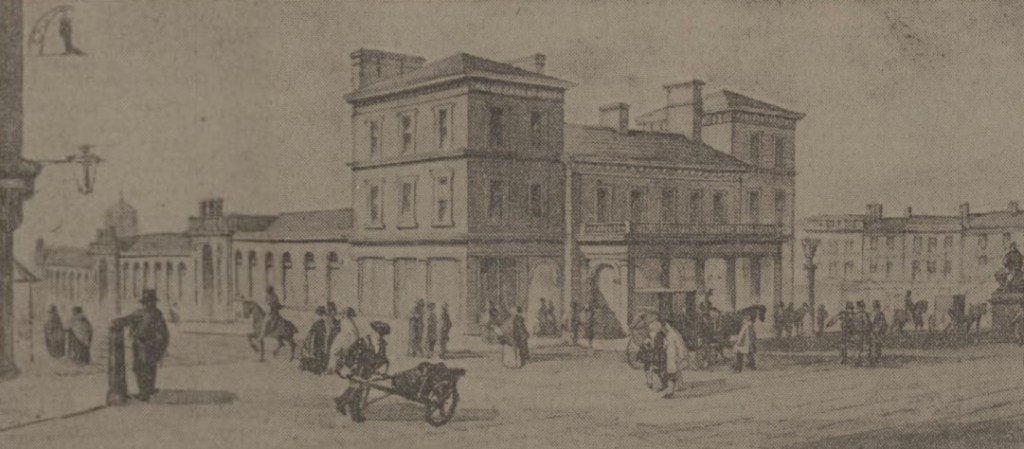
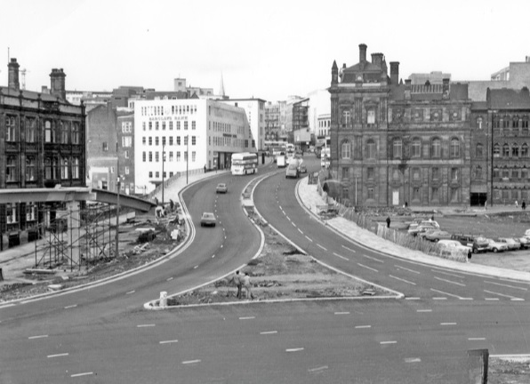
On Commercial Street itself, a bridge was being widened to take four lanes of traffic. It joined the civic circle at Castle Square, where traffic and pedestrians were already separated – cars at ground level, pedestrians underground. But before the road got there, it had to pass Fitzalan square, one of the principal routes for shoppers on foot. Everybody agreed this was a problem, but work on widening Commercial Street continued anyway, despite open criticism from Labour councillors.

Widened Commercial Street in 1970s, looking towards the Gas Company Offices on right, Electricity Supply Offices and Barclay’s Bank on left. Shude Hill behind car park on right. Image: Picture Sheffield

There were others also opposed to the scheme. Dr Leonard Taitz, a young South African doctor, working in Sheffield, was convener of the Conservation Society’s national transportation working party. He had started a campaign to bring the road building programme to a halt while a new policy on integrated transportation was formulated.

New roads were being built within the city centre but there were design flaws.

He cited the case of Furnival Gate, also a four-lane highway which, he suggested, was bound to be used by commuter traffic, but which divided The Moor and Pinstone Street, two proposed precinct streets. A subway to take people under the road had already been built, while Charter Row, another radial, had a barrier down its middle which cut a whole segment of the city from the centre.

Furnival Gate at the junction with The Moor showing (middle left) junction with Union Street in the 1960s. Image: Picture Sheffield

He argued that these roads were primarily being used by commuters cutting across town. But Mr K.D. Williams, head of technical design at the engineers, said this wasn’t the case, and that they were a necessary part of an integral system, that will one day be blocked off to prevent through traffic, and channel motorists to off-street car parks.

Whatever the interpretation, the roads were ‘not a pretty site.’ Certainly not ‘Sheffield’s Champs Elysees,’ as a councillor had called Arundel Gate.

Robert Waterhouse asked the important question? Would the new roads ever carry the massive traffic that Sheffield had come to expect? Would the inner ring road be built as a motorway, and would Sheffield get its two, or even three, motorway links with the M1?

Sir Ron Ironmonger pointed out that after 1974, highways would become the responsibility of the new South Yorkshire metropolitan authority and had no wish to make any drastic moves at such a late stage, and cited Nottingham which had done away with  a major part of its road programme. (Sir Ron later became leader of South Yorkshire Metropolitan County Council).

What did happen?

The 1970s proposal for the Inner Ring Road was abandoned because it would have destroyed important heritage assets like Kelham Island and the canal basin, and cash, as ever, was the stumbling block. But we did eventually get an Inner Ring Road, but it took a long time for it to be completed in its entirety. 

We can thank Duncan Froggatt, a Chartered Engineer, in his excellent book, ‘Sheffield – A Civilised Place’ (2018), for providing the timeline.

“The inner relief road had started in the 1960s starting with the dualling of Netherthorpe Road. But the later stages came much later with St Mary’s Gate and Hanover Way widened to dual carriageways in the 1980s.

“Sheaf Street was improved in the early 2000s leading to the improvement of Sheaf Square and subsequently links to St Mary’s Road up to 2009.

“The northern section from Sheffield Parkway to Penistone Road was built in two phases in the 1990s. The phase from the Parkway to The Wicker was completed in 2000, originally called Cutlers’ Gate, but later renamed Derek Dooley Way. The next stage, between the Wicker and Shalesmoor was finished in 2008.

“Once completed, it provided a continuous loop of dual carriageway, clockwise from Granville square in the southeast to Sheffield Parkway in the east, linking all main arterial routes in the city.”

Netherthorpe Road with Netherthorpe Street Flats under construction in 1965, looking towards Netherthorpe High Rise Flats. Image: SCC/Picture Sheffield

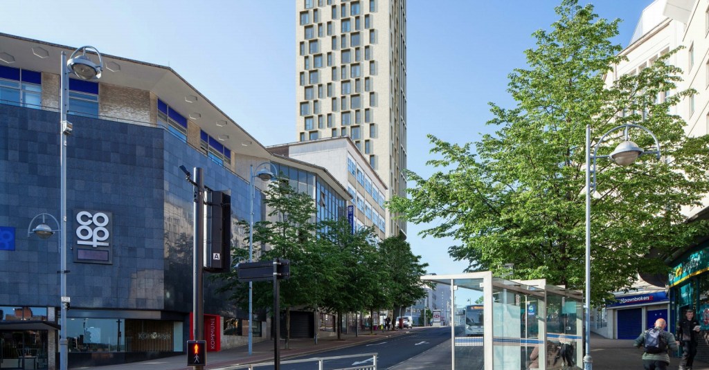
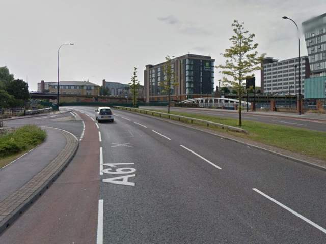
All done and dusted, but these days it is what is  happening within the Inner Ring Road that creates the interest.

Mr Williams’ plan for streets to be blocked off to traffic within the city centre did and continues to happen. Fargate and The Moor were the first to be pedestrianised, Pinstone Street is in transition, and Arundel Gate will be downgraded.

But what nobody in the 1970s envisaged was something that had been around for centuries… and that was the bicycle. Cycle routes, and the eagerness to cut car emissions, while greening our urban spaces, means that Sheffield city centre will eventually change beyond recognition.

I leave you with a story. Last week, I had to travel by car from one side of the city centre to the other. By foot it was less than a mile. By car, I travelled 2.5 miles.

Derek Dooley Way. Image: Sheffield Star

“Driving into Sheffield, I was looking forward to my friend’s hen-do. We had booked a city centre apartment, a spa day and a restaurant. What could go wrong? Yet, an hour-and-a-half later, I was bellowing tearfully into my mobile at my boyfriend: “You came to university here. Where AM I?” What had caused this emotional meltdown? Certainly not a fall-out with my friends – I hadn’t even seen them yet. Instead, my fun-filled city break had been spent navigating a series of roundabouts on the city’s ring road which kept spitting me out with increasing ferocity. Sheffield’s inner ring road has been tormenting drivers since 1961. Like many of the nation’s worst ring roads, it twists you round its little finger only to catapult you into bus-only zones or roads that lead you off in the opposite direction to the one you need.” – Jenny Scott – BBC News – 2014

NOTE
Robert Waterhouse is a journalist. Starting on the Guardian in Manchester and London, he turned freelance and was launch editor of the daily North West Times. He is a co-editor of the review Mediterraneans. His books include The Other Fleet Street, a history of national newspaper publishing in Manchester.

©2022 David Poole. All Rights Reserved.

Categories
Buildings

King’s Tower

A dramatic change to the High Street. King’s Tower, a 39-storey tower block, that has been granted planning permission.

Prepare for a major new addition to the Sheffield skyline, and its location may come as a surprise.

King’s Tower, at 51-57 High Street, will be a 39-storey tower, comprising 206 apartments, with space for a ground floor commercial unit, drinking establishment or hot food takeaway.

It is probably the first regeneration step for one of the most unkempt parts of the city centre.

King’s Tower will be a significant change to the High Street.

The building will be on the site of what many of us know as the former Primark building, and even further back, the one-time Peter Robinson department store.

When the wrecking balls arrive, there will likely be cries of contempt, but in the eyes of planners, the existing building has no architectural value.

In fact, when researching this post, it was discovered that it was always meant to be a temporary structure, even though it’s lasted almost sixty years.

King’s Tower will be on the site of the ancient market adjacent to Sheffield Castle, first established as the result of a Royal Charter of 1296. The market stall and buildings that occupied the site were demolished in 1786 to make way for the construction of the Fitzalan Market (also known as ‘The Shambles’), which underwent improvement about 1855.

Fitzalan Market was demolished in 1930 when the new Castle Hill Market opened, and a new shop was constructed on the corner of Angel Street for Montague Burton, of Burton Menswear, in 1932. The shop occupied the lower floors while the upper tiers were home to the City Billiard Hall and ‘The City’ Roller Skating Rink.

The grand-looking Burton Building, built at the corner of High Street and Angel Street in 1932. A billiard hall and roller-skating rink occupied the upper floors. (Image: Sheffield Telegraph)

The Burton building was badly-damaged during the Sheffield Blitz of 1940, and stood as an empty shell for many years, its replacement held up by funding and lack of building materials. By the 1950s, Sheffield Corporation insisted that plans for an alternative building would only be granted if it were of ‘temporary character, and not as before,’ because it had plans for a new roundabout intersecting Angel Street, High Street and what would become Arundel Gate.

After being badly damaged by German bombs in 1940, the Burton Building remained empty for many years. (Image: Picture Sheffield)

It was eventually demolished and replaced by a new steel-framed building, clad in concrete and tile panels, and opened in 1962 as a Peter Robinson department store. The chain store had been founded in 1833 as a drapery, soon expanding with a flagship store at Oxford Circus, London, and bought by Burton’s in 1946.

The shop in Sheffield was part of Peter Robinson’s nationwide expansion, at its height having 39 stores across Britain.  

Whilst the building may not be considered of architectural importance, it most certainly played a part in shaping High Streets across the country.

It was here, in 1964, that a new department was launched on the third floor, Top Shop, a youth brand, selling fashion by young British designers such as Polly Peck, Mary Quant, Gerald McCann, Mark Russell and Stirling Cooper.

The Top Shop name was later used for a large standalone store on Oxford Street, London, and expanded into further Peter Robinson branches at Ealing, Norwich, and Bristol.

It was not until 1973 that Top Shop was split from Peter Robinson, the Top Shop (later Topshop) brand flourished, subsequently becoming part of Phillip Green’s Arcadia Group, whose demise dominates present-day headlines.

Alas, by the end of the 1970s, the Peter Robinson name had all but disappeared.

The steel-frame of the Peter Robinson department store during construction in the early 1960s. (Image: Picture Sheffield)
Completed. Peter Robinson dominated this High Street corner. In 1964, the first Top Shop was opened on the third floor. (Image: Picture Sheffield)

From 1974, the adjacent C&A store absorbed the upper floors of Peter Robinson, while furniture retailer Waring & Gillow occupied the ground floor.

After C&A vacated in the 1990s, it became Primark until it relocated to The Moor in 2016, leaving the old department store empty.

During the 1970s C&A occupied the upper floors while Waring & Gillow sold furniture at ground level. (Image: Picture Sheffield)
Primark, originating from Dublin, took over the premises when C&A pulled out of the UK. (Image: Google)

On a final note, that proposed roundabout eventually became Castle Square, with the famous ‘Hole-in-the-Road’ linking into the building, filled in to accommodate Supertram in 1994.  

As part of the works to build King’s Tower, King Street, to the rear, will be improved with the market retained and access for vehicles.

Artist impressions of King’s Tower.

© 2020 David Poole. All Rights Reserved.

Categories
Buildings Companies

The rise and fall of Sheffield General Post Office

A sketch of Sheffield Post Office, Fitzalan Square, in 1909. Photograph by The British Newspaper Archive.

In this post, we look at the history of the Post Office in Sheffield, but a question before we start. Do you know where the Central Post Office is in Sheffield? I suspect a few might struggle to answer this, and I was the same. Answer at the end.

There is one certainty in the architectural world – we will never build Post Offices like we used to, if at all. Technology has done away with the need to create lavish buildings.

The story of the growth of the Sheffield Post Office mirrors the development of the city.

In January 1835, a Post Office and News-Room was opened at the Commercial Buildings in High Street (opposite where the Telegraph Building stands today).

A small room was all that was needed in those days, with postage stamps handed through a little door fixed in a hole cut through the wall. The population of Sheffield at this time was 91,692 but by 1851 this had risen to 140,000.

Sheffield’s first Post Office, in the Commercial Buildings on High street. Photograph by The British Newspaper Archive.

The demands on the Post Office increased and the facility was removed to Angel Street, in a part of a building that had once been Shore’s Bank.

The next move was to the top of Market Place (Castle Square), a much grander building that coincided with the increase in postal demand.

Sheffield Post Office, Market Place. Photograph by The British Newspaper Archive.

Sheffield’s industries were rapidly growing, and the population was advancing at an enormous rate. More general use was being made of postal facilities, and the authorities were improving the service, including the postal telegraph service, rates of postage to all parts of the world being reduced and the introduction of parcel post.

While the facilities in Market Place had been a great improvement on any previous office, there was a need for bigger premises.

In 1871, the population had reached nearly 240,000 and a new Post Office opened at the corner of Haymarket and Commercial Street (still standing, more recently home to Yorkshire Bank). However, by 1900 this was also too small and offices in Flat Street were opened and all that remained in the Haymarket was public counter work and the telegraphic department.

The Post Office had bought more land in Flat Street and Pond Hill from Sheffield Corporation as well as acquiring a site occupied by Mappin Brothers. By 1903, the Post Office had about one acre of land, a triangular plot stretching from Fitzalan Square and Pond Hill. Branch sorting offices were provided at Highfield, Broomhill, Montgomery Terrace Road, and Attercliffe, and sub-post offices opened all over the city.

These relieved the work at the central office, but still the business grew, and now, when the population was creeping up to half a million, a new office was provided at the top of Baker’s Hill, on the east side of Fitzalan Square.

The new Post Office, incorporating its Flat Street offices, opened in 1909, a Baroque-style building designed by Walter Pott of HM Office of Works. It coincided with Fitzalan Square improvement works and despite its grandiose appearance did not escape criticism.

In fact, the Post Office had been built on a hillside, and the result was that the greater proportion of the building was down below street level, and what people saw from Fitzalan Square was only the top.

The Post Office closed in 1999 and remained empty for several years before becoming the home to Sheffield Hallam University’s Institute of Arts in 2016. More about this building in a separate post.

And finally, the answer to that question. The Sheffield City Post Office can be found on the 1st floor of Wilko in Haymarket.

© 2020 David Poole. All Rights Reserved.

Categories
Buildings

The Bankers Draft

This building stands in one of Sheffield’s most historic parts and survives in an area that has changed considerably in the past eighty years. Thanks to the Blitz, the Hole-in-the-Road and Supertram, the environs show no resemblance to the day it was constructed.

These days we know it as The Banker’s Draft, a Grade II listed building, in Market Place, one of the first J.D. Wetherspoon pubs to open in Sheffield, but its origins goes back to the turn of the twentieth century.

In the old days, the three landmarks of Sheffield were the Castle, the Market Place and the Parish Church. When tradesmen recognised the Castle as less than a means of protection, they started clustering around the Market Place (or The Shambles), a place where they could face anyone proceeding towards the church, by means of High Street.

Markets had been held here since 1296, and its original buildings were replaced with picturesque timbered latticed gabled properties about 1752, and again around 1812.

Once, amidst the atmosphere of drapery, leather, grocery and hats, the place had a banking tradition, one that repeated itself later. Hannah Haslehurst and Son, departing from ancestral grocery, founded The Sheffield Old Bank on this spot, but it collapsed in 1785.

In 1901, the Market Place area was described as ‘an aching void,’ sharing the fate of similar early 19th century buildings, the homes of humble traders, that were demolished to make way for the York City and County Bank.

The bank was designed by Walter Brierley (1862-1926), a York architect, described as being the ‘Yorkshire Lutyens’ or ‘Lutyens of the North.’ He created 300 buildings across the north between 1885 and his death, mainly family mansions, churches, schools and banks. Brierley was also architect for North Riding County Council and the Diocese of York.

Construction started in 1901, the contractor being Sheffield-based George Longden and Son, and was finished in 1904.

Described as being Edwardian Baroque, built in Aberdeen granite and Italian marble, its interiors were lavish. A parquet floor was laid by the Acme Wood Flooring Company of London, with furnishings supplied by Goodall, Lamb & Heighway, manufacturers of high quality furniture, upholsterers and carpet warehousemen from Manchester.

Quite forgotten, is that the York City and County Bank had bought more land than it really needed. It rented out offices on the first, second and third floors, as well as the spacious basement (where remains of old stables can still be seen).

However, it was also proposed to build a first-class hotel next door, also designed by Brierley, that was never erected, probably the result of a long dispute with the council over its alcohol licence.

The York City and County Bank (established 1830) amalgamated with the London Joint Stock Bank in 1909, which itself merged with the London City and Midland Bank in 1919.

Despite the area being mostly destroyed during the Sheffield Blitz, the Midland Bank (as it became) survived unscathed, and remained open until 1989, before relocating to the end of Fargate.

Standing empty for a while, it was bought by J.D. Wetherspoon, operating as The Banker’s Draft ever since.

NOTES: –
Walter Brierley was the architect who designed several buildings in the village of Goathland, North Yorkshire, that were seen during the opening credits of ITV’s Heartbeat (1992-2010).

Market Place is now commonly known as Castle Square. However, Market Place is officially the paved area running in front of The Banker’s Draft, between High Street to Angel Street.

Categories
Companies

Top Shop

It appears that Topshop in Sheffield has come the full circle.

The news that Topshop and Topman is closing on Fargate could end a long-time association with Sheffield city centre. According to a recently submitted planning application, Nos. 33-35 Fargate, look to be falling into Superdrug hands.

The irony is that Topshop was founded in Sheffield in 1964, a brand extension of the Peter Robinson department store, then situated at the corner of Castle Square (now occupied by easyHotel).

Peter Robinson was a women’s fashion chain, founded in 1873, that had become part of Burton’s in 1946.

It opened as Peter Robinson’s Top Shop, a youth brand, selling fashion by young British designers such as Polly Peck, Mary Quant, Gerald McCann, Mark Russell and Stirling Cooper.

The Top Shop name was later used for a large standalone store on Oxford Street, London, and expanded into further Peter Robinson branches at Ealing, Norwich and Bristol.

It wasn’t until 1973 that Top Shop was split from Peter Robinson, focusing on the 13-24 age groups, leaving the department store to concentrate on the over 25s.

The Top Shop (later Topshop) brand flourished, subsequently becoming part of Phillip Green’s Arcadia Group, with 500 shops worldwide, of which 300 were in the UK.

Alas, by the end of the 1970s, the Peter Robinson name had all but disappeared.

In Sheffield, C&A had absorbed the former Peter Robinson shop, and when it pulled out of the UK, the unit transferred to Primark.

However, as we well know, times have been difficult for Phillip Green. Last year, the Arcadia Group went through a Company Voluntary Arrangement (CVA) with a significant number of stores closing.