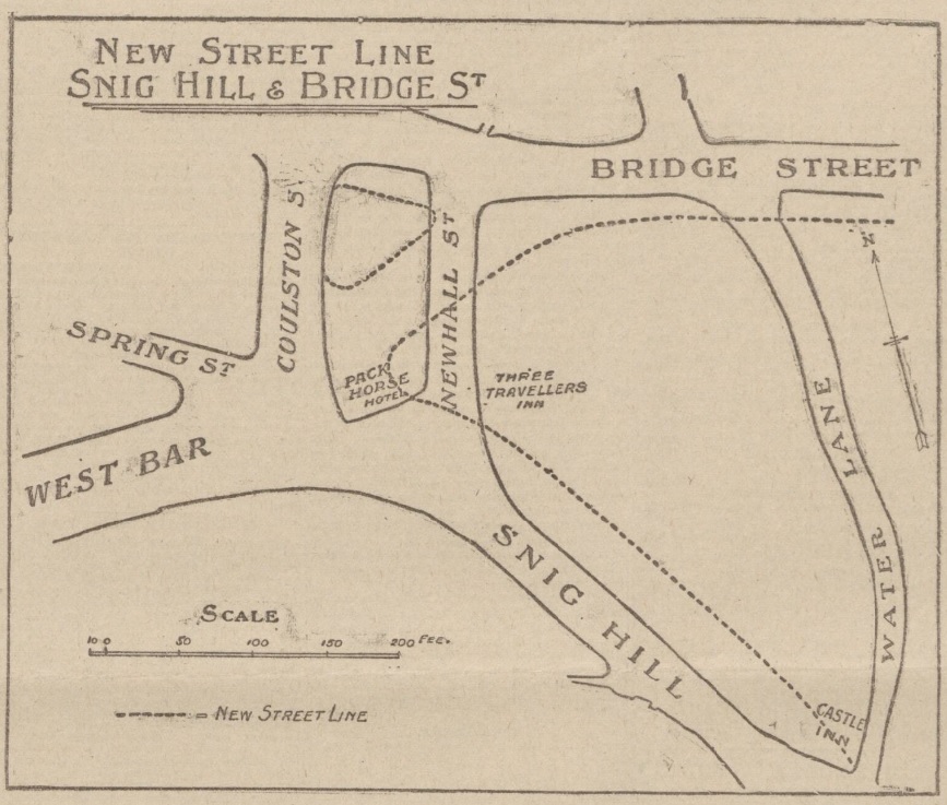
In 1900, the Improvements Committee of Sheffield Corporation paid £10,500 for 2,546 yards of land in Newhall Street. There were certain freehold premises here, including the Hollis Hospital.
The question we ask ourselves 122 years later, where was Newhall Street?
Sheffield Corporation wanted to carry out a road diversion with a straight way from Westbar to Bridge Street.
Newhall Street was at the bottom of Snig Hill and disappeared, the line of Westbar continued across land occupied by the Pack Horse Hotel (demolished), until it joined Bridge Street.
This illustration from 1902 shows the original road layout, with dotted lines indicating the new street pattern and building lines. It also shows the widening of Snig Hill.
The scheme was completed in 1903 providing a more direct route from Westbar to the Victoria Station, and in due course tram lines ran from Westbar into the Wicker. It allowed tramcars to run from Hillsborough to the Wicker and then back to Hillsborough by the Owlerton Route – another step in the completion of the city’s circular tramway system.
The loss of Newhall Street was significant because this had been the boundary between Saint Peter’s Ward and Saint Philip’s Ward, dating to 1843 when Queen Victoria granted The Charter to the Borough of Sheffield.
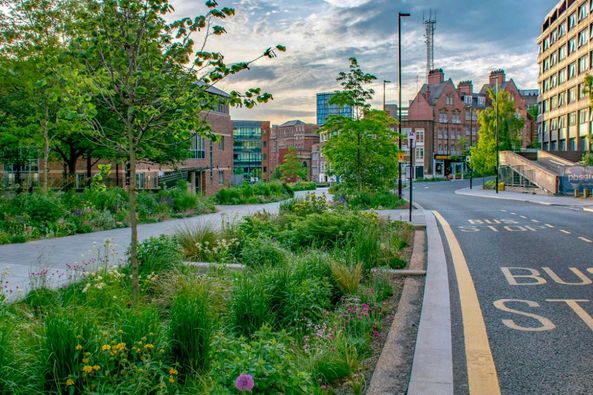
Fast forward to the present day and things are remarkably quieter, and more beautiful, thanks to Sheffield City Council’s ‘Grey-to-Green project.
©2022 David Poole. All Rights Reserved.
