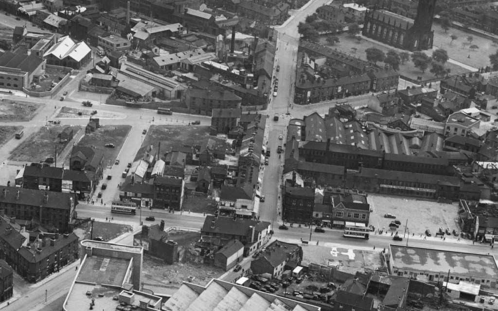
Two photographs that show how a Sheffield street lost its identity.
Hereford Street is shown as a wide thoroughfare in 1951, a continuation of Charlotte Road, and intersected by narrow St Mary’s Road, and Porter Street (that became the lower end of Eyre Street). It joined The Moor that continued south towards London Road. Note that Bramall Lane roundabout did not exist.
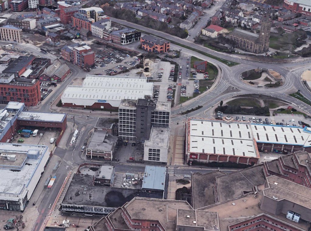
Seventy years later, the outline of Hereford Street can still be seen but is split by two dual carriageways – St Mary’s Road and Eyre Street. Gone are the factories, houses, and small shops, and the Moor-end is pedestrianised, and this section of The Moor lost beneath the Moorfoot Building.
Sadly, this area has become an unloved part of the city centre with Hereford Street falling on hard times.
Most astonishing is that few buildings appear in both photographs. Most were swept away for road development, factories were surplus to requirement, and old houses and shops deemed unfit for purpose.
St Mary’s Church, on Bramall Lane, does appear in both photographs. In 1951, it was covered in soot and suffered from air pollution, but look how large the churchyard was, and how much was taken away to make St Mary’s Road a dual-carriageway.
Buildings to point out in the modern-day image are the South Yorkshire Fire and Rescue Headquarters and Moor Markets (left), Decathlon and Deacon House (centre) and, of course, the Moorfoot Building (bottom).
© 2021 David Poole. All Rights Reserved
