The units are occupied by a mobile phone and vape shop and a discount fashion retailer – which already has a ‘closing down’ sign in the window. (Sheffield Star)
The subject of city development is emotive. People have different opinions. As someone who looks at historical detail, we’re no different to our ancestors.
In Victorian times, people agreed or disagreed about Sheffield’s redevelopment. Sheffield Corporation was always in the firing line. The difference now is that we’re able to make our views known on a much wider and accessible platform.
This piece of news will provoke the same split opinion.
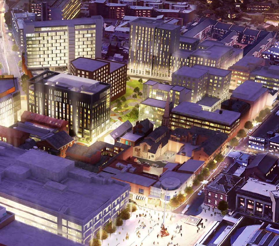
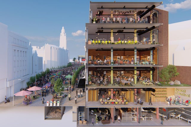
The Sheffield Star has revealed that Sheffield City Council is about to complete the purchase of 20-26 Fargate, the former Clintons card shop opposite Marks and Spencer, to become ‘Event Central,’ a six-storey flagship for the city’s ‘burgeoning creative sector.’
The acquisition and revamp of the building will consume a ‘sizeable’ chunk of £15.8m the authority won from the Future High Streets Fund, a partnership with Sheffield University, to improve Fargate and High Street.
How it could look by March 2024. (Sheffield City Council)
Prof Vanessa Toulmin, of Sheffield University, who led the bid said she would like to see the top floor used for music gigs and practice sessions. Event Central could also host festival events, such as for DocFest, and acts displaced by the closure of venues. There will also be co-working space, exhibitions and a café. The operating model had not been finalised but was likely to be a commercial and public sector partnership.
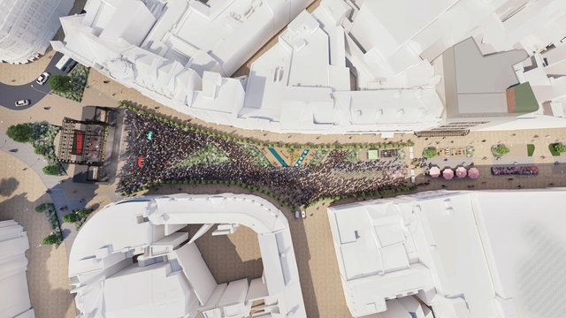
As part of the masterplan, the top of Fargate will be reconfigured to provide outdoor space for major events. The scheme is expected to attract 110,680 visitors annually. Meanwhile it is hoped that ‘Front Door Access’ to old offices above shops will spark investment in new flats.
The top of Fargate will be reconfigured to provide outdoor space for major events. (Sheffield City Council)
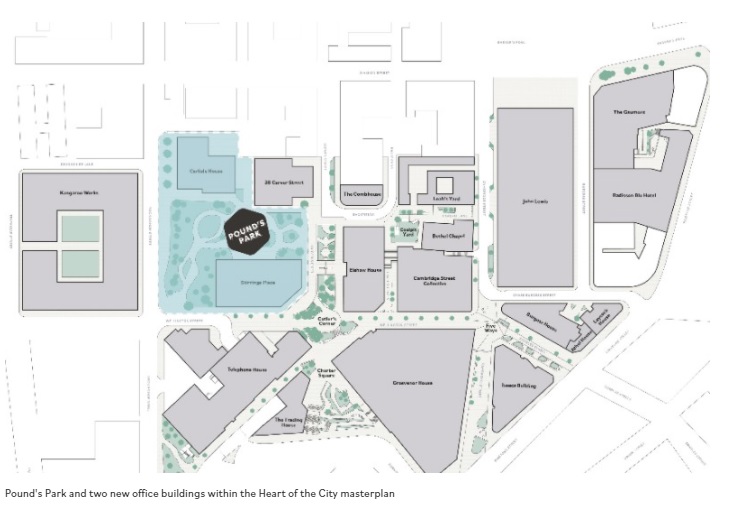
Pound’s Park, named after the man responsible for creating Sheffield’s first fire brigade. The former John Lewis store is seen at bottom-left. Cambridge Street is already being developed as a cultural centre. (Sheffield City Council)
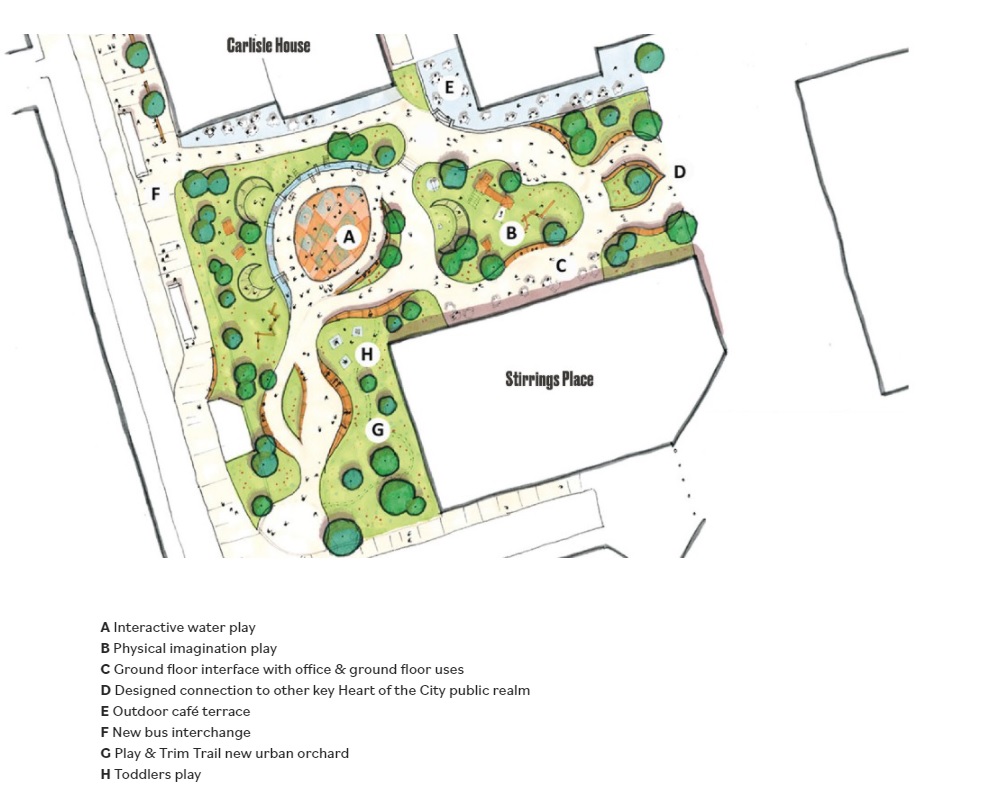
The Heart of the City II programme moves forward, and this artist impression shows Pound’s Park, a new public space that will be created on the site of the demolished Wellington Street fire station.
It will be on the western side of the Heart of the City masterplan, located between Rockingham Street, Wellington Street and Carver Street, and will create another green space in the city centre, as well as creating children’s’ play areas, water features, and a new bus interchange.
The Park will also provide an accessible new home for the William Mitchell frieze, which was removed from Barker’s Pool House a few months ago in preparation for the construction of the new Radisson Blu hotel on Pinstone Street.
A lot has been written about Pound’s Park, but I’d like to focus on the man it is named after.
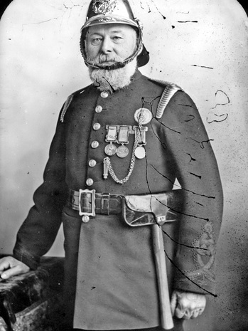
John Charles Pound (1834 -1918) was the city’s first Fire Superintendent, and responsible for laying the foundations of our modern fire service.
He was born at Sittingbourne in Kent and served for eight years in the Navy and Mercantile Marine Service, and as a man-of-war took part in operations in the Crimea.
Leaving the sea, he joined the Metropolitan Fire Brigade in its earliest days. He was engaged at the memorable Tooley Street fire in 1861, where his chief, Captain Braidwood, was killed by a falling wall just minutes after Pound had been talking to him. (It was referred to as ‘the greatest fire since the Great Fire of London,’ and occurred at Cotton Wharf where many warehouses were situated. It attracted a crowd of more than 30,000 spectators).
“This was in the early days of fire brigade work, and long before the extinguishing of fires had been the object of practical and scientific studies. The Metropolitan firemen learnt engineering by travelling on locomotives and receiving instruction from engine drivers. The scheme had been adopted by Captain Braidwood, and John Pound was one of those who familiarised himself in engineering. When proficient he was appointed to a responsible position on one of the brigade’s river floats.”
He applied for a position at Nottingham and was appointed as engineer of the first steam fire engine, staying two years before coming to Sheffield in 1869 to form the Corporation’s first fire brigade. The decision of the Corporation to take over and run the Fire Brigade was brought to a head by a series of large fires between 1865 and 1869.
John Charles Pound (1834-1918). Sheffield Fire Superintendent between 1869 and 1895. (Picture Sheffield)
Pound established the fire brigade over 26 years, with trained firemen, and the introduction of the best firefighting appliances. His biggest fires included Portland Street Confectionery Works (George Bassett and Co) and at G. H. Hovey and Sons (drapers and house furnishers) in Angel Street in the winter of 1893 in which six large shops were destroyed.
Superintendent Pound was injured at the Park Club fire, on Bernard Street, in February 1895 when he fell against a kerbstone whilst handling a jet. His injuries were at first thought to be bruising of the ribs, but later he suffered difficulty in breathing. He retired from the Fire Brigade shortly afterwards.
“He may now begin to feel the need of rest and relief from being in a state of incessant preparedness, and the Micawbian attitude of ‘waiting for something to turn up,’ and the good wishes of the citizens will follow him in retirement.”
John Charles Pound died from influenza at his home on Tullibardine Road in 1918. His coffin was shrouded in the Union Jack and conveyed on a horse-drawn fire brigade tender, with Indian Mutiny veterans, firemen and police taking part in the cortege. He was buried at Sheffield General Cemetery.
A fitting tribute that Sheffield’s first fire officer should be honoured with a park, and on the site of a former fire station.
Pound’s Park will be the latest addition to Sheffield City Council’s plans to create green spaces in the city centre. (Sheffield City Council)
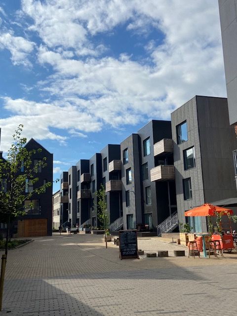
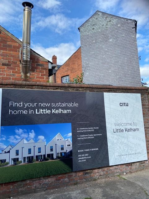
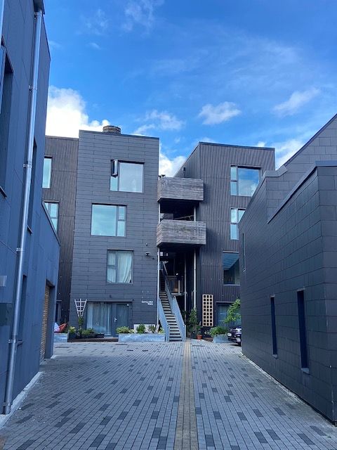
Once a rural idyll, along came industry, and Kelham Island became famous for its factories and works. It’s hard to believe that in a remarkably short space of time, the last remnants of industrial heritage are being squeezed out, and Kelham is becoming one of the “coolest places to live in Britain.”
Here’s an extract from Robert Eadon Leader’s ‘Reminiscences of Old Sheffield: Its Streets and Its People’ (1876), in which Richard Leonard remembered the days before industry.
“Beyond Bower Spring, the footpath – Cottonmill Walk – was the continuation of Spring Street. It ran in the direction now taken by Russell Street, across ‘Longcroft,’ as the open space was called in 1771, towards Green Lane. Of course, it took its name from the cotton mill of Mr Middleton.
“An open stream ran from the top of Cornish Street, in front of Green Lane, and emptied itself in the Don, below where Green Lane works now stand. On the other side of the stream were cottage gardens. Middleton’s silk mill – built in 1758, burnt down in 1792, and the cotton mill, re-erected on the same site only in turn to be burnt down in 1810, and again built only to become the Poor-house in 1829 – stood alone in its glory, its nearest neighbour being Kelham Wheel, still there, as it had been at least as long before as in 1674, on the now covered-in ‘Goit’.
“Across the river was the suburb of Bridgehouses, and all around was verdure. Those were the days when ‘the old cherry tree,’ whose name is now perpetuated only by the public-house (on Gibraltar Street) and the yard where it stood, was still young, and when Allen ‘Lane’ and the Bowling Green marked the extremity of the inhabited region of Gibraltar. Beyond the road ran between fields – ‘Moorfields’ (now Shalesmoor) – and on to the distant rural haunts of Philadelphia and Upperthorpe.”
The photographs show Citu’s recent sustainable housing development at Little Kelham (Little Kelham Street).
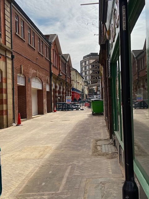
Sheffield’s forgotten street. It is hard to imagine that Orchard Street was once one of the city’s most important thoroughfares. (DJP/2021)
Never did a street fall out of favour as Orchard Street did. This narrow thoroughfare was once the main route between Church Street and Fargate, bustling with commerce, with horse-drawn carriages and carts squeezing past each other.
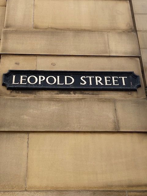
Neither did the creation of Leopold Street diminish its popularity, although only a small portion of the street retained its name.
It wasn’t until the 1980s, and the creation of Orchard Square, that it was relegated to become the back door to shops, and a place for lads to have a quick wee on a Saturday night.
It is an incredibly old thoroughfare, though the name Orchard Street wasn’t given to it until comparatively late.
Formerly all the land in the triangle between Church Street and Fargate consisted of orchards and gardens, but warehouses, shops, and cutlery works gradually covered the space.
In the early 1700s, it is referred to as Brinceworth’s Orchard, while in Fairbanks’ Plan of 1777 it was known as Brelsforth’s Orchards, and in the 1787 Directory it is described as Brinsworth’s Orchards. A document of 1763 gives the address of a trader as Brinsford Orchard. Both Brinsworth and Brelsford, or Brelsforth, are old Sheffield names, and possibly the various names indicate changes of ownership of the orchards through which the street passed.
Eventually the personal names were dropped, and the thoroughfare simply became Orchard Street.
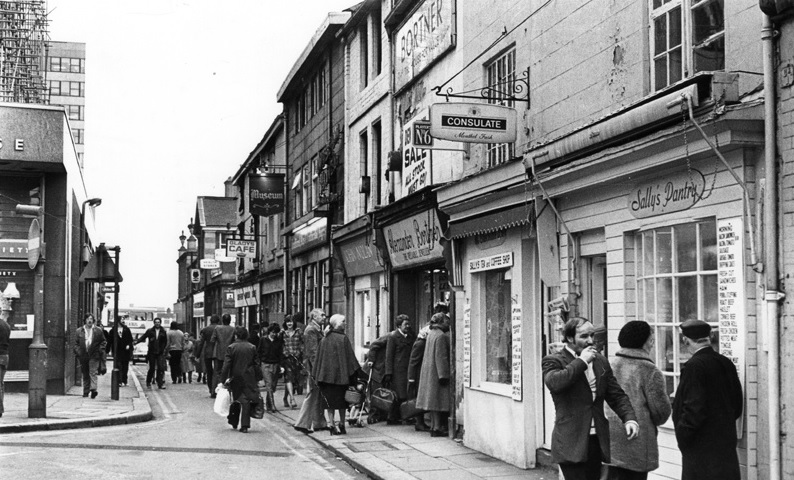
In 1980, the surviving portion of Orchard Street was still popular with shoppers. Most of these properties were demolished to make way for Orchard Square. (Picture Sheffield)
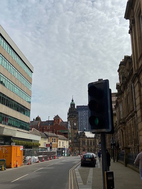
Work in progress. The pedestrianisation of Leopold Street (above), Pinstone Street, and Surrey Street, will create a traffic-free Town Hall Square. (DJP/2021)
Our city centre is at a crossroads. The city is in flux and a street that highlights it most is Leopold Street. Buses no longer run along here, and all traffic is halted mid-way. Sheffield is going car-free, and with it our streets become soulless. Nothing is sadder than a street about to undergo pedestrianisation. It is blocked with traffic cones and concrete barriers and unsure what it wants to be.
As far as Sheffield streets go, Leopold Street is relatively new, a pet-project for town planners in 1873. Back then, access to Fargate and Pinstone Street was via Church Street, along awkwardly narrow Orchard Street, to its junction with Orchard Lane, and dog-legged towards what is now the top of Fargate.
Its making was the result of Sheffield Corporation’s three-street development scheme – the creation of Surrey Street, Fargate improvements, and the construction of ‘modern-day’ Pinstone Street. A new road was needed to link these streets with Bow Street (the road that became the bottom of West Street) and a link between old Sheffield Moor and Shalesmoor.
A long-standing road, South Street, was swept away, the land around it cleared, and the large sloping site bounded by the proposed new road, Orchard Lane, Holly Street and Bow Street (West Street) earmarked for educational purposes. It became the site of Firth College (1879), School Board offices and the Central School (both 1880). Of course, we now know these buildings as the Leopold Hotel and Leopold Square
By May 1880, half its length had been completed, 60-feet wide from Bow Street to Fargate, paved in wooden blocks, and converted to macadam in 1883.
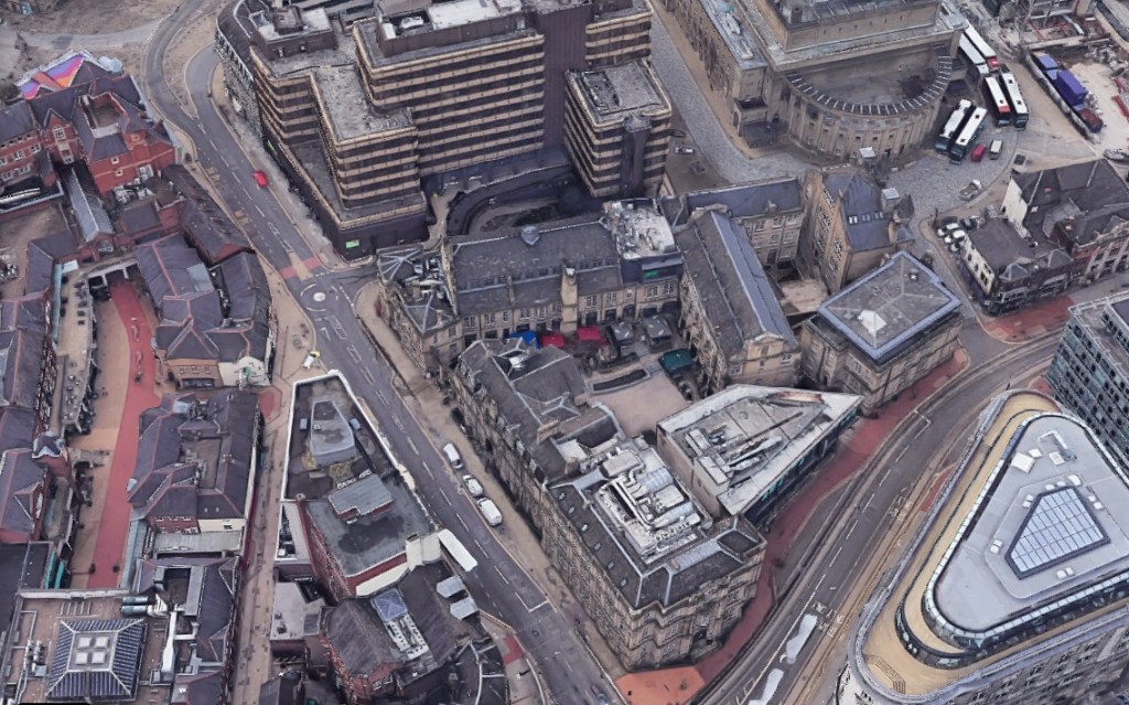
Aerial view of Leopold Street. The Leopold Hotel and Leopold Square are centre. Before 1880, the main route between Church Street and Fargate was along narrow Orchard Street, to the left, which curved at its junction with Orchard Lane (where the mini-roundabout is today). The top-end of Orchard Street (near to Fargate) was absorbed into Leopold Street. (Google)
The Watch Committee recommended that the new street be named after Prince Leopold, Duke of Albany (1853-1884), eighth and youngest son of Queen Victoria, who had opened Firth College in October 1879.
The addition of the Sheffield Medical Institution on the other side of the road in 1888 prompted one expert to say that Leopold Street would become a “street of institutions.”
It never became a street of learning. Firth College and the Medical Institution were the foundation stones for the University of Sheffield and moved away. By the late 1970s, the old education buildings were in decline, mostly unoccupied, but spared the fate that befell the nearby Assay Office and Grand Hotel, both demolished, and replaced with office blocks.
A street sign on the wall of what was once Firth College, at its junction with West Street, and now part of the Leopold Hotel. (DJP/2021)
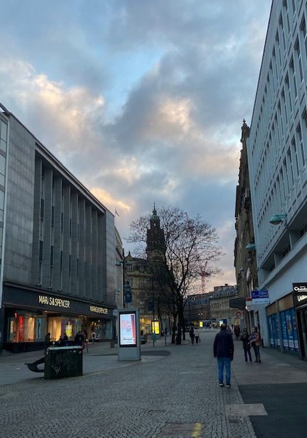
Fargate once extended from High Street up to Balm Green at Barker’s Pool. It now finishes at the junction of Pinstone Street and Leopold Street. (Image: David Poole)
Although one of the oldest streets, Fargate hardly appears to have cut a conspicuous figure in Sheffield history. It boasts no long roll of distinguished residents, and no catalogue of inspiring buildings.
It was never part of Sheffield’s business district, but reinvented itself to become one of the best shopping streets in Sheffield, the result of street widening in the 1880s.
By the 1920s, Fargate was entering its golden period, described as the ‘street of many windows,’ with pavements packed with shoppers.
“There is a charm about it at all times, early in the morning when trams are disgorging their hundreds of workers, and a few hours later when limousines, jaunty sports models, and cheery old-timers, stream through the centre of Sheffield one after another. It is the happy hunting ground of all shoppers, whether of the leisured class who saunter up and down between the hours of 11am and 1pm, or the busy housewife who finds that afternoons are more convenient and joins the crowd always to be found – especially on Saturday.”
Fargate became Sheffield’s first pedestrianised street in the 1970s and missed a trick. It was perfect for open-air café culture, but it never materialised. Fargate struggled to charm and was at its best when the pop-up Christmas market appeared.
Then, along came Meadowhall, the internet, pandemic, and lockdowns.
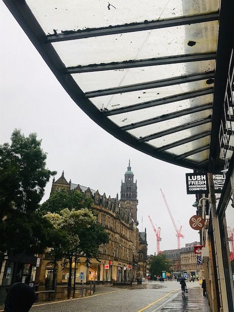
Fargate is suffering from the collapse in retail with an increasing number of empty shops. (Image: David Poole)
Sheffield’s ‘best’ street is in trouble, empty of workers and shoppers, and vacant shop units growing by the week. All this might change with plans drawn up by Sheffield City Council and the University of Sheffield to change Fargate and High Street into a ‘high-quality place to live, work, and socialise.’
Finally, the mystery of how it came to be called Fargate.
The road was obviously a ‘far gate’ with historians suggesting it was the farthest gate from Sheffield Castle. However, digging into the archives there might be a more plausible explanation.
Back in the 1600s, travellers heading towards the Parish Church (now the Cathedral) crossed a cornfield (Paradise Square) and entered a gate at the corner of what is now the corner of Campo Lane and Paradise Street. The other gate was called the ‘Far Gate,’ at what is now the High Street corner of the Cathedral forecourt, hence the name Fargate.
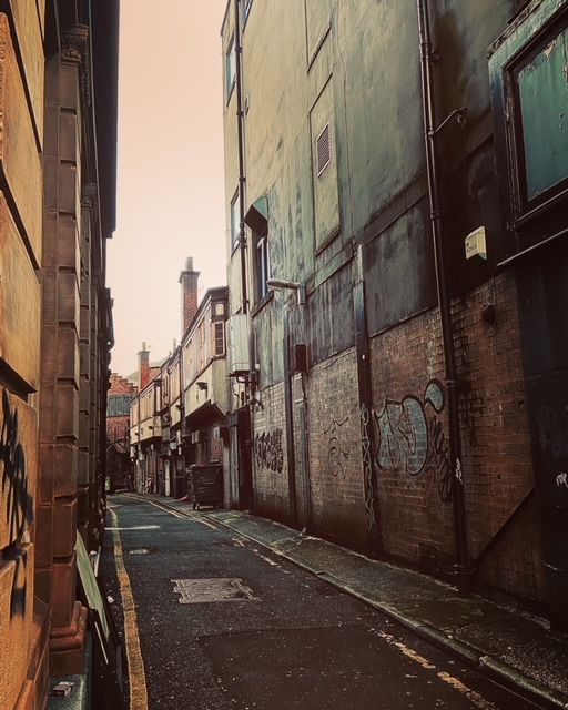
Black Swan Walk. A tale from the 1980s that suggested ghostly secrets. Image: David Poole
I am reminded that back in the eighties, an old man told me that one night in the 1950s he watched a horse and carriage pass down this lonely dead-end street and stop outside the building to the right. Its passengers dismounted and disappeared through a doorway. The carriage moved off and vanished into thin air. The man dared himself to wander down the lane. All the property was in darkness, locked-up for the night, and where the carriage disappeared stood only a high brick wall.
Today, I waited for someone at the opening to this lane, known as Black Swan Walk, when a mother and child walked past. The small boy looked down the desolate lane and said to his mother, “I want to see the horses.” She laughed and dragged him about his business.
In 1887, Sheffield Corporation paid William Davy, the licensee of the Black Swan public house, £11,600 for his land, and demolished the pub to allow for the widening of Fargate. The freehold was sold to Alwyn Henry Holland, provisions merchant, who built No. 9 Fargate, a narrow shop, still standing, and sadly empty, in between Black Swan Walk and Chapel Walk.
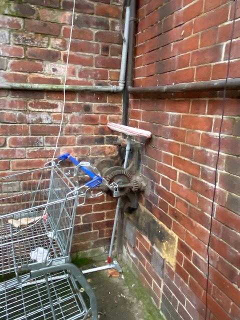
In later years, Holland bought adjoining land on Chapel Walk and built eight shops in English Renaissance style with the Howard Gallery above. Access to the art gallery was from Chapel Walk, with a carriage entrance around the back in Black Swan Yard. Alas, it was a dead end, and a turntable was assembled at the end of the lane that allowed carriages to be spun around and head back the way they came.
Wander down here today, and you will see that the outline of this turntable survives in concrete, with an old mechanism rusting away in a corner.
That story from the 1980s might have been the roguish imagination of an old man, long dead, but a lot of history remains in our forgotten streets.
Black Swan Walk, where carriages were turned around using a turntable that surprisingly survives. Image: David Poole
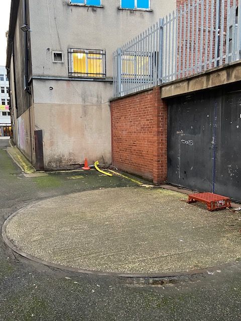
Victorian engineering. Hidden by an abandoned shopping trolley, and a handy place to dry a mop. Image: David Poole
Looking up Fargate. An artist impression of the future.
Sheffield is one of 15 towns and cities to receive all the money they had bid for, in the Government’s Future High Streets Fund.
Sheffield will receive £15.8m in recognition of the ‘forward-thinking and innovative’ proposals to help progress plans to boost its reputation as an ‘Outdoor City’ with high quality public spaces for the community.
The historic streets of Fargate and High Street will become a high quality place to live, work, and socialise, in plans drawn up by Sheffield City Council and the University of Sheffield.
A radical programme of improvements and modern digital infrastructure will complement well-designed residential and workspace conversions, making the most of unused floorspace. Particular blocks will be redeveloped to increase density by adding height while opening up new green spaces and views.
This transformation will play a major role in completing plans for a ‘Steel Route’ through the city centre, turning a declining shopping area into a mixed-use link between the two distinct regeneration projects already underway in Heart of the City at one end and Castlegate at the other.
The funding has been awarded as part of the Government’s flagship £831 million Future High Streets Fund and will help areas to recover from the pandemic while also driving long term growth.
Victoria Road, at Broomhall, is built on land that was once attached to the estate of Broom Hall, the manor house, and belonged to the de Ecclesall family, the Wickersleys, and the Jessops, until the death in 1734 of William, Lord Darcy, after which it passed down the female line to the Rev. Wilkinson, Vicar of Sheffield, in the late 18th century.
He died in 1805 and the Broom Hall estate passed to Philip Gell of Hopton, and from him to John Watson of Shirecliffe Hall, who farmed the land for 20 years, and from 1829 split and leased plots for development.
As Sheffield grew, there was an increasing demand for suburban villas to the west of the town where occupants included manufacturers of steel, cutlery, and edge tools.
Victoria Road, named in honour of our Queen, was laid out in 1855, the road curving from Broomhall Road to join Collegiate Crescent. It was a mix of detached and semi-detached properties, the larger houses built at the top end of the road, close to old Broom Hall, with smaller dwellings at the opposite end.
Little has changed since Victorian times, the houses are much the same, except the trees have grown much larger, and the stone walls at the front of each plot still hide what goes on behind.
Back then, this was a road of masters and servants, horse and carriages, gas lamps, grand staircases, busy kitchens, elaborate dining-rooms, lively drawing-rooms, large bedrooms, and fine furniture.
The likes of Daniel Doncaster, William Christopher Leng, and Miss Witham’s Boarding School moved on, to be replaced with new generations of professional people, who lost sons in World War One and witnessed the bombs of World War Two.
But Sheffield continued to grow, Broomhall was at the edge of the encroaching city centre, the affluent people moved farther away, and the area was blighted by nearby dereliction. Prostitutes moved into adjacent streets and the Yorkshire Ripper was caught just up the road.
Nevertheless, Victoria Road maintained its dignity.
And then it all changed for the better.
The Broomhall estate has become one of Sheffield’s hidden secrets, a leafy suburb, with new professionals, and students, and where it is a joy to walk through its streets and marvel at the architecture.
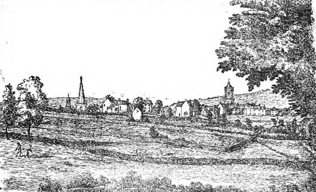
Sheffield in 1791. This reproduction was one of David Martin’s Series of Sheffield Sketches, showing what was the appearance of the town from the north side of Broomhall Spring.
The wood called Broomhall Spring extended to Broomhall Park, full of fine old oak trees, with very little underwood, and soft turf like that of a park. The wood was later cut down, the Government wanting oak timber for ship-building.
The spring itself was later referred to as Spring Garden Well, with the inscription “To the public use, by the Rev. James Wilkinson and Phillip Gell, Esq. Freely take – freely communicate. thank God.”
It was at what is now the corner of Gell Street and Conway Street, and it isn’t without coincidence that the names Broomspring Lane, Wilkinson Street and Gell Street emerged.
To the picture itself, and the fields between Broomhall Spring and the churches – the Parish Church, St. James’s and St. Paul’s – are known to us now as West Street, Division Street, and their adjacent thoroughfares.