Categories
Buildings

Sheffield Hallam University

Block D will become a key anchor for Howard Street and
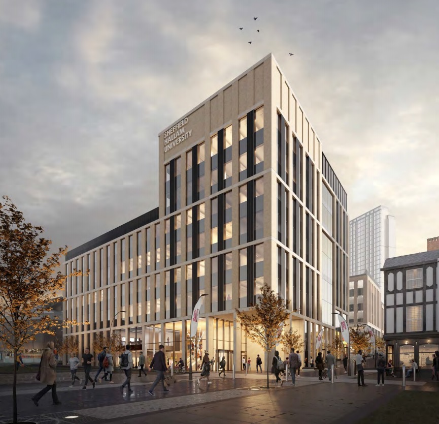
gateway building to the city and campus. This requires a
building facade that is both civic but restrained in its nature. (BDP)

News of a significant proposed development within Sheffield’s Cultural Industries Quarter Conservation Area.

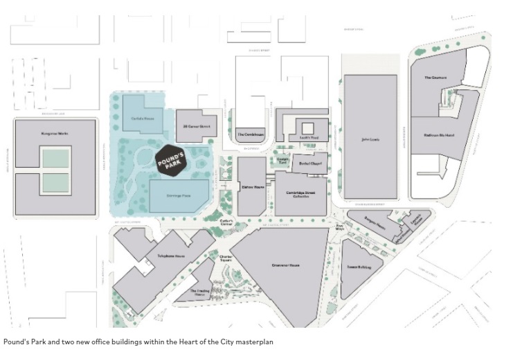
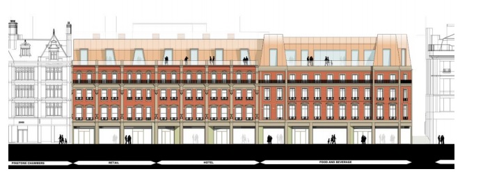
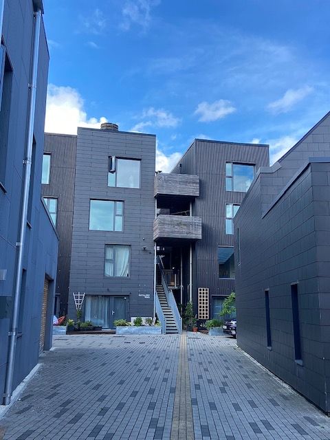
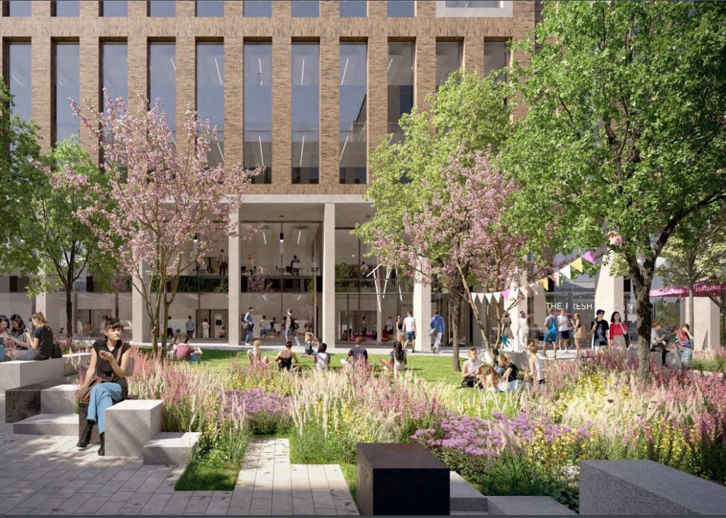
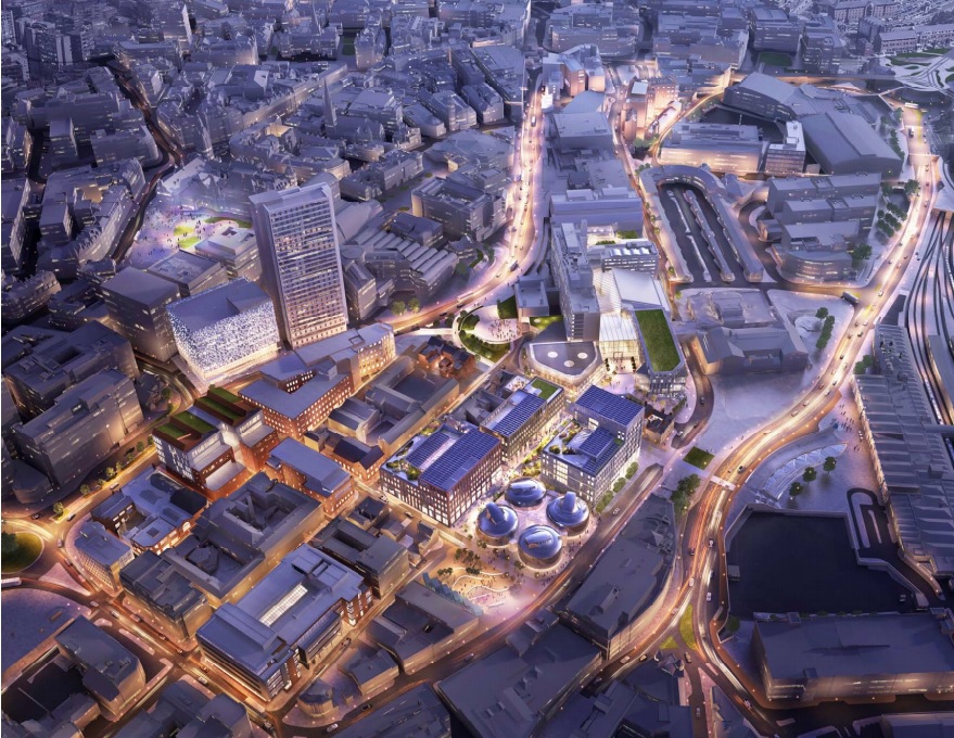
Sheffield Hallam University has submitted a planning application for the erection of three new higher education blocks within its city campus on the existing Science Park site and adjacent surface car park. Blocks A, BC and D are planned around a new public green space provisionally named University Green. It forms a revised Phase One of SHU’s campus masterplan, initiated in 2017/18, and considers changes to the workplace because of the pandemic.

The site covers an area bordered by Paternoster Row, Howard Street, Arundel Street and Charles Street, and is alongside the Hubs complex.

The ground floor plan illustrates public entrances,
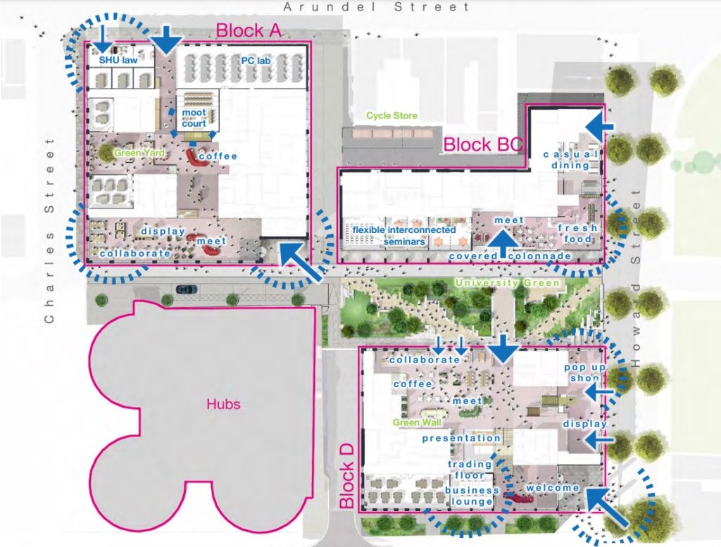
key internal spaces, range of activities and location of key
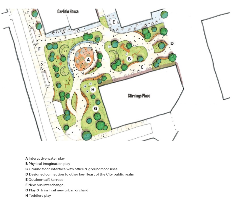
green spaces (internal yards and University Green). (BDP)

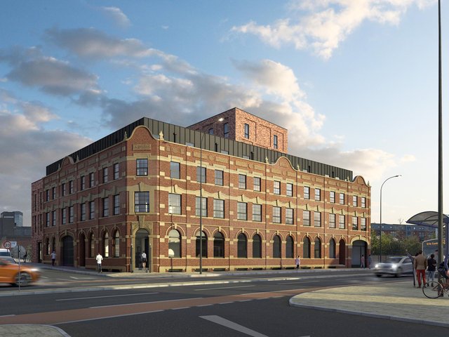
Block D will become a key civic gateway building to the city and campus. In response to this, the tallest part of the development is located at the key junction between Howard Street and Paternoster Row to symbolise a new gateway and reference to the old clock tower of the Arthur Davy & Sons building that once stood on part of the site.

The architectural expression of Block BC is three simple
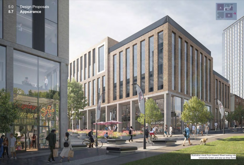
masses that step down from University Green towards the
Globe Pub.
(BDP)
Block A has showcase opportunities on Charles Street and
Arundel Street where applied learning functions such as SHU
Law may be showcased. (BDP)

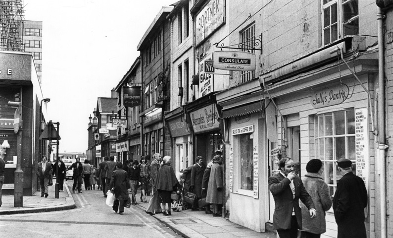
This area was once known as Alsop Fields where ancient hunting rights were claimed. In the late 18th century, the Duke of Norfolk set about his ambitious and grand plan to develop the neighbourhood into a fashionable residential district in response to the growing wealth of manufacture. The masterplan was prepared by James Paine. He proposed a rigid grid framework incorporating a hierarchy of streets, with main streets and a pattern of smaller ones for each urban block, serving mews to the rear of the main houses.

In the 1780s, work on the Georgian estate grid commenced to the north of the site beginning with the parallel routes of Union Street, Eyre Street and Arundel Street from the town centre, extending to Matilda Street (formerly Duke Street). However, the masterplan didn’t transpire largely because Sheffield’s inhabitants didn’t want or couldn’t afford the properties as planned.

Despite the masterplan never being wholly built, the legacy of the Duke of Norfolk is retained in many of the streets being named after his family members.

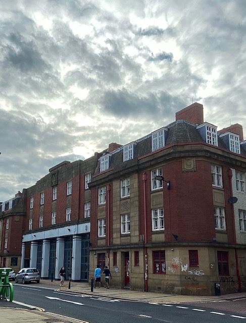
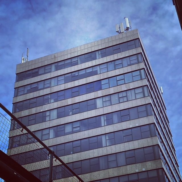
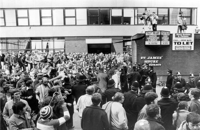
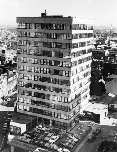
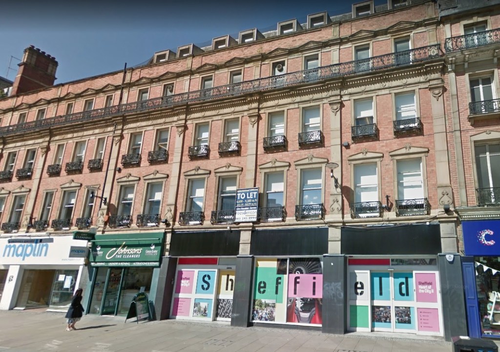
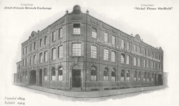
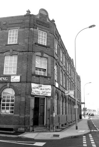
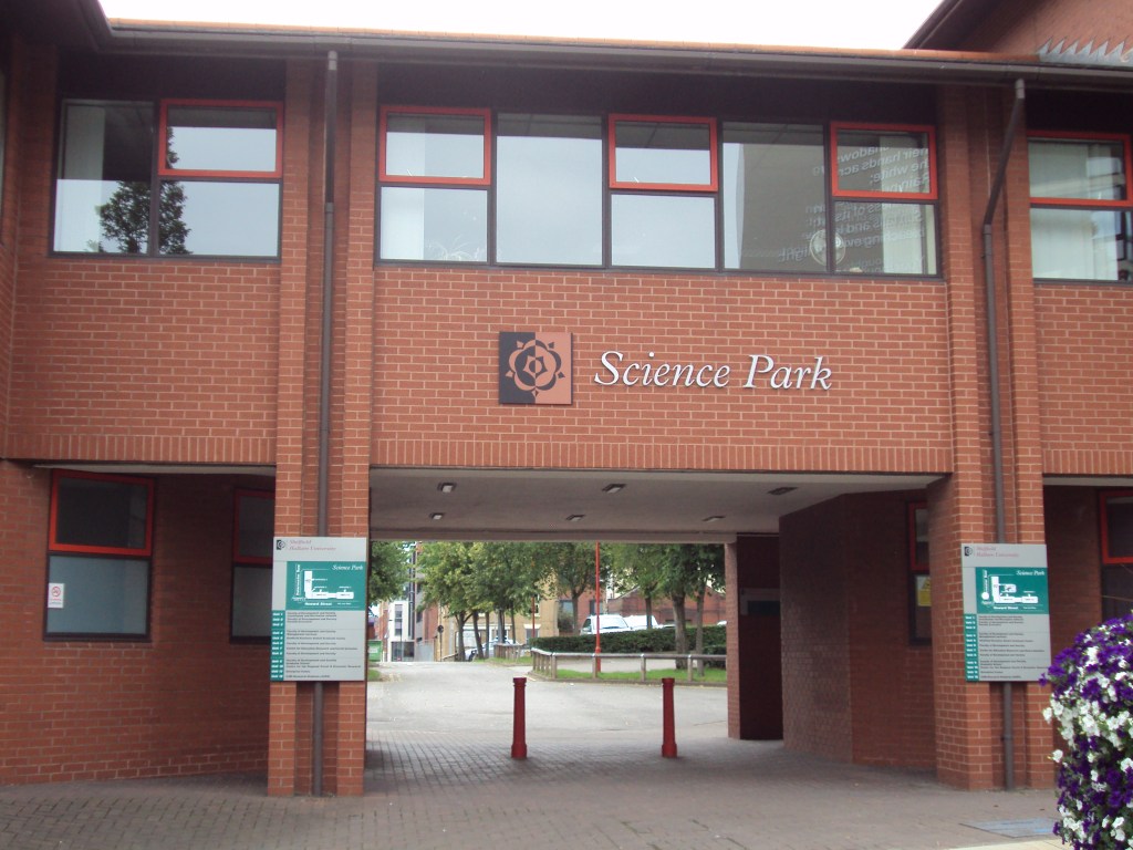
The site designated for redevelopment became a series of factories, workshops, small shops, as well as the site of the County Hotel. Much of the land was cleared during the 1980s, with the creation of Sheffield Hallam University’s Science Park (1996) in red brick by Hadfield Cawkwell Davidson. This will be swept away in the proposed development.

The Campus plan was developed around a number of
Campus plan Principles that are embedded in the design of
blocks A, BC, D and University Green. (BDP)
Illustrative photomontage view looking from Park Hill. (BDP)
Entrance to the Science Park on Howard Street. If planning permission is granted, the site will be cleared and replaced with the new development. (Wikimedia)

© 2021 David Poole. All Rights Reserved.

Categories
Buildings

St. John’s Buildings

Sheffield Medical School (1888) by J. D. Webster. Northern Renaissance-style. The Institution was the third provincial medical school and could accommodate a hundred students. (DJP/2021)

Here’s a building on Leopold Street with a thought-provoking history. St. John’s Buildings are now used as barristers’ chambers, the interior changed from its former use as the Bank of Scotland. However, a stone inscription (Ars Longa Vita Brevis) above the main entrance provides a clue to its original use.

Somewhere within, lies a foundation stone, and within its cavity is a bottle, a time capsule, containing Sheffield’s morning papers from June 1887, a conjoint prospectus for 1886-1887 for Firth College, Technical School, and School of Medicine, an old photograph, and a parchment engrossed as follows : –

“The Sheffield School of Medicine was built in 1828, at the corner of Surrey Street and Arundel Street, the foundation stone having been laid by Sir A.J. Knight in July 1828. The building having become inadequate to the requirements of the day in 1883, a proposal was made to amalgamate with or become a department of Firth College, the councils of the school and Firth College having met and fully considered points of co-operation, unanimously agreed that the union was likely to be advantageous to both, but before complete incorporation took place a new medical school was necessary.”

The new medical school was this building, the foundation stone laid by Dr Mariano Alejo Martin de Bartolomé, using a specially inscribed silver trowel.

I declare this stone duly laid in the name of the Father, the Son, and the Holy Ghost. From this humble structure may we raise up a structure perfect in all its parts, and creditable to the builders.

“It will, in the course of time, grow as an oak did from the acorn, that it will spread its beneficial shadow over the whole of the town and neighbourhood, and communicate the blessings of true medica and surgical practice.”

Designed by architect John Dodsley Webster and built by W. and A. Forsdyke, of St. Mary’s Road, it was opened with an extravagant soiree, including a special address from Sir Andrew Clark, President of the Royal College of Physicians, in September 1888.

The sum required to build the school was £6,000, of which about £3,000 was raised before an appeal was made to the public. “We venture to ask the help of the people of Sheffield, on the ground that school of medicine is an advantage to them; because it stimulates the members of the medical profession to keep pace with the rapid progress of medicine and surgery.” (DJP/2021)

A site had originally been purchased from the Corporation in Pinfold Street; but at the request of the medical council the Corporation agreed to exchange the land for a plot in Leopold Street, opposite Firth College. The area contained about 550 yards and the price was £5 a yard. There was a frontage of about 50ft on Leopold Street, the main elevation being entirely of stone, and the treatment a sort of classic free renaissance, which caused the building to harmonise well with the surrounding property.

On the ground floor towards Leopold Street was a faculty room and library, a lecturers’ room, with porter’s room, lavatory, main staircase, and entrance hall. Also, on this floor, running towards Orchard Street, was an injection room and lumber room. A hoist connected the ground floor with the first floor.

On the first floor were two classrooms and at the back was a museum. The medical theatre was on the second floor, with circular seats in tiers, alongside a practical physiology and a dissecting room.

The School of Medicine was short-lived here, its entwined relationship with Firth College, and the Technical School, leading them to form University College, Sheffield, in 1897, and the eventual creation of the University of Sheffield in 1905, with the medical school moving to a new building at Western Bank (now Firth Court). In 1973, it moved again, and can still be found on Beech Hill Road.

After the school vacated, the building has been in almost continuous use. It will be recognised by those of a certain age as Sheffield Education Committee’s Central School Clinic, afterwards as a bank, and now St. John’s Buildings.

© 2021 David Poole. All Rights Reserved.

Categories
Buildings

Central Fire Station

The former Central Fire Station, on Division Street, photographed in 2017. (Budby/Flickr)

This is Bungalows and Bears, on Division Street, a popular bar with students, but you might not be aware that in 2028 the building will celebrate its centenary. In Pevsner’s Architectural Guide to Sheffield, Harman and Minnis describe it as ‘bloodless, Neo-Georgian,’ typical of inter-war building. Sadly, it’s not looking its best these days.

This was the former Fire Brigade Headquarters, built in 1928 at a cost of £39,000, and opened by the Lord Mayor, Alderman H. Bolton in July 1929.

It would be interesting to know how much remains of its interior since its conversion to flats and ground-floor bar in the 1990s.  

Finishing touches to Sheffield’s new fire station in July 1929. Painters can be seen in rather precarious positions. (The British Newspaper Archive)

The fire station was designed by the City Architect, W.G. Davies, and was intended as an extension to an adjacent station on Rockingham Street (1883-1884). A row of shops fronting Division Street from Rockingham Street to Rockingham Lane was purchased and demolished.

The new Division Street frontage was 155ft long, of which 60ft was occupied by the engine room, with accommodation for 10 engines. Inside, the engine room had white-tiled walls, tastefully picked out in blue, a floor of terrayo, and huge teak doors that opened onto the road.

Adjoining the engine room was the ‘watch room’ – a private telephone exchange and switchboard, with automatic fire bells for calling out the firemen.

On each side of the buildings were stairways and sliding poles of stainless steel fitted on each floor, enabling the men to reach the engine room from the first and second floor firemen’s quarters. There was a children’s playground at the rear of the first floor, while the third floor housed a recreation hall, gymnasium, and more firemen’s quarters.

Electric clocks were fitted throughout, as well as a lighting system controlled by the watch room that ensured that when an alarm sounded emergency lights were switched on automatically.

Outside the engine house, in Division Street, two solid bronze flamboyant torch-fitting electric lamps were fitted, each consisting of three torch-shaped, red-tinted electric lamps.

At the back was a courtyard with a 70ft high brick tower used for drill purposes with Pompier and hook ladders.

The building work was undertaken by Messrs. Abbott and Bannister, Ltd., general builders, and public works contractors, of Machon Bank, using Stairfoot Double Pressed Red Facing bricks, and stone supplied by Joseph Turner of Middlewood Quarries. A green Westmorland slate roof was installed by W.W. Fawcett of Hale Street.

The next time you go past, have a look for five different carvings on the building. They include the Sheffield Coat of Arms and representations of four of the old Fire Marks, all executed by Frank Tory and Sons, architectural sculptors, of Ecclesall Road.

The fire station survived until 1983 when a replacement building was opened on Wellington Street, subsequently demolished in 2010, with South Yorkshire Fire and Rescue moving to its current Eyre Street headquarters. Now used as a car park, the Wellington Street site is earmarked to become Pound’s Park, named after Sheffield’s first Fire Superintendent.

Central Fire Station in operational use in 1974. The engine house could house ten fire engines, but by the 1970s only four were housed here. (Picture Sheffield)
The former fire station now requires some restorative work. The upper floors are flats and the old engine house is used as a bar. (DJP/2021)

© 2021 David Poole. All Rights Reserved.

Categories
People Places Streets

Pound’s Park: a belated tribute to a fire chief

Pound’s Park, named after the man responsible for creating Sheffield’s first fire brigade. The former John Lewis store is seen at bottom-left. Cambridge Street is already being developed as a cultural centre. (Sheffield City Council)

The Heart of the City II programme moves forward, and this artist impression shows Pound’s Park, a new public space that will be created on the site of the demolished Wellington Street fire station.

It will be on the western side of the Heart of the City masterplan, located between Rockingham Street, Wellington Street and Carver Street, and will create another green space in the city centre, as well as creating children’s’ play areas, water features, and a new bus interchange.

The Park will also provide an accessible new home for the William Mitchell frieze, which was removed from Barker’s Pool House a few months ago in preparation for the construction of the new Radisson Blu hotel on Pinstone Street.

A lot has been written about Pound’s Park, but I’d like to focus on the man it is named after.

John Charles Pound (1834 -1918) was the city’s first Fire Superintendent, and responsible for laying the foundations of our modern fire service.

He was born at Sittingbourne in Kent and served for eight years  in the Navy and Mercantile Marine Service, and as a man-of-war took part in operations in the Crimea.

Leaving the sea, he joined the Metropolitan Fire Brigade in its earliest days. He was engaged at the memorable Tooley Street fire in 1861, where his chief, Captain Braidwood, was killed by a falling wall just minutes after Pound had been talking to him. (It was referred to as ‘the greatest fire since the Great Fire of London,’ and occurred at Cotton Wharf where many warehouses were situated. It attracted a crowd of more than 30,000 spectators).

“This was in the early days of fire brigade work, and long before the extinguishing of fires had been the object of practical and scientific studies. The Metropolitan firemen learnt engineering by travelling on locomotives and receiving instruction from engine drivers. The scheme had been adopted by Captain Braidwood, and John Pound was one of those who familiarised himself in engineering. When proficient he was appointed to a responsible position on one of the brigade’s river floats.”

He applied for a position at Nottingham and was appointed as engineer of the first steam fire engine, staying two years before coming to Sheffield in 1869 to form the Corporation’s first fire brigade. The decision of the Corporation to take over and run the Fire Brigade was brought to a head by a series of large fires between 1865 and 1869.

John Charles Pound (1834-1918). Sheffield Fire Superintendent between 1869 and 1895. (Picture Sheffield)

Pound established the fire brigade over 26 years, with trained firemen, and the introduction of the best firefighting appliances. His biggest fires included Portland Street Confectionery Works (George Bassett and Co) and at G. H. Hovey and Sons (drapers and house furnishers) in Angel Street in the winter of 1893 in which six large shops were destroyed.

Superintendent Pound was injured at the Park Club fire, on Bernard Street, in February 1895 when he fell against a kerbstone whilst handling a jet. His injuries were at first thought to be bruising of the ribs, but later he suffered difficulty in breathing. He retired from the Fire Brigade shortly afterwards.

“He may now begin to feel the need of rest and relief from being in a state of incessant preparedness, and the Micawbian attitude of ‘waiting for something to turn up,’ and the good wishes of the citizens will follow him in retirement.”

John Charles Pound died from influenza at his home on Tullibardine Road in 1918. His coffin was shrouded in the Union Jack and conveyed on a horse-drawn fire brigade tender, with Indian Mutiny veterans, firemen and police taking part in the cortege. He was buried at Sheffield General Cemetery.

A fitting tribute that Sheffield’s first fire officer should be honoured with a park, and on the site of a former fire station.

Pound’s Park will be the latest addition to Sheffield City Council’s plans to create green spaces in the city centre. (Sheffield City Council)

© 2021 David Poole. All Rights Reserved.

Categories
Buildings

St James House

A familiar sight on the city centre skyline. St James House is one of Sheffield’s oldest office blocks, built in the 1960s, and still serving the same purpose today. (DJP/2021)

St James House, on Vicar Lane, may be an unassuming 11-storey office block. However, we shouldn’t forget that this 1960s construction plays an important part in Sheffield’s history.

The miners’ strike of 1984–85 turned out to be one of the bitterest fights in British history. The industrial action was to shut down the British coal industry in an attempt to prevent colliery closures. It was led by Arthur Scargill of the National Union of Mineworkers (NUM) against the National Coal Board (NCB), a government agency. Opposition to the strike was led by Prime Minister, Margaret Thatcher, who wanted to reduce the power of the trade unions.

Striking miners lobbying Miners Union leaders (who were meeting to decide strategy) outside St James House in March 1984) (Picture Sheffield)

Long-based in London, Scargill decided to move his headquarters to Sheffield ahead of the strike, and in 1983 chose St James House as temporary accommodation until custom-built offices were built on Holly Street. It had been completely refurbished, and the NUM occupied floors from eight to eleven, and half of the seventh floor for storage. Ironically, these floors had previously been used by the NCB pensions and insurance department.

In ‘Britain’s Civil War over Coal: An Insider’s View’ by David Feickert, he says that Arthur Scargill designed the office layout himself and his managerial views were firmly stamped on the design. “It was an office design straight out of the 1950s, but Arthur defended it rigorously.”

It was here that Scargill fought to the bitter end, and created the biggest news stories of the day. (I don’t need repeat what happened, neither do I need to report on the rights or wrongs. We’re looking at a building, after all).

The NUM vacated St James House in 1988, moving to brand-new offices on Holly Street (designed by Malcolm Lister in 1983, and now home to Grant Thornton, Pitcher & Piano, and Turtle Bay), and stayed four years before relocating to Barnsley.

St James House, before the time of the NUM, photographed in October 1981. (PIcture Sheffield)

© 2021 David Poole. All Rights Reserved.

Categories
Buildings

Reuben Thompson’s City Mews

Work is in progress to demolish the interiors of 30-42 Pinstone Street (as well as the adjacent Palatine Chambers) to create a new hotel. (DJP/2021)

The hoardings are up, contractors are in, and Nos. 30-42 Pinstone Street (as well as Palatine Chambers), are about to be resurrected as part of a Victorian frontage to a brand-new Radisson Blu Hotel. The old facades will remain, but everything behind it, including Barker’s Pool House, on Burgess Street, will be demolished and rebuilt.

Until the 18th century, Pinstone Lane (as it was called) crossed fields and rough grazing land. As Sheffield grew, it became a twisting, close, and sinister-looking passage. In 1875, Sheffield started a street widening programme, and Pinstone Lane was transformed into a 60ft wide thoroughfare to match the magnificence of the proposed new Town Hall.

In 1892, Reuben Thompson, of Glossop Road, an established operator of horse-drawn omnibuses, cabs, and funeral director, gave up his lease on premises at Union Street, and purchased a plot of vacant land opposite St. Paul’s Church (now Peace Gardens) from the Improvement Committee, along with adjoining property at the back towards Burgess Street.

The Salvation Army had already started building its Citadel on Cross Burgess Street as well as three large business premises at its corner with Pinstone Street. Thompson bought the land alongside this, and employed Flockton, Gibbs, and Flockton to design a red brick building, with handsome stone dressings, comprising ground floor shops, and offices and flats above.

An old sketch that shows Reuben Thompson’s City Mews to the left. The sign is visible on top of the building. (PIcture Sheffield)

In 1895, he purchased an additional plot of land to build three additional shops. This extended the length of the original building and incorporated an entrance tunnel from Pinstone Street through to stabling and carriage sheds behind, the carriages lifted from floor to floor by a hoist.

It extended the range to fifteen bays, and across the top of the building ran an enormous sign – ‘Reuben Thompson’s City Mews – and was completed in time for the opening of the new Town Hall.

This is the building we still see, although the advent of the motor car, and high petrol prices during the 1930s, saw Reuben Thompson Ltd vacate a property that had become far too big. It consolidated on Glossop Road and Queen’s Road and focused on its funeral business.

Looking up Pinstone Street. Reuben Thompson’s City Mews are on the right of this old photograph. Once again, the large sign is visible across the top of the building. (Picture Sheffield)

Those of a certain age will be familiar with the shops that have occupied this prime location on one of Sheffield’s most prestigious streets.

The Pinstone Street entrance to City Mews, where horses and carriages once passed, was filled-in, and later lost in the frontage of Mac Market (later to become International, Gateway, Somerfield, Co-op, Budgens, and finally, as a temporary home for WH Smiths).

The construction of Barker’s Pool House on Burgess Street in 1969-1970 (on the site of the former stabling and carriage-houses) linked both properties and altered much of the original Pinstone Street interiors. These too will be lost in the latest stage of the Heart of the City II redevelopment.

An old building plan shows Reuben Thompson’s City Mews, with stabling and carriage sheds located at the back of the Pinstone Street premises and stretching through to Burgess Street. This would later become the site of Barker’s Pool House, soon to be demolished. (Goad Insurance Plan 1896/British Library))
In the 1970s, Mac Market occupied three of the old shop units on Pinstone Street. The original carriage entrance passed underneath the offices above and was located where the central window is here. It remained a supermarket until fairly recently. (Picture Sheffield)
A recent image of 30-42 Pinstone Street. All the shops frequently changed hands. The former Mac Market was most recently used as a temporary shop for WH Smith. In 1970, Barker’s Pool House was built behind, and shoppers were able to use an alternative entrance on Burgess Street. Useful for Cole Brothers staff before and after work. (Google)
Proposed principal east elevation (Pinstone Street) for the Radisson Blu Hotel. Fifteen bays once formed Reuben Thompson’s City Mews. Palatine Chambers occupies twelve bays to the right. (Montagu-Evans)

© 2021 David Poole. All Rights Reserved.

Categories
Places Streets

Kelham Island

Little Kelham. (DJP/2021)

Once a rural idyll, along came industry, and Kelham Island became famous for its factories and works. It’s hard to believe that in a remarkably short space of time, the last remnants of industrial heritage are being squeezed out, and Kelham is becoming one of the “coolest places to live in Britain.”

Here’s an extract from Robert Eadon Leader’s ‘Reminiscences of Old Sheffield: Its Streets and Its People’ (1876), in which Richard Leonard remembered the days before industry.

“Beyond Bower Spring, the footpath – Cottonmill Walk – was the continuation of Spring Street. It ran in the direction now taken by Russell Street, across ‘Longcroft,’ as the open space was called in 1771, towards Green Lane. Of course, it took its name from the cotton mill of Mr Middleton.

“An open stream ran from the top of Cornish Street, in front of Green Lane, and emptied itself in the Don, below where Green Lane works now stand. On the other side of the stream were cottage gardens. Middleton’s silk mill – built in 1758, burnt down in 1792, and the cotton mill, re-erected on the same site only in turn to be burnt down in 1810, and again built only to become the Poor-house in 1829 – stood alone in its glory, its nearest neighbour being Kelham Wheel, still there, as it had been at least as long before as in 1674, on the now covered-in ‘Goit’.

“Across the river was the suburb of Bridgehouses, and all around was verdure. Those were the days when ‘the old cherry tree,’ whose name is now perpetuated only by the public-house (on Gibraltar Street) and the yard where it stood, was still young, and when Allen ‘Lane’ and the Bowling Green marked the extremity of the inhabited region of Gibraltar. Beyond the road ran between fields – ‘Moorfields’ (now Shalesmoor) – and on to the distant rural haunts of Philadelphia and Upperthorpe.”

The photographs show Citu’s recent sustainable housing development at Little Kelham (Little Kelham Street).

Little Kelham. (DJP/2021)

© 2021 David Poole. All Rights Reserved.

Categories
Buildings

Nichols Building

Nichols Building. An artist impression of how the old building might look after conversion into flats and commercial space. (Ashgate)

A £3.25m funding package from Lloyds Bank has been secured to support the redevelopment of a former grocer’s warehouse and coffee roastery in Sheffield’s Kelham Island district into apartments. Developer Ashgate is redeveloping the currently disused Nichols Building, Shalesmoor, to a mixed-use scheme with private residential units and commercial space.

Work is to start this summer, and retain many of the building’s original features, including mosaic tiling, stone, and brickwork.

The Nichols Building is an elegant three-storey range built with iron-hard engineering red bricks, such as Accrington or Noris type, laid in English Garden Wall bond.

Leather’s Plan of Sheffield (1823) shows the site (once known as Moor Fields) to have two buildings. The adjacent road had also been renamed ‘Shalesmoor’ although the smaller streets around it remained unnamed.

The 1853 Ordnance Survey map shows the site to comprise back-to-back housing, and likely small workshops, concentrated around two courtyards.

The Nichols Building appears to have been built in 1914 as indicated by a date sign located within the front gable at the corner between Shalesmoor and Shepherd Street. Cartographic records confirm such a date for the construction of the building as the site was formerly occupied by several terraced buildings with internal courts.

The building includes two signs stating, ‘FOUNDED AD 1854’, referring to the establishment of the company; and an additional one to the north-western end along Shalesmoor which reads ‘REBUILT AD 1914’, which refers to the ‘rebuilding’ of the company on the site.

An advertising postcard for Nichols and Co. (Sheffield) Ltd., Shalesmoor (dated between 1900-1919). The back of the postcard reads: “Wholesale grocers. Tea blenders and coffee roasters. Baking powder and self raising flour manufacturers. Dried fruit specialists. Tea packers to the trade. Colonial and foreign produce delivered or sold export. Only goods of reputed quality and of the leading manufacturers sold. Write for quotations.” (Picture Sheffield)

The business Nichols & Co., wholesale grocer, tea merchant and dealer, was established in 1854 by Charles Nichols which originally occupied premises at 231 Gibraltar Street. In 1868, the business held an additional property in Meadow Street and in 1877 in Langsett Road. The 1900 Kelly’s Directory also lists a property in Trinity Street. Once the company moved to the present Nichols Building, no other associated premises are listed, suggesting that the aim of the Nichols Building was to bring the different properties of the company together within a single and purposely-built warehouse.

Nichols and Co. are listed on the site until 1965 when the company is renamed ‘Nichols, Johnson and Bingham’. Following liquidation, various parts of the buildings were sold off with the final reference in the 1973 directory showing ‘Richardson, Arthurs and Son Ltd’ which had purchased part of the former Nichols and Co. business.

It subsequently became auction rooms for Eadon Lockwood & Riddle, and more recently functioned as an antique centre that closed in 2018.

ELR Auctions Ltd., The Nichols Building, at the junction of Shepherd Street and Shalesmoor in 2006. (Picture Sheffield)

© 2021 David Poole. All Rights Reserved.

Categories
Buildings

Leopold Chambers

Leopold Chambers. An important, but forgotten, part of Sheffield’s Victorian architecture. (DJP/2021)

At the corner of Church Street and Leopold Street is a building typical of Sheffield’s Victorian architecture.

Leopold Chambers was built in 1893-1894 as new offices for Webster and Styring, an established firm of solicitors set up by George Edward Webster and Dr Robert Styring. The imposing four-storey Renaissance building, in mellow golden sandstone, provided a handsome rounding to the corner, with four shops built beneath the offices.

The building neatly rounds-off the corner of Church Street and Leopold Street. The latter street had only been constructed a few years before. (DJP/2021)

The architect was Andrew Francis Watson (1856-1932), designer of many well-known buildings in Sheffield, including the Norfolk Market Hall, the old Fitzwilliam Market, Westminster bank, High Street, showrooms for Mappin and Webb, and the offices of Messrs Vickers and William Jessops on Brightside Lane. He was also the architect for the London and Midland Bank in the Sheffield District and responsible for 1-9 High Street that survives as an extension of Lloyds Bank.

A native of Lamport, Northamptonshire, he came to Sheffield in his twenties and eventually went into partnership with Edward Holmes (creating Holmes and Watson, and no apology to Arthur Conan Doyle).

The partnership between Webster and Styring was dissolved after George Webster’s retirement in 1908, and Leopold Chambers (typically blackened by Sheffield’s sooty air) was later taken over by the Bradford Equitable Building Society (later to become Bradford & Bingley).

Following their departure, the offices were sub-divided and more recently converted into student accommodation, with shops at ground level.

Leopold Chambers subsequently became home to the Bradford & Bingley Building Society. Seen here in the 1970s. (Picture Sheffield)

© 2021 David Poole. All Rights Reserved.

Categories
Streets

Orchard Street

Sheffield’s forgotten street. It is hard to imagine that Orchard Street was once one of the city’s most important thoroughfares. (DJP/2021)

Never did a street fall out of favour as Orchard Street did. This narrow thoroughfare was once the main route between Church Street and Fargate, bustling with commerce, with horse-drawn carriages and carts squeezing past each other.

Neither did the creation of Leopold Street diminish its popularity, although only a small portion of the street retained its name.

It wasn’t until the 1980s, and the creation of Orchard Square, that it was relegated to become the back door to shops, and a place for lads to have a quick wee on a Saturday night.

It is an incredibly old thoroughfare, though the name Orchard Street wasn’t given to it until comparatively late.

Formerly all the land in the triangle between Church Street and Fargate consisted of orchards and gardens, but warehouses, shops, and cutlery works gradually covered the space.

In the early 1700s, it is referred to as Brinceworth’s Orchard, while in Fairbanks’ Plan of 1777 it was known as Brelsforth’s Orchards, and in the 1787 Directory it is described as Brinsworth’s Orchards. A document of 1763 gives the address of a trader as Brinsford Orchard. Both Brinsworth and Brelsford, or Brelsforth, are old Sheffield names, and possibly the various names indicate changes of ownership of the orchards through which the street passed.

Eventually the personal names were dropped, and the thoroughfare simply became Orchard Street.

In 1980, the surviving portion of Orchard Street was still popular with shoppers. Most of these properties were demolished to make way for Orchard Square. (Picture Sheffield)

© 2021 David Poole. All Rights Reserved.