Categories
Streets

Those glass panels beneath our feet

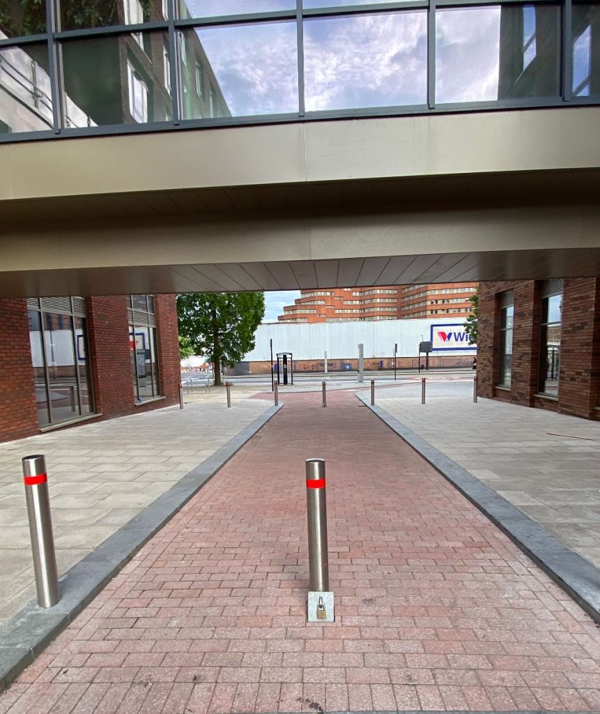
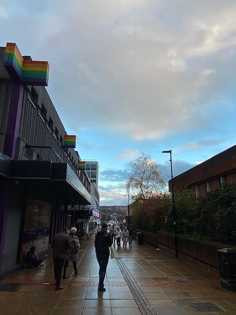
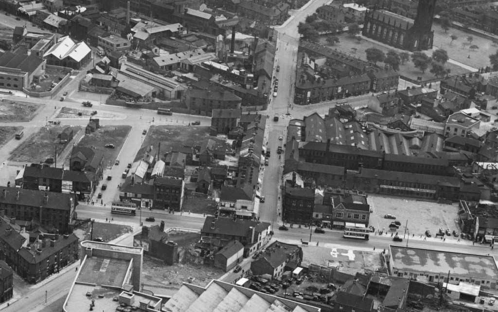
I was on Trippet Lane the other day, answering a telephone call, when I looked at my feet and realised, I was standing on a piece of history. Beneath were glass panels that were common in the late nineteenth and early twentieth centuries. More importantly, it tells us that there is a lot more going on underneath our pavements than we can see.

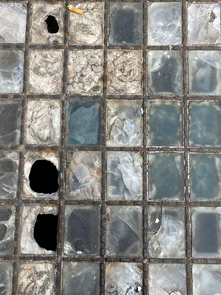
These are pavement lights that were installed to illuminate the space below, usually a basement or cellar. It was a way to lighten spaces where natural light wasn’t available and a way to avoid using gas, oil, and candles. It also indicates that basements often extended underneath the pavement and sometimes beneath the road as well.

The earliest pavement light was developed in America by Edward Rockwell in 1834 using single large round glass lenses set in an iron frame. The lenses often broke and it was Thaddeus Hyatt who corrected the faults with his Hyatt Light of 1854. They had protruding iron knobs, designed to protect the glass, and even if the lenses were broken the panel would still have been safe to walk on.

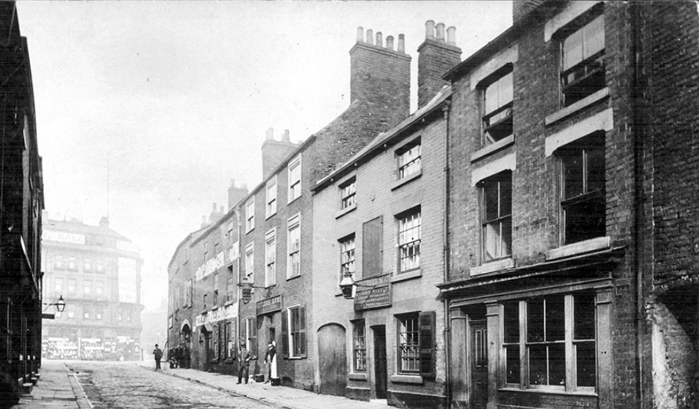
They first appeared in London in the late 1880s in the form of cast iron frames glazed with cut squares of glass. In time, the glass was replaced with pressed glass prism lenses designed to transmit as much light as possible. It wasn’t long before other towns and cities, including Sheffield, adopted them too.

Pavement lights were extremely popular, but they weren’t without problems. It was the responsibility of shopkeepers to replace broken squares, and it wasn’t uncommon for people to sustain injury after catching their heel in a hole. There were stories of small children getting their foot stuck in them and in World War One, wounded soldiers were reported to have had their crutch caught in them. Discarded cigarettes dropped through a broken panel were also the cause of many a fire below.

Pavement lights waned in popularity with the introduction of the electric light but have made a comeback in recent years.

They are far more common in Sheffield than you probably realise and provide clues that there are underground secrets waiting to be explored.

©2022 David Poole. All Rights Reserved.

Categories
Buildings Streets

Thomas Street – the people are returning

Thomas Street, looking towards Moore Street, with a covered walkway between Cosmos, recently constructed student accommodation.

This was formerly the site of Stokes Tiles, but back in 1892 we would have been looking at a much narrower Thomas Street, with the Noah’s Ark public house evident. The council paid £750 for 113 square yards of freehold land from Tennant Bros for the purpose of widening these streets.

Former back-to-back housing in the area was cleared and made way for industry, but times change, and the people are returning.

In the background is the Moorfoot Building, and Wickes, this land now under ownership of NewRiver, owners of The Moor, and I’m informed will be assigned for further residential development.

Cosmos. New student accommodation situated at the corner of Fitzwilliam Street and Moore Street. The people are returning to Sheffield city centre. Image: DJP/2021

©2022 David Poole. All Rights Reserved.

Categories
Streets

Grinders Hill – while you were sleeping last night

Grinders Hill. Lonely at 3am. A shortcut for our ancestors… a shortcut for us now.

But it nearly wasn’t.

November 1935. “The City of Sheffield. Notice is hereby given that a certain public highway to wit a footway known as ‘Grinders Hill’ situate in Sheffield and running in a south-westerly direction between certain other public highways known as Paternoster Row and Leadmill Road shall be entirely stopped up as being useless and unnecessary for the public.”

The motion failed, and Grinders Hill is still with us.

©2022 David Poole. All Rights Reserved.

Categories
Streets

Earl Way – while you were sleeping last night

While you were sleeping last night. This is a wet and deserted Earl Way, which lies parallel between The Moor and Eyre Street.

If we go back to Norman times, and the time of Thomas de Furnival, this was thought to have been the site of a large ditch at the edge of Sheffield Deer Park, one of England’s largest deer parks, and spanning a circumference of eight miles in total.

Earl Way is modern compared to most Sheffield roads. It was created in the second half of the twentieth century when this part of the city centre was redeveloped. Prior to this, there were three significant roads in the vicinity.

These were Porter Street, that ran diagonally from Hereford Street, towards Moorhead, and Porter Lane, a narrow road that linked it with Union Lane.

Union Lane once ran from Charles Street, near to the Roebuck Tavern, across Furnival Road (now Furnival Gate) and ended at Jessop Street (where the Moor Market now stands). The only surviving section of Union Lane is behind Derwent House, near The Roebuck (think deer).

In this photograph, it would have run along the left hand side where the former Plug nightclub and Kit-Kat car-park stand. Porter Street would have been to the right.

If we could go back in time, right in the centre of the picture, and in the middle of the road, would have been Porter Street School.

There were two reasons why Earl Way came into being.

Up until the 1930s, this was an area of back-to-back housing and designated for slum clearance. Then came World War Two. German bombs caused extensive damage around The Moor, Porter Street, and Eyre Street, leaving the site to be redeveloped afterwards.

Union Lane disappeared, and Earl Way was built as a link road to Earl Street (seen running across the end of the road here).

And familiar landmarks appeared too, including the Pump Tavern, later demolished to make way for the Moor Market, and Violet May, a record shop, run by a pivotal figure in the development of the music scene in Sheffield.

Perhaps the most dramatic modern building is the Kit-Kat car-park, designed by Broadway Malyan in 2008, and sold for £9m last month by joint owners NewRiver and BRAVO Strategies.

©2022 David Poole. All Rights Reserved.

Categories
Streets

The last days of haymaking

A pastoral scene from 1892. Image: Picture Sheffield

In 1892, a Mr Cunningham captured a scene of haymaking. A farm worker gathers hay by fork and piles it onto the back of a horse-drawn wagon on which a bowler-hatted man stands. Tending the horse is a young boy. In the background, a fire is on the go in an old cottage and smoke rises from the chimney. It is a scene of rural paradise with fields and trees rising-up the hillside behind.

Within fifty years this pastoral scene had disappeared. Sheffield’s growing population needed rehousing, and many were moved from old city centre slums into new housing estates that crept up the hillsides.

This photograph was taken on East Bank Road, and I’m led to believe that the old cottage stood in a glade behind Midhill House, a large country property that became what is now the Earl Marshall pub.

Still countryside but not for long. East Bank Road photographed in 1946. Image: Picture Sheffield

The road itself, then little more than a country lane, climbed the hillside and had once ended at Midhill house before eventually being extended towards the village of Gleadless.

The Arbourthorne estate, at the top of East Bank Road,  was under construction by the mid-1930s and the road  widened, with council houses built on the opposite side to Midhill House. The first bus service between Sheffield and Gleadless came up here from 1937 (and continues as the No. 51 bus route).

East Bank Road seen from from East Road, looking towards, No 291, Midhill Working Men’s Club and Institute Ltd (formerly Midhill House) in 1946. Image: Picture Sheffield

The old cottage disappeared, and farmland became property of Sheffield Corporation, and although housing eventually surrounded this little oasis, the area around Midhill House remained green space. The Norfolk Park estate was built at the top of the hill behind.

Modern day view of East Bank Road. Midhill House, now the Earl Marshall pub, survives. The old cottage in the haymaking photograph is believed to have existed where woodland now stands behind the house. Image: Google

© 2022 David Poole. All Rights Reserved.

Categories
Streets

Sands Paviours – a long forgotten street

West side of Sands Paviours (ran from Orchard Lane to Bow Street), pre 1890, demolished to make way for the Central Schools, Science School. Image: Picture Sheffield

Today, a look at a street in Sheffield city centre that was consigned to history long ago.

In 1874, a plan was produced by Sheffield architects, Innocent and Brown, for the laying out of Leopold Street, and the realignment of Church Street and Bow Street (now the bottom-end of West Street).

About this time, land between Orchard Lane, Bow Street, Orchard Street and Balm Green was covered by old houses in two streets, Smith Street and Sands Paviours.

The site was bought by the Sheffield School Board for building the Central Schools and offices. At the same time, Mark Firth founded Firth College, later part of the University of Sheffield, and this was opened by Prince Leopold in 1879.

The removal of old property between Bow Street and Orchard Lane caused the obliteration of the marvellously named Sands Paviours.

But what had once been a pathway across rural land had become a street of slum housing, workshops, shops, and a public house called the Norfolk Arms. And murder and crime were evident on the street.

According to John Daniel Leader, this little court of houses may have derived its name from Samuel Sands, who flourished in the reign of Queen Ann.

By an indenture dated 25 September 1708, Samuel Sands, a Sheffield cutler, conveyed to George Hawke of Leavygreave, yeoman, for the sum of £100, all that messuage, near the Townhead Cross with a smithy, barn, orchard, and garden, lately in the possession of John Hobson; also, a cottage adjoining, lately in the possession of Mary Wilson, to hold the same for ever of the chief Lord or Lords of the fee. The vendor signed his name ‘Samwell Sandes.”

However, there was another suggestion for it being named so.

In other towns there were streets called Sans Paviours (without paving stones), and it might be that because Sandes’ house was here, that he saw the name Sans Paviours elsewhere, and thought it appropriate for his own property.

The mystery was cleared up when the land was bought by the School Board, and the old deeds showed that it had been in the family called Sandes from 1657 to 1727, and that early mention was also made to Sands Croft and Sands Orchard.

Like many old street names that were adapted over the years, Sands Paviours was also referred to as Saint Pavers.

Remember this the next time you relax in Leopold Square. There is history beneath your feet.

Sands Paviors once ran from Orchard Lane to Bow Street (now the bottom part of West Street). Image: Google

© 2022 David Poole. All Rights Reserved.

Categories
Streets

A new beginning – container complex set for Fargate

It’s a long time since the Goodwin Fountain was a permanent fixture at the top of Fargate. It disappeared in 1998 and since then the site has hosted everything from big wheels to pop-up bars. Now its’s going to be a hub of cafes, shops, and toilets.

Planning permission has been granted for the 462 square metre installation made up of repurposed shipping containers, to be painted in a dark colour. Construction is underway in Leeds before it arrives in Sheffield and should be open in the next few months.

As well as independent shops, cafes, and free-to-use public toilets, the site will have a big screen, living walls and outdoor seating, and will be open daily between 8am and 11pm.

Sheffield City Council has secured £300K funding for the temporary container installation from the ‘Get Britain Building Fund’ through the South Yorkshire Mayoral Combined Authority. It has been designed by SteelYard, a locally owned company which operates a container complex over 2 floors and open event space at Kelham Island.

The appearance of the container installation will be softened using a combination of planting and artwork. This will allow it to fit within the existing context of nearby buildings.

© 2022 David Poole. All Rights Reserved

Categories
Streets

The people lined the street to catch a glimpse of Queen Victoria

Hereford Street, Sheffield. The road was one much wider, lined with shops, houses, and factories. Photograph: DJP/2021

Hereford Street’s greatest moment was when Queen Victoria officially opened Sheffield Town Hall in May 1897 and travelled down here on her way to Norfolk Park. It might be hard to believe now, but let your imagination do the rest.

“To stand on The Moor, at the top of Hereford Street, and look down the latter thoroughfare affords the spectator a great amount of pleasure. A scene is presented of bright flags of dainty and artistic colours, fancy streamers of every description, while other kinds of bunting and bannerettes float out gaily in every direction.

“Venetian masts are erected on either side of the street, 15 yards apart, and are surmounted by large gilt spearheads, while banners, shields, and trophies of flags are fixed to each mast. Every alternate mast has a pedestal covered with crimson cloth and gilt ornamentation, and at the summit of each pedestal is a group of real plants.

“Across the street at intervals are fixed canopies of handsome floral work, and streamer flags of harmonious colours and flower baskets are suspended from the centre of each floral canopy, with lines of streamer flags along the street at either side connecting the masts with the whole design.

“The buildings, too, in Hereford Street have been dealt with in the most artistic manner. Flags float out bravely from the tops of the principal works and houses, and on the fronts are displayed handsome shields, backed up with designs of small flags and other similar trophies.

“As the time arrived for the stopping of traffic, the corner where Hereford Street joins the Moor became so blocked with cars, cabs, and buses that the Derbyshire police, who extended from the top of Hereford Street along part of St Mary’s Road were hard put to it to prevent serious accidents.

“People would still insist on leaving the shelter of the barriers and coming across the road, and then, as likely as not, they were stranded amongst the horses and vehicles, who, being unused to the terrible commotion, were almost frantic and the drivers, but for the efforts of the police, could not possibly have helped running down some of these belated wayfarers.

“However, this was soon cleared, the arrival of the 1st Battalion of the Hallamshire Rifles having a great deal to do with the transformation.

“The men were placed eight paces apart and covered the entire length of Hereford Street and part of St Mary’s Road.

The visit of Queen Victoria. Pictured here on The Moor. Photograph: Picture Sheffield

“The crowd was very orderly, only a few attempting to elude the vigilant eye of the constables, and those that attempted this being in most cases drunk.

“As the time wore on, however, getting tired, perhaps, and some of them thirsty, occasional rows occurred. People attempted to change their positions and their neighbours’ mild remonstrations gradually developed into what may be styled ‘words,’ and again, in some cases, where the sum was particularly irritating, into blows.

“The few fights, however, that did take place soon raised cries of ‘Police!’ and the guardians of the peace immediately quelled the disorder and left the combatants to sing and shout once more with the rest.

“Several cases of fainting occurred, and it was rather unfortunate that at this point of the route there was no ambulance corps, but the gallantry to the ladies of the rough and ready grinders was quite touching, and these were immediately made room for even in the thickest crushes.

“Of course, skits and jokes passed amongst the members of the crowd, but, as a rule, the language was ‘fit for the Queen.’

“Stands, windows, and roofs were all crowded, and the number of people in the street was, as far as can be judged, above the average.

“The procession passed, the military lined up, and the crowd in one huge migration, made tracks, some for the park, and others in order to get another view, if possible, along South Street, Park.”

Looking towards The Moor from Hereford Street. Today, this part of the road is pedestrianised and is occupied by Dempseys, bar and Club and QJ (the former Yorkshire Bank). Photograph: Picture Sheffield

© 2021 David Poole. All Rights Reserved

Categories
Streets

Hereford Street: two photographs seventy years apart

Aerial photograph of Hereford Street (top to bottom) in 1951
Aerial photograph of Hereford Street (top to bottom) in 2021

Two photographs that show how a Sheffield street lost its identity.

Hereford Street is shown as a wide thoroughfare in 1951, a continuation of Charlotte Road, and intersected by narrow St Mary’s Road, and Porter Street (that became the lower end of Eyre Street). It joined The Moor that continued south towards London Road. Note that Bramall Lane roundabout did not exist.

Seventy years later, the outline of Hereford Street can still be seen but is split by two dual carriageways – St Mary’s Road and Eyre Street. Gone are the factories, houses, and small shops, and the Moor-end is pedestrianised, and this section of The Moor lost beneath the Moorfoot Building.

Sadly, this area has become an unloved part of the city centre with Hereford Street falling on hard times.

Most astonishing is that few buildings appear in both photographs. Most were swept away for road development, factories were surplus to requirement, and old houses and shops deemed unfit for purpose.

St Mary’s Church, on Bramall Lane, does appear in both photographs. In 1951, it was covered in soot and suffered from air pollution, but look how large the churchyard was, and how much was taken away to make St Mary’s Road a dual-carriageway.

Buildings to point out in the modern-day image are the South Yorkshire Fire and Rescue Headquarters and Moor Markets (left), Decathlon and Deacon House (centre) and, of course, the Moorfoot Building (bottom).

© 2021 David Poole. All Rights Reserved

Categories
Streets

A lost street underneath Sheffield Town Hall

New Church Street, looking towards Pinstone Street, now the site of Sheffield Town Hall, No 7, Cutlers’ Arms P.H., No 9, Old Green Man, No 11, Henry Bocking, Beer Retailer. Late 1800s. Photograph: Picture Sheffield

Do council officials, working late at Sheffield Town Hall, ever hear strange noises in the stilly night?

Do they listen with bated breath to the sound of prancing horses and the ghostly cries of coachmen?

Or, when all is quiet, does a rich melodious voice, declaiming in grand style, passages from Shakespeare, ever strike their astonished ears?

Or, do council officials ever work late? Or do they work from home now?

If there is any such things as ghosts, Sheffield Town Hall must be peopled with a vast multitude of them.

New Church Street (not to be confused with Church Street, near the cathedral) was demolished about 1890 to provide room for the Town Hall. It lay almost through the middle of the site of the Town Hall, from what is now the (padlocked) main front entrance, to a point in the west wall opposite the Mercure Hotel.

The Cutlers’ Arms can be seen almost in the centre of the picture, with three people near the doorway, and was the terminus for all the Derbyshire coaches.

“It was a great sight to see them coming in from Tideswell, Castleton, Baslow, Bakewell, and other places. Each coach had its name; the only ones I can remember are the ‘Lady Peel’ and the ‘Surprise,’ both of Castleton,” said Ambrose J. Wallis, who owned the photograph in 1931.

“Next to the Cutlers’ Arms were the Old Green Man and the Grapes – three public houses in a row.

“Almost opposite the Cutlers’ Arms was the house of a man who used to engrave memorial plates, one of which was in York Minster.

“His wife kept a theatrical boarding house, where a number of famous actors stayed. The most famous of all was the great Shakespearean actor, Henry Irving.”

At another house, higher up New Church Street, Mr Wallis said, there lived a man called Dunkerley, who was one of the survivors of the Charge of the Light Brigade.

All this history now covered up by the Town Hall.

© 2021 David Poole. All Rights Reserved