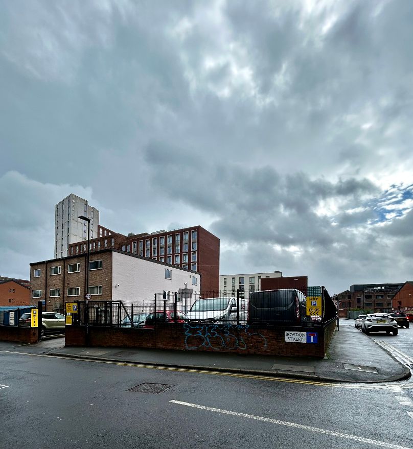
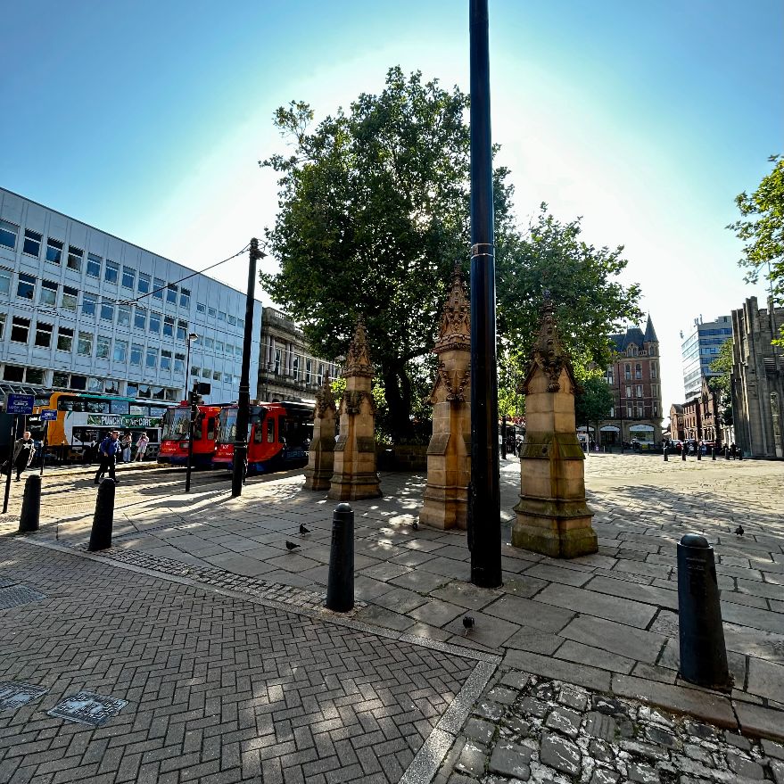
Categories
Places

The Lost Cemetery: Enclosed by high walls and the happy hunting ground for adventurous boys

Jewish Burial Ground, Bowdon Street. July 1964. Image: Picture Sheffield

“I saw him in the cells at the Town Hall. he appeared very delirious there: his face was swollen, and his eyes had turned yellow. I’m afraid the wretched cell in which he was placed had turned him delirious: it was a most wretched place. He was innocent of the charge against him; but, of course, it preyed upon his mind, and being in that wretched place would tend to make him delirious. The charge against him weighed heavily on his mind.”

These were the words of Henry Levy in 1862. He was a clothier on the High Street, and he was speaking at the inquest of his friend and neighbour, Benjamin Cohen, a jeweller.

Days before, Mr Cohen, aged fifty-five, had been taken into custody on the charge of having stolen gold and silver watches in his possession. They had been taken in Swansea five years earlier, the crime unsolved, until detective officer Brayshaw in Sheffield received information that watches bearing the victim’s name were in the ownership of Cohen.

Mr Cohen was released on bail, but confined himself to bed, and would not eat.

Henry Jackson, his surgeon, was summoned on the Tuesday morning.

“I found him lying on his right side in bed. The clothes were wrapped around him in a disordered state. His face was pale, his eyes closed, and his skin cold. On turning down the clothes I found his hands bloody. His shirt was saturated in blood. On turning him on his back I found a razor fully open and bloody. On lifting his shirt, I found a large portion of bowels protruding, with a considerable quantity of blood under and about him. I did what was needful in replacing the bowels and relieving him.”

Cohen died from his self-inflicted wounds that night.

“I had been with him all day,” added Mr Levy. “He kept saying ‘position, once, twice; I did it nicely.’ I don’t know what that referred.”

With tradition, Mr Cohen was buried the next day. A hearse and two mourning coaches trotted through the streets of Sheffield until it arrived at Bowdon Street, where there was a small Jewish cemetery. He was interned and became one of the last people to be buried here.

Unbelievably, this sad story became known after a friend made a chance remark in the pub. He’d been working on the conversion of Eyewitness Works on Milton Street into trendy apartments.

“If you look at Google Maps, it shows that there is a cemetery nearby, or at least there was.”

To prove the point, he showed me his mobile phone and zoomed in on the area around Milton Street. Sure enough, on the road that runs parallel to Fitzwilliam Street, between Charter Row and Milton Street (near Corporation), was a red label showing Bowdon Street Cemetery. I’ve since tried this on my own phone and can find no evidence of it.

But my friend is right, because there was a Jewish cemetery on Bowdon Street, but no trace of it remains.

According to Sheffield Archives, the earliest reference of Jews in Sheffield is in the trade directory of 1797. It grew from about sixty people, belonging to ten families, in the 1840s to about 800 in 1900. This was due to immigration, those fleeing from persecution in Eastern Europe, and settling in Sheffield on their way from Hull to Manchester, Liverpool and eventually America. Benjamin Cohen had been born at Posen, then in Prussia, now part of Poland. Most families lived around the Scotland Street and West Bar area, many becoming watchmakers, jewellers, and tailors.

“The Sheffield Hebrew Congregation is about 120 years old,” wrote Rabbi Barnet I. Cohen in 1926, “though there were a few Jewish families here some time before the congregation was formed. One of the first acts was to provide a burial ground.” This turned out to be a small plot on Bowdon Street that was suitable for the handful of Jewish residents at the time.

The land was acquired in 1831 but closed in 1874, although burials took place afterwards where a plot had been reserved.

“The present cemetery is in Blind Lane, Ecclesfield,” reported Rabbi Cohen (who might have been a relative of Benjamin Cohen), “and there is also a cemetery in Walkley belonging to the Central Synagogue on Campo Lane.”

“The congregation has constantly had trouble through the desecration of the graves by urchins, who not content with climbing over the (high) walls, actually found delight in breaking up the tombstones and digging up the graves, and so recently had a stout door erected and pieces of glass placed on top of the walls.”

The graveyard was surrounded by industry, stables, and back-to-back houses, one of which belonged to Percy Richardson in the 1920s.

“A cemetery enclosed by high walls and the happy hunting ground for adventurous boys. The graveyard is spread over with stones and old tin cans.” It was described as the untidiest graveyard in Sheffield.

Jewish Burial Ground, Bowdon Street. Image: Picture Sheffield

I mentioned Bowdon Street Cemetery to my 94-year-old dad, who couldn’t have been one of Rabbi Cohen’s urchins but may or may not have been a wartime urchin and remembers it from the time he lived on Milton Street.

The graveyard survived until 1975 when Sheffield City Council imposed a compulsory purchase order on the site, the ‘mortal remains of 35 grave spaces re-interred in Colley Road, Ecclesfield’.

Through an old map I’ve managed to find the exact location of Bowdon Street Cemetery, and on a rainy day this week, I visited the old site.

Bowdon Street is at the back of the NHS Substance Misuse building that fronts Fitzwilliam Street. The tiny plot would have run from Bowdon Street, the site partly landscaped, and would have taken up the back end of the Fitzwilliam Centre as it is now.

I thought about the tormented soul of Benjamin Cohen and trust that his remains are at peace in Ecclesfield.

Site of Bowdon Street Cemetery. Image: David Poole
Another view of former Bowdon Street Cemetery site. Image: David Poole

© 2024 David Poole. All Rights Reserved.

Categories
Streets

A busker plays La Bamba to no one outside Marks & Spencer

The evening gets off to a bad start. There have been no trams for a week because of a broken track at Manor Top. It sounds absurd in this modern age. Worse still, the bus I go to catch only runs every hour and doesn’t turn up. I run for the tram replacement bus service, and that doesn’t turn up on time either. By the time I get into the city centre, I’ve spent over an hour getting here when normally it would be a twenty minute journey.

High Street 8.00pm

Next door to The Banker’s Draft, there is a handsome old building that houses an indoor golf centre called Glory Holes – a golf club for adults. It is one of four venues operating across the country and is brightly lit. I assume that councillors were blissfully unaware what a ‘glory hole’ was, because had they done so, they would have insisted that they choose another name.

I suspect that the price of its drinks will deter punters from The Banker’s Draft from entering its doors. There is a female sat on the pavement outside. She is probably a lot younger than she looks and is wrapped in a blanket. She looks sad and holds her hand out in the hope that I might give her money.

I cross the road and walk up High Street. I pass a bus shelter where a girl is crying, and a man holds her tightly. He tells her not to worry and looks woefully at a large group of people nearby. Each one of them is holding a bottle of cider or a can of beer, at least four of them have dogs, and they are all shouting words of advice. These people aren’t waiting for a bus because they don’t have anywhere to go. I wonder what the commotion is about and leave them to it.

Perched on top of the next bus shelter is a traffic cone and the glass roof makes it look like it is floating in the air. I decide this is a good photo opportunity and take my phone out to snap it. The Telegraph Building forms a backdrop and I’m pleased with the result. Afterwards, a polite voice asks, “Am I okay to pass now?” and I thank him for his patience.

I look at the man as he walks ahead of me because I know what will come next.

He swings around. “I don’t suppose you’ve got any change?”

“I’m sorry,” I say, “all my money is on here now.” I wave my phone to show him that I use Apple Pay. He doesn’t reply and gives me a sour look.

On the ground floor of the old Telegraph Building is a Sainsbury’s Local that opens until eleven. It is next door to German Doner Kebab that is half empty, but the rest of the street is in darkness, including Cavell’s bar that might once have done brisk business on a Sunday night.

In the absence of trams, and the infrequency of buses, the High Street has a despondent look about it.

Gosling’s plan of 1736 is the chief authority for saying that High Street was formerly called Prior Gate; and it is probable that hereabouts was the Priory, and its existence can only be known from old deeds.

That was the general belief, but historians are sceptical that a priory ever existed at all, as they are about King John, who was supposed to have stayed at the White Horse Inn on Prior Gate while passing through Sheffield. I imagine an old Sheffielder telling a tall tale that became rooted in history.

The High Street we know today goes back to the street widening of the 1890s. Prior to this, it was much narrower with quaint and picturesque timbered gables, latticed windows and swinging signboards. Robert Eadon Leader told us that in the eighteenth century there were loads of hay that stuck fast, unable to pass the projecting upper story of Mr John Cooper’s confectionery shop.

The Sheffield Directory of 1787 mentions eight victuallers on this street, quite different from the present day. But it was always a shopping street, and all this was swept away so that the sites of its old buildings could not be located with certainty.

The High Street of the twentieth century was busy with elegant shops lining both sides. Most buildings survive but the lower end was obliterated during the Blitz of 1940.

By now, I’ve reached Wendy’s and McDonald’s, which are the busiest places tonight. People queue for takeaways and the tables are occupied by youngsters who see them as a place of refuge on a chilly night. Outside, where High Street meets Fargate, there are parked cars belonging to drivers collecting burgers and chips and then delivering them to the outreaches of the city centre.

Burger King has opened at the end of Fargate, the last of the big chains to get a foothold here. I’m meeting a friend, and he’s silhouetted against the takeaway’s cheerful interior. As I approach, he lights a cigarette and starts counting.

“One, two, three…”

He counts to seven before an unshaven male accosts him. The man is wearing an odd assortment of clothing, none of it designed for winter, and asks my friend for a ‘spare’ cigarette.

The irony is not lost on me.

This is where our ancestors used to meet for a night on the town. It was referred to as Cole’s Corner, a nod to Cole Brothers that once stood here, immortalised in a song by Sheffield’s Richard Hawley and one that has even found its way into Standing at the Sky’s Edge, the musical that recently moved to London’s West End.

Fargate 8.15pm

If High Street appears bleak, then Fargate surpasses it.

This was once the ‘far gate’ from the Parish Church and became Sheffield’s premier street. It was widened to accommodate traffic, its shoppers spilling from the narrow pavements as they jostled to get into the shops. There is a quote from a 1960s newspaper that called it the ‘Oxford Street of the north.’

Tonight, the scene on Fargate is anything but.

It was pedestrianised in the 1970s, and is now a building site, reinventing itself yet again, this time as a £15.8m social hub, to replace shops with event spaces, hospitality, and eating places. The paving is being changed and there will be flower beds promoting Sheffield’s ‘grey to green’ image.

For now, it is a maze of orange barriers, builders’ hoardings, and signs telling us how great it will be.

A busker plays La Bamba to no one outside Marks & Spencer and I wonder how he expects to earn a living. My friend suggests that he is doing it because he simply likes singing.

The shops are closed, but most are empty anyway. Gone are the big chain stores, replaced with vape stores and pop up shops. The last time that Google’s Streetview came here was in 2018 and it showed full occupancy. Since then, the decline has been rapid, and Fargate has become the classic tale of a street that lost its way.

People say that Meadowhall killed it, and while it didn’t help, we must remember that this was a quarter century ago.

I look at my iphone and realise that this is the reason we’ve fallen out of love with shops. Lockdown altered our habits, and retailers finally realised that we preferred to shop without physically shopping.

Tonight, some of the doorways are occupied by rough sleepers. They may or may not feel safe inside their sleeping bags but are far enough away from the party crowds of Carver Street and West Street to avoid being disturbed.

People walk past them, and I hear snatches of conversation, but cannot understand because they speak in different languages. The demographics say that Sheffield is 84% white, 8% Asian, and 4% Black. On Fargate, they are all speaking Eastern European. These are diligent people that will shape the city’s future, but I speculate as to what could entice them into the city centre tonight.

Towards the top end of Fargate is a recently opened Tesco Express that appears to be the liveliest place on the street. Along with other metros/express/locals opened by the big boys, this provides convenience shopping for daytime workers and shoppers, but on a Sunday, is more likely to service those mysterious folk who have moved into apartments.

A security guard stands in the doorway and keeps an eye on a group of kids riding bikes. They are masked like little ninjas and puffing on sweet-smelling vapes that look like fireworks in their hands. One of them asks me the time and I look at the Town Hall clock and tell him. I realise that they are up to no good but can’t quite determine what they are doing wrong.

At least they are riding proper bicycles, ones that take effort to ride, because every few minutes the silent killers on their electric bikes ride past. Somebody recently joked with me who might kill him first. Would it be Uber Eats or Deliveroo?

While we are walking, I remember an article that I read in Monocle magazine where an expert gave his views on the pedestrianisation of our cities.

“I have nothing against pedestrianisation, but if you’re going to do it, make sure there is something to encourage people to use it. Otherwise, life will be sucked out of the street.”

My friend says that Fargate will look nice when it is completed, and I must agree with him. But I am impatient, and it looks such a long way ahead.

We go to Benjamin Huntsman on Cambridge Street and start our Sunday Night Podcast, one that must never be heard by anybody else, because it is when we drink pints of Guinness, be politically incorrect, and put the world to right.

© 2024 David Poole. All Rights Reserved.

Categories
Places

“Best not to explore as there are rumours that the Old Bramall Lane Bridge troll eats anything.”

Bramall Lane Bridge, near former Staples Car Park. Image: DJP/2023

It was one night last summer, and I was taking photographs of skateboarders who had requisitioned the former Staples car park at the corner of St. Mary’s Gate and Eyre Street. There were about thirty of them, showing off to each other, trying to be cleverer than the next.

A small group noticed my interest and obliged by making their skateboards do remarkable things, but the resulting photos weren’t particularly good and soon forgotten.

Staples had long gone, so had Office Outlet that replaced it, and we forget that Mothercare had a shop here, later home to Theatre Delicatessen. The retail park was emptied, bought by Lidl for a new store, but plans had faltered, and the site had surrendered itself to broken windows and graffiti, hastening the rapid descent into decay.

Wooden gates had been erected, preventing entry into the car park, and allowing skateboarders to takeover.

The recent posts about St. Mary’s Church and Ladies’ Walk made me think about the conversations I’d had that night.

Taking a breather from their enactment, three boys sat on the tarmac, drinking bottled water, and chatting about their hallowed space.

I told them that where they were sitting had once been Ellin Street, still listed on maps, named after Thomas Ellin, who used waterpower from the adjacent Porter Brook where it widened into Bennett’s Dam. Here, he founded Vulcan Works with cutlery shops and a steel furnace, and the makeshift skateboard park was where the dam had been.

“That’s cool,” one said, “the dam disappeared, but the river’s still here.”

He was referring to nearby Porter Brook, and the reason Lidl withdrew their planning application last autumn. The discounter was aggrieved about calls to deculvert the river where it flowed under the site, with the loss of car parking spaces .

On the other side of Porter Brook is St. Mary’s Gate, where I took them to see an information board about an ancient structure called Bramall Lane Bridge. Like many Sheffielders, they had no idea about it, and were surprised to learn that it still existed, yards from where they skateboarded.

“Look here,” one of the boys said, pointing to a tongue in cheek warning on the sign.

“Best not to explore under the bridge as there are rumours that the Old Bramall Lane Bridge troll eats anything, especially with her carefully guarded bottle of Henderson’s.”

When told not to do something, lads of that age will do the opposite.

Days later, I saw them again, and they told me that they’d followed the river under the bridge, and then bottled it for fear of meeting the troll that protected it.

Their reaction is common because people don’t realise that Eyre Street, where it joins Bramall Lane Roundabout, is really built on a bridge that starts at the edge of the former Staples car park and ends on the other side of the dual carriageway near Decathlon.

The underside of Bramall Lane Bridge looking towards the former Staples car park end. Image: South Yorkshire Local Heritage List

These days, there is a Friends of Bramall Lane Bridge Facebook group that is responsible for the information board, and for getting the bridge listed on the South Yorkshire Heritage List. That was no mean feat because until the group had applied for its listing, the heritage body was also oblivious to its existence.

But what of its history?

I remembered a letter that had been published in the Sheffield Independent from 1831: –

“Permit me, Sir, through the medium of your valuable miscellany, to call the attention of the Town Trustees and others to this hitherto neglected, though now highly improving part of town. The bridge over the river Porter cannot remain as it is, and if all the owners of adjacent property were to come forward, I am certain the town trustees would not be appealed to in vain for their assistance in connecting Eyre Street, by means of a quadrant or an angle, with Brammall Street. This may be accomplished at considerably less expense than might be at first imagined, and most assuredly it would not only very much increase the value of property in the neighbourhood but would become a highly acceptable substitute for Porter Street, at the entrance to the new part of the town, by throwing open to view that most elegant structure, St. Mary’s Church.”

The letter showed remarkable foresight and within years, a new bridge had been built and Eyre Street eventually connected with Bramall Lane. Had this not been the case, then Bramall Lane might never have become home to Sheffield United FC.

The bridge’s history goes back to days when this was countryside, still a distance from the town that ended where Moorhead is now. At this time, Porter Brook had to be crossed by a narrow wooden footbridge, and horses and carts had to splash through the water to get to the other side.

When the file manufacturing Brammall family built White House and Sheaf House (now a pub), the road leading to the houses became known as Brammall Lane, later shortened to Bramall Lane, and extended across the Porter and would have finished near to where Moor Market is now.

By the 1835 Highways Act, Sheffield Corporation was allowed to replace a wooden bridge with a stone-built structure, and is thought to have been completed by 1845-1846, opening land for development to the south of the town, in places like Highfield, Little Sheffield, and Heeley.

For a long time, it was known as Porter Brook Bridge, and was widened in January 1864, but there were already concerns that the bridge might not be strong enough to carry the traffic that might pass over it. The bridge was now 100metres wide and curved as it followed the course of the river.

This was the height of the Industrial Revolution, and rural land had been swallowed by the town. In 1876, Sheffield’s Medical Officer, F. Griffiths, reported that Porter Brook was full of sewage and the putrid remains of cats and dogs.

In 1877, the Corporation proposed plans to demolish houses between the west of Eyre Street, and the junction of Hereford Street, Porter Street, and Bramall Lane, allowing the extension of Eyre Street to the Bramall Lane Bridge where roads converged.

Once the roads connected, factories and houses were built, even on the bridge itself, but these have long disappeared, and the modern landscape is quite different.

These days, the only visible signs of the bridge are near Staples car park because the other end remains hidden, and most people are oblivious that Eyre Street runs directly over it.

Halfway under the bridge is the well preserved tail goit from the old Vulcan Works (Staples site) that joins the riverbank and has yielded finds such as a Victorian inhaler and oyster shells.

There is also a visible join in the structure about 25metres from the Decathlon end (75metres from the Staples end) that is thought to be the 1864 extension, while the Porter was culverted further from the Decathlon end of the bridge from the 1890s onwards.

Bramall Lane Bridge has stood the test of time, unlike the later culverted section that famously collapsed, forcing part of the Decathlon carpark to remain closed.

The Staples car park is now fenced off and the skateboarders have gone. This week Lidl announced that a revised planning application is pending, and it might include deculverting of another stretch of Porter Brook.

Joint in structure, towards Decathlon end. Image: South Yorkshire Local Heritage List
The other end of the bridge, hidden from view under the Decathlon car park. Image: South Yorkshire Local Heritage List

©2024 David Poole. All Rights Reserved.

Categories
Streets

The gentlemen will be joking that their wives have been taking the air along Ladies’ Walk

It is late summer in 1782, and the sun is slipping behind the distant hills. The ladies of the town, wives of respectable businessmen, clergymen, and doctors, are taking an evening stroll with their friends and their daughters.

The air is fragrant with scents of the countryside: corncockle, yellow-flag iris, harebell, and wood anemone. The long row of trees provide respite from the waning heat, and beyond the wooden fence, cows and sheep lollop in the fields knowing that it will soon be time to settle down for the night.

When the ladies reach the river, sparkling and clear, they might cross in single file, using the narrow wooden bridge, and walk a little further towards the tiny village ahead, where its few houses will already have cast shadows on the ground.

Most will turn around and retrace their gentle steps along the grass path that leads back into town, and where their gentlemen will be waiting, joking amongst themselves that their wives have been taking the air along Ladies’ Walk again.

A decade later, James Montgomery, a Scottish-born writer who had unsuccessfully attempted a literary career in London, moved to Sheffield township and became assistant to Joseph Gales, auctioneer, bookseller, and printer of the Sheffield Register.

On the first Sunday after his residence, Montgomery was encouraged to take a walk along this same path, and where it reached the river, he watched as a horse and cart coming from remote Heeley had splashed its way through the river because the flat wooden bridge was designed only for those on foot.

Montgomery became a hymn writer, poet, and newspaper editor, and by the time he was famous, he had witnessed the growth of Sheffield and its expansion from Alsop Fields, across Sheffield Moor, towards that tiny village called Little Sheffield (now London Road).

Ladies’ Walk subsequently disappeared, with houses, and small workshops built along both sides of the path, and by the time the new century dawned, it had become known as Porter Lane, the road heading towards Porter Brook where a wider bridge accommodated horses and carts.

In time, Porter Lane became Porter Street, one of the shabbiest, dingiest, and dirtiest of suburban streets, far removed from the days when elegant ladies took the night air, but it became the main route between Moorhead and Bramall Lane.

During World War Two, Hitler’s bombs rained down on Porter Street, reducing most of it to rubble, and for the next twenty years or so, swathes of wasteland would be reclaimed by those forgotten wildflowers of yesteryear.

In the end, Porter Street ceased to exist, its remaining buildings demolished to make way for post-war redevelopment, and the stories of Porter Lane and Ladies’ Walk disappeared.

And so, my twenty-first century friends, there is a clue as to where Ladies’ Walk was.

If you travel up Eyre Street from Bramall Lane roundabout, the road bends to the right near Decathlon. Eyre Street became the prominent road into the city centre, but Ladies’ Walk, then Porter Lane, and Porter Street, went straight ahead from where the road still bends.

Imagine walking diagonally through 32 Eyre Street (known to many as Deacon House) at its corner with Hereford Street, across Cumberland Street, through Moor Market, across Earl Street, and through all the buildings until you reach Furnival Gate (once Furnival Street) where the modern H&M shop is now.

Those ladies would have walked from the end of Union Street on the opposite side of the road, straight through the side of the H&M shop, and into this lost and unimaginable rural idyll.

Eyre Street, Sheffield. 32 Eyre Street straight ahead.
H&M, Furnival Gate, Sheffield

©2024 David Poole. All Rights Reserved.