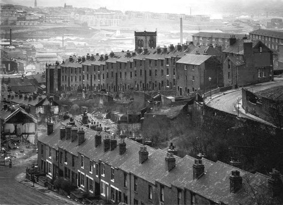
“I’ll miss it,” said the man with the flat cap and a Woodbine hanging from the corner of his mouth. “This is all we’ve known.” He patted the head of a snotty-nosed boy wearing hand-me-downs, who stood eating bread and dripping. The boy wiped his nose on the sleeve of a jacket that was too small because it belonged to Frank in the next yard who was taller and died of measles at Easter. The boy is pining for his dog called Major that ran away when the demolition men came. “When he comes back, he won’t know where we’ve gone,” he wailed.
“Look at it,” the flat cap man said. ”Street after street is being swept away, and with them go all the houses, shops, and pubs. All we’re left with are empty churches because the people have gone. The area looks like a man’s teeth have decayed, and only the black stumps remain. It’s being left to rats and rubble.”
But the flat cap man and the snotty-nosed boy had forgotten that these were the poorest and darkest parts of Sheffield. These sinks of the city were overcrowded, filthy, foetid, and dangerous. This was where whole families shared one room and everybody in the yard pissed and shit in the same toilet bowl. This was where overcrowding and industrial pollution spread sickness and disease. These were the houses where people couldn’t live anymore. Where gangs still ruled, and the sloping cobbled streets had become lawless. This was the poverty stricken north, where other classes dare not wander.
******
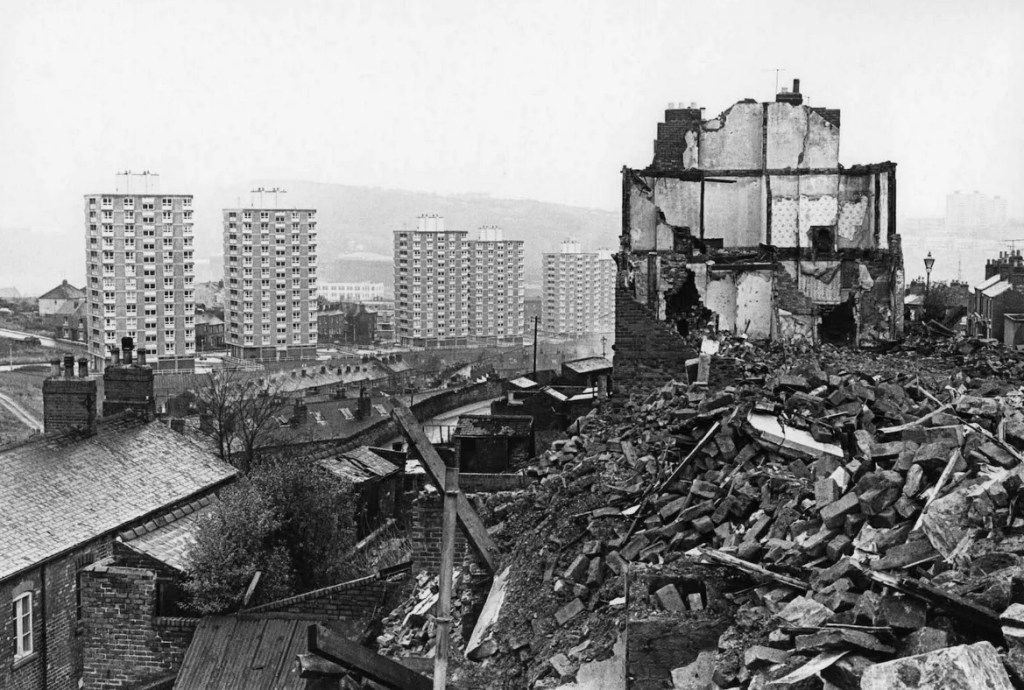
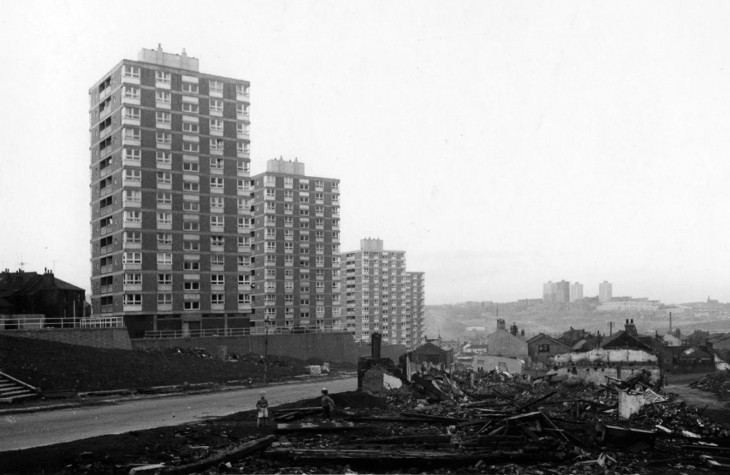
In the 1930s, Sheffield had a five year plan to pull down 7,000 houses and transport 30,000 people to new council estates. It was interrupted by war, and it wasn’t until 1955 that the council resumed its slum clearance programme with new council houses – ‘a boon to a rising generation’. Then came the flats, because housing wasn’t spreading out anymore, it was going up, and so did the rents.
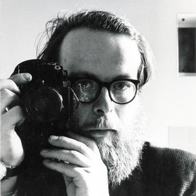
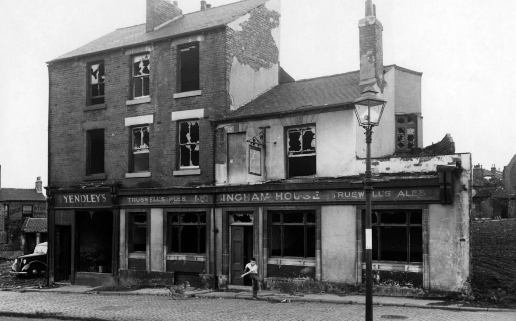
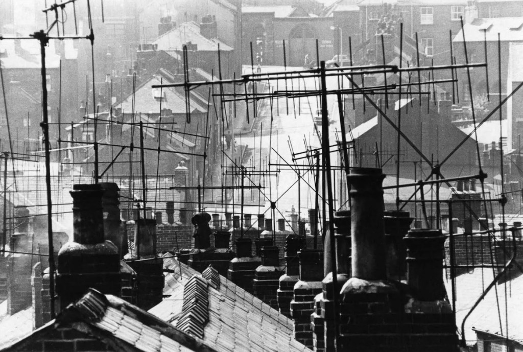
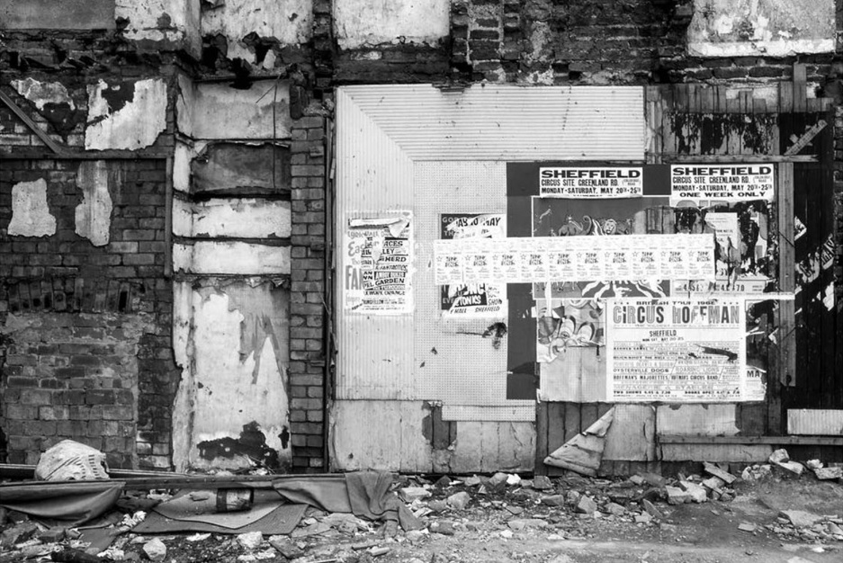
These remarkable photographs of Sheffield’s slum clearance in the 1960s were taken by Robert Blomfield (1938 – 2020), a family doctor who practised in Wrexham and then Hebden Bridge. At the age of thirteen, he started using his father’s Leica camera, showing a natural flair for photography.
Born in Leeds, Robert grew up in Sheffield where his grandfather, a keen amateur photographer, developed his photographs in a make-shift darkroom in the family home. Robert often helped him, and his passion for photography grew, but he never had the ambition to take it up professionally.
From early on he admired the two great French photographers, Henri Cartier-Bresson and Robert Doisneau, whose work challenged him to see more (and be seen less) with the cameras he carried with him everywhere – initially the small Leica borrowed from his father, later a pair of Nikons.
In those days Robert was using black and white film, taking images of Sheffield, Edinburgh, Glasgow, Newcastle, and London, and did all his own developing and printing. Most ended up in storage boxes and only became known in his later years.
“I didn’t need to set the stage. The stage set itself” – Robert Blomfield
New flats rise on Upperthorpe Road. 1960s. Image: Robert Blomfield
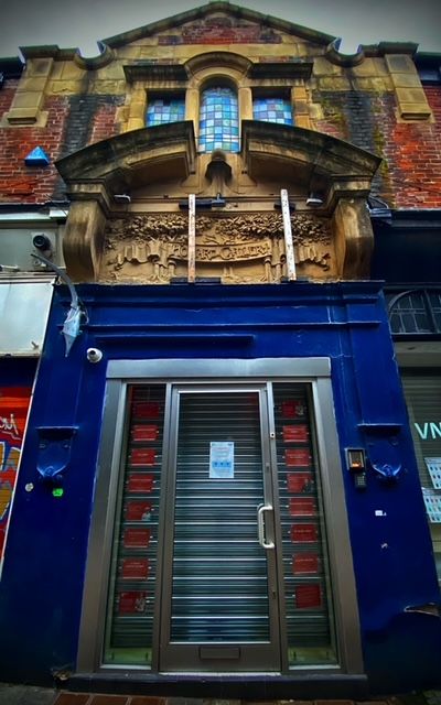
‘Howard Gallery’ carved relief above the now shuttered entrance to the first floor staircase
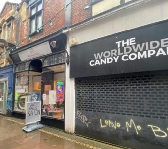
Chapel Walk has gone through a tough time of late, but here’s positive news about one of its most interesting buildings.
Fowler Sandford on behalf of The Twelve Capital Burgesses and Commonalty of the Town and Parish of Sheffield in the County of York have submitted a planning application for The Howard Building, which incorporates retail units 15-31 Chapel Walk to the ground floor and first floor offices above. The building fronts Chapel Walk with the rear elevation facing Black Swan Walk.
The proposal relates to the refurbishment of the promenade of shopfronts to improve the street scene along Chapel Walk within the City Centre Conservation Area, alongside the refurbishment and replacement of first floor office windows to the front and rear elevations, and the repair and restoration of the original roof lights. These works will accompany the refurbishment of the vacant first floor offices along with their entrance leading onto Chapel Walk.
No. 25 Chapel Walk to the left adjoined by modern shopfronts, shutters and the central entranceway to The Howard Gallery. Image: Walker Wood
It is thought that this narrow strip of buildings may reflect the layout of medieval burbage plots, with No. 9 Fargate (formerly Austin Reed) effectively standing at its head.
The building was designed by Flockton Gibbs & Flockton alongside Alwyn Henry Holland whose provisions store was at No. 9 Fargate, with associated offices and Holland’s Café located in the Howard Building.
Alwyn Henry Holland also established The Howard Gallery in rooms above the shops in Chapel Walk, the gallery opening its doors to the public at the end of the nineteenth century. Consisting of eight ground floor shops, along with Howard’s Café and Howard Gallery, the business failed in 1909 and by 1919 it housed a billiards saloon and offices.
Few of the internal gallery features remain but there are partly exposed roof trusses, stained glass windows to the staircase, and areas of original roof lanterns, installed to allow natural light into the gallery beneath.
Original roof timbers and roof lantern within the west wing of the former Howard Gallery. Image: Walker Wood
Original roof lantern where historically the glazing has been removed and blocked up. It is the intention to reinstate this. Image: Walker Wood
Externally, above the central staircase entrance, a reminder of the origins of the building’s use is visible within a carved stone relief.
Named by Holland after the Duke of Norfolk, the relief incorporates the ‘Howard Gallery’ name set within a carved treescape, celebrating the duke’s contribution to the city by granting public access to his parkland at Norfolk Park in the mid-nineteenth century, which he would later go on to donate to the city.
The application states that all remaining historical features will be retained and restored.
Read more about Alwyn Henry Holland and the Howard Gallery here Read more about No.9 Fargate here Read more about Black Swan Walk here
Virgin Money has a lease with building owner Fargate Properties until 2035
Good news for the former Yorkshire Bank building at the top of Fargate. York-based Pivovar which has venues including Sheffield Tap at Sheffield railway station, has applied to open it as Fargate Tap, serving ‘late night refreshments’ until 1am Monday to Saturday.
It was originally built as the Yorkshire Penny Bank, with the Albany Hotel above, in 1889.
It operated as Yorkshire Bank until closure in 2020 as a result of its takeover of Virgin Money that already had a branch on the other side of Fargate. The bank has been empty ever since.
At the same time, the BBC reports that Sheffield City Council is saying that rising costs and delays are hampering the regeneration of Fargate, High Street and Castle Square.
The council successfully bid for £15.8m from the government’s Future High Streets Fund in April 2021. The original costs of work on Fargate, High Street and Castle Square were estimated to be £8.8m based on tender prices, but following detailed design, these costs rose to nearly £18m.
The Fargate works are estimated to cost £14.4m, the increase primarily due to inflation, and there have been delays with paving supplies, issues with ground conditions and technical approval of underground bins. South Yorkshire Mayoral Combined Authority (SYMCA) has provided an additional £4.6m of funding to ensure the work is completed.
The council says Fargate should be substantially completed’ before Christmas but it was not expected to be fully finished until early in 2025.
Construction on the Event Central cultural hub on Fargate will now fall into the 2025/26 financial year, and work on High Street and Castle Square has been paused while the council concentrates its budget on Fargate.
The evening gets off to a bad start. There have been no trams for a week because of a broken track at Manor Top. It sounds absurd in this modern age. Worse still, the bus I go to catch only runs every hour and doesn’t turn up. I run for the tram replacement bus service, and that doesn’t turn up on time either. By the time I get into the city centre, I’ve spent over an hour getting here when normally it would be a twenty minute journey.
High Street 8.00pm
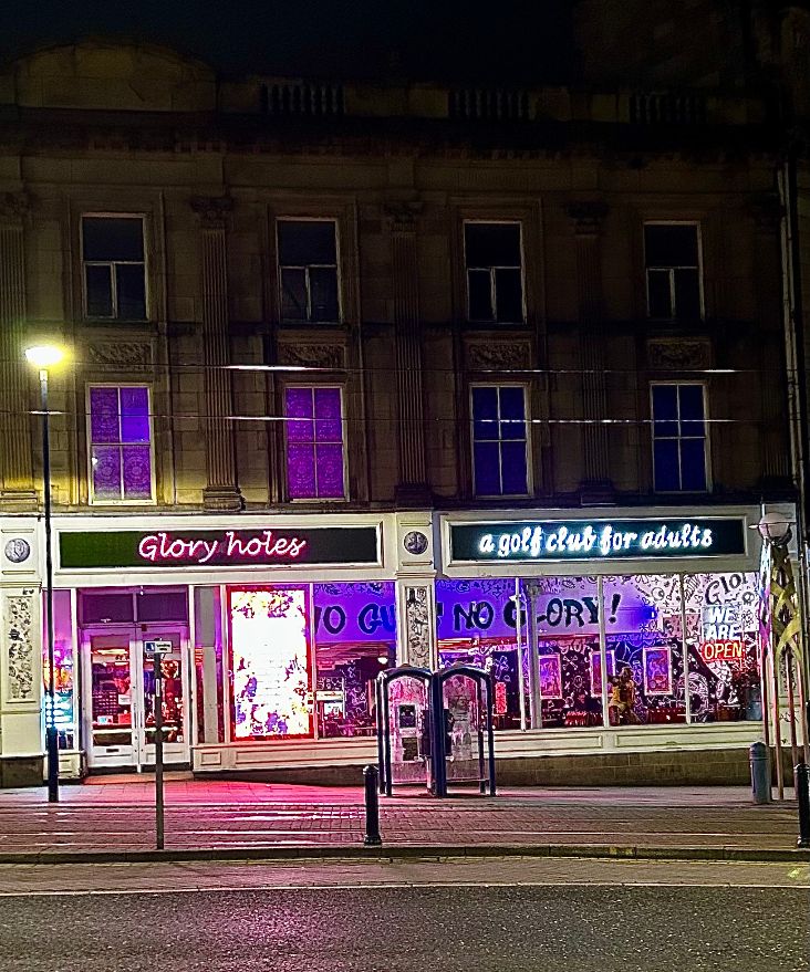
Next door to The Banker’s Draft, there is a handsome old building that houses an indoor golf centre called Glory Holes – a golf club for adults. It is one of four venues operating across the country and is brightly lit. I assume that councillors were blissfully unaware what a ‘glory hole’ was, because had they done so, they would have insisted that they choose another name.
I suspect that the price of its drinks will deter punters from The Banker’s Draft from entering its doors. There is a female sat on the pavement outside. She is probably a lot younger than she looks and is wrapped in a blanket. She looks sad and holds her hand out in the hope that I might give her money.
I cross the road and walk up High Street. I pass a bus shelter where a girl is crying, and a man holds her tightly. He tells her not to worry and looks woefully at a large group of people nearby. Each one of them is holding a bottle of cider or a can of beer, at least four of them have dogs, and they are all shouting words of advice. These people aren’t waiting for a bus because they don’t have anywhere to go. I wonder what the commotion is about and leave them to it.
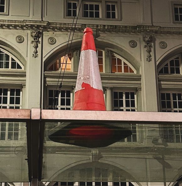
Perched on top of the next bus shelter is a traffic cone and the glass roof makes it look like it is floating in the air. I decide this is a good photo opportunity and take my phone out to snap it. The Telegraph Building forms a backdrop and I’m pleased with the result. Afterwards, a polite voice asks, “Am I okay to pass now?” and I thank him for his patience.
I look at the man as he walks ahead of me because I know what will come next.
He swings around. “I don’t suppose you’ve got any change?”
“I’m sorry,” I say, “all my money is on here now.” I wave my phone to show him that I use Apple Pay. He doesn’t reply and gives me a sour look.
On the ground floor of the old Telegraph Building is a Sainsbury’s Local that opens until eleven. It is next door to German Doner Kebab that is half empty, but the rest of the street is in darkness, including Cavell’s bar that might once have done brisk business on a Sunday night.
In the absence of trams, and the infrequency of buses, the High Street has a despondent look about it.
Gosling’s plan of 1736 is the chief authority for saying that High Street was formerly called Prior Gate; and it is probable that hereabouts was the Priory, and its existence can only be known from old deeds.
That was the general belief, but historians are sceptical that a priory ever existed at all, as they are about King John, who was supposed to have stayed at the White Horse Inn on Prior Gate while passing through Sheffield. I imagine an old Sheffielder telling a tall tale that became rooted in history.
The High Street we know today goes back to the street widening of the 1890s. Prior to this, it was much narrower with quaint and picturesque timbered gables, latticed windows and swinging signboards. Robert Eadon Leader told us that in the eighteenth century there were loads of hay that stuck fast, unable to pass the projecting upper story of Mr John Cooper’s confectionery shop.
The Sheffield Directory of 1787 mentions eight victuallers on this street, quite different from the present day. But it was always a shopping street, and all this was swept away so that the sites of its old buildings could not be located with certainty.
The High Street of the twentieth century was busy with elegant shops lining both sides. Most buildings survive but the lower end was obliterated during the Blitz of 1940.
By now, I’ve reached Wendy’s and McDonald’s, which are the busiest places tonight. People queue for takeaways and the tables are occupied by youngsters who see them as a place of refuge on a chilly night. Outside, where High Street meets Fargate, there are parked cars belonging to drivers collecting burgers and chips and then delivering them to the outreaches of the city centre.
Burger King has opened at the end of Fargate, the last of the big chains to get a foothold here. I’m meeting a friend, and he’s silhouetted against the takeaway’s cheerful interior. As I approach, he lights a cigarette and starts counting.
“One, two, three…”
He counts to seven before an unshaven male accosts him. The man is wearing an odd assortment of clothing, none of it designed for winter, and asks my friend for a ‘spare’ cigarette.
The irony is not lost on me.
This is where our ancestors used to meet for a night on the town. It was referred to as Cole’s Corner, a nod to Cole Brothers that once stood here, immortalised in a song by Sheffield’s Richard Hawley and one that has even found its way into Standing at the Sky’s Edge, the musical that recently moved to London’s West End.
Fargate 8.15pm
If High Street appears bleak, then Fargate surpasses it.
This was once the ‘far gate’ from the Parish Church and became Sheffield’s premier street. It was widened to accommodate traffic, its shoppers spilling from the narrow pavements as they jostled to get into the shops. There is a quote from a 1960s newspaper that called it the ‘Oxford Street of the north.’
Tonight, the scene on Fargate is anything but.
It was pedestrianised in the 1970s, and is now a building site, reinventing itself yet again, this time as a £15.8m social hub, to replace shops with event spaces, hospitality, and eating places. The paving is being changed and there will be flower beds promoting Sheffield’s ‘grey to green’ image.
For now, it is a maze of orange barriers, builders’ hoardings, and signs telling us how great it will be.
A busker plays La Bamba to no one outside Marks & Spencer and I wonder how he expects to earn a living. My friend suggests that he is doing it because he simply likes singing.
The shops are closed, but most are empty anyway. Gone are the big chain stores, replaced with vape stores and pop up shops. The last time that Google’s Streetview came here was in 2018 and it showed full occupancy. Since then, the decline has been rapid, and Fargate has become the classic tale of a street that lost its way.
People say that Meadowhall killed it, and while it didn’t help, we must remember that this was a quarter century ago.
I look at my iphone and realise that this is the reason we’ve fallen out of love with shops. Lockdown altered our habits, and retailers finally realised that we preferred to shop without physically shopping.
Tonight, some of the doorways are occupied by rough sleepers. They may or may not feel safe inside their sleeping bags but are far enough away from the party crowds of Carver Street and West Street to avoid being disturbed.
People walk past them, and I hear snatches of conversation, but cannot understand because they speak in different languages. The demographics say that Sheffield is 84% white, 8% Asian, and 4% Black. On Fargate, they are all speaking Eastern European. These are diligent people that will shape the city’s future, but I speculate as to what could entice them into the city centre tonight.
Towards the top end of Fargate is a recently opened Tesco Express that appears to be the liveliest place on the street. Along with other metros/express/locals opened by the big boys, this provides convenience shopping for daytime workers and shoppers, but on a Sunday, is more likely to service those mysterious folk who have moved into apartments.
A security guard stands in the doorway and keeps an eye on a group of kids riding bikes. They are masked like little ninjas and puffing on sweet-smelling vapes that look like fireworks in their hands. One of them asks me the time and I look at the Town Hall clock and tell him. I realise that they are up to no good but can’t quite determine what they are doing wrong.
At least they are riding proper bicycles, ones that take effort to ride, because every few minutes the silent killers on their electric bikes ride past. Somebody recently joked with me who might kill him first. Would it be Uber Eats or Deliveroo?
While we are walking, I remember an article that I read in Monocle magazine where an expert gave his views on the pedestrianisation of our cities.
“I have nothing against pedestrianisation, but if you’re going to do it, make sure there is something to encourage people to use it. Otherwise, life will be sucked out of the street.”
My friend says that Fargate will look nice when it is completed, and I must agree with him. But I am impatient, and it looks such a long way ahead.
We go to Benjamin Huntsman on Cambridge Street and start our Sunday Night Podcast, one that must never be heard by anybody else, because it is when we drink pints of Guinness, be politically incorrect, and put the world to right.
It is late summer in 1782, and the sun is slipping behind the distant hills. The ladies of the town, wives of respectable businessmen, clergymen, and doctors, are taking an evening stroll with their friends and their daughters.
The air is fragrant with scents of the countryside: corncockle, yellow-flag iris, harebell, and wood anemone. The long row of trees provide respite from the waning heat, and beyond the wooden fence, cows and sheep lollop in the fields knowing that it will soon be time to settle down for the night.
When the ladies reach the river, sparkling and clear, they might cross in single file, using the narrow wooden bridge, and walk a little further towards the tiny village ahead, where its few houses will already have cast shadows on the ground.
Most will turn around and retrace their gentle steps along the grass path that leads back into town, and where their gentlemen will be waiting, joking amongst themselves that their wives have been taking the air along Ladies’ Walk again.
A decade later, James Montgomery, a Scottish-born writer who had unsuccessfully attempted a literary career in London, moved to Sheffield township and became assistant to Joseph Gales, auctioneer, bookseller, and printer of the Sheffield Register.
On the first Sunday after his residence, Montgomery was encouraged to take a walk along this same path, and where it reached the river, he watched as a horse and cart coming from remote Heeley had splashed its way through the river because the flat wooden bridge was designed only for those on foot.
Montgomery became a hymn writer, poet, and newspaper editor, and by the time he was famous, he had witnessed the growth of Sheffield and its expansion from Alsop Fields, across Sheffield Moor, towards that tiny village called Little Sheffield (now London Road).
Ladies’ Walk subsequently disappeared, with houses, and small workshops built along both sides of the path, and by the time the new century dawned, it had become known as Porter Lane, the road heading towards Porter Brook where a wider bridge accommodated horses and carts.
In time, Porter Lane became Porter Street, one of the shabbiest, dingiest, and dirtiest of suburban streets, far removed from the days when elegant ladies took the night air, but it became the main route between Moorhead and Bramall Lane.
During World War Two, Hitler’s bombs rained down on Porter Street, reducing most of it to rubble, and for the next twenty years or so, swathes of wasteland would be reclaimed by those forgotten wildflowers of yesteryear.
In the end, Porter Street ceased to exist, its remaining buildings demolished to make way for post-war redevelopment, and the stories of Porter Lane and Ladies’ Walk disappeared.
And so, my twenty-first century friends, there is a clue as to where Ladies’ Walk was.
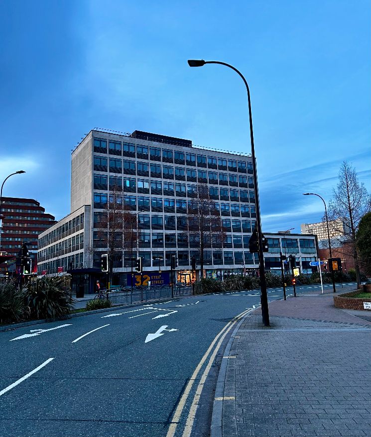
If you travel up Eyre Street from Bramall Lane roundabout, the road bends to the right near Decathlon. Eyre Street became the prominent road into the city centre, but Ladies’ Walk, then Porter Lane, and Porter Street, went straight ahead from where the road still bends.
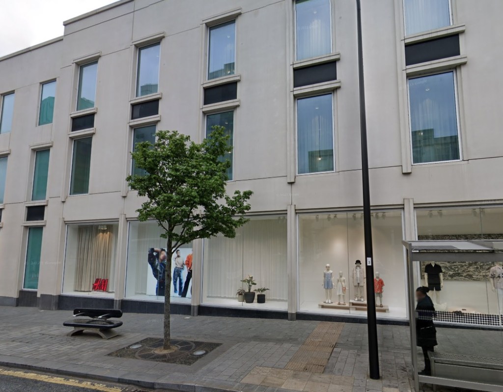
Imagine walking diagonally through 32 Eyre Street (known to many as Deacon House) at its corner with Hereford Street, across Cumberland Street, through Moor Market, across Earl Street, and through all the buildings until you reach Furnival Gate (once Furnival Street) where the modern H&M shop is now.
Those ladies would have walked from the end of Union Street on the opposite side of the road, straight through the side of the H&M shop, and into this lost and unimaginable rural idyll.
Eyre Street, Sheffield. 32 Eyre Street straight ahead.
I walked through the city centre the other day and remembered an old newspaper article that spoke of Pinson Lane in 1736, and later became Pinstone Street.
The article from 1927 was written by Harold Rowley who suggested that Pinstone Street may have had some connection with Penistone, once a common surname in the district, but had once been called Pincher Croft, which hinted it may have had some connection with Barker’s Pool, being originally Pitcher Croft.
When I got home, I referred to Sidney Oldall Addy’s ‘The Hall of Waltheof’ or ‘The Early Condition and Settlement of Hallamshire’ from 1893.
“We have few ‘lanes’ in Sheffield now. The popular idea seems to be that there is something mean and insignificant in a lane, and hence Pinson Lane now bears the grander name of Pinstone Street.
Old inhabitants of Sheffield speak of Pinson Lane. Gosling writes it Pinson Lane in 1736, and I find a croft called Pincencroft Len in a document dated 1554.
Pincen is probably the surname Pinson, so that Pincencroft is exactly analogous to Colson Crofts, Sims Croft, Scargill Croft, and Hawley Croft, which are derived from surnames.
The word ‘len’ in Pincencroft Len is not our ‘lane’ but the Old Norse lén, a. fief, or fee, a piece of freehold, or land held in fee simple. Thus, the meaning is Pinson Croft freehold. The croft acquired the name of the person or the family—the Pinsons—who once held it, and then it afterwards became known as the Pinsoncroft ‘len’ or fee.”
Mr Rowley also mentions that the old name for the Fargate end of Pinstone Street was once called Sowmouth, popularly explained because it tapered and grew narrower. However, he says, this was evidently wrong, because Sowmouth meant a door or opening.
I didn’t know this, but I referred to Robert Eadon Leader’s ‘Reminiscences of Old Sheffield: Its Streets and its people’ (1876) and found the following passage from Richard Leonard: –
“Forty years ago, there were one or two trees growing on the property of Mr Withers, in Pinstone Street. A passage leading from Fargate to New Church Street, was a favourite playground of the boys of those days and boasted the name of ‘Sow Mouth.’”
(New Church Street ran parallel to modern-day Surrey Street and was lost underneath the Town Hall when it was built in 1890-1897).
Sims Croft, from Townhead Street towards Tenter Street. Image/Picture Sheffield
“I believe that we can recapture the lost beauty of Sheffield. In fact, you are already beginning to recapture it. I thought this morning how greatly improved the city was architecturally and structurally. I noticed that many of the old crofts have disappeared – the old slumdom is going. Watch that you don’t get new slums in their place, and that you don’t let the jerry-builder play his old game and run up his weedy, seedy, respectable-looking, but fever-haunted dens, built on rottenness and breeding illness of all kinds in days to come.”
This is a quote from 1910, by the Rev. S.E. Keeble, of Southport, once a Methodist minister at Brunswick Church in Sheffield between 1893 and 1896, who had returned to speak at the Victoria Hall on Norfolk Street.
In olden days, it had been the fashion to name streets or lanes as ‘crofts’. Sheffield had Pea Croft, White Croft, Hollis Croft, Lea Croft, Sims Croft, Hawley Croft, Scargill Croft, and so on. These were (and some still are) located in the area between modern-day Bank Street and towards Scotland Street.
The ‘crofts’ area developed within plots formed by former fields, and the name was originally respectable and modern, much the same as ‘avenue’ became, but the advent of time led to the term becoming synonymous with slums.
And for this reason, Sheffield started eliminating the term, and under the Government’s Slum Clearance Scheme had eradicated the properties in the early twentieth century.
Scargill Croft, Lee Croft, White Croft, and Hollis Croft survive in very different circumstances, and in some cases the people have returned to live here.
Commercial Street. The Sheffield and Rotherham Independent jokingly said that the new road might be called ‘Wrangle Street.’ Image: DJP/2022
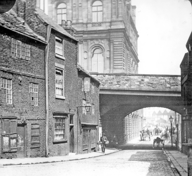
Let us go back to the early 1800s and visit a thoroughfare that was entered under an archway at the top of Haymarket. This narrow sloping lane was lined with squalid houses, little workshops, a few shops, and halfway down, on the left-hand side, was the Nag’s Head public house, that gave the lane its name. Nag’s Head Yard ended in a flight of steps that came out onto Shude Hill.
Despite its proximity to the old town, most folk avoided Nag’s Head Yard, for this was where you were likely to find many of the town’s thieves, brawlers, and drunkards.
Nag’s Head Yard is long forgotten, swept away in the late 1860s, when the construction of a new railway station for the Midland Railway on Sheaf Street necessitated road improvements to it.
Four approach roads were built to what became Sheffield Station. The first was down Howard Street, the second commenced on Sheaf Street, opposite the vegetable market, and passed along the River Sheaf into Harmer Lane. The third was a continuation of Cross Turner Street, emerging at the junction of Shrewsbury Road, Suffolk Road, and St Mary’s Road. And it might surprise you that the fourth approach was from Nag’s Head Yard, passing on arches over Shude Hill, and became known as Commercial Street.
This was one of two brand new roads built by Sheffield’s Street Improvements Committee, the other being Leopold Street.
Historians are easily confused by Commercial Street because there was already a road of the same name in proximity.
In 1834, the inhabitants of Jehu Lane wanted to change its name to something more in the spirit of the times. They asked Town Commissioners to allow street boards to be taken down and be replaced with a new name. Amazingly, the commissioners consented and told the residents to choose a new name. They chose Commercial Street, but this would be short-lived because the council started purchasing and demolishing properties on the east side of Market Street and the south side of Old Haymarket, to create Fitzalan Square, named after the Duke of Norfolk’s family.
This process of compulsory purchase didn’t go well, and Sheffield Corporation was involved in numerous court cases in which displaced residents and businesses demanded better compensation.
Nevertheless, the council pressed ahead with plans for a new 40ft street from the upper end of Old Haymarket, where Nag’s Head Yard was, over Shude Hill, near the gas works by a bridge, and into Sheaf Street.
Shude Hill passing under Commercial Street Bridge, Gas Company Offices, in background. Image: Picture Sheffield
The Sheffield and Rotherham Independent jokingly said that the new road might be called ‘Wrangle Street,’ but the surveyor of Sheffield Corporation announced in 1870 that the railway approach road would now become Commercial Street.
It confused locals and the Sheffield Independent’s ‘Spectator in Hallamshire’ asked, “What is the name of that street? I never know how to call it.”
Commercial Street allowed the construction of grand new buildings including the Post Office, at its corner with Haymarket, by James Williams in 1871, and offices and showrooms in 1875 for the Sheffield United Gas Company.
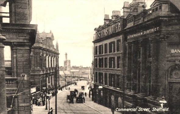
The King’s Arms Hotel and the Birmingham District Bank (later Barclays) would eventually be demolished to make Commercial Street wider.
One of the most interesting developments involved the King’s Arms Hotel whose frontage faced Jehu Lane (old Commercial Street). The new road cut immediately alongside it, and in a stroke of brilliant business acumen, the proprietors sold the building to the Midland Banking Company for £20,000.
It demolished the front portion of the hotel for a grand new banking hall, designed by Salmon Linton Swann, and redesigned the remaining part of the hotel so that it faced onto new Commercial Street. The bank would eventually become Barclays Bank.
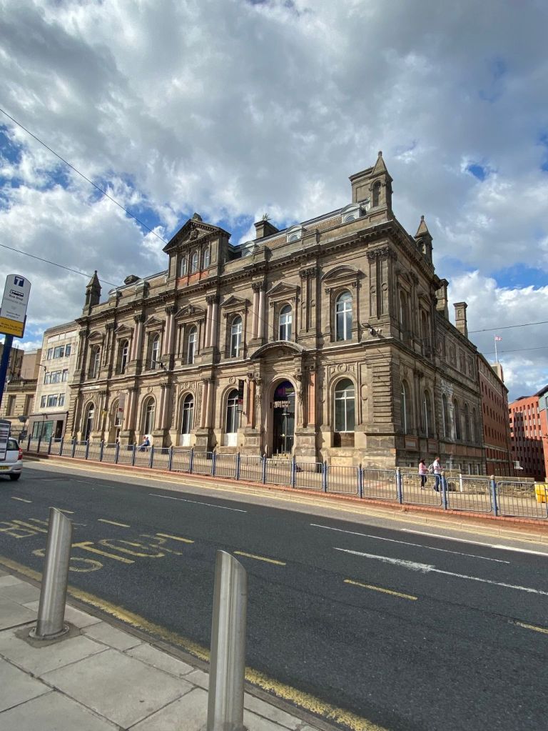
Both the old Post Office and gas showrooms survive but have been empty for years, the latter regarded as one of Sheffield’s finest Victorian buildings, and is now called Canada House, subject of a current planning application to turn it into Harmony Works, a new home for music education in the region.
Former Gas offices on Commercial Street. Image: DJP/2022
However, Barclays Bank and the King’s Arms Hotel were both demolished in the late 1960s as part of further road improvements. It had been decided to make Commercial Street a dual carriageway, linking it to Park Square and Sheffield Parkway, and the two old buildings were swept away. The bank relocated to a newly constructed white office block (behind the site of the old King’s Arms Hotel) and subsequently became Commercial House, occupied these days by law firm Knights.
Fitzalan Square looking towards Commercial Street and Gas Company Offices, 1880-1890, Birmingham District and Counties Banking Co. Ltd, right, General Post Office, left. Image: Picture Sheffield
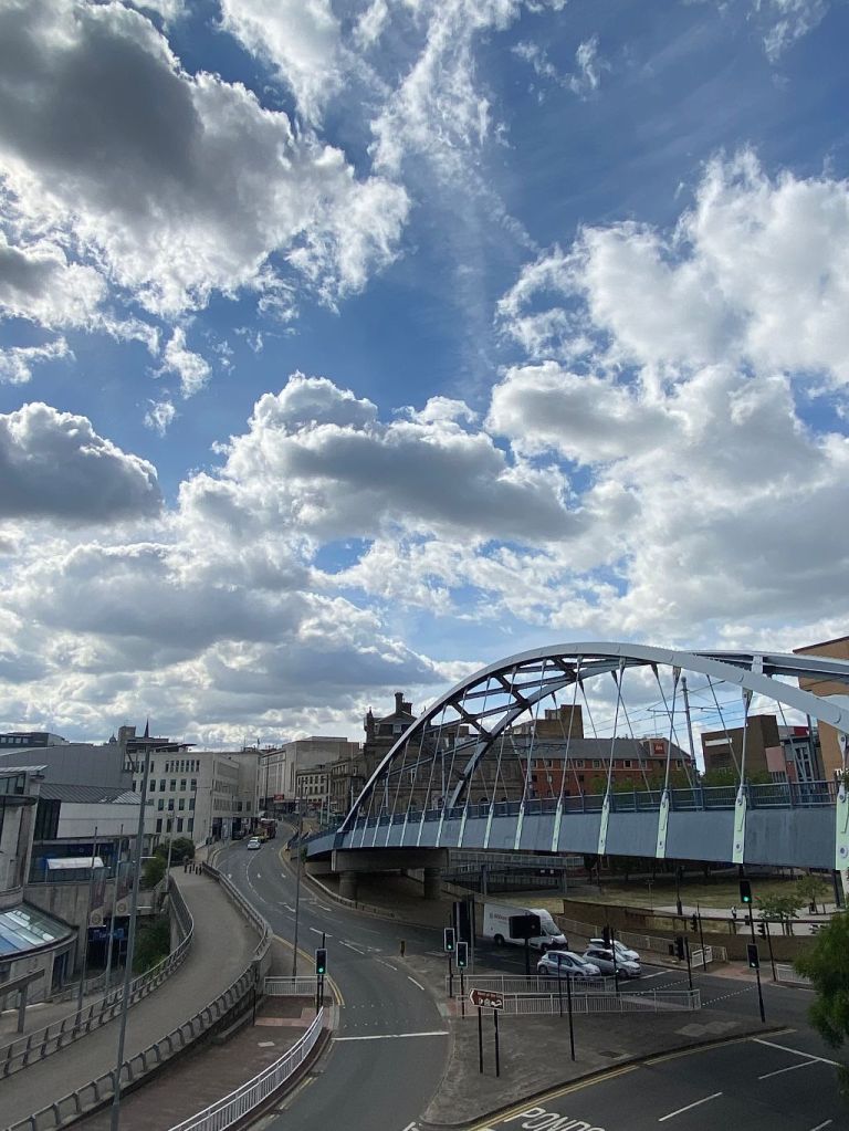
Ponds Forge International Leisure Centre was added to the bottom of Commercial Street by architects FaulknerBrowns for the World Student Games between 1989-1991.
But a few years later, Commercial Street underwent its biggest transformation with the building of Sheffield Supertram. The original line of the street was covered with new tram tracks, a gateway into the city centre, while the carriageway built on the site of the bank and hotel retained road traffic.
The construction of the iconic bowstring steel arch bridge allowed trams to travel over Park Square Roundabout, across Shude Hill, and onwards through the city centre.
Considering that Commercial Street is about 150 years old, building work has been limited, and there is no denying that recent times have been unkind. Empty buildings and graffiti blight the street, but with the redevelopment of Fitzalan Square, the Grey-to-Green project, proposals to develop Castlegate, and its proximity to Sheffield Hallam University, means that the future might be considerably brighter.
Commercial Street. Unrecognisable from the days when it was built. Image: DJP/2022
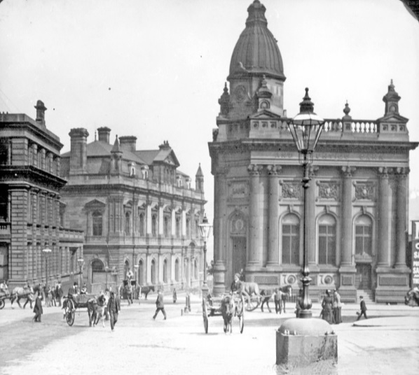
Sheffield City Hall, Barker’s Pool, with Holly Street (left), and Balm Green (right). Image: GoogleEarth
I have an intriguing question. If we were to dig beneath the roads flanking the City Hall, what would we find?
Holly Street and Balm Green, both 60ft wide, were created in 1932 to service the newly constructed building.
“The importance of a big space is emphasised when it is realised that between 3,000 and 4,000 people will frequently leave the City Hall within a few minutes and many of them will have motor-cars,” said M. J. Hadfield, the City Engineer, at the time.
It turned out to be a massive undertaking because the roads were built over old cellars and three deep wells and required a bed of 12 inch concrete with double reinforcements, triangulated to provide the greatest possible strength at the least expense. Masses of iron rods were intertwined in the form of triangles, allowing the roads to carry weights more than 100 tons.
The cellars had belonged to shops between Pool Square and Holly Street and had been erected well over a hundred years before. In the first instance they were private dwellings, but in the course of time were reconstructed and remodelled as shops and demolished to make way for the City Hall.
What undiscovered treasures lay beneath these roads?
In the Burgery of 1609 Holly Street is referred to as Blynde Lane, and in 1700 is called Blind Lane or Hollin Lane, while the records of 1823 show it as Hollin Street. The corruption of Hollin Street to Holly Street is simple because ‘hollin’ or ‘hollen’ was an ancient name for holly.
In Fairbank’s survey, what is now Barker’s Pool appears as Balm Green, while the lane now known as Balm Green was called Flint Well. In Taylor’s survey of 1832, Balm Green had been renamed Barker’s Pool, while Flint Well was known as Flint Well Lane. With the building of the City Hall, Flint Well Lane became Balm Green.
The origin of Balm Green is one that has puzzled historians, but there is a likely explanation.
Joseph Woolhouse wrote in 1832, that a Mr Barker was living at Balm House, a large farmhouse supposed to be situated in Coal Pit Lane (now Cambridge Street). Behind the house were orchards where now Back Fields is. It is possible that Balm Green was the herb garden attached to the orchards.
But we should also consider that Orchard Street, between Church Street and Leopold Street, was once the site of an extensive fruit garden known as Brelsforth’s Orchard, and Balm Green might have been the herb garden attached to this property instead.
A less likely theory suggests that the open space between the former John Lewis department store and the City Hall was once called Le Baine, with an early reference in a deed of 1333. Because the area was rich in springs and wells, it has been suggested that Le Baine evolved from the Latin word ‘balneum’, a warm bath, or a place for swimming, and eventually into ‘balm’.
Mr Barker established our first waterworks at Balm Green in 1434. The area subsequently became Barker’s Pool and two centuries later, it was cleaned and repaired by a public benefactor, Robert Rollinson, and for upwards of three centuries was in daily use. The pool in its latter days became defiled; the rubbish of the town, and dead animals, were thrown in, and it was subsequently filled up in 1793.
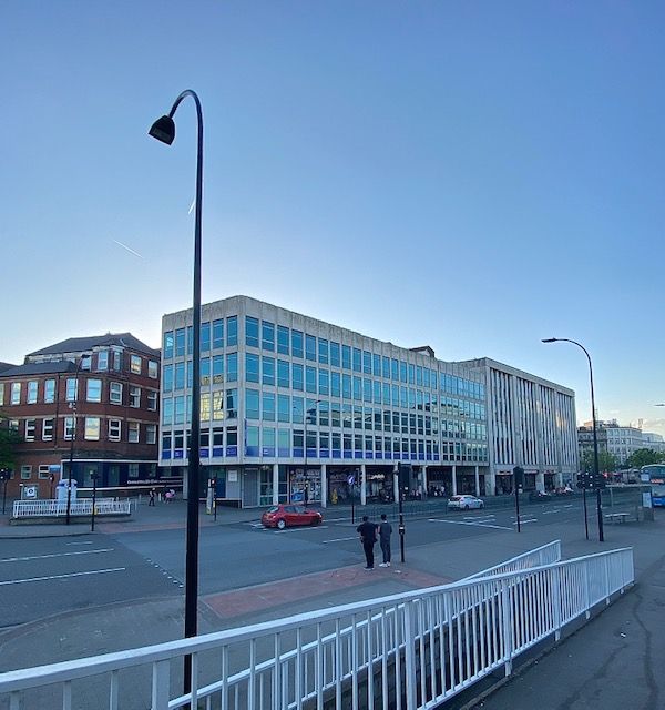
It is hard to imagine that beneath Arundel Gate, at its junction with Norfolk Street, is a lost road. When the dual carriageway was constructed in the 1960s, it swept away a street that had once been one of the most influential in Sheffield.
As someone who researches our past, the name of Milk Street frequently appears in the obituaries of well-known medical men, clergymen, merchants, manufacturers, solicitors, and people who rose to prominence, not only in Sheffield, but across Britain, and in all parts of the world.
Milk Street had once been called Petticoat Lane, but by the 1700s had changed its name, and in 1800 became the site of Milk Street Academy, its most famous building.
The academy was established by John Hessay Abraham, a Methodist, as a classical, commercial, philosophical, and mathematical seminary for boys. It used a single room in an existing building and was soon successful enough to occupy the rest of it.
Beneath Arundel Gate, at its junction with Norfolk Street, is a lost road. Image: DJP/2022
At this time, elementary education in Sheffield was poor, and only the wealthiest people paid for the privilege of private schooling. The boys started lessons at 7am and the curriculum included English, French, mathematics, penmanship, drawing, and the use of the globe. That a very high standard was reached may be judged in the London ‘Universal Magazine’ for April 1805, which produced ‘Juvenile Essays, comprising, in order of merit, the first and second half-yearly prize competitions of the pupils belonging to the Milk Street Academy, Sheffield.’
J.H. Abraham has appeared on these pages before as one of the occupants of Holy Green House. He was an extremely clever man, a Fellow of the Royal Society, and on his death in 1846, his extensive library was auctioned and included standard works in literature, especially philosophy, astronomy, electricity, magnetism, galvanism, chemistry, and mathematics.
In 1840, his daughter Emma had married Richard Bowling, a teacher of twenty years at Milk Street, who succeeded Abraham as principal.
Under ‘Dicky’ Bowling, the academy thrived and achieved success at preparing pupils for Oxford and Cambridge.
He was a fine gentleman – 5ft 11in high and very proportionate, a thorough disciplinarian – a good, all-round scholar who besides the three r’s which he thoroughly drilled into his pupils, taught Latin and Greek.
One guinea a quarter was the fee, drawing and languages extra, and when a new scholar arrived, the father had to pay a 5 shillings entrance fee.
There were about 400 boys in total, and there was what was called the Cabinet, which went to the boy who attained first prize in all subjects.
However, Bowling’s methods were somewhat barbaric.
“For playing truant he laid a boy across the desk (or on another boy’s back) and put his trousers down and gave him the cane on his bare flesh,” said a former pupil. “One boy was made to stand on the form while he sent another boy for an old-fashioned treacle-stick. He tore part of the paper off and made him suck it for a quarter of an hour allowing the schoolboys to jeer at him all the time.”
“I remember him giving me a severe blow to the side of the face because I was holding my pen improperly,” said another. “However, I remember Mr Bowling with pleasant memories as a great and distinguished schoolmaster, who developed in us the faculties which have contributed to any success we may have attained.”
All in all, the boys appeared to enjoy themselves, with physical education taking place at playing fields on the site of the old Winter Street Hospital, now part of Sheffield University. When let loose, they used Cheney Square (lost underneath the Town Hall) as happy hunting grounds.
Bowling resided at Norwood Rise, Pitsmoor, and subsequently at Clough House. At both places he had boarders, who attended the school every day. On his death in 1876, the academy became Milk Street School and continued under the partnership of his son, Walter Henry Bowling, and John Irwin, a former master, who, aged eighteen, had been apprenticed to the academy.
However, its days were numbered, hastened by the 1870 Education Act, the first legislation to provide for national education and create school boards across the country.
Milk Street from Sycamore Street looking towards Norfolk Street (1851-1859). Image: Picture Sheffield
In August 1880, Irwin closed Milk Street School, now surrounded by industry, and moved it to Montgomery College, Sharrow.
Gone, but not forgotten. “One Sheffield institution which is frequently mentioned in records of the early careers of public men is the old Milk Street School,” said a newspaper in 1904. “It is referred to more frequently even than the Grammar School or Wesley School as the educational home of prominent citizens. There seem to be few records of the school left, and the old boys have not formed themselves into an association.”
A few years later, the Rescue and Evangelisation Mission was established in the old building, and in 1913 it was occupied by the Sheffield Chauffeurs’ Society, that promoted sociability amongst its drivers, and to safeguard members. It later became premises for Harry Hartley and Son, hardware merchants.
The building and the street may have long disappeared, but you might be interested to know that the name lives on, and not far away from its original location.
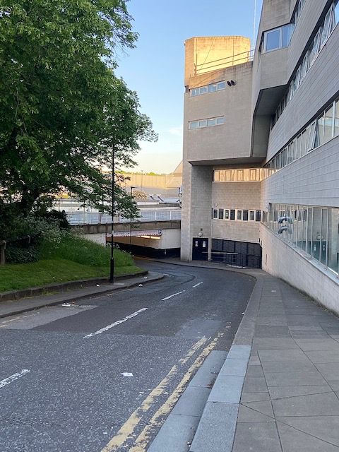
Beside the Crucible Theatre, leading from Norfolk Street, underneath Arundel Gate to the multi-storey car-park, is a service road, appropriately called… Milk Street.
Besides the Crucible Theatre, leading from Norfolk Street, underneath Arundel Gate to the multi-storey car-park, is a service road, appropriately called Milk Street. Image: DJP/2022