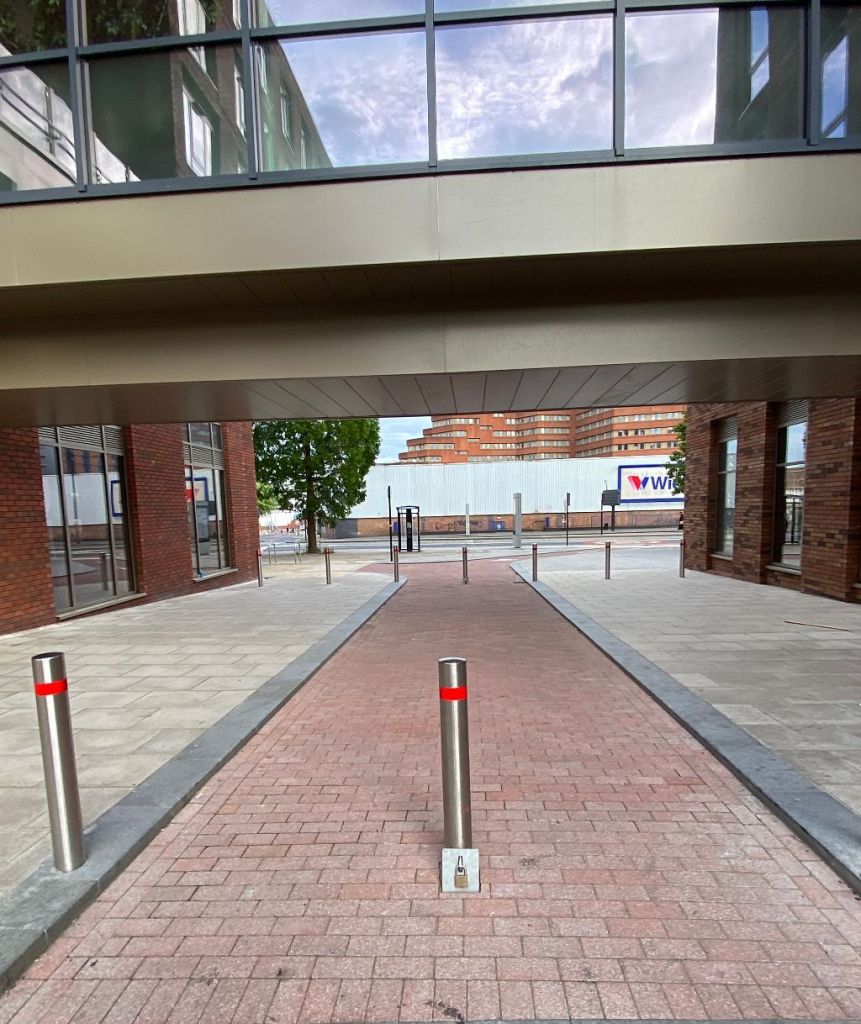
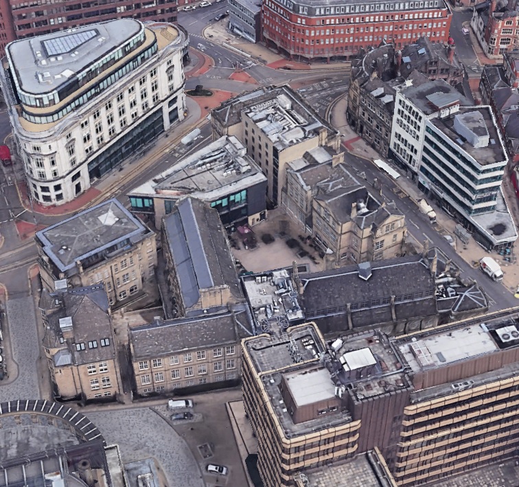
Thomas Street, looking towards Moore Street, with a covered walkway between Cosmos, recently constructed student accommodation.
This was formerly the site of Stokes Tiles, but back in 1892 we would have been looking at a much narrower Thomas Street, with the Noah’s Ark public house evident. The council paid £750 for 113 square yards of freehold land from Tennant Bros for the purpose of widening these streets.
Former back-to-back housing in the area was cleared and made way for industry, but times change, and the people are returning.
In the background is the Moorfoot Building, and Wickes, this land now under ownership of NewRiver, owners of The Moor, and I’m informed will be assigned for further residential development.
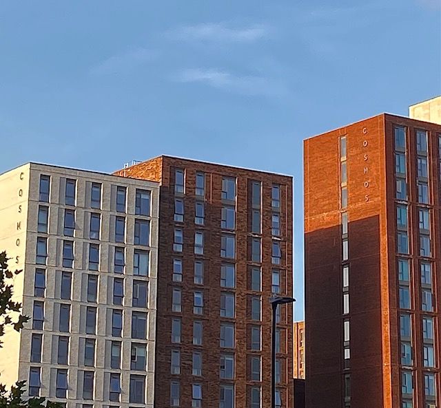
Cosmos. New student accommodation situated at the corner of Fitzwilliam Street and Moore Street. The people are returning to Sheffield city centre. Image: DJP/2021
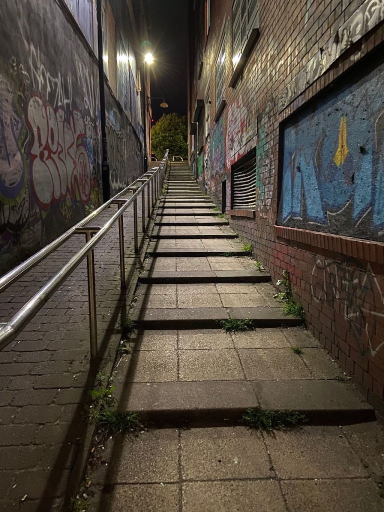
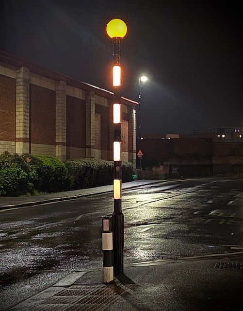
Grinders Hill. Lonely at 3am. A shortcut for our ancestors… a shortcut for us now.
But it nearly wasn’t.
November 1935. “The City of Sheffield. Notice is hereby given that a certain public highway to wit a footway known as ‘Grinders Hill’ situate in Sheffield and running in a south-westerly direction between certain other public highways known as Paternoster Row and Leadmill Road shall be entirely stopped up as being useless and unnecessary for the public.”
The motion failed, and Grinders Hill is still with us.
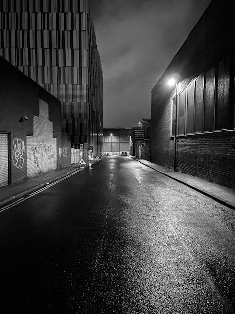
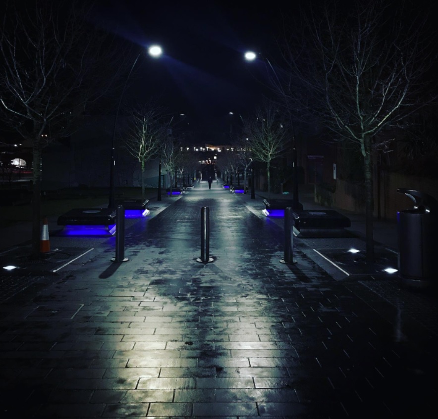
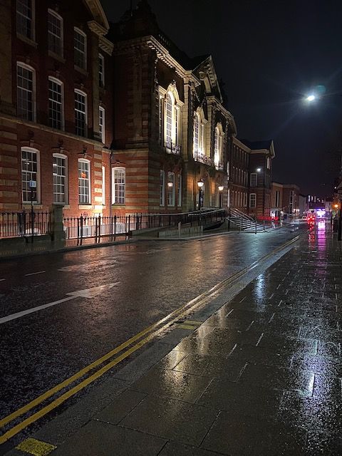
While you were sleeping last night. This is a wet and deserted Earl Way, which lies parallel between The Moor and Eyre Street.
If we go back to Norman times, and the time of Thomas de Furnival, this was thought to have been the site of a large ditch at the edge of Sheffield Deer Park, one of England’s largest deer parks, and spanning a circumference of eight miles in total.
Earl Way is modern compared to most Sheffield roads. It was created in the second half of the twentieth century when this part of the city centre was redeveloped. Prior to this, there were three significant roads in the vicinity.
These were Porter Street, that ran diagonally from Hereford Street, towards Moorhead, and Porter Lane, a narrow road that linked it with Union Lane.
Union Lane once ran from Charles Street, near to the Roebuck Tavern, across Furnival Road (now Furnival Gate) and ended at Jessop Street (where the Moor Market now stands). The only surviving section of Union Lane is behind Derwent House, near The Roebuck (think deer).
In this photograph, it would have run along the left hand side where the former Plug nightclub and Kit-Kat car-park stand. Porter Street would have been to the right.
If we could go back in time, right in the centre of the picture, and in the middle of the road, would have been Porter Street School.
There were two reasons why Earl Way came into being.
Up until the 1930s, this was an area of back-to-back housing and designated for slum clearance. Then came World War Two. German bombs caused extensive damage around The Moor, Porter Street, and Eyre Street, leaving the site to be redeveloped afterwards.
Union Lane disappeared, and Earl Way was built as a link road to Earl Street (seen running across the end of the road here).
And familiar landmarks appeared too, including the Pump Tavern, later demolished to make way for the Moor Market, and Violet May, a record shop, run by a pivotal figure in the development of the music scene in Sheffield.
Perhaps the most dramatic modern building is the Kit-Kat car-park, designed by Broadway Malyan in 2008, and sold for £9m last month by joint owners NewRiver and BRAVO Strategies.
A few weeks ago, I was in a bit of a quagmire. I had pages and pages of research notes and needed something to piece them together. I spent hours cross-checking facts, but a vital link was missing. And then I found a letter in an old newspaper that proved to be my eureka moment.
The letter was written in 1933 by Henry Tatton, who solved my mystery in five short paragraphs. I was ecstatic and thought it only right to thank him on my Facebook page.
Sadly, Henry will not have seen my appreciation because he is long-dead. But I could imagine an elderly gentleman, writing at his kitchen table, not knowing how important his words would prove to be almost ninety years later.
And then, I decided to find out a bit more about him. What I found was quite significant.
Sheffield has had fine historians – Robert Eadon Leader, Rev. William Odom, Edward Vickers, Peter Harvey, the list goes on – and the name of Henry Tatton should also be included. He turned out to be a prolific letter writer, each one providing insight into our history.
Sheffield Daily Telegraph. June 1927. A typical letter from Henry Tatton
Henry was born in Sheffield in 1864, the son of Adam and Mary Tatton, and lived at Sheaf Gardens. He was educated at Brunswick Wesleyan Day School and in 1878 was working as a pattern maker to Thomas Steade, iron founder, in Cemetery Road.
He married Susan in 1889 at Townhead Street Baptist Chapel and lived at Lancing Road, off Shoreham Street. In 1898, they had a shop in Matilda Street and, along with his father, an ironmonger’s stall in the Norfolk Market Hall.
Advertisement from 1929. Henry Tatton, Norfolk Market Hall
It is said that, after moving to 69 Ranby Road in 1919, Henry learnt to draw, and began recording his memories in a series of notebooks. However, I suspect that his talents went back much further when, as a young man, he appears to have studied drawing at the Sheffield Mechanics’ Institute.
His drawings were copied from old newspapers, but many were originals. The reason he gave for his work was his ‘love of his native Sheffield.’ He retired in 1929 and, despite failing eyesight, completed his third notebook in 1931. Six years later, in 1937, the three thick foolscap notebooks were presented to Sheffield City Libraries, where they remain.
One of the factors that makes the books even more interesting were the dated notes of the state of each building when he wrote. He paid particular attention to any prospect of demolition, and this was often the reason for choosing a building to sketch.
A sample of Henry Tatton’s work.
In 1939, Henry added to his reminiscences with thirty-six closely-written manuscript pages.
He recalled the time that he saw the last stagecoach come into Sheffield. It was from Chesterfield and stopped at the Travellers’ Rest on The Moor. Shops under the names of Roberts, Atkinsons, and Binns, were just being opened.
After giving close details of shops and other buildings in High Street, Church Street, Fargate, Angel Street – which were then only wide enough to allow the passage of two wagonettes – he told of the suburbs as they were in those days.
The outskirts of town were surrounded by natural beauty, and bounded by Sharrow Lane, Collegiate Crescent, Rock Street, Hyde Park, and Shrewsbury Road.
Ironically, Henry recalls that a fine row of trees was cut down at Highfield, and the resulting public outcry in newspapers against what was considered ‘destruction.’ Yes, history does repeat itself.
He also remembered the days when there was neither ‘telephones nor telegraph’ and ‘hot’ news was collected by hansom cab. Handicap races were run in Hyde Park, and he recalled thrilling races between cabs going to the newspaper offices with the results.
Henry died, almost blind, in 1947, aged eighty-six, and was buried at Norton Cemetery.
There is a rare book, ‘Fine Old Sheffield – An historical walk with Henry Tatton’, edited by Sylvia Anginotti, with meticulous research by Sylvia Jackson, which shaped this article, and the time is right for his notebooks to be reproduced in a book.
All these years later, it seems strange that this post is cheaply imitating what Henry did best. He saw significant changes, but it might be one he could never have imagined – the internet – that reawakens our interest in one of Sheffield’s forgotten men.
May 1850. Water that flowed down an underground sewer in Howard Street had formerly been derived from springs in the neighbourhood. It ran down the hillside and emptied into the River Sheaf near the Pond tilt. All went well until several properties in Eyre Street, at the top of the hill, started emptying waste into the drain. It might not have been an issue had it not been for Thomas Dewsnap of Arundel Works, who discovered that his father had diverted the sewer to a reservoir at the works and used the water to power a steam engine. The reservoir water started giving-off a foul smell and after numerous complaints from neighbours was deemed to be injurious to the health of the neighbourhood.
July 1885. Henry Bradbury, a boy, living in South Lane, was charged with stealing seven newspapers from the shop of Mrs Pearson. The youngster made a small profit by selling the newspapers to men living in the slum neighbourhood. With this money he bought food for his brothers and sisters. He had previously been convicted of similar thefts and was sentenced to seven days’ imprisonment and hard labour. He cried in court.
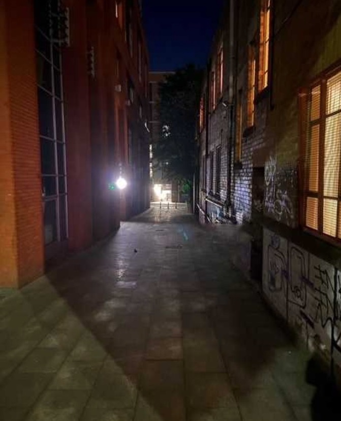
Last night I met the old man with the pipe. He was leaning against a wall. “Good evening again,” he said. “This is a lonely spot,” I commented. “Aye lad, it is that. Duke Lane is not a nice place at night. Just last week, three ruffians went into the Three Legs of Man down yonder, and such a commotion they caused. Police Constable Hobson was called and ordered them to go away. The poor man was knocked down and kicked. He blew his whistle and they got ‘em, and all three went to prison for hard labour.” I looked at the scene of the crime and when I turned back to the old man he had disappeared.
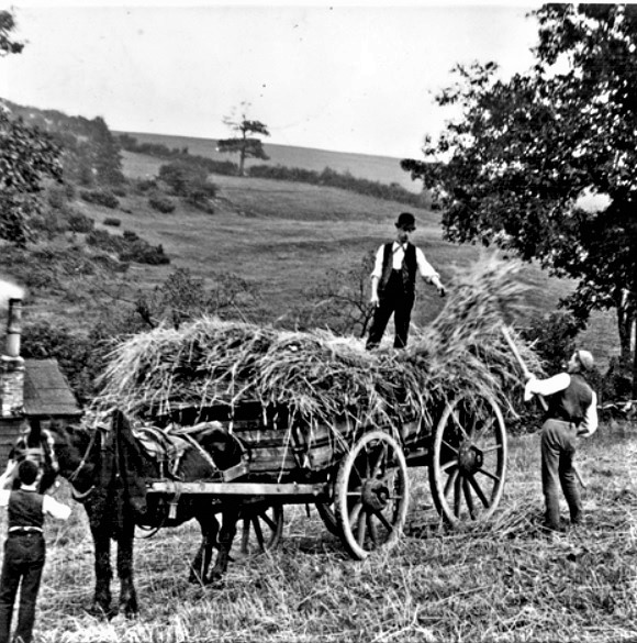
In 1892, a Mr Cunningham captured a scene of haymaking. A farm worker gathers hay by fork and piles it onto the back of a horse-drawn wagon on which a bowler-hatted man stands. Tending the horse is a young boy. In the background, a fire is on the go in an old cottage and smoke rises from the chimney. It is a scene of rural paradise with fields and trees rising-up the hillside behind.
Within fifty years this pastoral scene had disappeared. Sheffield’s growing population needed rehousing, and many were moved from old city centre slums into new housing estates that crept up the hillsides.
This photograph was taken on East Bank Road, and I’m led to believe that the old cottage stood in a glade behind Midhill House, a large country property that became what is now the Earl Marshall pub.
Still countryside but not for long. East Bank Road photographed in 1946.Image:Picture Sheffield
The road itself, then little more than a country lane, climbed the hillside and had once ended at Midhill house before eventually being extended towards the village of Gleadless.
The Arbourthorne estate, at the top of East Bank Road, was under construction by the mid-1930s and the road widened, with council houses built on the opposite side to Midhill House. The first bus service between Sheffield and Gleadless came up here from 1937 (and continues as the No. 51 bus route).
East Bank Road seen from from East Road, looking towards, No 291, Midhill Working Men’s Club and Institute Ltd (formerly Midhill House) in 1946. Image: Picture Sheffield
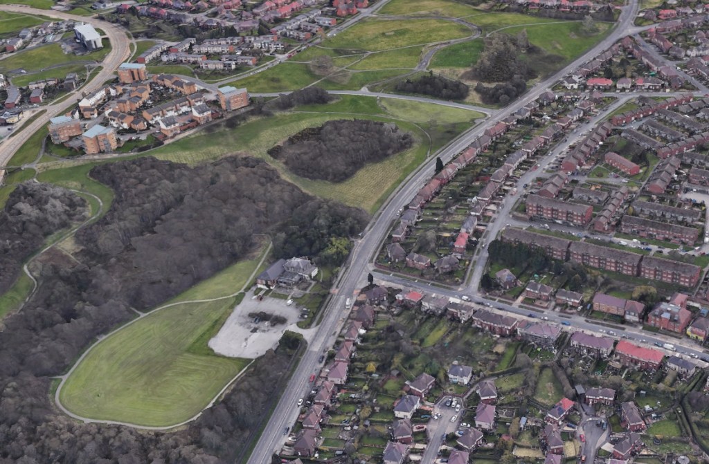
The old cottage disappeared, and farmland became property of Sheffield Corporation, and although housing eventually surrounded this little oasis, the area around Midhill House remained green space. The Norfolk Park estate was built at the top of the hill behind.
Modern day view of East Bank Road. Midhill House, now the Earl Marshall pub, survives. The old cottage in the haymaking photograph is believed to have existed where woodland now stands behind the house. Image: Google
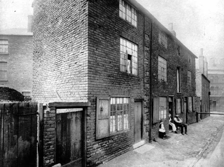
West side of Sands Paviours (ran from Orchard Lane to Bow Street), pre 1890, demolished to make way for the Central Schools, Science School. Image: Picture Sheffield
Today, a look at a street in Sheffield city centre that was consigned to history long ago.
In 1874, a plan was produced by Sheffield architects, Innocent and Brown, for the laying out of Leopold Street, and the realignment of Church Street and Bow Street (now the bottom-end of West Street).
About this time, land between Orchard Lane, Bow Street, Orchard Street and Balm Green was covered by old houses in two streets, Smith Street and Sands Paviours.
The site was bought by the Sheffield School Board for building the Central Schools and offices. At the same time, Mark Firth founded Firth College, later part of the University of Sheffield, and this was opened by Prince Leopold in 1879.
The removal of old property between Bow Street and Orchard Lane caused the obliteration of the marvellously named Sands Paviours.
But what had once been a pathway across rural land had become a street of slum housing, workshops, shops, and a public house called the Norfolk Arms. And murder and crime were evident on the street.
According to John Daniel Leader, this little court of houses may have derived its name from Samuel Sands, who flourished in the reign of Queen Ann.
By an indenture dated 25 September 1708, Samuel Sands, a Sheffield cutler, conveyed to George Hawke of Leavygreave, yeoman, for the sum of £100, all that messuage, near the Townhead Cross with a smithy, barn, orchard, and garden, lately in the possession of John Hobson; also, a cottage adjoining, lately in the possession of Mary Wilson, to hold the same for ever of the chief Lord or Lords of the fee. The vendor signed his name ‘Samwell Sandes.”
However, there was another suggestion for it being named so.
In other towns there were streets called Sans Paviours (without paving stones), and it might be that because Sandes’ house was here, that he saw the name Sans Paviours elsewhere, and thought it appropriate for his own property.
The mystery was cleared up when the land was bought by the School Board, and the old deeds showed that it had been in the family called Sandes from 1657 to 1727, and that early mention was also made to Sands Croft and Sands Orchard.
Like many old street names that were adapted over the years, Sands Paviours was also referred to as Saint Pavers.
Remember this the next time you relax in Leopold Square. There is history beneath your feet.
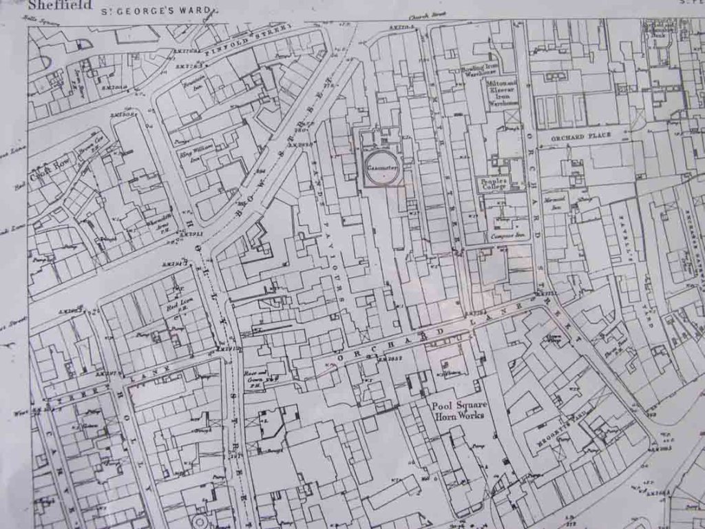
Sands Paviors once ran from Orchard Lane to Bow Street (now the bottom part of West Street). Image: Google
Last night, I met an elderly gentleman, who stood smoking a pipe outside the gate to St George’s Church. “It’s a wet night,” he obliged. “Aye, but Mappin Street looks very beautiful in the rain,” I said.
“Nay lad. This is Charlotte Street, and before that it was St George’s Square.” He paused. “I understand why you might be confused,” and pointed his pipe back towards West Street.
“Walk back yonder and look at the white paint on the building at the end. It says ‘Zarlot Street.’ Once upon a time, there was a Pitman Society in Sheffield, and they persuaded the town authorities to allow them to name our streets phonetically. That’s the last reminder, but it’s always been Charlotte Street to us.”
And Charlotte Street became Mappin Street, named after Sir Frederick Mappin, whose building for the University of Sheffield was completed in 1913.