Categories
Streets

Cheney Row

My favourite walkway in Sheffield. Cheney Row, running alongside the Town Hall and Peace Gardens. It is a name transferred from Cheney Square, a group of nice houses destroyed when Surrey Street and the Town Hall were in the making during the 1890s. One of them was the residence for many years of Hugh Cheney, a doctor. The site of Cheney Square, being on the fringe of a small town, developed after the breaking up of Alsop Fields (a long-lost name), and with the building of St. Paul’s Church and the laying out of its large burial ground. The church stood on the site of the Peace Gardens and was demolished in 1938.

Categories
Streets

Cheney Row

A relic of the past. Cheney Row runs alongside the Town Hall adjacent to the Peace Gardens. It is an old thoroughfare, a survivor from the days of Cheney Square, demolished during the construction of the Town Hall in the 1890s.

Cheney is a very old Sheffield name, being found in the accounts of the Burgery as far back as 1645.

There is a record that says one Edward Cheney, in 1725, bought surplus land left over from the building of St. Paul’s Church, which stood on the site of the Peace Gardens and was demolished in 1938.

The land was known as Oxley Croft before the church was built, but that name disappeared and, in its place, we had New Church Street (also gone) and Cheney Row and Square.

In some old directories the name appeared as China Square, probably the result of a ‘politically-correct’ compiler believing that Cheney was a derivation of China.

And again, the name Cheney has been traced to Dr Hugh Cheney, originally from Bakewell, one of the first surgeons at the Royal Infirmary, who lived in a house at the corner of Cheney Square about 1803. But it was Cheney Square before his time.

There is little doubt that the Edward Cheney, who bought the surplus land of Oxley Croft, built the houses and called two of the thoroughfares after himself.

In January 1886 the Town Council decided that a site bounded by Pinstone Street, (New) Surrey Street, Norfolk Street, and Cheney Row should be utilised for a new Town Hall, and that New Church Street, Cheney Square and an unnamed lane should disappear.

Categories
Streets

Cabbage Alley

Somewhere underneath Sheffield Town Hall there are likely to be the remains of a dark, narrow, cobbled lane with the sweet-sounding name of Cabbage Alley.

Its existence is almost airbrushed from history, partly because those that used it back in the day didn’t even know that it had a name.

This photograph remains the only image of Cabbage Alley, reproduced in a newspaper in 1931, taken from an old painting by William Topham in 1877, of which its current existence is unknown.

The picture is a view down Cabbage Alley, looking towards the south. In the background can be seen St. Paul’s Church, built in the 1720s and demolished in 1938. In its place we now have the Peace Gardens.

Cabbage Alley ran from New Church Street, both demolished when the Town Hall was built in the 1890s, and Cheney Row, a walkway that survives.

The painting that emerged in 1931 belonged to Mr Ambrose James Wallis, head of Ambrose Wallis and Son, whitesmiths, of Norfolk Lane. His father, who commissioned the artwork, had set up business in Cabbage Alley in 1867 and remained there until about 1889.

“Cabbage Alley was an old-fashioned street even in those days,” he told the Sheffield Daily Independent. “The gutter ran down the centre instead of at the sides.

“A strange thing was that nobody seemed to know its name, and it was not until the notices for us to quit were received, that we learned that we had been living in Cabbage Alley.”

Categories
Streets

Barker’s Pool

A prominent street with a name that has been familiar for centuries. In Barker Pool, or Barker’s Pool as we now know it, we have the first attempt to give the inhabitants of Sheffield a constant supply of pure water.

The tradition is that one Mr Barker, of Balm Green, in 1434, took steps to make some sort of reservoir for the storage of water supplied by springs.

All we know for certain, is that in this year, there had been a “Barker of Balm”, and that there had been a William Barkar in 1379.

“Barker Powle” is mentioned in a deed of 1567, and in 1570 the Burgery was ‘amerced’ in the sum of 3s. 3d., paid as a fine, or rent, to the Lord of the Manor, for the pool.

From this date until 1786, the cleansing and keeping of the pool was acknowledged as one of the specific charges upon the town property.

Indeed, we can bring it to a later date than this, for after the pool, superseded by a more efficient water supply, had been removed as a nuisance in 1793, the Town Trustees put up a pump nearby which remained, although unused in later years, until 1876.

The pool was an oblong, walled space, about 36 yards by 20, not quite right-angled, for it was slightly wider at its upper than at its lower end, and ran across what eventually became the entrance to Division Street.

It appears that Barker Pool was, on occasion, used for ducking undesirable characters, for in the constables’ accounts for 1654, there is a charge for bringing the cucking stool (from Lady’s Bridge) up to Barker Pool. (Cucking stools or ducking stools, were chairs used for punishment of disorderly women, scolds (troublesome and angry people who habitually chastised, argued and quarrelled with their neighbours) and dishonest tradesmen.

We get our best description of the part the pool played in the local economy from the autobiography of Samuel Roberts in 1849.

In it, he gives a vivid account of the excitement caused amongst residents in the streets down which the channels passed, when periodical flushings afforded a general clean-up of the town: –

“All the channels were then in the middle of the streets which were generally in a very disorderly state, manure heaps often lying in them for a week together. About once every quarter the water was let out of Barker Pool, to run into all these streets into which it could be turned, for the purpose of cleansing them. The bellman gave notice of the exact time, and the favoured streets were all bustle, with a row of men, women and children on each side of the channel, anxiously and joyfully awaiting, with mops, brooms, and pails, the arrival of the cleansing flood, whose first appearance was announced by a long, continuous shout. Some people were throwing the water up against their houses and windows; some raking the garbage into the kennel; some washing their pigs; some sweeping the pavement; youngsters throwing water on their companions or pushing them into the widespread torrent. Meanwhile a constant, Babel-like uproar, mixed with the barking of dogs, and the grunting of pigs, was heard both above and below, till the waters, after about half an hour, had become exhausted.”

Barker Pool was also used when fires broke out in the town, water being let out of the reservoir, and leather buckets hung in the Church and Town Hall for residents to use. By 1703, the Town Trustees had improved on this by providing a fire engine.

And that, as they say, is the history of why we call it Barker’s Pool all these years later.

Categories
Streets

Paradise Square

On a cold rainy night, it’s hard to believe that Paradise Square was once a cornfield called Hick Stile Field.

About 1736, Nicholas Broadbent, a successful merchant of Old Bank House, Hartshead, built a row of five houses on the Shrewsbury Hospital estate, along the east side of the field and called it, for some reason only known to himself, Paradise Row.

In 1771, his grandson, Thomas, a banker, obtained a lease of the cornfield, which he offered for subleases in building lots, designed by William Fairbank.

The square was to be called after the row of houses already built, and between 1771 and 1790 he laid out the other three sides of the square with a variety of houses.

It was this same Thomas who was responsible for building Page Hall, constructed for his own use, but unable to be completed due to the collapse of his bank in 1782.

The square and its occupants have played an important part in Sheffield history.

The painter and sculptor Francis Chantry had rooms at No.24 in 1802, and Dr David Daniel Davis, the physician who attended the birth of Queen Victoria, lived at No.12 from 1803 to 1812.

No.18 was the Freemasons Lodge in the early 19th century, and the House of Help for Women and Girls was set up at No.1 in 1885 to rescue those “in moral danger and miserable surroundings.”

Paradise Square was used for a time as a market-place and its size and slope made it an ideal meeting venue. In 1779, John Wesley preached to a vast crowd from the balcony of No.18, and to the alarm of authorities thousands gathered here to support the Chartists’ cause in the 1830s and 1840s.

The square was also home to Mr Edward Hebblethwaite’s academy, one of the leading schools in the town, and from which ladies and gentlemen went on to command high positions in society, both at home and abroad.

He started as a schoolmaster, aged 21, at the Lancastrian School, later having his employment terminated. “He was passing through the streets of Sheffield very much depressed, with his eyes cast down and wondering what he should do, when he walked into the well-known square and saw premises to let, which he took to carry on a mixed school.”

The school opened in 1829 and lasted until about 1865.

It was notable through its connection with political history. The broad flight of stone steps leading to its entrance were often used by political candidates to address electors, and it was from here that the likes of J.A. Stuart Wortley, Lord Brougham, Earl Fitzwilliam, Ebenezer Elliott and James Montgomery tried to improve the townsfolk.

When middle-class residents started to move out the square slipped into dereliction and decay, resulting in a comprehensive restoration scheme of 1963-1966 directed by Hadfield Cawkwell Davidson and Partners.

Categories
Streets

Pepper Alley

I bet most of you have never heard of the delightfully named Pepper Alley. This was once a thoroughfare passing from Fargate to Norfolk Street, quite close to the surviving Upper Chapel.

Its existence is shown on this map, taken from “A Correct Plan of the Town of Sheffield, in the County of York, drawn by William Fairbanks, 1771.”

You’ll notice that Norfolk Row, pictured, doesn’t appear on the map at all, only coming into existence about nine years later. However, Chapel Walk is shown.

A little bit of Pepper Alley (Pepper is a local surname) can still be seen today, leading into Upper Chapel Yard, behind the shops which form part of the former YMCA property, now named Carmel House, at the corner with Fargate.

If you study the map you’ll see that the Town Hall stood by the Church Gates (now the Cathedral), at the junction of High Street and Church Lane (now Church Street).

Other names to look for are Bullstake (now Haymarket), Pudding Lane (King Street), Castle Green Head (Castle Street), Irish Cross (Queen Street), and Pinstone Croft Lane (Pinstone Street)

Categories
Streets

George Street

It is one of Sheffield’s oldest streets and contains some of our most significant buildings, including the former premises of the Sheffield Banking Company, now reborn as the Curzon Cinema (middle right), the old offices of the Alliance Insurance Company (centre) and the 1960s-built Cutler’s Hotel (left, originally the Sheffield Club).

The greatest mystery with George Street is the “dog’s hind leg” half-way along, a cause of traffic congestion in Victorian and Edwardian times, as it was a thoroughfare between High Street and Norfolk Street.

While many roads were widened, George Street was mercifully spared, despite our ancestors wanting the road to be straightened. This would have necessitated wholesale demolition of buildings.

The street’s historic layout was secured when the offices of the Alliance Insurance Company were built in 1913-1914, replacing the old Sheffield Fire Insurance Company building where the town fire engine was once housed.

It is now the NSPCC, Sheffield Service Centre.

Categories
Buildings Streets

Fargate

The long-term plan for Fargate is to address the decline of retail and focus on leisure instead.

The regeneration of The Moor as a retail destination and the future development of Heart of the City II, which on completion will consolidate the retail core to the south of Fargate, has prompted Sheffield City Council to bid for up to £25million of government funding to improve the pedestrianised street.

It comes as no surprise then that the council has granted planning permission for the conversion of the old Next building at the corner of Norfolk Row.

Woodhead Investments’ proposal for a dining venue, along with a roof terrace fronting Norfolk Row, was accepted by the council, seen as regenerating the area.

Next relocated to The Moor in August, and the empty store was used as a pop-up Christmas shop during November and December.

The unit will be renovated to designs by Pearce Bottomley Architects, using new glazed panels and stone cladding, with a minimalist clock placed at the front of the building.

Categories
Streets

West Street

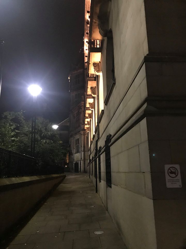
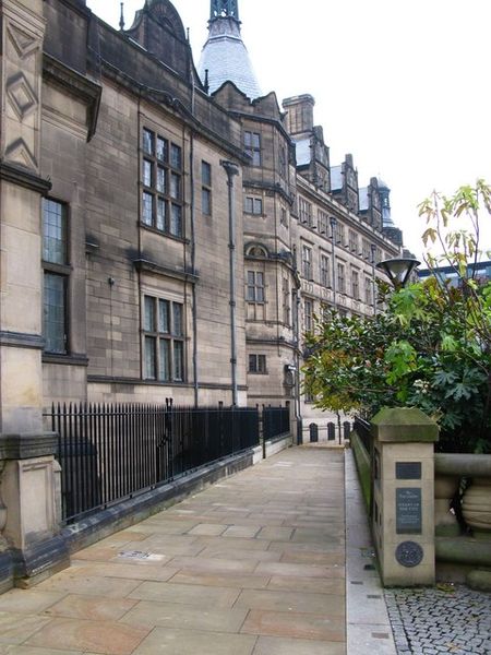
Let’s talk about West Street, a haven for bars, restaurants and takeaways, a road that has changed considerably since the 1990s.

However, a look back in history suggests that there were attempts during the 1920s to make West Street one of the city’s main shopping thoroughfares.

In 1929, the Sheffield Daily Telegraph made the following observation: –

“West Street seems intent upon coming into line with other busy shopping centres in the city, and of acquiring the same prestige. Many new shop premises have opened, and recently the removal of a length of hoarding revealed an array of smart, single-fronted shops.

“Such signs are distinctly encouraging, for although many roads radiate from the hub of Sheffield – High Street and Fargate – yet, West Street, with its width and fine approach, appears to be the natural outlet and extension of the shopping centre of the city.

“There are other reasons why the street should continue to develop. It is the main approach to many important public buildings, such as the Royal Hospital, the Edgar Allen Institute, Jessop Hospital, Children’s Hospital, the Applied Science Department of the University in St. George’s Square, Weston Park, Mappin Art Gallery, Western Bank Buildings of the University, and Glossop Road Baths.

“Hundreds of persons daily pass and repass along West Street, on their way to and from these buildings, and motorists going to Derbyshire also make great use of this route out of the city.

“Despite the fact that West Street is served by an excellent service of Corporation tramcars and motor-buses which run to a number of outlying residential districts, it has to be admitted that the road has not, hitherto, enjoyed the prosperity that would appear to be its right.

“It should always be borne in mind that West Street has been developed by private enterprise, Sheffield Corporation do not now possess a single square yard in this street, but there was a period when they owned a considerable area of freehold land there.

“When this was in their possession, the Corporation did not do anything to encourage traders by building new shops, and otherwise improving the amenities of the highway, but simply erected hoardings around the land, making it an unsightly blot in the neighbourhood.”

An interesting look at the past that also throws up some noteworthy observations.

Take, for instance, the fact that all premises built had to be three storeys, or over, and conform with the adjacent property.

Gone were the days of narrow, mean streets, with high crooked houses, each one with a dark and dismal “basement,” and of low, badly lit shops, with small window space. In their place were wide, low windows and a spaciousness about the new properties.

And we also discover that Sheffield Corporation, at one time, considered building a square in West Street, about 5,200 square yards in size, the plan later abandoned as being too costly.

The shopping centre that was promised never really materialised, although there were several specialist and prestige shops. But West Street did eventually thrive.

As the decades rolled on, the University of Sheffield expanded, with West Street becoming the gateway between the city centre and campus buildings. It soon became obvious that the street’s traditional public houses would become popular with students – once described as the “West Street Run” – a turn of events that eventually created the trendy bars that we see today.

And, of course, city living became popular again, particularly along West Street, with numerous new-build apartments, alas creating conflict between those living in them, and the businesses that brought prosperity in the first place.

Categories
Streets

Mushroom Lane

This is the story of a narrow road with a magical name.

Mushroom Lane winds up Crookesmoor Valley, originally from St. Stephen’s Church at Netherthorpe (now called The Vine), but now assumes its name further up the hillside. It crosses over Winter Street, and winds between Weston and Crookes Valley Parks, before emerging at Western Bank, near to the museum.

These days, most people barely take notice of the name , and those that do often presume it relates to the growing of mushrooms on the hillside back in ancient times.

However, the tale behind Mushroom Lane is far more interesting than that and begins at a time when this area was simply fields, trees and rolling countryside.

In early days, great tracts of waste or common land lay between villages. This land belonged to no one and was sometimes referred to as “Folkland” – as we see in Fulwood, a corruption of “Folkwood.”

The villagers had free access to this land for grazing purposes, fetching and carrying wood and using it for the benefit of the community. There was no special right to any part because it belonged to all, in the true communal manner.

Under certain conditions, however, it was possible for an enterprising squatter, providing he was a free man and able to quit his Lord’s service, to obtain a tenure on that waste land.

This is how a house called Mushroom Hall came to be built.

In the year 1789, a man called Ben Pinder contrived to build and cover, between sunset and sunrise (that is in a single night), a house, and to boil a pot therein. Once completed, it gave him the right to hold the place under what was known as a Keyhole Tenure.

The house was built of sods, stones, brick-ends and other binding materials, and the springing up of the place in one night naturally led locals to call it Mushroom Hall. As time passed the house was gradually improved, and the track that ran up the hillside to it became known as Mushroom Lane.

It was later bought by Whittington Sowter, landlord of the delightfully named Warmhearthstone public house at Townhead Street in Sheffield Town.

The custom of Keyhole tenure and the boiling of a pot harks back to Pagan times when hearth fires were held sacred.

It wasn’t the boiling of the pot that made the tenancy complete, but rather the lighting of the fire that boiled it. The ever-burning village fire was held to be hallowed, and the kindling and the maintenance of the fire upon real estate was proof of lawful occupation and possession.

And so, Mushroom Hall and Mushroom Lane may sound ridiculous, but were named in quite serious circumstances.

What became of Mushroom Hall?

A far cry from its humble origins, it is now part of 362 Mushroom Lane, owned by the University of Sheffield, and where you will find the Department for Human Communication Sciences.