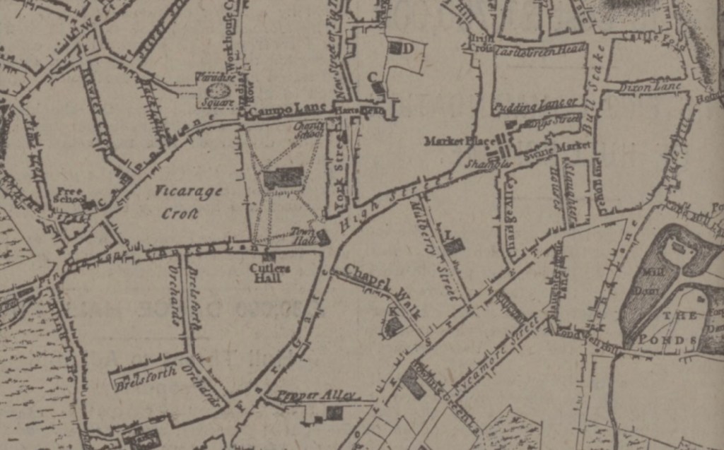
I bet most of you have never heard of the delightfully named Pepper Alley. This was once a thoroughfare passing from Fargate to Norfolk Street, quite close to the surviving Upper Chapel.
Its existence is shown on this map, taken from “A Correct Plan of the Town of Sheffield, in the County of York, drawn by William Fairbanks, 1771.”
You’ll notice that Norfolk Row, pictured, doesn’t appear on the map at all, only coming into existence about nine years later. However, Chapel Walk is shown.
A little bit of Pepper Alley (Pepper is a local surname) can still be seen today, leading into Upper Chapel Yard, behind the shops which form part of the former YMCA property, now named Carmel House, at the corner with Fargate.
If you study the map you’ll see that the Town Hall stood by the Church Gates (now the Cathedral), at the junction of High Street and Church Lane (now Church Street).
Other names to look for are Bullstake (now Haymarket), Pudding Lane (King Street), Castle Green Head (Castle Street), Irish Cross (Queen Street), and Pinstone Croft Lane (Pinstone Street)
