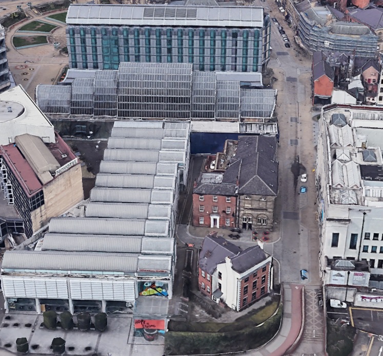
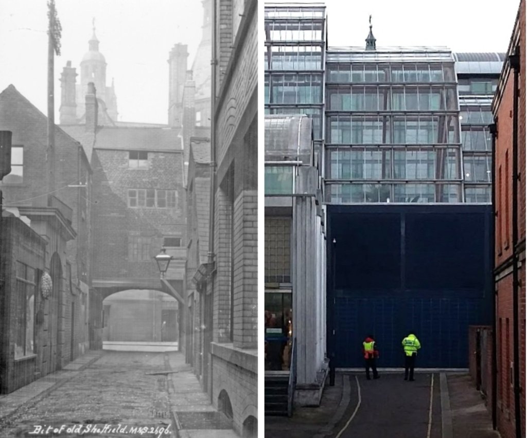
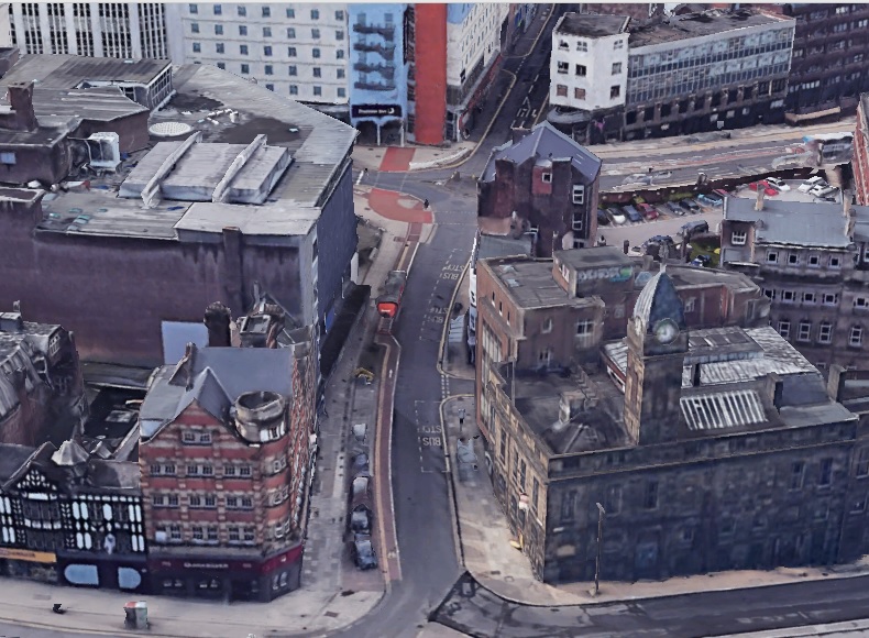
Cadman Lane ran from Eyre Street (this part of Eyre Street is now Arundel Gate) up to Norfolk Street, opposite where the Town Hall is. Only a small portion of the street remains in the centre of the picture. Photograph: Google Earth
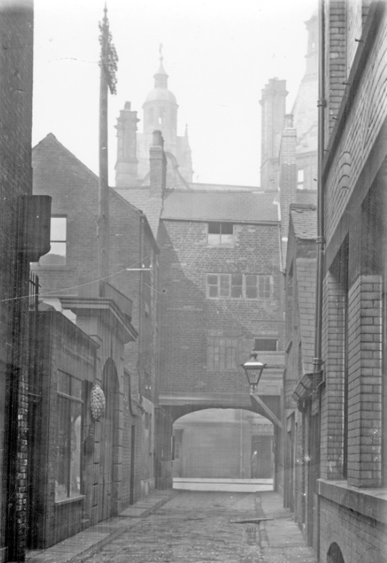
Yesterday, we featured a sketch of Cadman Lane, drawn by Sheffield artist Kenneth Steel (1906-1970). The drawing brought several queries as to the whereabouts of this characteristic old street. Presumably lost? Well, you might be surprised to know that Cadman Lane still exists.
Granted, it is not a street that many wander down anymore. It is a far cry from its heyday when it was a busy thoroughfare lined with factories, workshops, and offices. It survives in truncated form and can be found behind the Graduate public house, running parallel with the Millennium Gallery, and cut short by the presence of the Winter Garden.
How did Cadman Lane get its name?
In the 1780s, there is a story of Thomas Leader walking with the father of T Wilkinson in the field through which Surrey Street was later built. He remarked that the land below had been measured for building. “Yes,” said his companion, “It’s for young Roberts and for a plated manufactory, too.” This was Samuel Roberts, coupled with the mechanical cleverness of his colleague, George Cadman, and “aided by the capital of Mr Naylor, Unitarian Minister, as sleeping partner, and enabled the firm of Roberts and Cadman to outstrip local competitors.”
Cadman Lane looking towards Norfolk Street and Town Hall. This part of the road is now underneath the Winter Garden and the Mercure Hotel. Photograph: Picture Sheffield
The most likely candidate for the naming of the street is Peter Cadman, a merchant, who, in 1781 had houses up the south-east side of Norfolk Street. He died in 1812 in the house which he built next “to the gateway in Norfolk Street.” The gateway in question may well have been the arched entrance to Cadman Lane.
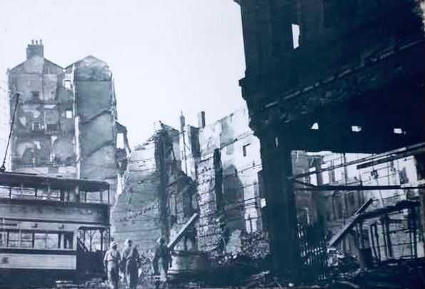
In 1929, Sheffield Corporation bought the block of property with the intention of reserving the land to build new administrative offices or public buildings. However, demolition did not start until the 1960s and the new Town Hall extension (the ‘egg box’) opened in 1977. It was demolished in 2002 and replaced with the Millennium Gallery, Winter Garden and McDonalds (now Mercure) Hotel.
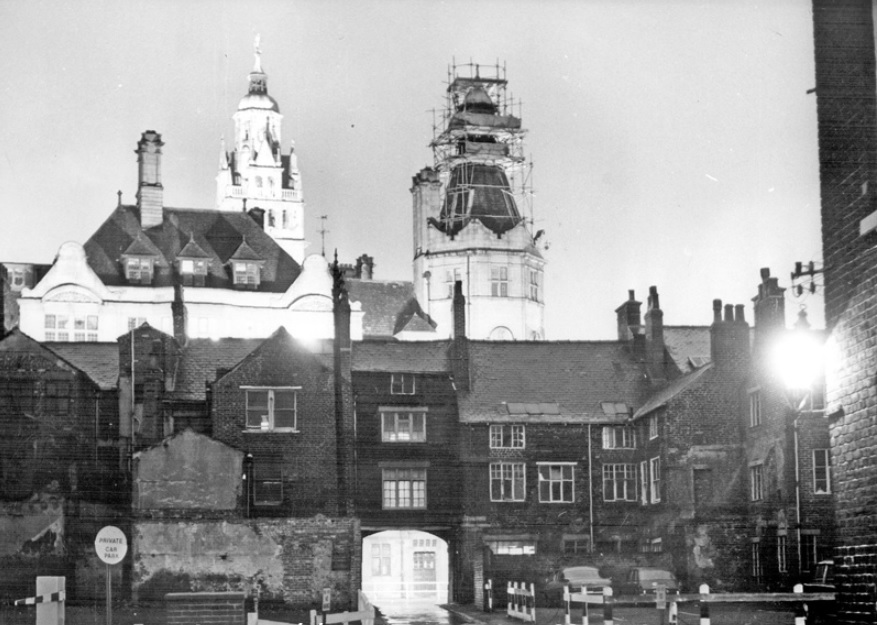
Cadman Lane with the Town Hall in the background, 1967. Photograph: Picture Sheffield
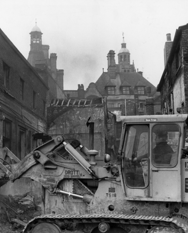
Demolition on Cadman Lane in 1966 with the Town Hall in the background. Photograph: Picture Sheffield
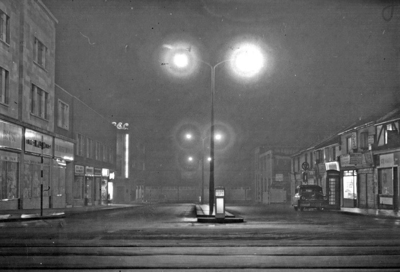
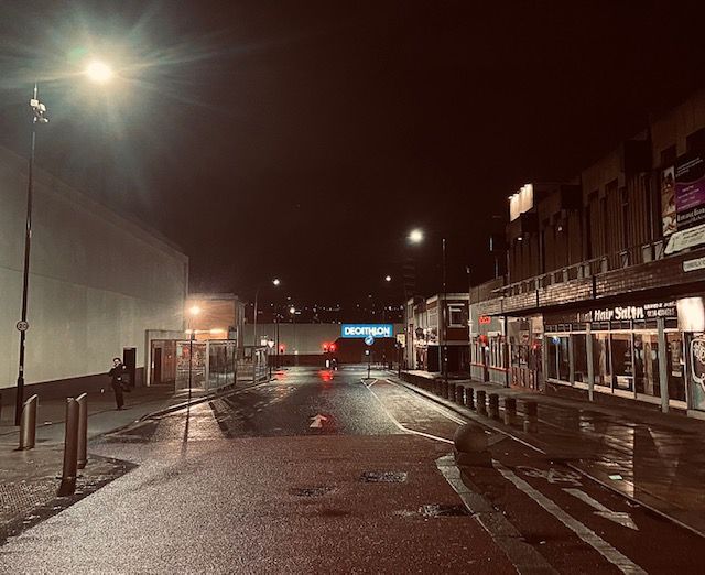
Two night-time shots of Cumberland Street, Sheffield, sixty years apart. The black and white photograph, looking towards Eyre Street, was taken in the early 1960s, and even though almost everything was demolished, it is still recognisable.
The row of shops down the left became Moor Market, including the tall and imposing General Electric Company building.
The old properties down the right were replaced in the early 1970s, including the addition of the Whetstone Public House, later Moorfoot Tavern, and now El Paso restaurant.
Only one building survives – the former Martin’s Bank at the far right corner of Cumberland Street with Eyre Street.
About halfway down are two roads with contrasting fortunes. To the right, South Lane, then a narrow thoroughfare, but significantly widened. To the left, Cumberland Way, lost during Moor Market construction, and now forming the entrance to the market service area.
In the far gloom was the factory belonging to W.A. Tyzack (built in 1958 and demolished in 1984), and now the site of Decathlon.
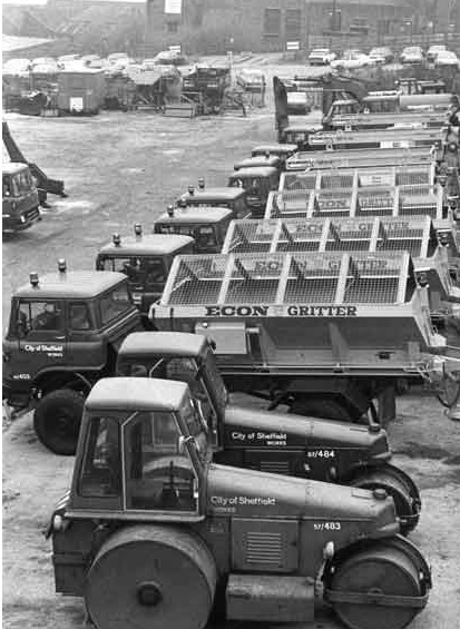
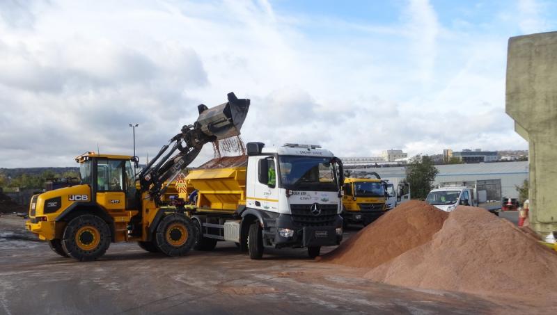
Gritter lorries on standby at the Streets Ahead Olive Grove depot. Photograph: Sheffield City Council
Temperatures are set to fall this week, with ice and possibly some snow forecast, and Sheffield’s gritters are ready to treat the roads. One thing is certain, we’ll all have a good moan if they get it wrong.
There are five weather stations across the city providing up-to-the-minute weather forecasts. This helps Streets Ahead contractor Amey to determine when there is a need to grit our roads.
Contrary to belief, over 60% of the city’s highway network is gritted in priority order. That is 610 miles of urban and rural roads and can take up to 8.5 hours to complete a full gritting run. Priority 1 routes include main arterial roads linking Sheffield to other towns and motorways. Priority 2 routes are bus routes, link roads, roads where public service facilities are located, and rural routes. Snow is also cleared from city centre pavements, but pavements across the city are not gritted anymore.
As the temperature drops to near freezing point the gritters will be out, but it isn’t grit they are spreading. It is rock salt. And the salt used comes from mines of ancient underground deposits in Cleveland, County Antrim, and below the Cheshire town of Winsford, and lowers the freezing point of moisture. Pure salt is the most effective pre-treatment, but grit is often added once snow has started to lay and compact.
The pre-treating of the highway network mitigates the formation of ice and snow, although traffic is needed to make it effective. Very often, when an area has slush or rainfall, it washes the salt away and makes the road vulnerable again, necessitating them to be re-gritted a second time before the weather freezes.
Gritter lorries and road rollers at Sheffield Works Department’s Manor Lane site in 1982. Photograph: Picture Sheffield
In 2003, the Highways Act 1980 was amended to place Sheffield City Council (and others) under a legal obligation to keep the roads clear. According to the amendment: “A highway authority are under a duty to ensure, so far as is reasonably practicable, that safe passage along a highway is not endangered by snow or ice.”
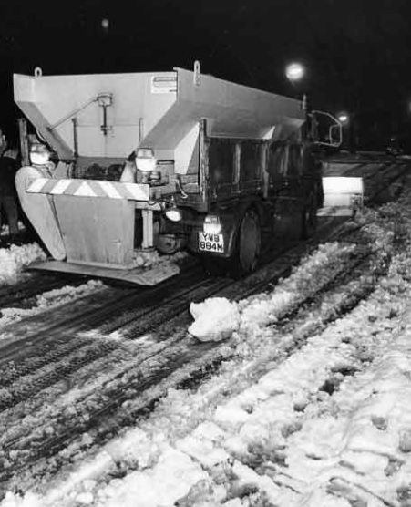
It is a far cry from Victorian times when sand was shovelled off the backs of horses and carts, and although the switch to motor vehicles greatly improved operations, it wasn’t until the development of the first spinning salt distribution gritter in 1970 by Ripon-based Econ Engineering that the process was speeded up.
Today, Econ supply 85% of the UK’s rock salt spreaders and even have a dedicated gritting museum with fully restored vintage road maintenance vehicles, gritters, spreaders and snowploughs.
October is the start of the Streets Ahead winter maintenance period and is in operation 24-hours a day, seven days a week. Photograph: Sheffield City Council
Whilst rock salt has been the choice for generations it can have a negative effect on soil and plants, interfering with the nitrogen cycle, and causing roots to absorb salt instead of important minerals. Salt water can also drain into soil affecting insects and can disturb the eco-system in watercourses. In addition, sodium chloride can be harmful to animals. And let’s not forget that it can cause damage to road surfaces.
As you might expect, alternative methods are being sought including urea (used in the production of fertilizer), potassium chloride, calcium chloride, potassium acetate (all incredibly expensive), beet juice, cat litter (yes, you read right), sand, ashes, and stone grits. Other eco-friendly alternatives being explored are cheese brine, garlic salt, potato juice, pickle brine and coffee grounds.
But for now, it seems rock salt will be here for a while because it remains cheap and readily available.
Finally, the truth surrounding gritter lorries in the summer. In very hot weather when tar is at risk of melting the gritters spread salt. This absorbs moisture from the air and cools the tar and creates a non-stick road surface.
Gritter and snowplough seen here in a wintery 1977. Photograph: Picture Sheffield
Castle Street, Sheffield. The original Truelove’s Gutter. Photograph: Google
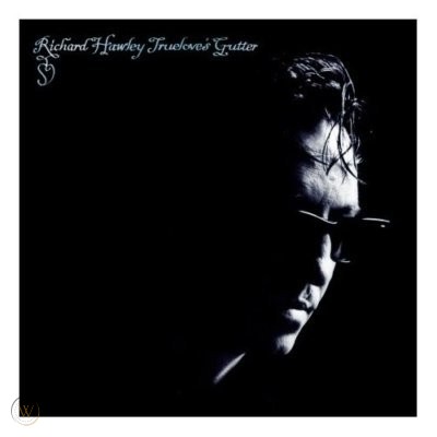
In 2009, singer-songwriter Richard Hawley released a dark album called Truelove’s Gutter, said to refer to an ancient Sheffield street which was allegedly named after 18th century innkeeper Thomas Truelove, who used to charge people to dump rubbish in the gutter in the street that then flowed down into the River Don.
Thomas Truelove may have existed, I can’t find any evidence, but the Truelove family did own houses and land nearby.
The album reawakened interest in a long forgotten street.
In the 15th century no proper drainage existed, so as an aid to cleaning the streets a pool was constructed to make a reservoir for the storage of water supplied by springs on the hills above West Bar. This came to be known as Barker’s Pool and had a pair of sluice gates that could be opened to allow water to escape when required.
All the streets had an open drain or gutter which ran down the middle of the narrow road and into this, all the refuse and filth of the town were thrown.
To cleanse the town, bells would be rung about once a month to warn people and the water would be allowed to escape from the pool to rush down the sloping streets until it joined the River Don at Lady’s Bridge.
The drains also carried rainwater and after very heavy storms they became rushing torrents. Rails or fences were erected at the side of parts of the drain and in places bridges were put across the gap.
It was upon one of these small bridges that a courting couple were seated when they were washed away in 1690.
This inspired James Wills, a local writer, to pen a poem in 1827 called ‘The Contrast: or the Improvements of Sheffield’ and referred to a town about sixty years previous.
“You remember the sinks in the midst of the streets – And when rain pours down each passenger greets His fellow with ‘What a wide channel is here! We all shall be drowned I greatly do fear’; For lately two lovers sat here on a rail, On the side of the ditch, fondly telling their tale, When the flood washed them down in each other’s embrace, For no longer could they keep their seat in the place; And hence, True-Love’s Gutter, it’s old name was given, Because by the flood these two lovers were driven!”
The historian Robert Eadon Leader destroyed this sad and romantic tale, and said the name really derived from the family of Truelove who lived for many generations in the vicinity.
The gutter exists in old deeds and in 1677 True Love’s Gutter Bridge is said to have been repaired by the Burgess. Also, in a Directory of Sheffield (1787), many tradesmen are living in this street – a grocer, baker, victualler, butcher, inkpot maker, linen draper, shoemaker, saddler, and hairdresser – as well as William Staniforth, surgeon, and man midwife.
Truelove’s Gutter, a narrow street, was renamed Castle Street in the early 1800s and widened a century later. It extended into what became Exchange Street and there have been recent suggestions that the name should be revived.
“We have indeed seen Sheffield burn. Many parts of our city have been destroyed; our peacetime occupations have been replaced by a complete conversion to wartime conditions. We must rebuild, reorganise, and reabsorb the men who are now away fighting. What a task! It will not be done by talking. It can only be achieved by enterprise, organisation, and very hard work. Also, we shall need good fortune and that which happens elsewhere will determine in large measure our own opportunities. If this war has taught us one thing, it is that our city is simply a cog in the wheel which is our country, and that our country is a part, and no mean part, of the mechanism of the civilised world.” – Dr W.H. Hatfield, Sheffield, 1943.
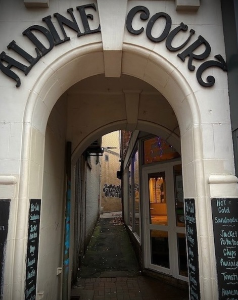
Aldine Court looking from High Street. Photograph: DJP 2021.
The glitziness of Sheffield’s High Street has long disappeared, now it’s a modern-day Miss Havisham, whose dilapidated appearance attracts only those of similar behaviour.
As such, we’re not likely to risk cutting along Aldine Court to Hartshead if we can help it. However, it is one of our oldest streets, and although concealed by surrounding buildings, it can tell a few stories.
Up until 1913 Aldine Court meandered from High Street towards Hartshead in so erratic a fashion that historian Robert Eadon Leader suggested its origin could have been from a primeval footpath across the waste.
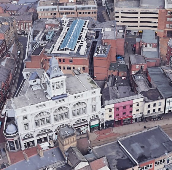
Aerial view of Aldine Court. Its entrance is to the immediate right of the Telegraph Building on High Street and passes between later newspaper extensions behind. Photograph: Google.
It was Leader who disclosed a deed from Mary Trippett’s time, she was descended from John Trippitte, yeoman, and Master Cutler in 1794, which revealed the haphazard buildings that had wantonly appeared; a malthouse (once William Patrick, then Thomas Wreaks), a maltkiln, a stable, workshops, and a bakehouse, as well as the old Sheffield Iris newspaper office at the Hartshead end.
“No two buildings were the same shape, the same height, scarcely of the same alignment; yet, decayed and ramshackle, they proved good enough for a typographer.”
Aldine Court had been called Trippett’s Yard, Wreaks Yard, and in 1845, when Joseph Pearce set up a printing works here, was referred to as Wilson’s Yard (probably after George Wilson, of the Sharrow Mills family, who had set up a snuff shop on High Street in the 1830s).
Pearce, the son of a bookseller in Gibraltar Street, was a stationer, printer and part-proprietor of the Sheffield Times before launching the Sheffield Telegraph, Britain’s first daily provincial newspaper, in 1855.
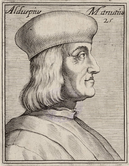
Aldo Manuzio (Aldus Manutius) (1449/52-1515)
The narrow thoroughfare would become forever linked with newspapers, and it was Pearce who renamed it Aldine Court, honouring one of history’s publishing greats.
Aldo Manuzio arrived in Venice in 1490 and produced small books in Latin and Italian, publishing the works of Dante, Petrarch, and Erasmus. Over two decades, his Aldine Press published 130 editions, famous for its imitation of the handwriting of Petrarch, using a typeface called ‘venetian’ or ‘aldine’, but later known by the name we are familiar with today – ‘italic’.
Between 1913-1916, Aldine Court was somewhat straightened to accommodate the Sheffield Telegraph building, and partly covered with later newspaper extensions.
Aldine Court looking towards the back of the Telegraph Building. Photograph: DJP2021.
Aldine Court looking towards Hartshead. Photograph: DJP2021.
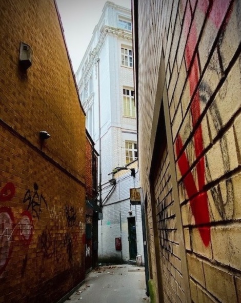
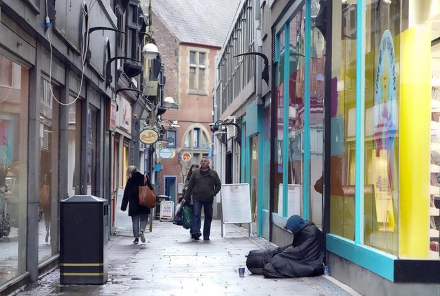
The current state of Chapel Walk is in stark contrast to when it was Tucker Alley, leading from Fargate into the rural idyll of Alsop Fields. Photograph: Sheffield Star.
Let us dismiss a legend before we go any further. I cannot find any evidence that bodies are buried beneath Chapel Walk, but there again, nor can I prove that they aren’t. The only connection with the ‘dead’ these days is the number of empty shops and lack of pedestrians.
Since the 1990s, the decline of Chapel Walk is the most remarkable example of degeneration in Sheffield city centre. From being a busy thoroughfare, where people struggled to avoid bumping into each other, it has become a ‘ghost’ street, but one that has the most potential to be impressive again.
Chapel Walk is one of our oldest streets, with origins in medieval times, but its importance surfaces in the 1700s.
At that time, every house on Prior Gate (High Street) had long gardens behind them, backing onto Alsop Fields, a rural and agricultural area sloping down to the River Sheaf.
In 1660, followers of Rev. James Fisher, vicar of Sheffield, broke away from Sheffield Parish Church to form the beginnings of Congregationalism. They met in rooms around the town but in 1700 rented a site that faced ‘Farrgate’ and called it the New Chapel, the back of it looking across Alsop Fields.
On the death of the Rev. Timothy Jollie in 1714, the Trustees of the New Chapel appointed the Arian John Wadsworth, causing some dissenters to breakaway and build a new chapel.
They looked to John Tooker, an early Master Cutler, who lived on ‘Farrgate’ and agreed to sell a piece of garden behind his house for £60 to Elia Wordsworth, a prominent member of the seceding independents, to build a new meeting house.
The chapel, across gardens from New Chapel, was built in 1714 within Tooker’s Yard, access being from Tooker Alley (later Tucker Alley), a narrow thoroughfare, with the conveyance ensuring permanent right of way to the chapel from Fargate and Alsop Fields, and that the passage should never be narrower than two yards. Thereafter, Tucker Alley became known as Chapel Walk.
Only Fargate is familiar in this illustration. Tucker Alley became Chapel Walk. Norfolk Street was built at the edge of Alsop Fields. Photograph: British Newspaper Archive.
Because of their proximity to each other, New Chapel became the Upper Chapel with the one on Chapel Walk called Nether Chapel.
“One regrets that there is no picture available of the Nether Chapel of those far-off days. We can imagine the little congregation during a long sermon on a hot summer’s day being beguiled by the song of birds coming through the open windows. We can see them, through fancy’s eye, coming out after worship into the strong sunlight and indulging in a friendly chat under the shade of neighbouring trees, and then dispersing to their homes in the vicinity along narrow lanes with hedges of honeysuckle and hawthorn; the air fragrant with the scent of new-mown hay – the silence broken now and again by the bleating of sheep and the lowing of cattle grazing contentedly in the adjacent fields.”
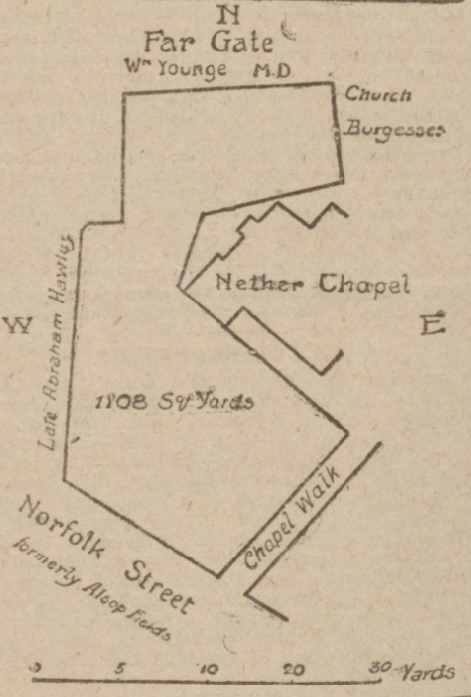
The chapel was partly destroyed by fire in 1827, and foundations for a New Nether Chapel were laid in May. It cost £4,200 and looked towards Norfolk Street (built at the edge of Alsop Fields) instead of Chapel Walk which had done its duty for 113 years. Dr William Younge sold land fronting Norfolk Street allowing the creation of a new chapel yard.
This illustration shows land purchased for the New Nether Chapel. Photograph: British Newspaper Archive.
In 1826, Dr William Younge sold land fronting Norfolk Street for £700 allowing Nether Chapel to be rebuilt and giving them a new frontage. Photograph: Picture Sheffield.
Over the next hundred years, Sheffield changed considerably. Gone were those rural delights and solitudes. Nether Chapel now stood in the heart of a city of bricks and mortar. The countryside had been obliterated by factories, workshops, and offices, and Chapel Walk became a popular shopping street.
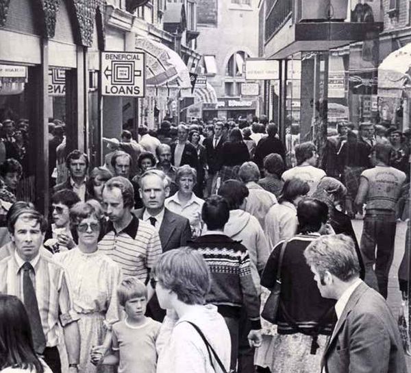
Chapel Walk was an incredibly busy shopping street during the 1970s. Photograph: Sheffield Star.
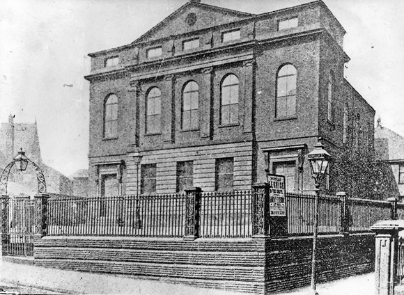
In 1931, Sheffield Corporation purchased a portion of the Nether Chapel yard in Norfolk Street for street improvement purposes. An ‘awkward bulge’ was removed bringing the frontage of Victoria Hall (1908), Nether Chapel, and St Marie’s Presbytery, into line. Photograph: British Newspaper Archive.
In 1963, congregations at Burngreave, Wicker, Queen Street and Nether Chapel resolved to unite and form one church and to build a new chapel in the city centre. Nether Chapel was demolished, and a new Central Congregational Church opened in 1971.
When the United Reformed Church was formed in 1972 from Congregational and Presbyterian denominations the Church became Central United Reformed Church. It was significantly altered in 2000 and stands at the Norfolk Street end of Chapel Walk.
Meanwhile, Chapel Walk has fallen on tough times. Not helped by the Fargate end being shrouded in ‘abandoned’ scaffolding for several years, attempts to regenerate the street have so far failed. However, with the right investment, this slender pedestrian walkway could rise again. Small independent shops?
NOTE:- Upper Chapel was remodelled in the 1840s, turned around to face across fields. It survives in solitude on Norfolk Street.
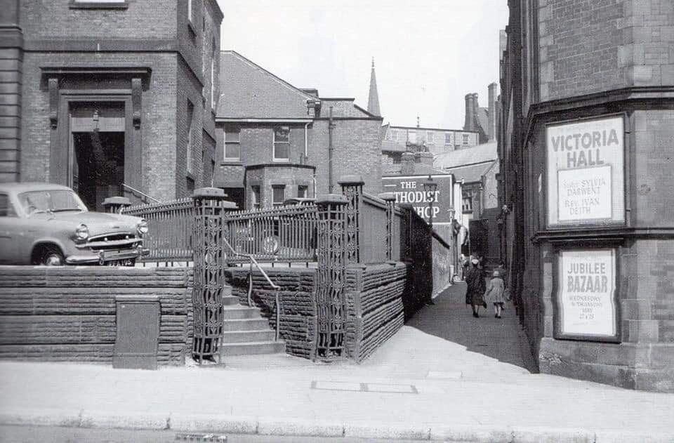
Norfolk Street end of Chapel Walk in the 1960s. Nether Chapel is on the left, the Victoria Hall is to the right. Photograph: Picture Sheffield.
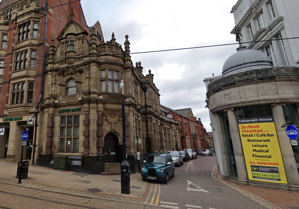
The entrance to York Street from High Street. The Crown Inn once stood where this photograph is taken. Photograph Google.
York Street is just a street to many of us, a shortcut between High Street and Hartshead. Apart from its long, recently ended, association with the Star and Telegraph, it hasn’t played a significant role in the city centre’s history.
However, despite having few buildings of architectural importance, York Street can still tell a story.
In 1565, documents state that the property between the Church Gates (now Sheffield Cathedral) passed into new hands and was bounded by the churchyard to the west, and on the east by lands belonging to John Skynner of London.
York Street didn’t exist, the land changing ownership many times, steadily developed towards its High Street frontage.
We now come across an old tavern, sometimes called Morton’s, and at others as The Crown, often used for public meetings (and drinking) by the Town Trustees and the Cutlers’ Company.
John Morton, landlord, had the honour of being a Master Cutler and a victualler. He occupied the chair in 1709-10, and during his year, the Archbishop of York seems to have been entertained at The Crown. In 1721, when the Duke of Norfolk entertained leading inhabitants, a substantial amount of plate and table requisites were lent from this inn.
The Crown’s location is found in property deeds from adjacent properties in 1711 and 1735, bounded by the lands of John Morton westwards, and putting it where the opening to York Street is now.
In 1744, Morton’s widow, announcing her retirement from business, advertised in the Leeds Mercury her desire to let ‘that very good, accustomed inn, known by the sign of the Crown, near the Church Gates, with stabling for twenty-four horses.’
Soon afterwards, the inn appears to have closed and in 1770, Thomas Vennor, a Warwick man, bought the Crown property from the owners of ‘The Great House at the Church Gates,’ and established himself as a mercer.
In 1772, he had ‘lately’ made ‘a new street called York Street, leading from High Street to Hartshead,’ which ran through the ground ‘whereon stood the house of John Morton, over its yard, and beyond to Hartshead across a piece of vacant land purchased from the Broadbents.’
We can fix 1770 as the date York Street was created, possibly as a nod to the Archbishop of York’s historical visit, and it appears on Fairbank’s map of 1771.
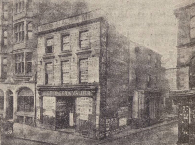
This photograph dates to about 1890. The spot underwent a complete metamorphosis, with the addition of a bank on the left hand corner and the Sheffield Telegraph offices on the right. The shop shown on the right was that of the Goldsmiths’ Company. Photograph: British Newspaper Archive.
Its creation was important because prior to construction pedestrians could only pass from High Street to Hartshead through narrow ‘jennels,’ while wheeled traffic had to negotiate Townhead and travel the full length of Campo Lane to reach it.
In this respect, Robert Eadon Leader, that cherished Sheffield historian, regarded him as a ‘public benefactor,’ something not shared by Vennor’s contemporaries, who failed to support his efforts to become a Town Trustee in 1778.
York Street was a busy thoroughfare, with houses, shops, and offices, lining both sides, but there was a darker characteristic.
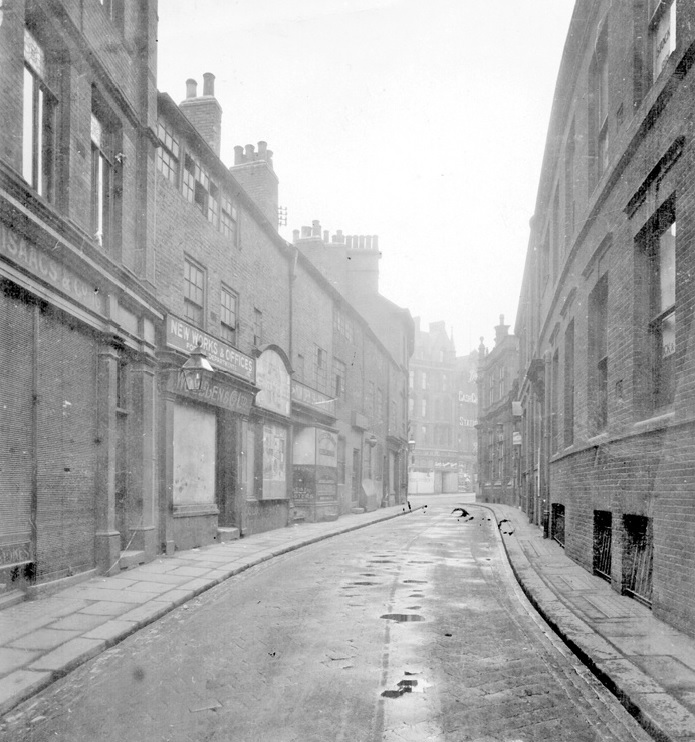
York Street in 1905, looking towards High Street. Photograph: Picture Sheffield.
In 1868, a resident wrote that “the neighbourhood of York Street is infested with night walkers, who won’t let you pass without receiving the grossest insults imaginable.”
The building of respectable Victorian buildings towards High Street improved its reputation, but in 1922 a correspondent to the Sheffield Telegraph said that it was “in a very bad state of repair, and in wet weather large pools of water collect, with the result that not only is property splashed up with dirt (your beautiful white building is an example), but foot passengers have their clothes ruined by every wheeled vehicle that passes up and down. It is the busiest street for motor traffic in the city, and the footpath the narrowest.”
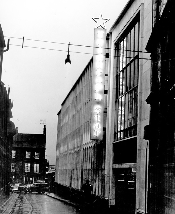
A sight more familar to us. York Street looking towards Hartshead in 1965. The Telegraph and Star Offices are on the right, now apartments. Photograph: Picture Sheffield.
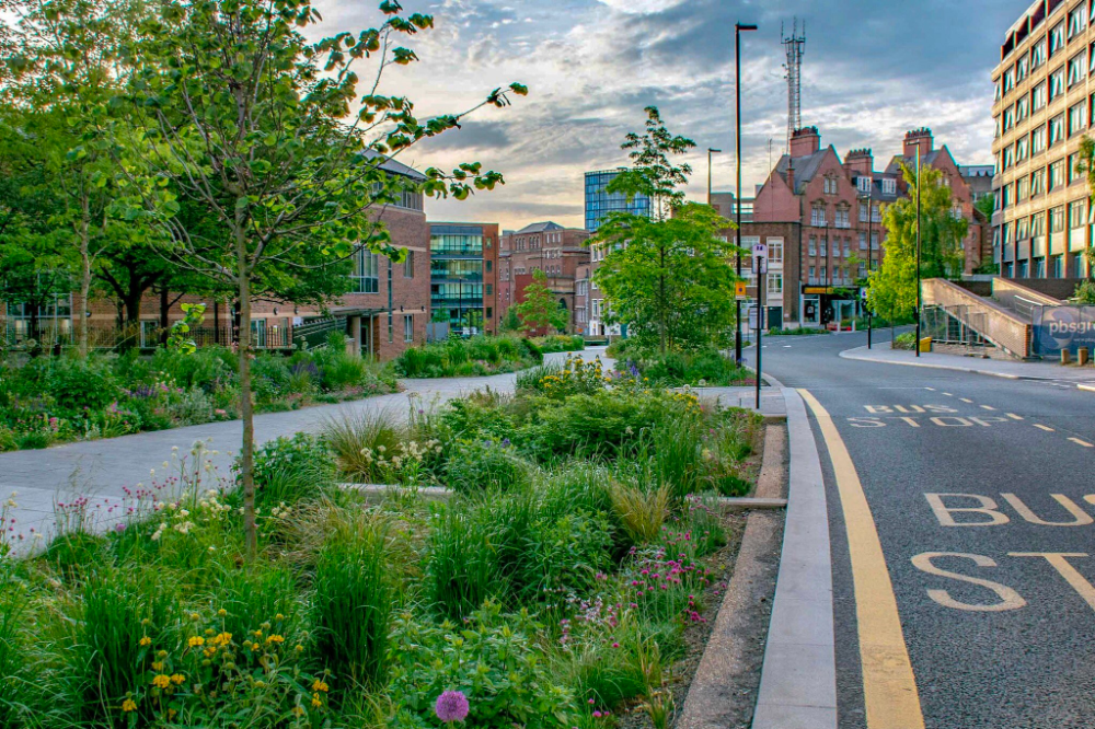
The ‘Grey to Green ’ project is a development from Sheffield City Council to transform redundant carriageway in the city centre into a network of sustainable drainage and rain gardens. The greening of West Bar has already been completed. Photograph: Nigel Dunnett.
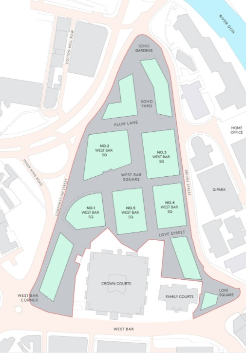
In years to come, West Bar will alter beyond recognition. The triangular area bordering West Bar, Bridge Street, and Corporation Street will be demolished. A £300m regeneration scheme will see old factories and workshops replaced with residential and business units.
According to the masterplan, West Bar Square will be a prestigious new address – a place where people will meet to do business, attracting workers and visitors, day and night. Once completed, the only recognisable buildings remaining will be the Law Courts and adjacent Family Court.
Planned area of development. Photograph: Urbo.
The development is aligned with Sheffield’s £3.6m Grey to Green scheme with wildflowers, grasses and trees already planted at West Bar. Alongside the grey to green development will be Love Square, a pop-up urban nature park designed by staff and students from the University of Sheffield’s Landscape Architecture Department.
While it is sad to see our heritage disappear, the project will go towards greening an area swallowed by the industrial revolution.
The 1.4m sq West Bar Square city centre scheme will be built next to the city’s inner relief road. Photograph: Urbo.
It will involve building 200,000 sq ft of office space, 350 build to rent homes, a multi-storey car park and quality landscaped public spaces. Photograph: Urbo.
West Bar is one of Sheffield’s oldest streets and mentioned in ancient records of the Burgery. There seems to be no explanation available as to the derivation of its name. In bygone times a ‘bar’ was a barrier of posts and chains set up to close the entrance to a town or city, and West Bar is likely to have been the northern limit of old Sheffield.
The development area was included in a survey of the manor of Sheffield in 1637 which described the site as part of Coulston (or Colston) Crofts, previously part of the demesne lands of the lord of the manor. Surviving deeds from 1622 contained wording suggesting the area was originally part of the lord’s game preserve, with all rights of hawking, hunting, fishing, and fowling reserved to the Duke of Norfolk. It was later used for both pasture and arable cultivation.
By 1637, the area had been divided into two large fields, the area on the west leased from the Duke of Norfolk by Robert Bower, and that on the east by Edward Wood. In the 17th century the area was at least partially wooded, confirmed by a description in 1837, which stated that until the late 18th century the area had been “swampy meadows and damp osier [willow] grounds.”
The West Bar area remained on the outskirts of town into the 18th century. The town’s first workhouse was built to the southwest in 1733, now survived by Workhouse Lane to the left of the Law Courts.
The street layout principally dates to the period between 1783 and 1802, although Spring Street and the streets to the south are earlier. West Bar is likely to be medieval in origin, and part of Spring Street was shown in 1736. Workhouse Lane and Paradise Street were shown in 1771.
Corporation Street cut through the estate in 1853, and was altered as part of the Inner Relief Road development in 2006.
West Bar was widened in stages during the late 19th and early 20th centuries. The construction of the Court Houses between 1993-1996 led to the truncation of Spring Street and Love Lane.
No.1 West Bar Square comprises approximately 100,000 sqft of office space, together with ground floor retail/leisure units. Photograph: Urbo.
By the 1870s, many Sheffield roads had been laid with macadam but the corporation found it difficult to maintain and keep clean. As such, many roads were ripped up and replaced with granite setts.
Complaints about pot-holes always cause a stir. But you might be surprised to know that our roads have long been the subject of contention. The columns of local newspapers have been filled with grumbles going back to Victorian times.
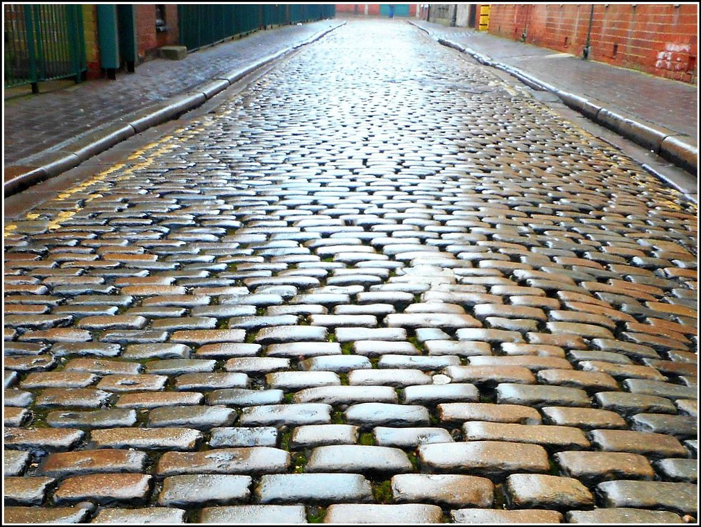
The grievance was the type of material used to surface our streets. As Sheffield grew, the network of roads expanded, and many of the main streets were overlaid with cobbles (water-rounded stones collected from beaches and rivers), irregular flat-shaped stones, or more commonly, slag macadam.
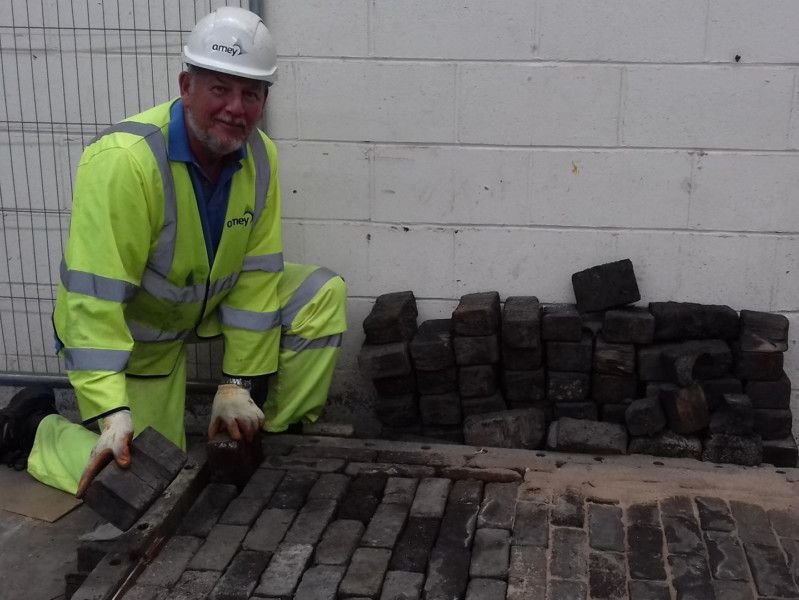
In the 19th century, cobbles were replaced with round or hexagonal wooden setts, probably creosoted Norway pine, that provided a safer surface for horses and wagons. They gave a better grip for horse-shoes and the iron rims on wheels, and reduced the noise of traffic.
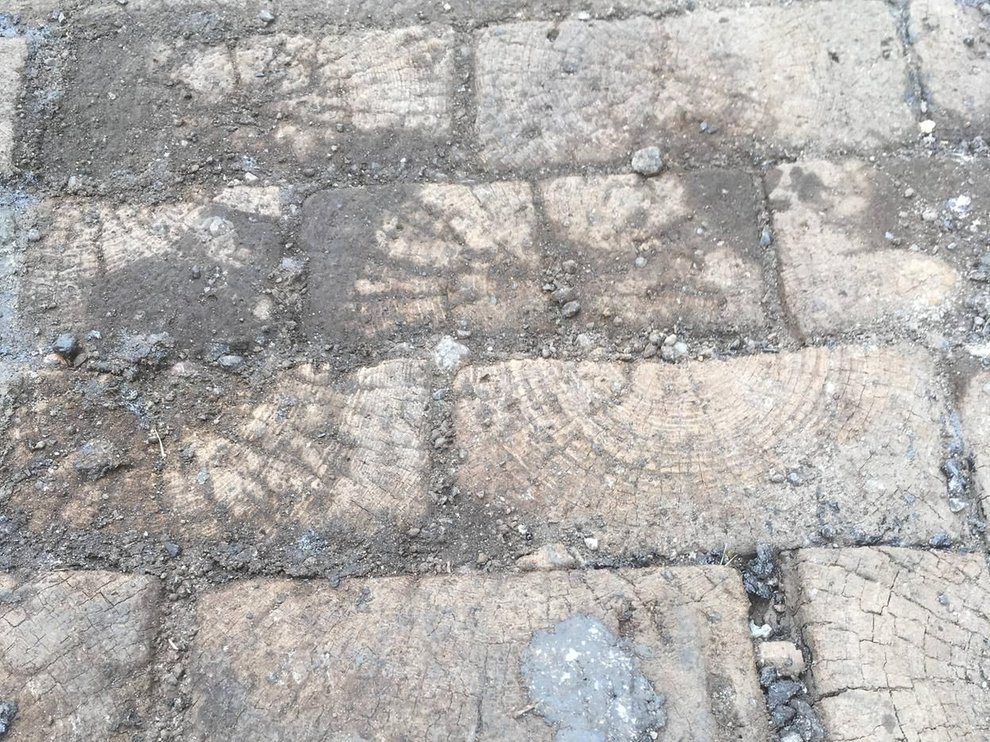
Wooden cobbles unearthed on Hodgson Street. Picture: Nigel Humberstone
The wooden setts, although abundant in supply, proved expensive, and granite setts, squared off by hand, were brought to Sheffield from several locations, including Cornwall, the Channel Islands, and then increasingly from Aberdeen.
Once worked, granite setts were capable of much greater precision of laying and could help construct a far smoother street surface. They lasted for 30 years, hardwood for 15 years, and afterwards could be taken up and redressed.
However, the people of Sheffield objected to granite, complaining that noise generated by horse-drawn traffic was too loud. On West Street, wooden setts had been laid to make it quieter around the Royal Hospital, but ratepayers on the other side, on Division Street and Devonshire Street, protested that noise from granite was “nerve-racking,” “a distinct disgrace to the city,” and “enough to send people to the county asylum.”
There was a bigger drawback. Horses tended to slip on granite causing serious injury, sometimes death, to the animals. It was reason enough for Sir John Bingham, head of the firm of Walker and Hall, to campaign against their use in the 1890s.
Bingham had good reason to dislike granite setts. When driving a high dog cart, one of his horses had slipped and fallen, pitching him out onto his head. He started a crusade and gained support from Reuben Thompson and Joseph Tomlinson, proprietors of Sheffield’s two largest horse-drawn cab and omnibus firms.
“I, like many others, have been injured for life upon these granite setts, and I feel most strongly that where they are laid, they should be properly and regularly roughed. About a year ago, accidents happened on the same day to two of our leading steel manufacturers, Colonel Vickers, and Sir Alexander Wilson, one of them having his horse killed, the other being seriously injured, and will bear deep scars on his forehead so long as he lives, and says will never drive again in Sheffield.”
Bingham re-entered the council to enforce his views and was eventually able to stop granite setts being used on Sheffield’s main streets.
In 1895, he discovered that the stringy bark of a Tasmanian tree could be combined with granite to create a safer, quieter, and more durable road surface. He developed Bingham Patent Paving, first used on Norfolk Street, and then across many of the city’s main streets.
However, by the 1920s, the use of asphalt meant that Sheffield Corporation hadn’t bought any wood or granite setts (or Bingham’s paving) for several years. Asphalt had been created by accident in Kent after tar barrels had fallen onto a road and broken. Ultimately, it was discovered the part of the road covered with tar was found the best, and afterwards the use of tar had spread all over the country.
It resulted in most of Sheffield’s cobbled streets being covered over, a practice that continues to this day using modern techniques.
Thankfully, there are still plenty of granite setts in streets across Sheffield, and some of the wooden setts have even resurfaced in recent years, notably on Hodsgon Street, near the Moore Street roundabout, and on Sackville Road, at Crookes.
Highways supervisor Gary Booth examines some of the wooden blocks in 2018 at the Streets Ahead Olive Grove depot. Picture: Sheffield Star