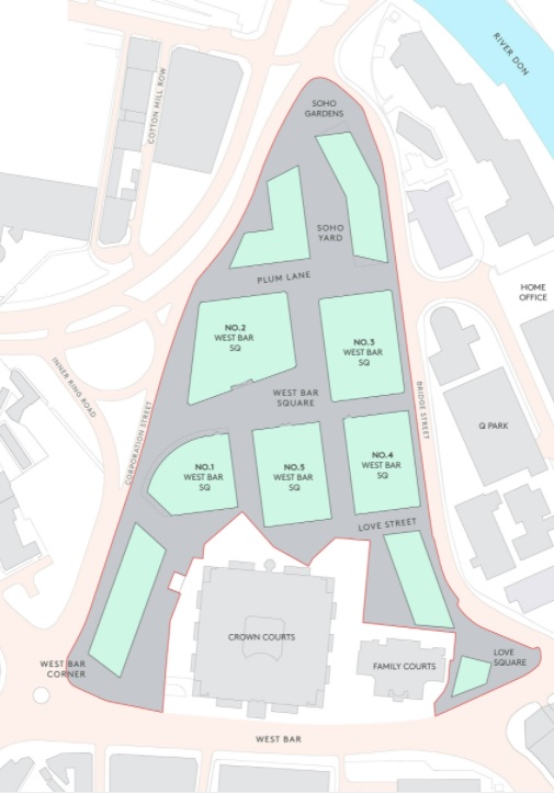
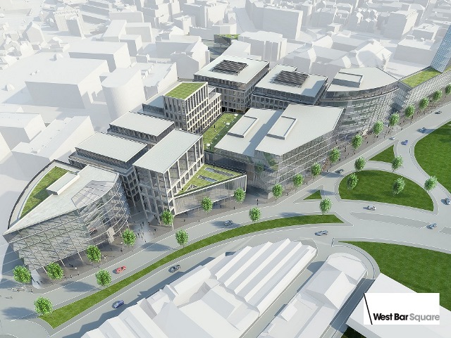
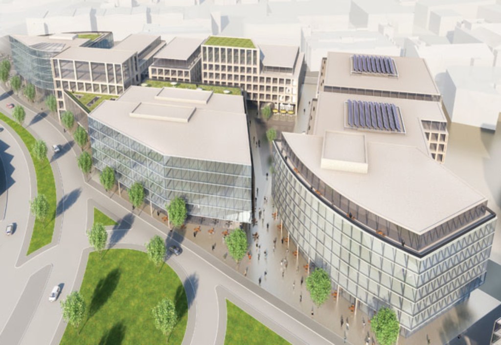
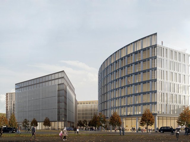
In years to come, West Bar will alter beyond recognition. The triangular area bordering West Bar, Bridge Street, and Corporation Street will be demolished. A £300m regeneration scheme will see old factories and workshops replaced with residential and business units.
According to the masterplan, West Bar Square will be a prestigious new address – a place where people will meet to do business, attracting workers and visitors, day and night. Once completed, the only recognisable buildings remaining will be the Law Courts and adjacent Family Court.
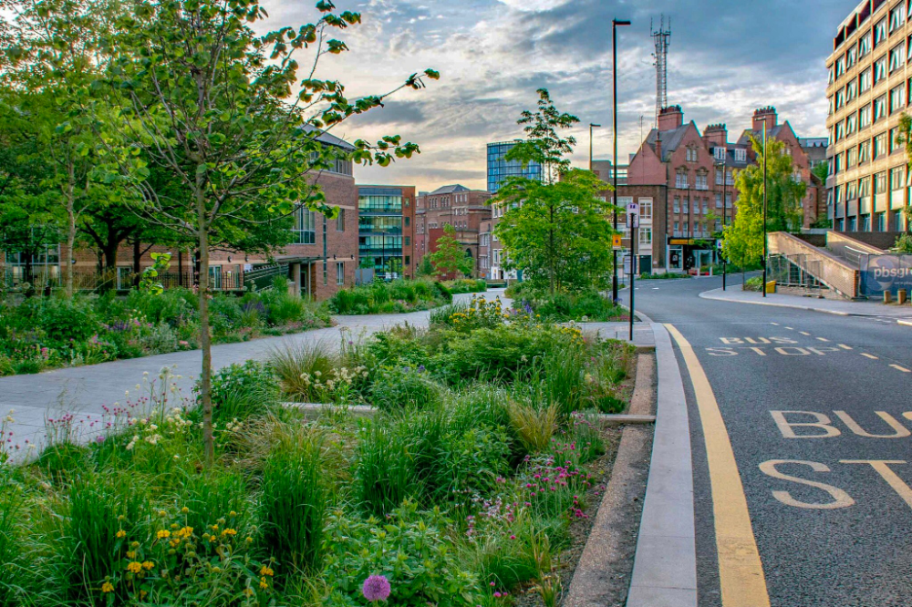
The development is aligned with Sheffield’s £3.6m Grey to Green scheme with wildflowers, grasses and trees already planted at West Bar. Alongside the grey to green development will be Love Square, a pop-up urban nature park designed by staff and students from the University of Sheffield’s Landscape Architecture Department.
While it is sad to see our heritage disappear, the project will go towards greening an area swallowed by the industrial revolution.
West Bar is one of Sheffield’s oldest streets and mentioned in ancient records of the Burgery. There seems to be no explanation available as to the derivation of its name. In bygone times a ‘bar’ was a barrier of posts and chains set up to close the entrance to a town or city, and West Bar is likely to have been the northern limit of old Sheffield.
The development area was included in a survey of the manor of Sheffield in 1637 which described the site as part of Coulston (or Colston) Crofts, previously part of the demesne lands of the lord of the manor. Surviving deeds from 1622 contained wording suggesting the area was originally part of the lord’s game preserve, with all rights of hawking, hunting, fishing, and fowling reserved to the Duke of Norfolk. It was later used for both pasture and arable cultivation.
By 1637, the area had been divided into two large fields, the area on the west leased from the Duke of Norfolk by Robert Bower, and that on the east by Edward Wood. In the 17th century the area was at least partially wooded, confirmed by a description in 1837, which stated that until the late 18th century the area had been “swampy meadows and damp osier [willow] grounds.”
The West Bar area remained on the outskirts of town into the 18th century. The town’s first workhouse was built to the southwest in 1733, now survived by Workhouse Lane to the left of the Law Courts.
The street layout principally dates to the period between 1783 and 1802, although Spring Street and the streets to the south are earlier. West Bar is likely to be medieval in origin, and part of Spring Street was shown in 1736. Workhouse Lane and Paradise Street were shown in 1771.
Corporation Street cut through the estate in 1853, and was altered as part of the Inner Relief Road development in 2006.
West Bar was widened in stages during the late 19th and early 20th centuries. The construction of the Court Houses between 1993-1996 led to the truncation of Spring Street and Love Lane.
© 2021 David Poole. All Rights Reserved.
